Barisal Sadar Upazila
Barisal Sadar (Bengali: বরিশাল সদর) is an Upazila of Barisal District in the Division of Barisal, Bangladesh.[1]
Barisal Sadar
বরিশাল সদর | |
|---|---|
 Barisal Sadar Location in Bangladesh | |
| Coordinates: 22°42′N 90°22′E | |
| Country | |
| Division | Barisal Division |
| District | Barisal District |
| Area | |
| • Total | 307.59 km2 (118.76 sq mi) |
| Population (1991) | |
| • Total | 414,281 |
| • Density | 1,300/km2 (3,500/sq mi) |
| Time zone | UTC+6 (BST) |
| Website | Official Map of the Barisal Sadar Upazila |
Geography
Barisal Sadar is located at 22.7000°N 90.3667°E. It has 114,774 households and a total area of 324.41 km2.[2]
Demographics
According to provisional results of the 2011 national census, the population of Barisal Sadar Upazila stands at 527,017. Males constitute 52.72% of the population, and females 47.28%. The population density is about 1625 people per km2.
Administration
Barisal Sadar Upazila is divided into ten union parishads: Chandpura, Chandramohan, Char Baria, Char Kowa, Char Monai, Jagua, Kashipur, Roypasha Karapur, Shayestabad, and Tungibaria. The union parishads are subdivided into 105 mauzas and 110 villages.[3]
References
- Ushasi Eashika Khan (2012). "Barisal Sadar Upazila". In Sirajul Islam and Ahmed A. Jamal (ed.). Banglapedia: National Encyclopedia of Bangladesh (Second ed.). Asiatic Society of Bangladesh.
- "Bangladesh Bureau of Statistics Region Census 2011 page 17" (PDF). Bangladesh Bureau of Statistics. Archived from the original (PDF) on 2015-09-23. Retrieved 2014-09-20.
- "District Statistics 2011: Barisal" (PDF). Bangladesh Bureau of Statistics. Archived from the original (PDF) on 13 November 2014. Retrieved 14 July 2014.
| Upazila/Thana: | ||
|---|---|---|
Capital: Barisal | ||
| Barguna District | 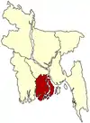 | |
| Barisal District | ||
| Bhola District | ||
| Jhalokati District | ||
| Patuakhali District | ||
| Pirojpur District | ||
This article is issued from Wikipedia. The text is licensed under Creative Commons - Attribution - Sharealike. Additional terms may apply for the media files.
