Betagi Upazila
Betagi (Bengali: বেতাগী) is an upazila of Barguna District[1] in the Division of Barisal, Bangladesh.
Betagi
বেতাগী | |
|---|---|
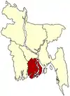
 Betagi Location in Bangladesh | |
| Coordinates: 22°25′N 90°10.1′E | |
| Country | |
| Division | Barisal Division |
| District | Barguna District |
| Area | |
| • Total | 167.75 km2 (64.77 sq mi) |
| Population (1991) | |
| • Total | 110,926 |
| • Density | 660/km2 (1,700/sq mi) |
| Time zone | UTC+6 (BST) |
| Website | Official Map of the Betagi Upazila |
Geography
Betagi is located at 22.4167°N 90.1681°E. It has 22,156 households and a total area of 167.75 km2.
Demographics
According to the 1991 Bangladesh census, Betagi had a population of 110,926. Males constitute 49.95% of the population, and females 50.05%. The population aged 18 or over was 57,885. Betagi had an average literacy rate of 87% (7+ years), compared to the national average of 72.4%.[2]
Administration
Betagi Upazila is divided into Betagi Municipality and seven union parishads: Betagi, Bibichini, Buramazumdar, Hosnabad, Kazirabad, Mokamia, and Sarishamuri. The union parishads are subdivided into 59 mauzas and 73 villages.[3]
Betagi Municipality is subdivided into 9 wards and 9 mahallas.[3]
References
- Saidul Islam Mantu (2012). "Betagi Upazila". In Sirajul Islam and Ahmed A. Jamal (ed.). Banglapedia: National Encyclopedia of Bangladesh (Second ed.). Asiatic Society of Bangladesh.
- "Population Census Wing, BBS". Archived from the original on 2005-03-27. Retrieved November 10, 2006.
- "District Statistics 2011: Barguna" (PDF). Bangladesh Bureau of Statistics. Archived from the original (PDF) on 13 November 2014. Retrieved 14 July 2014.
| Upazila/Thana: | ||
|---|---|---|
