Hizla Upazila
Hizla (Bengali: হিজলা) is an upazila of Barisal District in the Division of Barisal, Bangladesh.[1]
Hizla
হিজলা | |
|---|---|
 Hizla Location in Bangladesh | |
| Coordinates: 22°54′N 90°30.5′E | |
| Country | |
| Division | Barisal Division |
| District | Barisal District |
| Area | |
| • Total | 515.36 km2 (198.98 sq mi) |
| Population (1991) | |
| • Total | 166,265 |
| • Density | 320/km2 (840/sq mi) |
| Time zone | UTC+6 (BST) |
| Website | Official Map of the Hizla Upazila |
Geography
Hizla Upazila (barisal district) area 515.36 km2, located in between 22°50' and 23°05' north latitudes and in between 90°25' and 90°43' east longitudes. It is bounded by gosairhat and haimchar upazilas on the north, mehendiganj upazila on the south, muladi upazila on the west.
Hijla Upazila is located in Kolghes of Shariatpur district of Dhaka division north of Barishal on the map of the country. Ghosairhat Upazila of Shariatpur district on the north, Haimchar Upazila of Chandpur district on the northeast, Mehendiganj Upazila on the south, Raipur Upazila of Noakhali district on the east, and Muladi Upazila on the west. The distance from the district headquarters is 50 km. It is an area surrounded by rivers.
The largest Upazila of Barishal district is Hizla Upazila.
Jayanti, Nayabhangani, Meghna, Lower Meghna, and Azimpur rivers are flooded.
Demographics
According to the 1991 Bangladesh census, Hizla had a population of 166,265. Males constituted 52.76% of the population, and females 47.24%. The population aged 18 or over was 75,315. Hizla had an average literacy rate of 27.7% (7+ years), the national average being 32.4%.[2]
Administration
Hizla Upazila is divided into seven union parishads: Bara Jalia, Dhulkhola, Guabaria, Harinathpur, Hizla Gaurabdi, Kuchaipatti, and Memania. The union parishads are subdivided into 139 mauzas and 112 villages.[3]
UNO: Kaniz Fatema Tania Bilai
References
- KM Saiful Islam (2012). "Hizla Upazila". In Sirajul Islam and Ahmed A. Jamal (ed.). Banglapedia: National Encyclopedia of Bangladesh (Second ed.). Asiatic Society of Bangladesh.
- "Population Census Wing, BBS". Archived from the original on 2005-03-27. Retrieved November 10, 2006.
- "District Statistics 2011: Barisal" (PDF). Bangladesh Bureau of Statistics. Archived from the original (PDF) on 13 November 2014. Retrieved 14 July 2014.
| Upazila/Thana: | ||
|---|---|---|
Capital: Barisal | ||
| Barguna District | 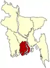 | |
| Barisal District | ||
| Bhola District | ||
| Jhalokati District | ||
| Patuakhali District | ||
| Pirojpur District | ||