Barguna District
Barguna (Bengali: বরগুনা Borguna) is a district in the division of Barisal, Bangladesh.[3] It is situated in the southern part of Bangladesh. Barguna subdivision was established in 1969 and promoted to district on 28 February 1984.
Barguna
বরগুনা | |
|---|---|
| Barguna District | |
.jpg.webp) 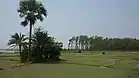 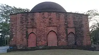 .jpg.webp) .jpg.webp) .jpg.webp) From top: Seabirds in Barguna Coastal area (Laldia beach), Tengragiri Wildlife Sanctuary, Bibicini Shahi Mosque, Haringhata Reserved Forest, Ashar Chor and Bibicini Shahi Mosque | |
 Location of Barguna in Bangladesh | |

Expandable map of Barguna District | |
| Coordinates: 22.1508°N 90.1264°E | |
| Country | |
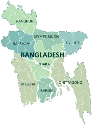
| Division | Barisal Division |
| Government | |
| • Deputy Commissioner | Mustain Billah |
| • District Council Chairman | Md. Delwar Hossein [1] |
| • Chief Executive Officer | Md. Owahedur Rahman |
| Area | |
| • Total | 1,939.39 km2 (748.80 sq mi) |
| Population (2011 census) | |
| • Total | 892,781 |
| • Density | 460/km2 (1,200/sq mi) |
| Literacy rate | |
| • Total | 62.10% |
| Time zone | UTC+06:00 (BST) |
| HDI (2018) | 0.586[2] medium · 16th of 21 |
History
Barguna district was in the Sundarban area. In the evolution of time, people started clearing the forest by cutting down the trees and started to live here. Wood merchants used to come here to collect woods from the forest.
Etymology
There is not enough strong proof of naming the district. Some historians say that timber traders of the northern region came here to buy timbers and waited for the favoring flow (Baro - Gone) to overcome and from there the name "Baro-Gana" was derived. Others say that it was named after a famous Rakhine resident of this district while some say that the name came from a bawali named "Barguna"[4]
Geography
The Barguna District has a total area of 1939.39 km2. It was established as a district on 28 February 1984. It is bounded on the north by the districts of Jhalkathi, Barisal, Pirojpur and Patuakhali. In the east, it borders the Patuakhali district. On the south, Barguna is bounded by the Patuakhali district, and the Bay of Bengal. On the western side, it borders Pirojpur and Bagerhat districts. There are six upazilas, six thanas, four municipalities, 42 unions and 560 villages. Important rivers include the Paira River, Bishkhali River, Khakdon river, Baleshwar River and Haringhata river. The total area of the river is 160 km2 which is 22% of the total area of the district. Moreover, there are 300 natural canals in the district. The average annual temperature is 33.3° Celsius and annual lowest temperature is 12.1° Celsius. Annual rainfall of the district is 2506 mm. Total area of reserved forest area is 30533.90 acres.[5]
Administration
Barguna district has 6 upazilas and 42 unions. Taltali is the newest. The upazilas are:
| Upazila | Area (km2) | No. of Unions | Population (2011) |
|---|---|---|---|
| Amtali | 720.76 | 7 | 244,438 |
| Bamna | 101.05 | 4 | 79,564 |
| Barguna Sadar | 454.39 | 10 | 219,729 |
| Betagi | 167.75 | 7 | 110,926 |
| Patharghata | 387.36 | 7 | 134,635 |
| Taltali | 258.94 | 7 | 88,004 |
Economy
Barguna's economy is primarily dependent on agriculture. Principal crops include rice and pulses. Jute cultivation was once important, but it gradually lost popularity as a cash crop. Being a coastal district, Barguna has a thriving fishing industry. Produce of the district includes betel leaf, pulses, bananas, betel nut, molasses, marine fish, and shrimp. Total area of agricultural land is 104231 hectares.
There is no major industry in this district. A number of small manufacturing industries comprise mostly rice mills, saw mill, soap factory, flour mill, ice factory and pen factory. There are 25 food processing industries, 10 chemical industries, 10 textile home-craft industries and 35 miscellaneous industries in thos district. Majority of the industries are in the sadar area and the remainings are in different upazilas. Traditional cottage industries such as weaving, bamboo and cane art work, goldsmithing, blacksmithing, pottery, wood work, and tailoring also thrive in rural areas.[6]
Demographics
As of 2011, Barguna District had an overall population of 892,781 with a population density of 460 people per km2. Females constitute a majority of the population with 51.01% while males constitute 48.99%. Total male population is 437,413 and total female population is 455,368. Total numbers of voters are 662,375.
Religion
The overwhelming majority of the population of the district is Muslim, with the population share of Hindus seeing a decline since the 1981 census, when they constituted 9.35 per cent. The same has been true for Buddhists and Christians. Similar to other districts in the Barisal division, the absolute number of all the three minority populations reduced in the 2001-2011 period.
The district has 3760 mosques, 144 temples, one church and 18 Buddhist pagodas.[8]
Education
Literacy rate of Barguna district is 62.10%. There are total 1332 educational institutions. There are 2 government and 22 non government colleges, 2 government and 148 non government high schools, 814 government primary schools, 339 madrasas, one non government B.Ed college, one government primary teachers training institute, one government polytechnic institute, one government technical institute and college and one government textile vocational institute. Notable educational institutions are:
- Barguna Polytechnic Institute
- Taslima Memorial Academy
- Barguna Govt. College
- Barguna Zilla School
- Barguna Govt. Girls school
Health
There is a modern government general hospital in this district which has 100 bed capacity but an upgradation of 250 bed capacity is under construction. Besides this, there are 5 upazila health complexes, 8 upazila health centres and 123 community clinics in this district. There are total 32 government doctors servicing this whole district. There is a lack of total 134 doctors in the hospitals and clinics.[5]
Transportation
There is direct connection from the capital to this district by road. The total length of Upazila Road is 464 km, of which 352 km is concrete and 112 km is dirt. The total length of Union Road is 568 km. 336 km, of which is concrete and 232 km is dirt. Sakura travels, Mia travels, Abdullah travels, Sugandha travels, Patuakhali express, Meghna travels, and Saudia travels are major bus travels.
Total length of riverway is 250 nautical miles. M.V. Bandhan-7, Juboraj-4, Juboraj-2, Allahu Marji, Nusrat, Mashiran Khan, Tipu-3 are some of naval transports available in this district.
There is no airport in this district.[9]
Member of the eleventh Jatiyo Sangsad (2020 - current)
| Area | SIlected Midnight MP | Party | Editing |
|---|---|---|---|
| Barguna-1 | Dhirendra Debnath Shambhu[10] | Bangladesh awami League | Eliach Hossain Barguna(+393278856367) |
| Barguna-2 | Showkat Hasanur Rahman (Rimon)[10] | Bangladesh awami League | Eliach Hossain Barguna(+393278856367) |
Notable places
Notable people
- Professor Syed Fazlul Haque
- Md. Akhtaruzzaman, Vice-Chancellor, University of Dhaka
See also
References
- zp.barguna.gov.bd
- "Sub-national HDI - Area Database - Global Data Lab". hdi.globaldatalab.org. Retrieved 2020-03-18.
- Md Monir Hossain Kamal (2012). "Barguna District". In Sirajul Islam and Ahmed A. Jamal (ed.). Banglapedia: National Encyclopedia of Bangladesh (Second ed.). Asiatic Society of Bangladesh.
- "Background of district". Bangladesh national portal.
- "Barguna at a glance". Bangladesh national portal.
- "Business and industries". Bangladesh national portal.
- "Bangladesh Population & Housing Census 2011 (Zilla Series)" (PDF). Retrieved 23 September 2020.
- "Barguna district". Banglapedia. Retrieved 23 September 2020.
- "Transportation system of district". Bangladesh national portal.
- "List of 11th parliament members". Bangladesh Parliament.
- "Barguna district". Banglapedia.
External links
| Wikimedia Commons has media related to Barguna District. |
| Upazila/Thana: | ||
|---|---|---|