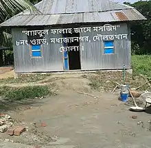
Daulatkhan Upazila
Daulatkhan (Bengali: দৌলতখান) is an upazila of Bhola District in the Division of Barisal, Bangladesh.[1]
Daulatkhan
দৌলতখান | |
|---|---|
 Daulatkhan Location in Bangladesh | |
| Coordinates: 22°36.4′N 90°44.1′E | |
| Country | |
| Division | Barisal Division |
| District | Bhola District |
| Area | |
| • Total | 316.99 km2 (122.39 sq mi) |
| Population (1991) | |
| • Total | 153,458 |
| • Density | 480/km2 (1,300/sq mi) |
| Time zone | UTC+6 (BST) |
| Website | Official Map of the Daulatkhan Upazila |
Geography
Daulatkhan is located at 22.6069°N 90.7358°E. It has 29,233 households and its total area is 316.99 km2.
Demographics
According to the 1991 Bangladesh census, Daulatkhan had a population of 153,458, of whom 69,112 were aged 18 or older. Males constituted 52.54% of the population, and females 47.46%. Daulatkhan had an average literacy rate of 24.5% (7+ years), against the national average of 32.4%.[2]
Administration
Daulatkhan Upazila is divided into Daulatkhan Municipality and nine union parishads: Char Khalipa, Charpata, Dakshin Joynagar, Hazipur, Madanpur, Madua, Sayedpur, Uttar Joynagar, and Vhovanipur. The union parishads are subdivided into 25 mauzas and 25 villages.[3]
Daulatkhan Municipality is subdivided into 9 wards and 9 mahallas.[3]
References
- Syed Mujtaba Ahmed Khan (2012). "Daulatkhan Upazila". In Sirajul Islam and Ahmed A. Jamal (ed.). Banglapedia: National Encyclopedia of Bangladesh (Second ed.). Asiatic Society of Bangladesh.
- "Population Census Wing, BBS". Archived from the original on 2005-03-27. Retrieved November 10, 2006.
- "District Statistics 2011: Bhola" (PDF). Bangladesh Bureau of Statistics. Archived from the original (PDF) on 13 November 2014. Retrieved 14 July 2014.
| Upazila/Thana: | ||
|---|---|---|
Capital: Barisal | ||
| Barguna District | 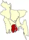 | |
| Barisal District | ||
| Bhola District | ||
| Jhalokati District | ||
| Patuakhali District | ||
| Pirojpur District | ||
