Jhalokati District
Jhalokati, widely written as Jhalokathi (Bengali: ঝালকাঠি) is a district in southern Bangladesh.[2] It is located in the Barisal Division and covers an area of 758.06 km2 It is bounded by Barisal district to the north and east, Barguna district and the Bishkhali river in the south, Lohagara Upazila and Pirojpur district to the west. Annual average temperatures: maximum 33.3 °C, minimum 12.1 °C; annual rainfall 2506 mm. The main rivers in this district are Bishkhali, Dhanshiri, Gabkhan, Sugandha, Jangalia, Bamanda and Bajitpur. "পেয়ারা আর শীতলপাটি, এই নিয়ে ঝালকাঠি" "(Jhalokathi, The land of tasty Guava and Shitolpati)" is the official moto of the district.[3]
Jhalokati
ঝালকাঠি | |
|---|---|
 .jpg.webp) .jpg.webp)  From top: Jhalokati Sadar Road, Kirtipasha Zamindar Bari Ruins and Jhalokathi N S Kamil Madrasah Complex | |
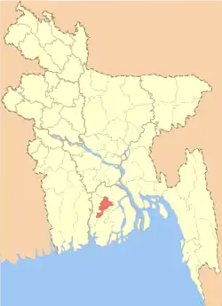 Location of Jhalokati in Bangladesh | |

Expandable map of Jhalokati District | |
| Coordinates: 22.6431°N 90.2000°E | |
| Country | |
| Division | Barisal Division |
| Government | |
| • Deputy Commissioner | Md. Johar Ali |
| Area | |
| • Total | 758.06 km2 (292.69 sq mi) |
| Population (2011 census) | |
| • Total | 694,090 |
| • Density | 920/km2 (2,400/sq mi) |
| Time zone | UTC+06:00 (BST) |
| HDI (2018) | 0.672[1] medium · 2nd of 21 |
| Website | www |
Subdivisions
The district is administratively subdivided into 4 upazilas, these are:
Administration
Administrator of Zila Porishad: Sarder Mohammad Shah Alam [4]
Transportation
- Roads & Highways:
- Rural communications: Water transport is a major attraction in Jhaokati district. People can travel at a cheap cost by boats and various types of engine boats. Jhalokati is famous for beautiful rivers and canals like Barishal. Tourists can find it enjoyable to travel through boats.
Population
According to the 2001 Bangladesh census, Jhalokati District had a population of 694,090, of whom 346,161 were male, and 347,929 were female.[3]
Religion
A large majority of the district population is Muslim. It has 2475 mosques, 46 Hindu temples and five Buddhist pagodas. The percentage share of minority Hindus and Christians have seen a decline in absolute numbers since the 1981 census.
Media
Print media:
- Prothom Alo (National)
- Kaler kantho (National)
- Daily Samakal (National)
- The Daily Star (National)
Notable personalities
- Nachiketa Chakraborty, famous Tollywood singer's family hails from Chechri Rampur village in Kathalia Upazila[8]
References
| Wikimedia Commons has media related to Jhalokati District. |
- "Sub-national HDI - Area Database - Global Data Lab". hdi.globaldatalab.org. Retrieved 18 March 2020.
- Rahman, Humayun (2012). "Jhalokati District". In Islam, Sirajul; Jamal, Ahmed A. (eds.). Banglapedia: National Encyclopedia of Bangladesh (Second ed.). Asiatic Society of Bangladesh.
- ছবিতে জেলা ব্র্যান্ডিং [District Branding]. Jhalokati District (in Bengali).
- "AL men appointed administrators". The Daily Star. 16 December 2011.
- "List of Deputy Commissioners". Ministry of Public Administration.
- "Officers: Deputy Commissioner's Office".
- "Bangladesh Population & Housing Census 2011 (Zila Series)" (PDF). Retrieved 22 September 2020.
- "Shekorer taane Nachiketa ghure gelen Nachiketa". amaderbarisal.com. 18 November 2014. Retrieved 22 September 2019.
| Upazila | 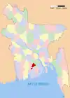 | |
|---|---|---|
| Thana |
| |
| Municipalities | ||
| Barisal Division | 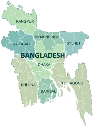 | |
|---|---|---|
| Chittagong Division | ||
| Dhaka Division | ||
| Khulna Division | ||
| Mymensingh Division | ||
| Rajshahi Division | ||
| Rangpur Division | ||
| Sylhet Division | ||
| Wikivoyage has a travel guide for Jhalokati District. |
