Barnby, Suffolk
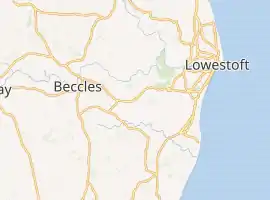
Barnby is a village and civil parish in the East Suffolk district of the English county of Suffolk.[2] The village is 5 miles (8.0 km) west of Lowestoft and 3 miles (4.8 km) east of Beccles in the north of the county. It is effectively merged with the village of North Cove which constitutes a separate parish.
| Barnby | |
|---|---|
_-_geograph.org.uk_-_591729.jpg.webp) St John the Baptist's Church, Barnby | |
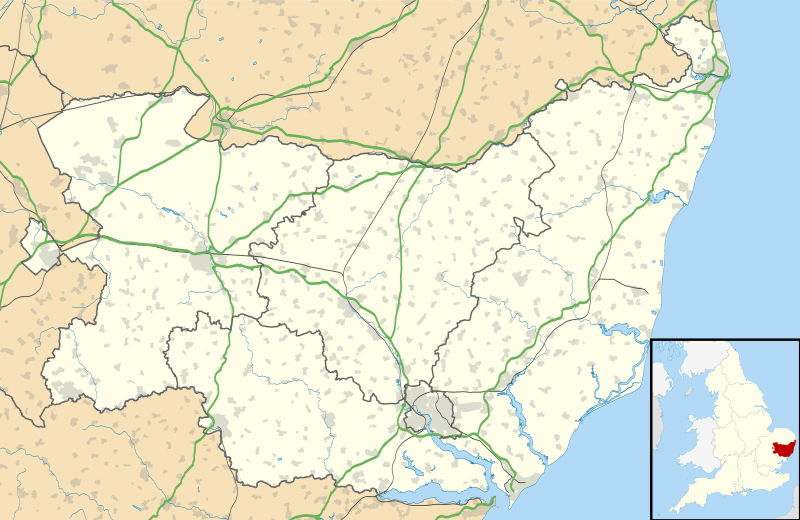 Barnby Location within Suffolk | |
| Population | 479 (2011 census)[1] |
| District | |
| Shire county | |
| Region | |
| Country | England |
| Sovereign state | United Kingdom |
| Post town | Beccles |
| Postcode district | NR34 |
| Dialling code | 01502 |
| |
The village is on the edge of the Broads and lies on the A146 road running between Norwich and Lowestoft. This bypasses the built up area on a series of bends known locally as the "Barnby bends". The East Suffolk Line runs on the northern edge of the village, although the nearest stations are Oulton Broad South and Beccles.
History
The village was mentioned in the Domesday Book. It had an average population at this time with about 13 families in the village.[3] The village formed part of the holdings of Earl Hugh of Chester.[3]
Church of St John the Baptist
The village church is dedicated to St John the Baptist and is a grade II* listed building.[4][5] The nave and chancel date from the 13th century with a 14th-century tower.[4][6] There are the remains of three 15th century wall paintings inside the church.[4][5]
Culture and community
The village contains a pub and a garden centre. Barnby and North Cove Primary School educates around 45 children aged 4 to 11.[7] It is federated with Southwold primary school, sharing a headteacher.[8] At age 11 children transfer to Sir John Leman High School in Beccles.
Barnby Broad and Marshes SSSI
Barnby Broad and Marshes is designated as a Site of Special Scientific Interest. It covers an area of 189.6 hectares (469 acres) of grazing marsh, carr woodland and fen running from the village to the banks of the River Waveney to the north, much of it in the parish of North Cove.[9] Barnby Broad itself is an area of open water resulting from medieval peat cutting and is part of the Broads system.[9] A range of natural and semi-natural habitats are present in the area which is an important bird nesting site.[9]
References
- Civil Parish population 2011. Retrieved 2015-09-25.
- OS Explorer Map OL40: The Broads: (1:25 000) : ISBN 0 319 24086 X.
- Barnby Archived 20 April 2013 at Archive.today, Open Domesday. Retrieved 2013-01-23.
- Church of St John the Baptist, Barnby, British Listed Buildings. Retrieved 2013-01-23.
- St Johns Church Archived 9 March 2016 at the Wayback Machine, English Heritage. Retrieved 2013-01-23.
- St John the Baptist, Barnby, Suffolk Churches website. Retrieved 2013-01-23.
- Barnby and North Cove Community Primary School, Department for Education Edubase. Retrieved 2013-01-23.
- Two Suffolk schools to share headteacher, Beccles and Bungay Journal, 2011-06-11. Retrieved 2013-01-04.
- Barnby Broad and Marshes Archived 4 May 2015 at the Wayback Machine, SSSI citation, Natural England. Retrieved 2013-01-23.
External links
 Media related to Barnby at Wikimedia Commons
- Barnby in the Domesday Book
| Boroughs or districts | |
|---|---|
| Major settlements |
|
| Topics | |
