Sotherton
Sotherton is a dispersed village and civil parish in the East Suffolk district, in the county of Suffolk, England, located approximately 7 miles (11 km) south of Beccles and 3 3⁄4 miles (6.0 km) north east of Halesworth close to the A145. The mid-2005 population estimate for Sotherton parish was 70.[1] Uggeshall is located just to the north-east and Blythburgh to the south-east. Latitude Festival takes place a couple of miles east.
| Sotherton | |
|---|---|
 Public Phone Box | |
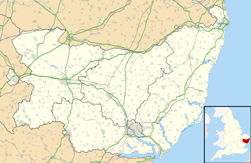
 Sotherton Location within Suffolk | |
| Population | 70 (2005) |
| OS grid reference | TM442796 |
| District | |
| Shire county | |
| Region | |
| Country | England |
| Sovereign state | United Kingdom |
| Post town | Beccles |
| Postcode district | NR34 |
| Dialling code | 01502 |
| UK Parliament | |
Climate
| ||||||||||||||||||||||||||||||||||||||||||||||||||||||||||||||||||||||||||||||||||||||||||||||||||||||||||||||||||||||||||||
Doomsday Book entry
HUNJRET OF BlIDINGA [BlYTHING] (At) SuDRETUNA [Sotherton] Rada a freeman held under Harold 2 carucates of land as a manor. now Franc holds it of Drogo. Then and after- wards 16 bordars, now 19. Then as now 2 serfs. Then and afterwards I plough on the demesne, now 2. Then as now 3 ploughs be- longing to the men. And 2 acres of meadow. Wood(land) for 100 swine. A church with 5 acres. And 1 rouncey. And now i beast. Then 12 swine, now 24, and 25 sheep. Then as now it was worth /^.os. It is i league long and half a league broad. And (pays) i\d. in geld. Rada, Drogo's predecessor, had soke and sac. To this manor Humphrey de Sancto Bertino added I freeman with 12 acres, over whom his predecessor had commendation T.R.E. Then as now 1 bordar. And half a plough. Worth 2s. [3]
C19 Gazetteer Descriptions

In 1868 The National Gazetteer of Great Britain and Ireland wrote, "SOTHERTON, a parish in the hundred of Blything, county Suffolk, 4 miles N.E. of Halesworth, 7 S. of Beccles, and 2 N.W. of Wangford, its post town. The village, which is of small extent, is situated on the river Blyth, and is wholly agricultural. The living is a rectory annexed to that of Uggeshall, in the diocese of Norwich. The church is dedicated to St. Andrew." [4]
In 1870–72, John Marius Wilson's Imperial Gazetteer of England and Wales: "SOTHERTON, a parish in Blything district, Suffolk; 4 miles ENE of Halesworth r. station. Post town, Wangford. Acres, 1,085. Real property, £1,675. Pop., 187. Houses, 39. The property belongs to the Earl of Stradbroke. The living is a rectory, annexed to Uggeshall. The church was rebuilt in 1854." [5]
And in 1894-5 The Comprehensive Gazetteer of England and Wales: "Sotherton, a parish in Suffolk, 4 miles ENE of Halesworth station on the East Suffolk branch of the G.E.R. Post town and money order and telegraph office, Wangford (R.S.O.) Acreage, 1095; population, 159. The property belongs to the Earl of Stradbroke, who is lord of the manor. The living is a rectory, annexed to Uggeshall; joint gross value, £588 with residence, in the gift of the Earl of Stradbroke. The church, which was rebuilt in 1854, is a small building of flint in the Decorated style. "[6]
St Andrews Church

The parish church is dedicated to St Andrew and is located on a small dead-end lane signposted off the A145.[7] It is a Grade II* listed building.[8] It possesses a fine 1811 bust of John Rous, 1st Earl of Stradbroke by Nollekens, and a good late C13 effigy of a knight,[9] of which the British Museum possesses 2 C19 prints.[10]
Global Village Trucking Company
In the 1970s Jeremy and James Lascelles, sons of the 7th Earl of Harewood, had a commune in Church Farm, with their band Global Village Trucking Company, roadies, etc. Jeremy Thorpe was a regular visitor. The writer Dinah Jefferies lived there, and has written about her experiences.[11] In 1973 the BBC made a documentary film about the rock group living in a Suffolk commune with their families, friends, roadies and managers. They made a follow up in 2003.[12] Church Farm is now a holiday let.
Sotherton Hall

Sotherton Hall is a grade II listed Tudor timber framed farmhouse or Hall house with a shaped brick gable end, set by a listed 17th/18th century timber framed and weatherboarded barn,[13] in a small park towards the North of the parish[14] mentioned by Nikolaus Pevsner. It belonged to the Earls of Stradbroke, as part of the Henham Park estate, until 1951 when it became part of the Blyford Estate of John Hill.[15]
References
- Estimates of Total Population of Areas in Suffolk Archived 19 December 2008 at the Wayback Machine, Suffolk County Council, 2007-05-01. Retrieved 2009-04-19
- "NASA Earth Observations Data Set Index". NASA. Retrieved 30 January 2016.
- https://archive.org/stream/victoriahisto01page/victoriahisto01page_djvu.txt
- http://www.genuki.org.uk/big/eng/SFK/Sotherton/
- http://www.visionofbritain.org.uk/place/7696
- https://ukga.org/england/Suffolk/towns/Sotherton.html
- The Suffolk Churches site. Retrieved 2009-04-19
- Listed Buildings in Waveney District Area Waveney District Council, 2007. Retrieved 2009-04-19
- Suffolk By Nikolaus Pevsner, Enid Radcliffe, p424
- http://www.britishmuseum.org/research/collection_online/search.aspx?place=28610&plaA=28610-1-2
- https://www.theguardian.com/lifeandstyle/2014/jun/14/my-children-grew-up-in-commune
- http://www.bbc.co.uk/programmes/b00bbt5j
- https://historicengland.org.uk/listing/the-list/list-entry/1032094
- Stuff, Good. "Sotherton Hall - Sotherton - Suffolk - England | British Listed Buildings". www.britishlistedbuildings.co.uk. Retrieved 4 October 2015.
- https://portal.uea.ac.uk/documents/6207125/6460911/Hill%2BPapers%2Blisting.pdf/4ede29f5-95b1-4499-a809-d05b5f48bda6
