Orford, Suffolk
Orford is a village with historic town status in Suffolk, England, within the Suffolk Coast and Heaths AONB.
| Orford | |
|---|---|
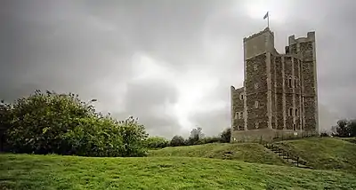
 Orford Castle | |
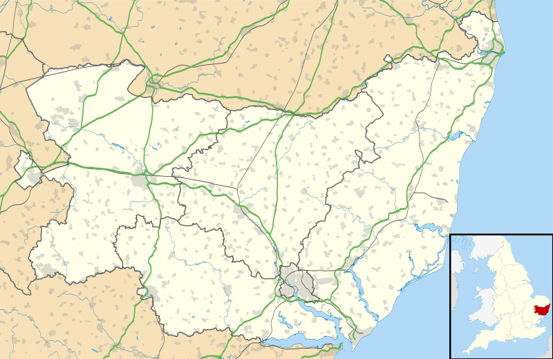
 Orford Location within Suffolk | |
| Population | 713 (2011 Census)[1] |
| OS grid reference | TM422499 |
| Civil parish |
|
| District | |
| Shire county | |
| Region | |
| Country | England |
| Sovereign state | United Kingdom |
| Post town | WOODBRIDGE |
| Postcode district | IP12 |
| Dialling code | 01394 |
| Police | Suffolk |
| Fire | Suffolk |
| Ambulance | East of England |
| UK Parliament | |
History
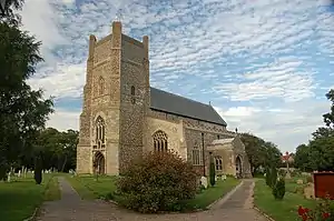
Like many Suffolk coastal towns it was of some importance as a port and fishing village in the Middle Ages. It has a mediaeval castle, built to dominate the River Ore and a Grade I listed parish church, St Bartholomew's.
The main geographical feature of the area is Orford Ness, a long, wide shingle spit at the mouth of the Ore. From 1913 to 1983, Orford Ness was used by the Ministry of Defence and other government bodies for various military developments and tests, and in the early 1970s it was the site of a powerful radar station as part of the Cold War defences against low-flying attacking aircraft. It is now a nature reserve, owned and run by the National Trust. A prominent feature of Orford Ness was its lighthouse, which was demolished in 2020 because of coastal erosion.[2]
Orford provides the only point of access to the nature reserves of Orford Ness and Havergate Island. Both sites can only be accessed via ferry boat from Orford quay. The Orford Ness ferry runs on selected days between April and October[3] and the Havergate Island ferry on selected Saturdays.[4]
The population of Orford greatly increases during the summer months, partly due to its flourishing sailing club. In common with other Suffolk coastal towns and villages, a substantial number of properties in Orford are holiday or second homes.[5]
As well as the Castle, Orford's attractions include river cruises, three pubs, a renowned traditional bakery, a smokehouse and a restaurant; the Butley-Orford Oysterage.
Governance
Orford forms part of the electoral ward called Orford and Tunstall. The population of this ward at the 2011 census was 1,830.[6]
Gallery
| Orford Ness, Suffolk, showing locations of main sites.[7] |

 View from the top of Orford Castle
 Houses in the village
 The Kings Head pub
 Orford Quay
 The view from the back of the boat leaving Orford Quay
 Orford Quay from Orford Ness
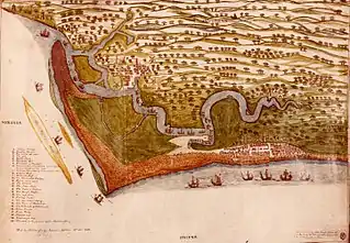
 Orford is the centre-left settlement depicted in this 1588 map
References
- "Town population 2011". Retrieved 16 September 2015.
- "Orfordness Lighthouse: Historic Suffolk landmark reduced to rubble". BBC News. 11 August 2020. Retrieved 12 August 2020.
- "Orford Ness National Nature Reserve". National Trust for Places of Historic Interest or Natural Beauty. Archived from the original on 30 April 2010. Retrieved 26 April 2010.
- "Havergate Island – How to get here". The Royal Society for the Protection of Birds. Retrieved 26 April 2010.
- East Anglian Daily Times 12 March 2016 "Revealed: The Suffolk communities dominated by second homes"
- "Orford and Tunstall Ward population 2011". Retrieved 16 September 2015.
- "Orfordness Visitor Map" (PDF). National Trust. 2018. Retrieved 19 November 2018.
External links
| Wikimedia Commons has media related to Orford. |
| Wikisource has the text of the 1911 Encyclopædia Britannica article Orford. |
| Wikivoyage has a travel guide for Orford. |
- Photographs and more details about Orford
- A Fishy Tale of Orford
- The Wild Man of Orford – An animated version of the 12th Century myth
- "My Orford" by Charlie Underwood M.B.E. – An interesting insight into village life in Orford.