Gisleham
Gisleham is a small village and civil parish located on the western edge of Lowestoft in the East Suffolk district, in the English county of Suffolk. It is situated between Carlton Colville and Kessingland. The place name of Gisleham derives from the Old English gysla and ham, meaning "Gysla's Village".[2]
| Gisleham | |
|---|---|
 Holy Trinity, Gisleham | |
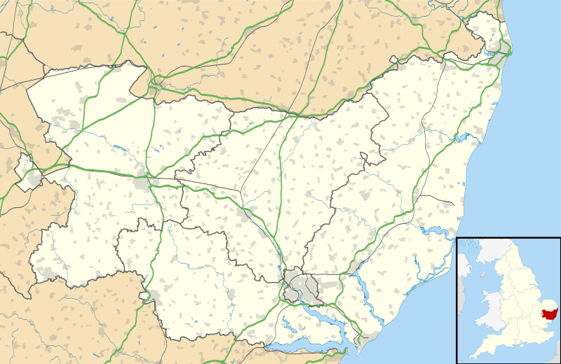 Gisleham Location within Suffolk | |
| Area | 6.35 km2 (2.45 sq mi) |
| Population | 778 (2011)[1] |
| • Density | 123/km2 (320/sq mi) |
| Civil parish |
|
| District | |
| Shire county | |
| Region | |
| Country | England |
| Sovereign state | United Kingdom |
| Post town | Lowestoft |
| Postcode district | NR33 |
| Dialling code | 01502 |
| Police | Suffolk |
| Fire | Suffolk |
| Ambulance | East of England |
In the 1870s, Gisleham was described as:
a parish in Mutford district, Suffolk; near the coast, 3 miles S of Mutford railway station, and 4½ SW by S of Lowestoft. Post town, Mutford-Bridge, under Lowestoft. Acres, 1, 344. Real property, £2, 677. Pop., 267. Houses, 55. The property is divided among a few. The living is a rectory in the diocese of Norwich. Value, £331.* Patron, the Lord Chancellor. The church is ancient, but very good; has a round tower, surmounted by a hexagonal steeple; and contains an octagonal later English font, and remains of a screen.[3]

Holy Trinity Church
The church at Gisleham, Holy Trinity, is one of 38 existing round-tower churches in Suffolk. The church has a late Anglo-Saxon or early Norman round base topped with a 15th-century octagonal brick crown.[4] The medieval church was restored in 1861 and 1887, and the chancel in 1902 to 1908. Holy Trinity is a Grade I listed building.[5]
Gisleham Manor
Within the civil parish of Gisleham is a moated site called Gisleham Manor. The manor dates back to the 13th-century.[6] A house once existed that was enclosed within the moats, and is very likely to have been a fortified manor house. The house and associated buildings of the manor no longer exist.[7]
However, the outer moat survived as a buried feature of the manor. It is thought to have once been infilled. Information regarding the construction and occupation of the moated site is of great importance as it retains archaeological information from the medieval and post-medieval periods.[7] The Manor is now a scheduled monument protected by law under the Ancient Monuments and Archaeological Areas Act 1979.[6]
The lordship of Gisleham Manor House was held by a number of seven families in succession. According to English Heritage: "The majority of moated sites served as prestigious aristocratic and seigneurial residences with the provision of a moat intended as a status symbol rather than a practical military defence."[7]
Demographics
The first national census of 1801 records a population of 198 people within the civil parish of Gisleham. Although the population fell in the years of 1881, 1921 and 1931, it has increased since this time.[8] In the 2001 national census, the civil parish had a population of 549 people (267 males and 282 females).[9] In the 2011 national census, the population had increased by 42%. Within the civil parish, there are now 778 people (388 males and 390 females). The population density of Gisleham is currently 1.2 persons per hectare.[10]

In the 2001 national census, the number of people who lived in Gisleham and identified as White British was 533 people, or 97% of the population.[11] The 2011 national census, also records the percentage of the population who identify as being White British as 97%. However, the White British population increased to 753 people. Other ethnic groups from the 2011 national census include: 11 White Other, 5 Asian/Asian British, 4 White and Asian, 3 White and Black Caribbean, and 2 White Irish/White Irish Traveller.[12]
.png.webp)
According to the 2011 national census, the religious faith of the civil parish is 57% Christian (441 people), and 43% either have no religion or did not state their faith (336 people).[13] However, in the 2001 national census 3 people identified as being Muslim.[14]
The 2001 national census recorded the number of people who were born in England and live in Gisleham as 511 people, or 93% of the population.[15] However, the 2011 national census records the number of people who were born in England and live in Gisleham as 740 people, or 95% of the population.[16]
Housing
The 1831 national census records a number of 47 dwellings within the civil parish of Gisleham. In 1901, it had risen to 75. In 1961, it had risen to 187.[17] The 2011 national census, records a number of 318 dwellings.[18] There are 147 detached households, 66 semi-detached households, 102 terraced households, and 13 apartments.[19]
The 2011 national census records 161 households as deprived in some way, and 157 households as not deprived.[20] English is the first language in 312, or 98% of households.[21] The living arrangements of the people of Gisleham include 438 people living as a couple, and 170 people who do not live as a couple.[22]
Industry
In 1831, occupations were grouped by social status. This included: 9 employers and professionals, 9 middling sorts, and 43 labourers and servants.[23] The 1831 national census simplified industry into four occupational categories which included: agriculture, manufacturing, retail and handicraft, and other. 52 worked in agriculture, 0 worked in manufacturing, 6 worked in retail and handicraft, and 3 worked in 'other'.[24] The 'other' category included 2 capitalists and professionals, and 1 servant.[25]
The 1881 national census records agriculture as the most popular occupation in Gisleham; 45 people worked in agriculture. Services were the second most popular occupation; 17 people worked in this industry. There were many occupations in Gisleham at this time that did not require more than one person to do the job, such as having only 1 blacksmith, wheelwright, and bricklayer. Also, there were a number of people who had unspecified work. Many of them, 51 to be exact, were women.[26]

The 2001 national census recorded 229 people in employment. There were 173 people who were in full-time employment, and 56 people who were in part-time employment.[27] However, this changed during the 2011 national census. The 2011 national census records 374 people in employment. There are 271 people who are in full-time employment, and 103 people who are in part-time employment.[28]
Agriculture is no longer the most popular occupation as it was in 1881, with only 10 people working in this field today. The most popular occupation currently is wholesale and retail trade; it is the occupation of 55 people. The second most popular occupation is human health and social work activities; 40 people work in this area.[29] The most common method of transport to work is driving.[30] For those who are not economically active: 91 are retired, 18 are full-time students, 27 look after home or family, 29 people are sick or disabled in the long-term, and 27 are unemployed.[31]

References
- "Parish population 2011". Office for National Statistics: Neighbourhood Statistics. Retrieved 19 September 2015.
- "Key to English Place Names (Gisleham)". Key to English Place Names (The University of Nottingham). Retrieved 15 February 2017.
- Wilson, John Marius (1870–72). Imperial Gazetteer of England And Wales. Edinburgh: A. Fullerton & Co. Retrieved 24 February 2017.
- "Village Guide (Gisleham)". Eastern Daily Press. Retrieved 15 February 2017.
- "Church of Holy Trinity (Gisleham)". British Listed Buildings. Retrieved 15 February 2017.
- Historic England. "Gisleham Manor moated site, 400m south west of White House Farm (1018967)". National Heritage List for England. Retrieved 13 April 2017.
- "Extract from English Heritage's Record of Scheduled Monuments (Gisleham Manor House)" (PDF). English Heritage. Retrieved 11 March 2017.
- "Population Statistics | Total Population (Gisleham)". Vision of Britain through Time. Retrieved 15 February 2017.
- "Key Figures, 2001 (Gisleham)". Office for National Statistics: Neighbourhood Statistics. Archived from the original on 4 March 2017. Retrieved 3 March 2017.
- "Population Density, 2011 (Gisleham)". Office for National Statistics: Neighbourhood Statistics. Archived from the original on 22 February 2017. Retrieved 22 February 2017.
- "Ethnic Group, 2001 (Gisleham)". Office for National Statistics: Neighbourhood Statistics. Archived from the original on 5 March 2017. Retrieved 3 March 2017.
- "Ethnic Group, 2011 (Gisleham)". Office for National Statistics: Neighbourhood Statistics. Archived from the original on 22 February 2017. Retrieved 22 February 2017.
- "Religion, 2011 (Gisleham)". Office for National Statistics: Neighbourhood Statistics. Archived from the original on 22 February 2017. Retrieved 22 February 2017.
- "Religion, 2001 (Gisleham)". Office for National Statistics: Neighbourhood Statistics. Archived from the original on 4 March 2017. Retrieved 7 March 2017.
- "Country of Birth, 2001 (Gisleham)". Office for National Statistics: Neighbourhood Statistics. Archived from the original on 5 March 2017. Retrieved 3 March 2017.
- "Country of Birth, 2011 (Gisleham)". Office for National Statistics: Neighbourhood Statistics. Archived from the original on 22 February 2017. Retrieved 22 February 2017.
- "Housing Statistics | Total Houses (Gisleham)". Vision of Britain through Time. Retrieved 23 February 2017.
- "Key Statistics, 2011 (Gisleham)". Office for National Statistics: Neighbourhood Statistics. Archived from the original on 2 February 2017. Retrieved 1 February 2017.
- "Dwellings, Household Spaces and Accommodation Type, 2011 (Gisleham)". Office for National Statistics: Neighbourhood Statistics. Archived from the original on 25 February 2017. Retrieved 19 February 2017.
- "Households by Deprivation Dimensions, 2011 (Gisleham)". Office for National Statistics: Neighbourhood Statistics. Archived from the original on 23 February 2017. Retrieved 22 February 2017.
- "Household Language, 2011 (Gisleham)". Office for National Statistics: Neighbourhood Statistics. Archived from the original on 22 February 2017. Retrieved 22 February 2017.
- "Living Arrangements, 2011 (Gisleham)". Office for National Statistics: Neighbourhood Statistics. Archived from the original on 7 March 2017. Retrieved 7 March 2017.
- "Social Structure Statistics | Social Status, based on 1831 occupational statistics (Gisleham)". Vision of Britain through Time. Retrieved 3 March 2017.
- "Industry Statistics | Males aged 20 and over, in four industrial categories (Gisleham)". Vision of Britain through Time. Retrieved 7 March 2017.
- "Industry Statistics | Males aged 20 and over, in 9 occupational categories (Gisleham)". Vision of Britain through Time. Retrieved 7 March 2017.
- "Occupations of Males and Females in the Division and its Registration Counties (Gisleham)". Vision of Britain through Time. Retrieved 19 February 2017.
- "Hours Worked, 2001 (Gisleham)". Office for National Statistics: Neighbourhood Statistics. Archived from the original on 5 March 2017. Retrieved 3 March 2017.
- "Hours Worked, 2011 (Gisleham)". Office for National Statistics: Neighbourhood Statistics. Archived from the original on 23 February 2017. Retrieved 23 February 2017.
- "Industry, 2011 (Gisleham)". Office for National Statistics: Neighbourhood Statistics. Archived from the original on 23 February 2017. Retrieved 23 February 2017.
- "Method of Transport, 2011 (Gisleham)". Office for National Statistics: Neighbourhood Statistics. Archived from the original on 23 February 2017. Retrieved 23 February 2017.
- "Economic Activity, 2011 (Gisleham)". Office for National Statistics: Neighbourhood Statistics. Archived from the original on 23 February 2017. Retrieved 23 February 2017.
External links
| Wikimedia Commons has media related to Gisleham. |
| Boroughs or districts | |
|---|---|
| Major settlements |
|
| Topics | |