Bazeilles-sur-Othain
Bazeilles-sur-Othain (French pronunciation: [bazɛj syʁ‿ɔtɛ̃]) is a commune in the Meuse department in the Grand Est region in northeastern France.
Bazeilles-sur-Othain | |
|---|---|
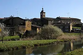 A general view of Bazeilles-sur-Othain | |
.svg.png.webp) Coat of arms | |
Location of Bazeilles-sur-Othain 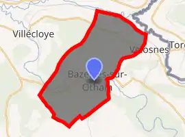
| |
 Bazeilles-sur-Othain  Bazeilles-sur-Othain | |
| Coordinates: 49°29′51″N 5°25′44″E | |
| Country | France |
| Region | Grand Est |
| Department | Meuse |
| Arrondissement | Verdun |
| Canton | Montmédy |
| Intercommunality | Pays de Montmédy |
| Government | |
| • Mayor (2020–2026) | Fabienne Thomas |
| Area 1 | 7.66 km2 (2.96 sq mi) |
| Population (2017-01-01)[1] | 116 |
| • Density | 15/km2 (39/sq mi) |
| Time zone | UTC+01:00 (CET) |
| • Summer (DST) | UTC+02:00 (CEST) |
| INSEE/Postal code | 55034 /55600 |
| Elevation | 187–337 m (614–1,106 ft) (avg. 240 m or 790 ft) |
| 1 French Land Register data, which excludes lakes, ponds, glaciers > 1 km2 (0.386 sq mi or 247 acres) and river estuaries. | |
Geography
The river Othain flows west through the southern part of the commune and crosses the village. The Chiers forms all of the commune's northern border.
Population
| Year | Pop. | ±% |
|---|---|---|
| 1962 | 118 | — |
| 1968 | 118 | +0.0% |
| 1975 | 109 | −7.6% |
| 1982 | 96 | −11.9% |
| 1990 | 72 | −25.0% |
| 1999 | 91 | +26.4% |
| 2007 | 96 | +5.5% |
| 2009 | 103 | +7.3% |
See also
References
- "Populations légales 2017". INSEE. Retrieved 6 January 2020.
| Wikimedia Commons has media related to Bazeilles-sur-Othain. |
| Authority control |
|---|
This article is issued from Wikipedia. The text is licensed under Creative Commons - Attribution - Sharealike. Additional terms may apply for the media files.