Les Hauts-de-Chée
Les Hauts-de-Chée is a commune in the Meuse department in Grand Est in north-eastern France.
Les Hauts-de-Chée | |
|---|---|
 The town hall in Les Hauts-de-Chée | |
 Coat of arms | |
Location of Les Hauts-de-Chée 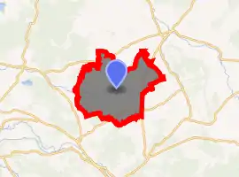
| |
 Les Hauts-de-Chée  Les Hauts-de-Chée | |
| Coordinates: 48°52′05″N 5°10′03″E | |
| Country | France |
| Region | Grand Est |
| Department | Meuse |
| Arrondissement | Bar-le-Duc |
| Canton | Revigny-sur-Ornain |
| Intercommunality | Communauté de communes de Triaucourt Vaubecourt |
| Government | |
| • Mayor (2008–2014) | Reine Varinot |
| Area 1 | 50.17 km2 (19.37 sq mi) |
| Population (2017-01-01)[1] | 728 |
| • Density | 15/km2 (38/sq mi) |
| Time zone | UTC+01:00 (CET) |
| • Summer (DST) | UTC+02:00 (CEST) |
| INSEE/Postal code | 55123 /55000 |
| Elevation | 184–301 m (604–988 ft) (avg. 213 m or 699 ft) |
| 1 French Land Register data, which excludes lakes, ponds, glaciers > 1 km2 (0.386 sq mi or 247 acres) and river estuaries. | |
The former towns of Génicourt-sous-Condé, Hargeville-sur-Chée, Louppy-sur-Chée (Loppy-le-Petit) and Les Marats (Marat-la-Grande, Marat-la-Petite) were joined to Condé-en-Barrois on 20 June 1972, which subsequently changed its name to Les Hauts-de-Chée on 1 July 1972.
Geography
The river Chée rises in the eastern part of the commune, then flows westward through the middle of the commune, crossing through several villages and hamlets.
See also
References
- "Populations légales 2017". INSEE. Retrieved 6 January 2020.
| Wikimedia Commons has media related to Les Hauts-de-Chée. |
| Authority control |
|---|
This article is issued from Wikipedia. The text is licensed under Creative Commons - Attribution - Sharealike. Additional terms may apply for the media files.