City of Wakefield
The City of Wakefield is a local government district in West Yorkshire, England, with the status of a city and metropolitan borough. Wakefield is the district's administrative centre. The population of the City of Wakefield at the 2011 Census was 325,837.[1] The district includes the ‘Five Towns’ of Normanton, Pontefract, Featherstone, Castleford and Knottingley. Other towns include Ossett, Horbury, Hemsworth, South Kirkby and Moorthorpe and South Elmsall. The City and borough are governed by Wakefield Metropolitan District Council. Wakefield is located between Leeds and Barnsley [2]
City of Wakefield | |
|---|---|
.JPG.webp) Wakefield Cathedral from Northgate | |
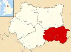 Wakefield shown within West Yorkshire | |
| Sovereign state | United Kingdom |
| Country | England |
| Region | Yorkshire and the Humber |
| Ceremonial county | West Yorkshire |
| Founded | 1974 |
| Admin. HQ | Wakefield |
| Government | |
| • Type | Metropolitan borough, City |
| • Governing body | Wakefield Metropolitan District Council |
| • Mayor | Cllr Charles Keith (L) |
| • Leadership | Leader & Cabinet |
| • Executive | Labour |
| • MPs: | Andrea Jenkyns (C), Yvette Cooper (L), Imran Ahmad-Khan (C), Jon Trickett (L) |
| Area | |
| • Total | 130.7 sq mi (338.6 km2) |
| Area rank | 121st |
| Population (mid-2019 est.) | |
| • Total | 348,312 |
| • Rank | Ranked 21st |
| • Density | 2,700/sq mi (1,000/km2) |
| Time zone | UTC+0 (Greenwich Mean Time) |
| • Summer (DST) | UTC+1 (British Summer Time) |
| ISO 3166-2 | GB-WKF |
| ONS code | 00DB (ONS) E08000036 (GSS) |
| NUTS | 3 |
| Ethnicity | 97.7% White 1.3% S.Asian |
| Website | wakefield.gov.uk |
In 2010, Wakefield was named as the UK's third most musical city by PRS for Music.[3]
Economy
In recent years, the economic and physical condition of several of the former mining towns and villages in Wakefield District have started to improve due to the booming economy of Leeds – and an increase in numbers of commuters to the city from the sub-region – and a recognition of undeveloped assets. For instance Castleford, to the North East of Wakefield is seeing extensive development and investment because of the natural asset of its outlook on to the River Aire, its easy access to the national motorway network and the availability of former mining land for house-building. In Ossett, house prices have risen from an average of £50,000 in 1998 to £130,000 in 2003.
Although unemployment was amongst the highest in the country for most of the 1980s, and 1990s, Wakefield District now has below-average unemployment. The "Wakefield East" ward had 4.7% unemployment in May 2005 (source: Office for National Statistics)—which was more than 1% higher than any other ward. The eastern half of the district remains considerably less prosperous than the western half, with several deprived wards
The district is mainly made out of old coal-mining towns, although other industries include wool, chemicals, machine tools, glass and other forms of manufacturing. Horbury is something of an anomaly in having had an iron works.[4] When Margaret Thatcher came to power in 1979 there were 21 pits in the district. By the time the 1984 Strike began this had decreased to 15, however it still had more collieries than any other district in the country. At the time of privatisation in November 1994, only two remained: the Prince of Wales at Pontefract, which closed in 2002, and Kellingley at Knottingley which closed in 2015 ending the industry that once dominated the district. Most of the district's pits had been very hardline during the 1984 strike.
History
The former Borough of Wakefield was raised to city status by letters patent in 1888. It became a county borough in 1913, taking it out of the jurisdiction of the West Riding County Council. The present boundaries were set in 1974 by the Local Government Act 1972, when the county borough of Wakefield merged with the West Riding municipal boroughs of Castleford, Ossett and Pontefract, the urban districts of Featherstone, Hemsworth, Horbury, Knottingley, Normanton and Stanley, along with Wakefield Rural District and parts of Hemsworth Rural District and Osgoldcross Rural District. The new metropolitan district's city status was reconfirmed by letters patent in 1974. The Council's headquarters is County Hall, originally built for the West Riding County Council and acquired by Wakefield in 1989.
Geography
Green belt
The district is within a green belt region that extends into the wider surrounding counties, and is in place to reduce urban sprawl, prevent the cities and towns in the West Yorkshire Urban Area conurbation from convergence, protect the identity of outlying communities, encourage brownfield reuse, and preserve nearby countryside. This is achieved by restricting inappropriate development within the designated areas, and imposing stricter conditions on permitted building.[5]
The green belt surrounds the Wakefield built up area, and stretches into the wider borough, with larger outlying towns and villages such as Hollingthorpe, Walton, Netherton, Castleford, Knottingley, and Pontefract exempted from it. However, smaller villages, hamlets and rural areas such as Warmfield and Heath, Stanley Ferry, Newmillerdam, Snydale, Wintersett, and Chapelthorpe are 'washed over' by the designation. The green belt was first adopted in 1987,[5] and the size in the borough in 2017 amounted to some 23,500 hectares (235 km2; 91 sq mi).[6]
A subsidiary aim of the green belt is to encourage recreation and leisure interests,[5] with rural landscape features, greenfield areas and facilities including the River Calder and valleys, the Aire and Calder navigation canal, Barnsley Canal, Walton nature reserve, Brandy Carr hill, Pugney's country park and lakes, Sandal Castle, Crigglestone Cemetery War Memorial, Crigglestone rugby club, Altofts and Stanley sports centres, several golf courses, Church of St Peter the Apostle at Kirkthorpe, Fitzwilliam Country Park, and the Stanley Ferry marina.
Governance
The district is divided into 21 wards, with each ward represented on the district's Wakefield Metropolitan District Council by three councillors. Each councillor is elected on a first past the post basis, normally for a four-year period which is staggered annually with the other councillors of that ward so that only one councillor per ward is up for election at any one time. Exceptions to this include by-elections and ward boundary changes.
Wakefield Metropolitan District wards
| Ward | Areas covered[7] |
|---|---|
| 1 Ackworth, North Elmsall and Upton | Ackworth, Ackworth Central, Huntwick with Foulby & Nostell, Hessle & Hill Top, West Hardwick, Badsworth, North Elmsall, Thorpe Audlin, Wentbridge & Kirk Smeaton, Ackworth West, Upton |
| 2 Airedale & Ferry Fryston | Airedale, Ferry Fryston, Townville, Fryston Village |
| 3 Altofts & Whitwood | Normanton (Altofts), Normanton (Lee Brigg), Whitwood, Whitwood Mere, Roundhill, Half Acres, Normanton Industrial Estate, Featherstone North West |
| 4 Castleford Central & Glasshoughton | The Potteries, Central Castleford, Wheldon Road & Lock Lane, Glasshoughton, Redhill (part), Smawthorne Estate, The Maltkilns, Healdfield Area, Cutsyke |
| 5 Crofton, Ryhill & Walton | Chevet, Notton, Notton – Bleakley, Walton South, Walton North, Crofton, Ryhill, Wintersett, Havercroft with Cold Hiendley, Havercroft East |
| 6 Featherstone | Featherstone Central, Featherstone East, Featherstone North West, Featherstone South, Sharlston |
| 7 Hemsworth | Hemsworth South, Hemsworth East, Fitzwilliam, Kinsley, Hemsworth West, South Hiendley |
| 8 Horbury & South Ossett | Horbury Bridge, Horbury Central, Horbury Junction, Horbury North, Horbury West, Ossett Low Common, Ossett South East, Storrs Hill |
| 9 Knottingley | Ferrybridge, Hill Top, Knottingley South, Simpsons, Weeland, Cridling Stubbs (part) |
| 10 Normanton | Newland with Woodhouse Moor, Normanton, Normanton Woodhouse, Warmfield-cum-Heath (Heath), Warmfield-cum-Heath (Warmfield), Normanton Common |
| 11 Ossett | Broadowler, Flushdyke, Gawthorpe & Paleside, Headlands, Holme Lees, Ossett Central, Ossett Towngate, Ossett East, Ossett West, |
| 12 Pontefract North | Castle, Park, Monkhill, Central, Nevison, Barracks' Estate |
| 13 Pontefract South | Baghill, Carleton, Chequerfield, Darrington, East Hardwick, Wakefield Road, Westbourne, Wentbridge (North) |
| 14 South Elmsall & South Kirkby | Moorthorpe, South Kirkby, South Elmsall |
| 15 Stanley & Outwood East | St John's North, Outwood West, Bottomboat, Lake Lock, Newton Hill East, Outwood (Leeds Road), Stanley, Newmarket Lane, Stanley Lee Moor, Lofthouse Gate, Lofthouse |
| 16 Wakefield East | Heath View, Northgate, St Swithuns, Windhill, Pinders Heath, Belle Vue, Greenhill, Northgate South, Primrose Hill, Portobello, Northgate North, Stanley Marsh |
| 17 Wakefield North | Plumpton, Peacock, St John's East, St John's West, West Alverthorpe Central, Westgate Common, Silcoates, Kirkgate, Alverthorpe North, Newton Bar, Whitehall Rise, Batley Road, Flanshaw |
| 18 Wakefield Rural | Crigglestone, Durkar, Hall Green, Newmillerdam, Painthorpe, Middlestown, Netherton, West Bretton, Woolley East, Woolley (Haigh Hill), Woolley West, Calder Grove |
| 19 Wakefield South | Agbrigg South, Kettlethorpe, Sandal Castle, Sandal Woodthorpe, Agbrigg North, Belle Vue, Milnthorpe |
| 20 Wakefield West | Snapethorpe & Roundwood, West Alverthorpe South, Calder, Kirkgate South, Lupset East, Lupset East Central, Snapethorpe South, Lupset West Central, Westgate Central, Westgate North, Westgate South, Lupset Park, Roundwood, Wakefield Road |
| 21 Wrenthorpe & Outwood West | Kirkhamgate, West Alverthorpe North, Gentian Court, Newton Hill West, Carr Gate, Outwood (Ledger Lane), Outwood North, Lingwell Gate, Wrenthorpe, Silcoates |
Elections
| Party | Seats | Current Council (2019) | ||||||||||||||||||||||||||||||||||||||||||||||||||||||||||||||||||
|---|---|---|---|---|---|---|---|---|---|---|---|---|---|---|---|---|---|---|---|---|---|---|---|---|---|---|---|---|---|---|---|---|---|---|---|---|---|---|---|---|---|---|---|---|---|---|---|---|---|---|---|---|---|---|---|---|---|---|---|---|---|---|---|---|---|---|---|---|
| 2015[8] | 2016[9] | 2018[10] | 2019[11] | |||||||||||||||||||||||||||||||||||||||||||||||||||||||||||||||||
| Labour | 53 | 53 | 52 | 49 | ||||||||||||||||||||||||||||||||||||||||||||||||||||||||||||||||
| Conservative | 6 | 7 | 11 | 11 | ||||||||||||||||||||||||||||||||||||||||||||||||||||||||||||||||
| Independent | 2 | 1 | 0 | 2 | ||||||||||||||||||||||||||||||||||||||||||||||||||||||||||||||||
| Lib Dems | 0 | 0 | 0 | 1 | ||||||||||||||||||||||||||||||||||||||||||||||||||||||||||||||||
The city was the safest Labour council in England in 2003, but there was a short-lived swing against Labour in recent years. After the 2008 election results the Labour Party had a majority of just one. However the death of Labour councillor Graham Phelps meant that the authority was for a time in no overall control.[12] Labour did however, hold the seat in the by-election in January 2010 restoring their majority.[13]
In the May 2010 local elections Labour held all of their seats and made a net gain of one seat from the Independents increasing Labour's majority on the Council to three. Following the defection of an Independent to Labour, Labour's majority was increased to 5.[14] In January 2011 a Conservative Councillor defected to become an independent Councillor, leaving the Tories with 23 seats.[15]
In May 2011 Labour increased their majority on the council to 15 making 5 gains, taking 3 seats from the Conservatives (Horbury and South Ossett, Pontefract South and Wrenthorpe and Outwood West), and 2 from the Independents (Featherstone and South Elmsall and South Kirkby). The Conservatives gained Ossett from the Liberal Democrats, which means there are no Liberal Democrat councillors in Wakefield.
The current Council make up is Labour 54, Conservatives 6, UKIP 2 and 1 Independent following the 2014 local elections held in May 2014.
Sports
The city district is home to three professional rugby league clubs, the Wakefield Trinity, Castleford Tigers who both play in the Super League and Featherstone Rovers who play in the Kingstone Press Championship. All three have had periods of success. The city also has several amateur rugby league clubs including Featherstone Lions and Normanton Knights. Current England rugby league internationals from the area include; Tom Briscoe, Rob Burrow, Zak Hardaker, and Brett Ferres. Wakefield is also home to Frickley Athletic association football club who play in Northern Premier League Premier Division, the highest level football club in the Wakefield region, based in South Elmsall.
The district has a strong heritage of cricket with former Yorkshire and England captain Geoffrey Boycott born in Fitzwilliam and current Yorkshire and England cricketer Tim Bresnan from Pontefract.
Social aspects
%252C_Wood_Street%252C_Wakefield.jpg.webp)
A decision was made, in 2004, to transfer the district's extensive council housing to Wakefield and District Housing (WDH), an 'independent' housing association, who would be more efficient with repairs and maintaining decent accommodation; as council housing represented almost 30% of the district, this was the second-largest stock transfer in British history. WDH are investing over £700 million to regenerate the District and working with partners, such as WMDC, are investing in new housing within the District.
References
- "City of Wakefield population 2011". Neighbourhood Statistics. Office for National Statistics. Archived from the original on 15 March 2016. Retrieved 1 March 2016.
- "Yorkshire Districts". Archived from the original on 27 March 2017.
- Richard Smith. "Bristol named Britain's most musical city". Archived from the original on 5 June 2011. Retrieved 4 April 2018.
- "Horbury Junction Iron Co". Grace's Guide. Archived from the original on 31 December 2014. Retrieved 31 December 2014.
- "Green belt review - Wakefield Council" (PDF). Archived (PDF) from the original on 22 March 2018. Retrieved 5 April 2018.
- "Green belt statistics - GOV.UK". www.gov.uk. Archived from the original on 3 July 2018. Retrieved 5 April 2018.
- "Wards". Wakefield Council. Archived from the original on 16 January 2005. Retrieved 16 December 2009.
- http://www.wakefield.gov.uk/about-the-council/elections/previous-election-results-electorate-statistics/local-election-results/local-election-results-2014
- http://www.wakefield.gov.uk/about-the-council/elections/previous-election-results-electorate-statistics/local-election-results/local
- http://www.wakefield.gov.uk/about-the-council/elections/current-elections/local
- Council, Wakefield Metropolitan District. "Local elections 2019 - results". www.wakefield.gov.uk. Retrieved 5 May 2019.
- "Tributes to Councillor Graham Phelps". Wakefield Council. 19 November 2009. Retrieved 23 November 2009.
- "Airedale and Ferry Fryston by-election result". Archived from the original on 30 August 2010. Retrieved 25 September 2010.
- "Local election results 2010". Wakefield Council. Archived from the original on 9 May 2011. Retrieved 9 March 2011.
- "Jesty, Graham". Wakefield Council. Archived from the original on 20 March 2012. Retrieved 9 March 2011.