National Register of Historic Places listings in Cumberland County, Maine
This is a list of the National Register of Historic Places listings in Cumberland County, Maine.
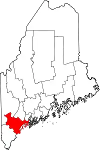
This is intended to be a complete list of the properties and districts on the National Register of Historic Places in Cumberland County, Maine, United States. Latitude and longitude coordinates are provided for many National Register properties and districts; these locations may be seen together in a map.[1]
There are 242 properties and districts listed on the National Register in the county, including 12 National Historic Landmarks. 148 of these properties and districts, including 5 National Historic Landmarks, are located outside Portland, and are listed here, while the properties and districts in Portland are listed separately. Two once-listed properties outside Portland have been removed.
- This National Park Service list is complete through NPS recent listings posted February 5, 2021.[2]
| Androscoggin - Aroostook - Cumberland - Franklin - Hancock - Kennebec - Knox - Lincoln - Oxford - Penobscot - Piscataquis - Sagadahoc - Somerset - Waldo - Washington - York |
Current listings
Portland
Outside Portland
| [3] | Name on the Register[4] | Image | Date listed[5] | Location | City or town | Description |
|---|---|---|---|---|---|---|
| 1 | Academy Building | 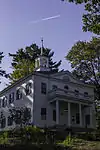 Academy Building |
January 18, 1973 (#73000111) |
Gorham campus of the University of Southern Maine 43°40′55″N 70°26′45″W |
Gorham | |
| 2 | Lt. Robert Andrews House | 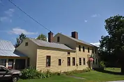 Lt. Robert Andrews House |
December 21, 2005 (#05001440) |
428 S. Bridgton Rd. 43°59′42″N 70°42′27″W |
Bridgton | |
| 3 | Androscoggin Swinging Bridge | 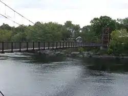 Androscoggin Swinging Bridge |
January 14, 2004 (#03001404) |
Spanning the Androscoggin River between Topsham and Brunswick 43°55′06″N 69°58′26″W |
Brunswick | |
| 4 | Art Gallery | 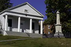 Art Gallery |
December 27, 1972 (#72000071) |
Gorham campus of the University of Southern Maine at Gorham 43°40′47″N 70°26′53″W |
Gorham | |
| 5 | Auburn-Harpswell Association Historic District | 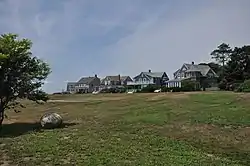 Auburn-Harpswell Association Historic District |
March 21, 1985 (#85000615) |
State Route 123 43°44′47″N 70°00′46″W |
Harpswell | |
| 6 | Babb's Bridge | 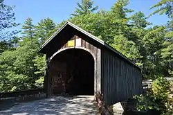 Babb's Bridge |
September 7, 1972 (#09000088) |
Over the Presumpscot River, west of River Rd. and east of Cane Rd. 43°45′58″N 70°26′53″W |
Gorham | |
| 7 | Bailey Island Cobwork Bridge |  Bailey Island Cobwork Bridge |
April 28, 1975 (#75000093) |
On State Route 24 connecting Bailey and Orrs islands 43°44′55″N 69°59′22″W |
Harpswell | |
| 8 | Bailey Island Library Hall | 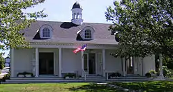 Bailey Island Library Hall |
December 31, 2008 (#08001253) |
2167 Harpswell Island Rd. 43°43′57″N 69°59′43″W |
Harpswell | |
| 9 | Baxter House | 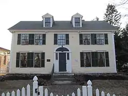 Baxter House |
June 27, 1979 (#79000135) |
South St. 43°40′37″N 70°26′34″W |
Gorham | |
| 10 | Baxter Summer Home |  Baxter Summer Home |
December 26, 1985 (#85003155) |
Mackworth Island 43°41′17″N 70°13′59″W |
Falmouth | |
| 11 | Beckett's Castle | December 31, 1974 (#74000156) |
Off State Route 77 43°36′55″N 70°12′42″W |
Cape Elizabeth | ||
| 12 | Capt. S.C. Blanchard House | 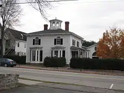 Capt. S.C. Blanchard House |
May 7, 1979 (#79000136) |
317 Main St. 43°48′09″N 70°11′29″W |
Yarmouth | Houses the 317 Main Community Music Center |
| 13 | Henry Boody House | 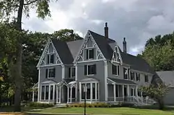 Henry Boody House |
February 24, 1975 (#75000094) |
256 Maine St. 43°54′25″N 69°57′57″W |
Brunswick | Owned by Bowdoin College. |
| 14 | C.A. Brown Cottage | 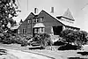 C.A. Brown Cottage |
July 30, 1974 (#74000157) |
9 Delano Park 43°37′11″N 70°12′40″W |
Cape Elizabeth | |
| 15 | Brunswick Commercial Historic District |  Brunswick Commercial Historic District |
January 12, 2016 (#15000968) |
50-151 Maine St. 43°54′57″N 69°57′56″W |
Brunswick | |
| 16 | Burnell Tavern | 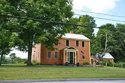 Burnell Tavern |
December 29, 1983 (#83003638) |
State Route 113 43°50′01″N 70°46′46″W |
Baldwin | |
| 17 | Camp Hammond | 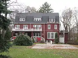 Camp Hammond |
February 1, 1979 (#79000137) |
74 Main St. 43°48′10″N 70°11′23″W |
Yarmouth | |
| 18 | Caswell Public Library (Former) | 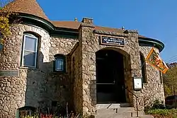 Caswell Public Library (Former) |
February 15, 2005 (#05000056) |
42 Main St. 44°06′39″N 70°40′50″W |
Harrison | |
| 19 | Central Parish Church | 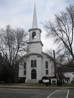 Central Parish Church |
June 23, 1988 (#88000892) |
146 Main St. 43°47′57″N 70°10′58″W |
Yarmouth | |
| 20 | Parker Cleaveland House | 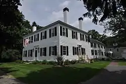 Parker Cleaveland House |
May 16, 2000 (#00000702) |
75 Federal St. 43°54′38″N 69°57′36″W |
Brunswick | |
| 21 | Benjamin Cleaves House | 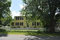 Benjamin Cleaves House |
April 20, 1988 (#88000390) |
S. High St. 44°02′23″N 70°42′39″W |
Bridgton | |
| 22 | Cousins Island Chapel | 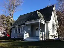 Cousins Island Chapel |
June 20, 1997 (#97000605) |
Eastern side of Cousins Rd., 1.9 miles southeast of its junction with Morton Rd. 43°45′39″N 70°08′30″W |
Yarmouth | |
| 23 | Crescent Lodge | 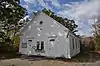 Crescent Lodge |
June 19, 2018 (#100002591) |
1 Wheeler Rd. 43°34′20″N 70°13′14″W |
Cape Elizabeth | AKA the Bowery Beach School |
| 24 | Crystal Spring Farm | 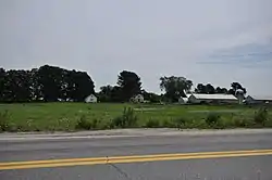 Crystal Spring Farm |
April 29, 2004 (#04000369) |
277 Pleasant Hill Rd. 43°53′24″N 69°59′49″W |
Brunswick | |
| 25 | Cumberland and Oxford Canal | 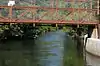 Cumberland and Oxford Canal |
November 1, 1974 (#74000317) |
From Sebago Lake Basin to Conant St. 43°45′05″N 70°25′47″W |
Gorham, Standish, Westbrook, and Windham | |
| 26 | Cumberland Mills Historic District | 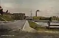 Cumberland Mills Historic District |
May 2, 1974 (#74000316) |
Both sides of the Presumpscot River between railroad tracks and Warren Ave. 43°40′57″N 70°21′10″W |
Westbrook | |
| 27 | Dalton Holmes Davis Memorial Library | 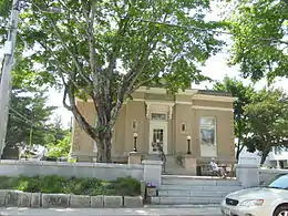 Dalton Holmes Davis Memorial Library |
January 5, 1989 (#88003020) |
Main St. 44°03′15″N 70°42′37″W |
Bridgton | |
| 28 | Deertrees Theatre | 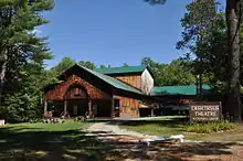 Deertrees Theatre |
January 5, 1989 (#88003002) |
Deertrees Rd. 44°07′03″N 70°39′54″W |
Harrison | |
| 29 | Dry Mills School | 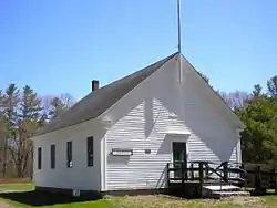 Dry Mills School |
December 13, 1996 (#96001495) |
Maine Wildlife Park Rd. 43°55′42″N 70°21′00″W |
Gray | |
| 30 | John Dunlap House | 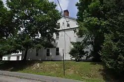 John Dunlap House |
June 14, 1979 (#79000138) |
4 Oak St. 43°55′02″N 69°58′08″W |
Brunswick | |
| 31 | Deacon Andrew Dunning House |  Deacon Andrew Dunning House |
October 8, 1999 (#99001188) |
Mountain Rd., 0.6 miles southeast of its junction with State Route 123 43°49′01″N 69°57′23″W |
Harpswell | |
| 32 | Dunstan Methodist Episcopal Church | 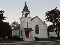 Dunstan Methodist Episcopal Church |
July 13, 1989 (#89000839) |
U.S. Route 1 43°34′02″N 70°23′27″W |
Scarborough | |
| 33 | Isaac W. Dyer Estate | 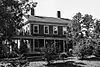 Isaac W. Dyer Estate |
April 1, 1998 (#98000307) |
180 Fort Hill Rd. 43°41′18″N 70°26′56″W |
Gorham | Misspelled "Isaac E. Dyer Estate" in the National Register |
| 34 | Dyer-Hutchinson Farm | 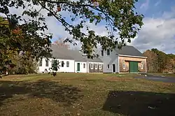 Dyer-Hutchinson Farm |
April 14, 1997 (#97000313) |
1148 Sawyer Rd. 43°36′18″N 70°15′48″W |
Cape Elizabeth | |
| 35 | Dyke Mountain Annex | 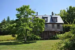 Dyke Mountain Annex |
February 15, 2005 (#05000059) |
319 Dyke Mountain Rd. 43°52′19″N 70°42′37″W |
Sebago | |
| 36 | Eagle Island | 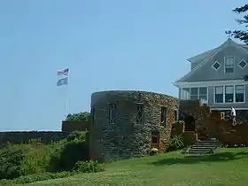 Eagle Island |
November 23, 1971 (#71000069) |
South of Harpswell on Eagle Island 43°42′41″N 70°03′23″W |
Harpswell | |
| 37 | East Harpswell Free Will Baptist Church |  East Harpswell Free Will Baptist Church |
June 23, 1988 (#88000888) |
Cundys Harbor Rd. 43°50′03″N 69°53′56″W |
Harpswell | |
| 38 | East Raymond Union Chapel |  East Raymond Union Chapel |
April 28, 2004 (#04000370) |
394 Webbs Mills Rd. 43°56′02″N 70°26′29″W |
Raymond | |
| 39 | Falmouth High School |  Falmouth High School |
January 12, 2016 (#15000967) |
192 Middle Rd. 43°43′26″N 70°14′42″W |
Falmouth | Most recently known as the Plummer-Motz School |
| 40 | Falmouth House |  Falmouth House |
September 1, 1976 (#76000091) |
349 Gray Rd. 43°46′21″N 70°18′04″W |
Falmouth | |
| 41 | Farnsworth House | November 14, 1980 (#80000229) |
State Route 117 44°05′30″N 70°41′56″W |
Bridgton | ||
| 42 | Federal Street Historic District | 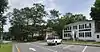 Federal Street Historic District |
October 29, 1976 (#76000092) |
Roughly bounded by Mason, Maine, College, and Federal Sts. 43°54′45″N 69°57′45″W |
Brunswick | |
| 43 | First Parish Church | 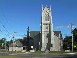 First Parish Church |
December 2, 1969 (#69000008) |
207 Maine St. 43°54′38″N 69°57′47″W |
Brunswick | |
| 44 | First Parish Congregational Church | 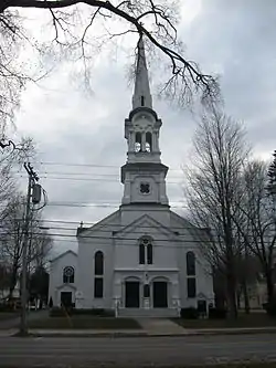 First Parish Congregational Church |
June 20, 1995 (#95000728) |
135 Main St. 43°47′55″N 70°11′04″W |
Yarmouth | |
| 45 | First Parish Meetinghouse | 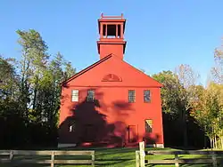 First Parish Meetinghouse |
March 27, 1975 (#75000204) |
Oak Hill Rd. 43°44′17″N 70°33′21″W |
Standish | |
| 46 | Fitch's General Store and House | 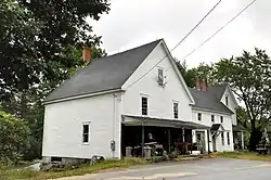 Fitch's General Store and House |
March 10, 1995 (#95000215) |
Eastern side of Long Hill Rd. at its junction with State Route 114 43°51′26″N 70°38′32″W |
Sebago | |
| 47 | Freeman Farm Historic District | 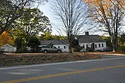 Freeman Farm Historic District |
July 10, 2003 (#03000621) |
342 W. Gray Rd. 43°51′18″N 70°23′08″W |
Gray | |
| 48 | Freeport Main Street Historic District | 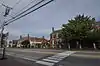 Freeport Main Street Historic District |
November 16, 1977 (#77000064) |
Main St. 43°51′22″N 70°06′19″W |
Freeport | Main Street (US 1) between Holbrook and Nathan Nye Streets. |
| 49 | Friends Meetinghouse | 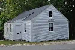 Friends Meetinghouse |
September 9, 1975 (#75000095) |
Quaker Ridge 43°58′12″N 70°31′56″W |
Casco | |
| 50 | Goold House | 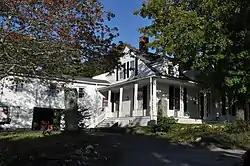 Goold House |
August 10, 1990 (#89000251) |
280 Windham Center Rd. 43°47′11″N 70°24′09″W |
Windham | |
| 51 | Gorham Campus Historic District | 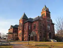 Gorham Campus Historic District |
May 5, 1978 (#78000171) |
College Ave. 43°40′51″N 70°26′47″W |
Gorham | |
| 52 | Gorham Historic District | 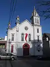 Gorham Historic District |
October 2, 1992 (#92001298) |
Roughly bounded by College, Church, Cross, State, and Maple Sts., including School St. from State to north of Church 43°40′46″N 70°26′44″W |
Gorham | |
| 53 | Grand Trunk Railroad Station | 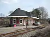 Grand Trunk Railroad Station |
July 10, 1979 (#79000139) |
State Route 115 43°48′06″N 70°11′28″W |
Yarmouth | |
| 54 | Great Chebeague Golf Club | July 14, 2015 (#15000416) |
16 Stone Wharf Rd. 43°45′07″N 70°06′18″W |
Chebeague Island | ||
| 55 | Great Falls Historic District |  Great Falls Historic District |
January 12, 1995 (#94001541) |
Along Windham Center Rd., east of the Presumpscot River 43°48′09″N 70°26′49″W |
Windham | |
| 56 | Greene Cottage | September 30, 2019 (#100004472) |
516 Basin Point Rd. 43°44′22″N 70°02′29″W |
Harpswell | ||
| 57 | Halfway Rock Light Station | 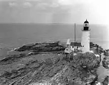 Halfway Rock Light Station |
March 14, 1988 (#88000150) |
Casco Bay off Bailey Island 43°39′21″N 70°02′14″W |
Harpswell | |
| 58 | Hall's Tavern |  Hall's Tavern |
March 30, 1978 (#78000172) |
West of Falmouth at 377 Gray Rd. 43°46′38″N 70°18′09″W |
Falmouth | |
| 59 | Harpswell Meetinghouse |  Harpswell Meetinghouse |
November 24, 1968 (#68000014) |
Harpswell Center on State Route 123, 9 miles south of Brunswick 43°47′56″N 69°59′15″W |
Harpswell | |
| 60 | Harraseeket Historic District | 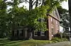 Harraseeket Historic District |
June 28, 1974 (#74000160) |
Roughly both sides of the Harraseeket River, including South Freeport, Porters Landing, and Mast Landing 43°49′36″N 70°05′40″W |
Freeport | |
| 61 | Nathan Harris House | 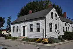 Nathan Harris House |
October 14, 1993 (#93001116) |
425 Main St. 43°40′53″N 70°20′55″W |
Westbrook | |
| 62 | Nathaniel Hawthorne Boyhood Home |  Nathaniel Hawthorne Boyhood Home |
December 2, 1969 (#69000030) |
Hawthorne and Raymond Cape Rds. 43°54′22″N 70°30′47″W |
Raymond | |
| 63 | Winslow Homer Studio | 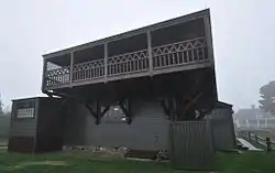 Winslow Homer Studio |
October 15, 1966 (#66000092) |
Winslow Homer Rd., Prouts Neck 43°31′42″N 70°19′13″W |
Scarborough | |
| 64 | Richard Hunniwell House | 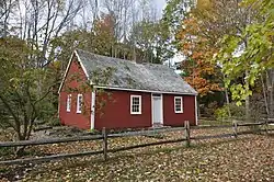 Richard Hunniwell House |
May 12, 1976 (#76000093) |
West of Scarborough at Winnock's Neck and Old County Rds. 43°34′50″N 70°19′55″W |
Scarborough | |
| 65 | Intervale Farm | 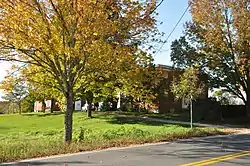 Intervale Farm |
January 14, 2004 (#03001407) |
1047 Intervale Rd. 43°55′39″N 70°15′06″W |
New Gloucester | |
| 66 | Elijah Kellogg Church | 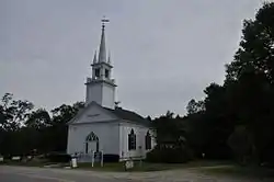 Elijah Kellogg Church |
June 27, 1979 (#79000140) |
State Route 123 43°47′59″N 69°59′12″W |
Harpswell | |
| 67 | Elijah Kellogg House | 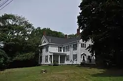 Elijah Kellogg House |
April 28, 1975 (#75000096) |
North of North Harpswell off State Route 123 43°50′06″N 69°58′03″W |
Harpswell | |
| 68 | Lakeside Grange #63 | 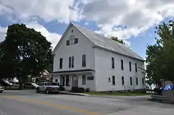 Lakeside Grange #63 |
October 19, 2005 (#05001173) |
Main St. at its junction with Lincoln St. 44°06′37″N 70°40′54″W |
Harrison | |
| 69 | Lincoln Street Historic District |  Lincoln Street Historic District |
December 12, 1976 (#76000094) |
Lincoln St. between Main and Union Sts. 43°55′00″N 69°58′03″W |
Brunswick | |
| 70 | Little Mark Island Monument | June 7, 2016 (#16000338) |
N. Casco Bay at mouth of Merriconeag Sound 43°42′33″N 70°01′53″W |
Harpswell | ||
| 71 | Stephen Longfellow House |  Stephen Longfellow House |
March 22, 1984 (#84001365) |
Longfellow Rd. 43°40′07″N 70°23′54″W |
Gorham | |
| 72 | Mallett Hall |  Mallett Hall |
October 16, 1991 (#91001511) |
Eastern side of State Route 9 north of Dyer Rd. 43°53′34″N 70°11′03″W |
Pownal Center | Pownal's town hall |
| 73 | E.B. Mallett Office Building |  E.B. Mallett Office Building |
February 19, 1982 (#82000747) |
Mill St. 43°51′22″N 70°06′13″W |
Freeport | |
| 74 | Richard Manning House |  Richard Manning House |
July 29, 1993 (#93000639) |
Western side of Raymond Cape Rd. 0.3 miles south of U.S. Route 302 43°54′33″N 70°30′53″W |
Casco | |
| 75 | Manor House |  Manor House |
July 12, 1978 (#78000173) |
U.S. Route 302 43°58′47″N 70°37′37″W |
Naples | |
| 76 | Maplewood Farm |  Maplewood Farm |
December 13, 1991 (#91001813) |
River Rd. southeast of its junction with Webber Rd. 43°42′47″N 70°23′34″W |
Windham | |
| 77 | Daniel Marrett House |  Daniel Marrett House |
February 15, 1974 (#74000314) |
On State Route 25 43°43′55″N 70°33′05″W |
Standish | |
| 78 | Massachusetts Hall, Bowdoin College | 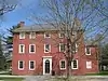 Massachusetts Hall, Bowdoin College |
July 27, 1971 (#71000042) |
Bowdoin College campus 43°54′35″N 69°57′44″W |
Brunswick | |
| 79 | McLellan House | 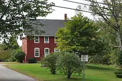 McLellan House |
December 5, 1972 (#72000073) |
140 School St. 43°41′06″N 70°26′49″W |
Gorham | |
| 80 | Merriconeag Grange No. 425 | 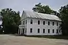 Merriconeag Grange No. 425 |
May 31, 2019 (#100004068) |
529 Harpswell Neck Rd. 43°49′19″N 69°57′54″W |
Harpswell | |
| 81 | Merriconegan Farm | 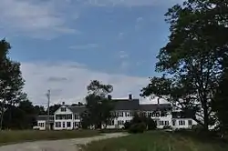 Merriconegan Farm |
June 15, 1979 (#79000269) |
State Route 123 43°51′16″N 69°56′58″W |
Harpswell | |
| 82 | Capt. Reuben Merrill House |  Capt. Reuben Merrill House |
July 12, 1974 (#74000313) |
233 W. Main St. 43°48′14″N 70°12′15″W |
Yarmouth | |
| 83 | Capt. Reuel and Lucy Merrill House |  Capt. Reuel and Lucy Merrill House |
April 14, 1999 (#99000378) |
66 Winn Rd. 43°46′46″N 70°15′34″W |
Cumberland Center | |
| 84 | Mitchell House |  Mitchell House |
January 20, 1978 (#78000325) |
333 Main St. 43°48′11″N 70°11′32″W |
Yarmouth | |
| 85 | New Gloucester Historic District |  New Gloucester Historic District |
November 13, 1974 (#74000162) |
Both sides of SR 231, Gloucester Hill Rd., Cobbs Bridge Rd. 43°57′41″N 70°16′58″W |
New Gloucester | |
| 86 | North Yarmouth Academy | 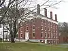 North Yarmouth Academy |
March 4, 1975 (#75000097) |
On State Route 115 43°48′00″N 70°11′04″W |
Yarmouth | Russell Hall and Academy Hall on the NYA campus |
| 87 | North Yarmouth and Freeport Baptist Meetinghouse | 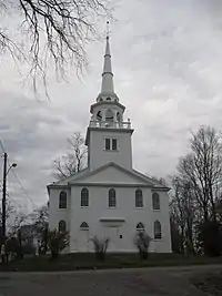 North Yarmouth and Freeport Baptist Meetinghouse |
November 20, 1978 (#78000174) |
Hillside St. 43°48′13″N 70°11′46″W |
Yarmouth | |
| 88 | Norton House Historic District | 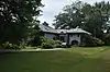 Norton House Historic District |
January 28, 2004 (#03001501) |
241 and 243 Foreside Rd. 43°43′54″N 70°12′36″W |
Falmouth | |
| 89 | Paine Neighborhood Historic District | 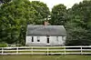 Paine Neighborhood Historic District |
April 11, 1985 (#85000731) |
State Route 113 43°44′27″N 70°36′05″W |
Standish | |
| 90 | Payson House at Thornhurst | 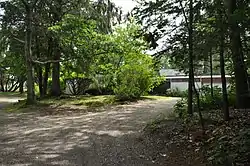 Payson House at Thornhurst |
February 15, 2005 (#05000057) |
48 Thornhurst Rd. 43°42′56″N 70°13′07″W |
Falmouth | |
| 91 | Peabody-Fitch House | 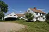 Peabody-Fitch House |
April 7, 1989 (#89000254) |
Off Ingalls Rd. 43°58′59″N 70°43′28″W |
Bridgton | |
| 92 | Pennell Institute | 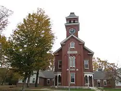 Pennell Institute |
July 12, 1982 (#82000750) |
Lewiston Rd. 43°53′16″N 70°19′41″W |
Gray | Now houses town offices |
| 93 | Pennellville Historic District | 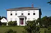 Pennellville Historic District |
October 10, 1985 (#85002923) |
Roughly bounded by Pennellville Rd., Middle Bay Cove, and Pennell Way 43°51′42″N 69°57′40″W |
Brunswick | |
| 94 | Sam Perley Farm |  Sam Perley Farm |
July 10, 1979 (#79000143) |
Perley Rd. 43°59′09″N 70°39′47″W |
Naples | |
| 95 | William F. Perry House |  William F. Perry House |
September 25, 1975 (#75000098) |
32 Main St. 44°03′17″N 70°42′52″W |
Bridgton | |
| 96 | Pettengill House and Farm |  Pettengill House and Farm |
October 6, 1970 (#70000041) |
South of Bow St. 43°51′01″N 70°04′55″W |
Freeport | |
| 97 | Portland Breakwater Light |  Portland Breakwater Light |
June 19, 1973 (#73000238) |
Northeastern end of the Portland Breakwater in Portland Harbor 43°39′19″N 70°14′07″W |
South Portland | |
| 98 | Portland Headlight | 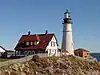 Portland Headlight |
April 24, 1973 (#73000121) |
Portland Head off Shore Rd. 43°37′23″N 70°12′29″W |
Cape Elizabeth | |
| 99 | Portland Railroad Company Substation |  Portland Railroad Company Substation |
March 22, 1991 (#91000320) |
U.S. Route 1 43°34′06″N 70°23′31″W |
Scarborough | |
| 100 | Capt. Greenfield Pote House | 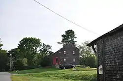 Capt. Greenfield Pote House |
October 6, 1970 (#70000042) |
Wolf Neck Rd. 43°49′49″N 70°04′58″W |
Freeport | |
| 101 | Pownal Cattle Pound | 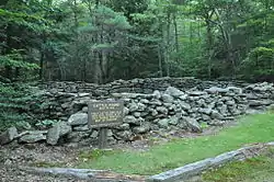 Pownal Cattle Pound |
July 28, 2004 (#04000745) |
Hallowell Rd., Bradbury Mountain State Park, 0.7 miles north of its junction with Dyer Rd. 43°54′06″N 70°10′41″W |
Pownal | |
| 102 | Cushing and Hannah Prince House | 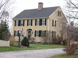 Cushing and Hannah Prince House |
July 1, 1999 (#99000772) |
189 Greely Rd. 43°47′50″N 70°13′25″W |
Yarmouth | |
| 103 | Proprietors Meeting House and Parish House | 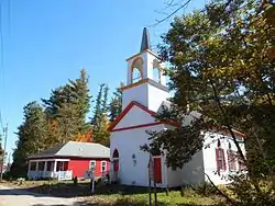 Proprietors Meeting House and Parish House |
August 2, 2001 (#01000813) |
Junction of State Route 22 and Old County Rd. 43°37′14″N 70°28′45″W |
South Buxton (Scarborough side) | |
| 104 | Elisha Purington House | 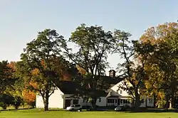 Elisha Purington House |
February 14, 1985 (#85000271) |
71 Mast Rd. 43°45′52″N 70°20′38″W |
Falmouth | |
| 105 | Ram Island Ledge Light Station | 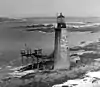 Ram Island Ledge Light Station |
March 14, 1988 (#88000157) |
Ram Island Ledge in Portland Harbor 43°37′53″N 70°11′16″W |
Cape Elizabeth | |
| 106 | Jacob Randall House | 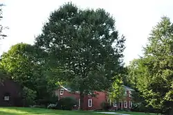 Jacob Randall House |
March 2, 1979 (#79000144) |
Lawrence Rd. 43°55′48″N 70°11′32″W |
Pownal | |
| 107 | Richardson House | 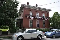 Richardson House |
May 16, 1974 (#74000165) |
11 Lincoln St. 43°54′42″N 69°58′12″W |
Brunswick | |
| 108 | Richmond's Island Archeological Site | 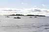 Richmond's Island Archeological Site |
November 2, 1978 (#78000175) |
most of Richmond Island 43°32′38″N 70°14′05″W |
Cape Elizabeth | |
| 109 | Ryefield Bridge | 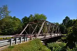 Ryefield Bridge |
September 24, 1999 (#99001193) |
Ryefield Bridge Road over the Crooked River 44°08′34″N 70°35′43″W |
Harrison | Extends into Oxford County |
| 110 | St. Hyacinth School and Convent | 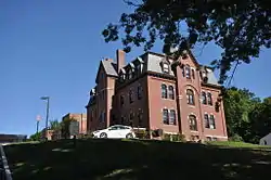 St. Hyacinth School and Convent |
June 25, 2013 (#13000439) |
2 Walker Street 43°40′49″N 70°21′55″W |
Westbrook | |
| 111 | St. Paul's Episcopal Church | 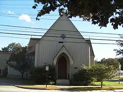 St. Paul's Episcopal Church |
January 31, 1978 (#78000177) |
27 Pleasant St. 43°54′49″N 69°58′06″W |
Brunswick | |
| 112 | Scarborough High School | 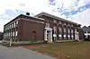 Scarborough High School |
June 27, 2007 (#07000595) |
272 U.S. Route 1 43°35′19″N 70°20′28″W |
Scarborough | |
| 113 | Scribner Homestead | 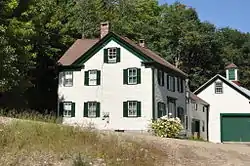 Scribner Homestead |
April 12, 2001 (#01000368) |
244 Scribner's Mill Rd. 44°05′10″N 70°36′22″W |
Harrison | |
| 114 | Seavey-Robinson House | 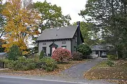 Seavey-Robinson House |
September 11, 1986 (#86002468) |
580 Ocean St. 43°37′22″N 70°14′57″W |
South Portland | |
| 115 | Shaker Village | 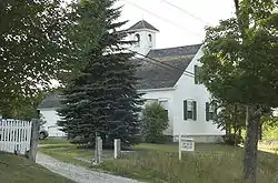 Shaker Village |
September 13, 1974 (#74000318) |
State Route 26 43°59′22″N 70°21′59″W |
New Gloucester | Extends into Androscoggin County |
| 116 | Thomas Skelton House | 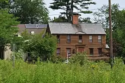 Thomas Skelton House |
May 7, 1973 (#73000124) |
124 U.S. Route 1 43°42′28″N 70°14′14″W |
Falmouth | |
| 117 | Parson Smith House |  Parson Smith House |
July 16, 1973 (#73000237) |
Southeast of South Windham on River Rd. 43°42′58″N 70°23′33″W |
Windham | |
| 118 | Songo Lock | 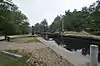 Songo Lock |
February 16, 1970 (#70000093) |
South of Naples off State Route 114 43°55′55″N 70°34′48″W |
Naples | |
| 119 | South Bridgton Congregational Church | 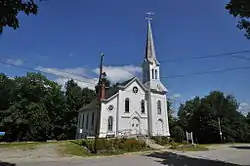 South Bridgton Congregational Church |
June 25, 1987 (#87000947) |
Fosterville Rd. 43°59′19″N 70°42′23″W |
Bridgton | |
| 120 | South Street Historic District |  South Street Historic District |
April 20, 1988 (#88000398) |
South St. between Green and Morrill 43°40′37″N 70°26′29″W |
Gorham | |
| 121 | Southgate Farm |  Southgate Farm |
March 26, 2018 (#100002225) |
577 US 1 43°34′24″N 70°23′04″W |
Scarborough | |
| 122 | Spring Point Ledge Light Station | 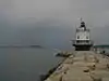 Spring Point Ledge Light Station |
January 21, 1988 (#87002279) |
Spring Point Ledge in Portland Harbor 43°39′07″N 70°13′28″W |
South Portland | |
| 123 | Spurwink Congregational Church | 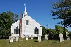 Spurwink Congregational Church |
May 19, 1970 (#70000044) |
Spurwink Ave. 43°34′47″N 70°15′08″W |
Cape Elizabeth | |
| 124 | Standish Corner Historic District | 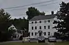 Standish Corner Historic District |
October 14, 1993 (#93001117) |
Junction of State Routes 25/113 and 35 43°44′06″N 70°33′03″W |
Standish | |
| 125 | State Reform School Historic District | 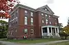 State Reform School Historic District |
April 11, 1985 (#85000730) |
Westbrook St. 43°38′14″N 70°18′24″W |
South Portland | |
| 126 | Steep Falls Library | 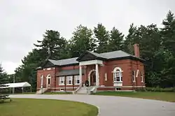 Steep Falls Library |
January 15, 2004 (#03001406) |
1128 Pequawket Trail 43°47′32″N 70°39′03″W |
Steep Falls | |
| 127 | Stimson Memorial Hall | 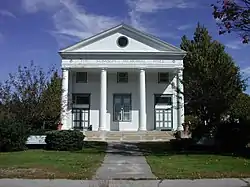 Stimson Memorial Hall |
October 2, 1992 (#92001296) |
Eastern side of State Route 26, 0.5 miles north of its junction with U.S. Route 202 43°53′11″N 70°19′52″W |
Gray | |
| 128 | Stone House | 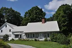 Stone House |
July 19, 1984 (#84001361) |
Burnham Rd. 44°00′02″N 70°40′38″W |
Bridgton | |
| 129 | Capt. Johnson H. Stover Jr. House | 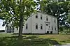 Capt. Johnson H. Stover Jr. House |
June 20, 2018 (#100002592) |
1691 Harpswell Neck Rd. 43°45′11″N 70°00′32″W |
Harpswell | |
| 130 | Harriet Beecher Stowe House |  Harriet Beecher Stowe House |
October 15, 1966 (#66000091) |
63 Federal St. 43°54′46″N 69°57′39″W |
Brunswick | |
| 131 | Tarr-Eaton House | 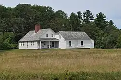 Tarr-Eaton House |
December 31, 2001 (#01001416) |
906 Harpswell Neck Rd. 43°48′02″N 69°59′14″W |
Harpswell Center | |
| 132 | Two Lights | 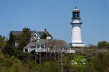 Two Lights |
December 27, 1974 (#74000167) |
Off State Route 77 43°33′55″N 70°12′05″W |
Cape Elizabeth | |
| 133 | Union Church | 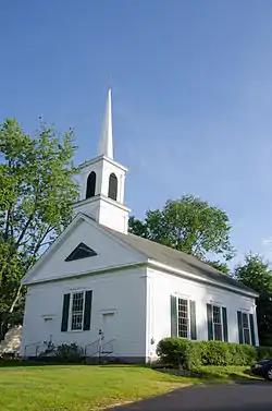 Union Church |
June 24, 1994 (#94000638) |
Southern side of U.S. Route 302, 0.1 miles west of its junction with State Routes 11/114 43°58′11″N 70°36′25″W |
Naples | |
| 134 | Union Church | 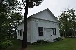 Union Church |
June 28, 1988 (#88000889) |
State Route 123 43°49′14″N 69°58′00″W |
Harpswell | |
| 135 | Union Hotel |  Union Hotel |
September 12, 1985 (#85002179) |
926 Cundy's Harbor Rd. 43°47′32″N 69°53′36″W |
Harpswell | Now the Captain's Watch B&B. |
| 136 | Universalist Meeting House |  Universalist Meeting House |
June 23, 1988 (#88000887) |
State Route 231 in Intervale 43°55′24″N 70°14′54″W |
New Gloucester | |
| 137 | Vallee Family House |  Vallee Family House |
October 13, 1988 (#88001853) |
36 Monroe Ave. 43°40′27″N 70°21′32″W |
Westbrook | |
| 138 | Valley Lodge |  Valley Lodge |
September 19, 1977 (#77000138) |
Saddleback Mountain Rd. 43°49′44″N 70°42′51″W |
Baldwin | Listed in Steep Falls. |
| 139 | Wales and Hamblen Store | 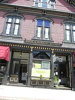 Wales and Hamblen Store |
June 14, 1990 (#90000924) |
134 Main St. 44°03′15″N 70°42′11″W |
Bridgton | |
| 140 | Walker Memorial Hall | 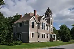 Walker Memorial Hall |
December 29, 1983 (#83003639) |
Lower Ridge Rd. 44°04′50″N 70°43′31″W |
Bridgton | |
| 141 | Walker Memorial Library | 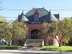 Walker Memorial Library |
November 10, 1980 (#80000231) |
800 Main St. 43°40′34″N 70°21′51″W |
Westbrook | |
| 142 | Walking Man Sign | 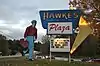 Walking Man Sign |
May 31, 2019 (#100004069) |
10 Hardy Rd. 43°44′38″N 70°21′18″W |
Westbrook | A locally iconic roadside sign. |
| 143 | Warren Block | 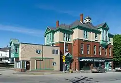 Warren Block |
November 5, 1974 (#74000315) |
Main St. 43°40′53″N 70°20′55″W |
Westbrook | |
| 144 | Watkins House and Cabins | 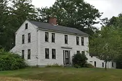 Watkins House and Cabins |
July 2, 1992 (#92000792) |
Junction of U.S. Route 302 and Raymond Cape Rd. 43°54′43″N 70°31′01″W |
Casco | |
| 145 | John and Maria Webb House | 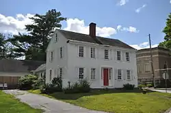 John and Maria Webb House |
October 16, 2013 (#13000834) |
121 Main St. 44°03′15″N 70°42′34″W |
Bridgton | |
| 146 | Westbrook High School | 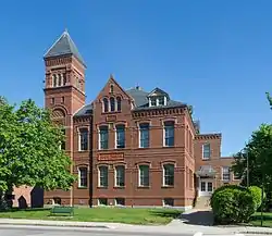 Westbrook High School |
November 27, 1979 (#79000146) |
765 Main St. 43°40′36″N 70°21′46″W |
Westbrook | Old Westbrook High School is now senior housing |
| 147 | Whittier Field Athletic Complex | 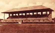 Whittier Field Athletic Complex |
June 26, 2017 (#100001238) |
Roughly bounded by Harpswell Rd., Bowker & Pine Sts. 43°54′28″N 69°57′16″W |
Brunswick | [6] |
| 148 | Winn Road School | 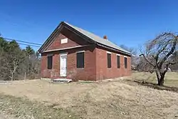 Winn Road School |
March 22, 1984 (#84001364) |
Winn Rd. 43°46′41″N 70°15′37″W |
Cumberland Center |
Former listing
| [3] | Name on the Register | Image | Date listed | Date removed | Location | City or town | Summary |
|---|---|---|---|---|---|---|---|
| 1 | Atlantic House | July 10, 1979 (#79000134) | October 13, 1989 | S of Scarborough on Kirkwood Rd. |
Scarborough | Demolished in 1988. | |
| 2 | Barrows-Scribner Mill | 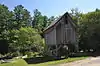 Barrows-Scribner Mill |
March 26, 1976 (#76000090) | August 1, 1986 | Southeast of Harrison on Scribner's Mill Rd. 44°05′08″N 70°36′21″W |
Harrison | Extensively damaged by flooding and heavy snow; has been partially rebuilt |
| 3 | Percival P. Baxter House | 1973 (#73002282) | December 1, 1973 | 61 Deering St. |
Gorham | Birthplace of Percival Proctor Baxter, 53rd Governor of Maine. | |
| 4 | Friends School | 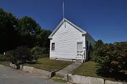 Friends School |
June 24, 1996 (#96000650) | December 21, 2020 | Behind the town offices on State Route 121 44°00′15″N 70°31′24″W |
Casco | Destroyed by arsonists in 2018.[7] |
See also
| Wikimedia Commons has media related to National Register of Historic Places in Cumberland County, Maine. |
References
- The latitude and longitude information provided in this table was derived originally from the National Register Information System, which has been found to be fairly accurate for about 99% of listings. Some locations in this table may have been corrected to current GPS standards.
- "National Register of Historic Places: Weekly List Actions". National Park Service, United States Department of the Interior. Retrieved on February 5, 2021.
- Numbers represent an alphabetical ordering by significant words. Various colorings, defined here, differentiate National Historic Landmarks and historic districts from other NRHP buildings, structures, sites or objects.
- "National Register Information System". National Register of Historic Places. National Park Service. April 24, 2008.
- The eight-digit number below each date is the number assigned to each location in the National Register Information System database, which can be viewed by clicking the number.
- "National Register of Historic Places: Weekly Lists 2017" (PDF). National Park Service. 2017. Retrieved April 9, 2020 – via nps.gov.
- https://www.pressherald.com/2018/04/22/fire-destroys-historic-schoolhouse-in-casco/
| Topics | |
|---|---|
| Lists by state |
|
| Lists by insular areas | |
| Lists by associated state | |
| Other areas | |
| Related | |
| |
Municipalities and communities of Cumberland County, Maine, United States | ||
|---|---|---|
| Cities | Cumberland County map | |
| Towns | ||
| CDPs | ||
| Other villages | ||
| ||