Diep River, Cape Town
Diep River is a suburb in Cape Town, South Africa, named after the Diep River that runs through the area. The suburb is bordered by Heathfield to the south and Plumstead to the north. Diep River railway station is on the main line from Cape Town to Simon's Town.
Diep River | |
|---|---|
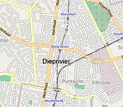
 Street map of Diep River | |
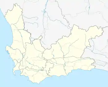
 Diep River Street map of Diep River  Diep River Diep River (South Africa) | |
| Coordinates: 34°2′3″S 18°27′52″E | |
| Country | South Africa |
| Province | Western Cape |
| Municipality | City of Cape Town |
| Main Place | Cape Town |
| Area | |
| • Total | 0.75 km2 (0.29 sq mi) |
| Population (2011)[1] | |
| • Total | 2,515 |
| • Density | 3,400/km2 (8,700/sq mi) |
| Racial makeup (2011) | |
| • Black African | 11.8% |
| • Coloured | 24.8% |
| • Indian/Asian | 0.7% |
| • White | 60.2% |
| • Other | 2.4% |
| First languages (2011) | |
| • English | 82.3% |
| • Afrikaans | 9.7% |
| • Xhosa | 1.0% |
| • Other | 6.9% |
| Time zone | UTC+2 (SAST) |
| Postal code (street) | 7800, 7945 |
References
- "Sub Place Diep River". Census 2011.
This article is issued from Wikipedia. The text is licensed under Creative Commons - Attribution - Sharealike. Additional terms may apply for the media files.
.svg.png.webp)