Bakoven
Bakoven is a residential suburb on the west coast of the Cape Peninsula, south of Camps Bay.
Bakoven | |
|---|---|
Suburb of Cape Town | |
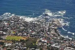 Aerial view over Bakoven from Table Mountain | |
 Bakoven  Bakoven | |
| Coordinates: 33.963°S 18.382°E | |
| Country | South Africa |
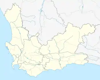
| Province | Western Cape |
| Municipality | City of Cape Town |
| Area | |
| • Total | 1.35 km2 (0.52 sq mi) |
| Population (2011)[1] | |
| • Total | 2,209 |
| • Density | 1,600/km2 (4,200/sq mi) |
| Racial makeup (2011) | |
| • Black African | 10.6% |
| • Coloured | 3.4% |
| • Indian/Asian | 2.2% |
| • White | 82.6% |
| • Other | 1.1% |
| First languages (2011) | |
| • English | 72.6% |
| • Afrikaans | 14.2% |
| • Xhosa | 1.7% |
| • Other | 11.5% |
| Time zone | UTC+2 (SAST) |
| Postal code (street) | 8005 |
| Area code | 021 |
It is the last suburb out of Cape Town on Victoria Road past Camps Bay, positioned between Camps Bay and the wild Nature Reserve. Thereafter the coastline is protected, with thousands of acres of mountain Nature Reserve. This scenic drive from Bakoven to Llandudno and Hout bay is one of the most visited in the Cape.
It has views of the Atlantic Ocean, is surrounded by a fynbos nature reserve and has a backdrop of the Twelve Apostle mountains.
As of 2017 it is the 4th most expensive suburb in Cape Town. [2]
Named "Baking oven", possibly after an off shore rock of that shape; the name is Dutch in origin.[3]
Bakoven has two popular beaches, Beta Beach and Oudekraal - which were an old settlement of Khoi San people there, the original people in the Cape. [4]
References
- "Sub Place Bakoven". Census 2011.
- More info at property24.com, accessed on Feb 21, 2019
- Raper, Peter E. (1987). Dictionary of Southern African Place Names. Internet Archive. p. 63. Retrieved 28 August 2013.
- More info at afristay.com, accessed on Feb 21, 2019