Dietwiller
Dietwiller (German: Dietweiler) is a commune in the Haut-Rhin department in Alsace in eastern France. It forms part of the Mulhouse Alsace Agglomération, the inter-communal local government body for the Mulhouse conurbation.[2]
Dietwiller | |
|---|---|
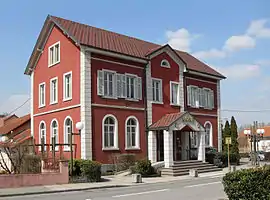 The town hall in Dietwiller | |
.svg.png.webp) Coat of arms | |
Location of Dietwiller 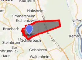
| |
 Dietwiller  Dietwiller | |
| Coordinates: 47°41′31″N 7°24′07″E | |
| Country | France |
| Region | Grand Est |
| Department | Haut-Rhin |
| Arrondissement | Mulhouse |
| Canton | Brunstatt |
| Intercommunality | Mulhouse Alsace Agglomération |
| Government | |
| • Mayor (2008–2014) | Robert Riss |
| Area 1 | 11.06 km2 (4.27 sq mi) |
| Population (2017-01-01)[1] | 1,447 |
| • Density | 130/km2 (340/sq mi) |
| Time zone | UTC+01:00 (CET) |
| • Summer (DST) | UTC+02:00 (CEST) |
| INSEE/Postal code | 68072 /68440 |
| Elevation | 240–304 m (787–997 ft) (avg. 250 m or 820 ft) |
| 1 French Land Register data, which excludes lakes, ponds, glaciers > 1 km2 (0.386 sq mi or 247 acres) and river estuaries. | |
History
The Thalbahn Habsheim ran through Dietwiller. It was a 24.6 km (15.3 mi) long narrow-gauge railway with a gauge of 600 mm (1 ft 11 5⁄8 in). It was built during World War I by German soldiers and Romanian prisoners of war as a military light railway. Many prisoners of war died due to malnutrition, forced labor and the poor living conditions and were buried in the Romanian cemetery in Dietweiler.[3]
See also
References
- "Populations légales 2017". INSEE. Retrieved 6 January 2020.
- "Mulhouse Alsace Agglomération". Mulhouse Alsace Agglomération. Retrieved 2011-04-07.
- Paul Erhart: Histoire du chemin de fer militaire reliant la Hardt à Altkirch pendant la guerre 1914-18…
| Wikimedia Commons has media related to Dietwiller. |
| Authority control |
|---|
This article is issued from Wikipedia. The text is licensed under Creative Commons - Attribution - Sharealike. Additional terms may apply for the media files.