Erquy
Erquy (Breton: Erge-ar-Mor, Gallo: Erqi) is a commune in the Côtes-d'Armor department of Brittany in northwestern France.
Erquy
Erge-ar-Mor | |
|---|---|
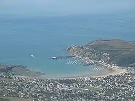 Aerial view | |
 Coat of arms | |
Location of Erquy 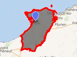
| |
 Erquy 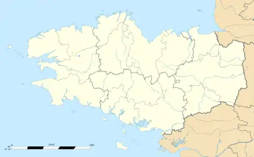 Erquy | |
| Coordinates: 48°37′57″N 2°27′47″W | |
| Country | France |
| Region | Brittany |
| Department | Côtes-d'Armor |
| Arrondissement | Saint-Brieuc |
| Canton | Pléneuf-Val-André |
| Intercommunality | Côte de Penthièvre |
| Government | |
| • Mayor (2014–2020) | Christiane Guervilly |
| Area 1 | 26.46 km2 (10.22 sq mi) |
| Population (2017-01-01)[1] | 3,910 |
| • Density | 150/km2 (380/sq mi) |
| Time zone | UTC+01:00 (CET) |
| • Summer (DST) | UTC+02:00 (CEST) |
| INSEE/Postal code | 22054 /22430 |
| Elevation | 0–116 m (0–381 ft) |
| 1 French Land Register data, which excludes lakes, ponds, glaciers > 1 km2 (0.386 sq mi or 247 acres) and river estuaries. | |
Erquy is located in a cove of the Penthièvre coast bordered by cape Erquy on one side and a volcanic rock formation called pointe de la Heussaye on the other. Erquy harbour shelters a flotilla of about 80 trawlers and the town is known as the scallop "capital". The shellfish are collected in the Saint-Brieuc bay.
With its ten fine sand beaches and lovely pink sandstone houses, Erquy is a popular summer tourist destination.
Population
| Year | Pop. | ±% |
|---|---|---|
| 1962 | 2,974 | — |
| 1968 | 2,998 | +0.8% |
| 1975 | 3,347 | +11.6% |
| 1982 | 3,426 | +2.4% |
| 1990 | 3,568 | +4.1% |
| 1999 | 3,760 | +5.4% |
| 2008 | 3,783 | +0.6% |
| 2012 | 3,898 | +3.0% |
Inhabitants of Erquy are called Réginéens or Erquiais in French.
Geography
Erquy offers a variety of natural landscapes: pink sandstone cliffs and rocks, wild heathland, pinewoods, beaches, dunes and a transparent emerald sea.
Some coastal paths run along the spectacular pink sandstone cliffs of Cape Erquy and Cape Fréhel, close by. The heathland of Cape Erquy is listed as one of the most remarkable natural environments of the Côtes-d'Armor department. Once used as farmland, it is now a nature reserve. It shelters a wide variety of species of heather and gorse creating a colourful landscape changing with the seasons.
Erquy’s ten beaches come in all shapes and sizes: from the small coves bordered by heathland north of the cape to the large expanses of Caroual and Saint-Pabu.
During the summer season, the population is multiplied by seven and can go as high as 30 000 inhabitants. In just a few years, Erquy has become the most active town of the Penthièvre coast economically, commercially, culturally as well as in sports.
History
Erquy and its neighbouring hamlets are rich in heritage with chapels, mansions, lighthouses, a dolmen and a castle. Besides being a harbour, Erquy used to shelter an active pink sandstone quarry and the small pink Tu-Es-Roc village is a testimony of that activity. Nowadays, a trail with interpretative panels allows visitors to explore the former quarry whose pits have become ponds: Les Lacs Bleus.
The jewel of its rich past is the Château de Bienassis, a pink sandstone castle.
Other interesting pieces of heritage in Erquy include:
- The guardhouse at Trois Pierres which was built in 1744 as part of a vast defensive system instigated by Louis XVI who formed coast guard companies and stationed batteries and guardhouses along the whole Breton coast.
- A cannonball oven which was completed in 1794. The cannonballs were heated until they were red-hot so they could set enemy ships on fire.
- The Saint-Michel Chapel: this picturesque chapel is located on a tiny island, Îlot Saint-Michel, linked to the coast by a natural pebble causeway covered by the sea at high tide.
- The Caroual viaduct: built by Harel de la Noë, it enabled the first trains to run from the towns of Côtes-d'Armor to Erquy from 1922 onwards.
The fishing harbour:
Erquy became an important fishing port following the discovery of clam banks in the early 1950s and of scallop banks in 1962. Since then, it has been rated one of the important scallop ports in Europe.
Cultural significance
Erquy and two other harbours, Saint-Quay-Portrieux and Loguivy-de-la-Mer/Paimpol, organise every year and in turn a scallop festival : La Fête de la Coquille Saint-Jacques.
References
- "Populations légales 2017". INSEE. Retrieved 6 January 2020.
External links
| Wikimedia Commons has media related to Erquy. |
- Official website (in French)
- Erquy Tourist Office
- Base Mérimée: Search for heritage in the commune, Ministère français de la Culture. (in French)
| Authority control |
|
|---|