Ploumagoar
Ploumagoar (Breton: Plouvagor) is a commune in the Côtes-d'Armor department of Brittany in northwestern France.
Ploumagoar | |
|---|---|
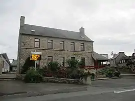 The town hall of Ploumagoar | |
Location of Ploumagoar 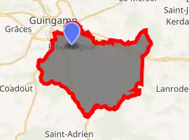
| |
 Ploumagoar  Ploumagoar | |
| Coordinates: 48°32′45″N 3°07′53″W | |
| Country | France |
| Region | Brittany |
| Department | Côtes-d'Armor |
| Arrondissement | Guingamp |
| Canton | Guingamp |
| Intercommunality | Guingamp |
| Government | |
| • Mayor (2014–2020) | Bernard Hamon |
| Area 1 | 32.07 km2 (12.38 sq mi) |
| Population (2017-01-01)[1] | 5,434 |
| • Density | 170/km2 (440/sq mi) |
| Time zone | UTC+01:00 (CET) |
| • Summer (DST) | UTC+02:00 (CEST) |
| INSEE/Postal code | 22225 /22970 |
| Elevation | 67–202 m (220–663 ft) |
| 1 French Land Register data, which excludes lakes, ponds, glaciers > 1 km2 (0.386 sq mi or 247 acres) and river estuaries. | |
Population
| Year | Pop. | ±% |
|---|---|---|
| 1793 | 819 | — |
| 1800 | 1,769 | +116.0% |
| 1806 | 1,934 | +9.3% |
| 1821 | 2,035 | +5.2% |
| 1831 | 2,055 | +1.0% |
| 1836 | 2,004 | −2.5% |
| 1841 | 2,101 | +4.8% |
| 1846 | 2,189 | +4.2% |
| 1851 | 2,151 | −1.7% |
| 1856 | 2,096 | −2.6% |
| 1861 | 2,134 | +1.8% |
| 1866 | 2,268 | +6.3% |
| 1872 | 2,192 | −3.4% |
| 1876 | 2,267 | +3.4% |
| 1881 | 2,282 | +0.7% |
| 1886 | 2,236 | −2.0% |
| 1891 | 2,322 | +3.8% |
| 1896 | 2,348 | +1.1% |
| 1901 | 2,308 | −1.7% |
| 1906 | 2,427 | +5.2% |
| 1911 | 2,495 | +2.8% |
| 1921 | 2,370 | −5.0% |
| 1926 | 2,489 | +5.0% |
| 1931 | 2,358 | −5.3% |
| 1936 | 2,517 | +6.7% |
| 1946 | 2,557 | +1.6% |
| 1954 | 2,499 | −2.3% |
| 1962 | 2,604 | +4.2% |
| 1968 | 3,092 | +18.7% |
| 1975 | 3,940 | +27.4% |
| 1982 | 4,563 | +15.8% |
| 1990 | 4,567 | +0.1% |
| 1999 | 4,399 | −3.7% |
| 2008 | 4,983 | +13.3% |
Inhabitants of Ploumagoar are called ploumagoariens in French.
Breton language
The municipality launched a linguistic plan through Ya d'ar brezhoneg on 11 February 2008.
References
- "Populations légales 2017". INSEE. Retrieved 6 January 2020.
External links
| Wikimedia Commons has media related to Ploumagoar. |
- Official website (in French)
- Base Mérimée: Search for heritage in the commune, Ministère français de la Culture. (in French)
| Authority control |
|---|
This article is issued from Wikipedia. The text is licensed under Creative Commons - Attribution - Sharealike. Additional terms may apply for the media files.
