Fernando de Noronha Airport
Gov. Carlos Wilson Airport (IATA: FEN, ICAO: SBFN) is the airport serving the island of Fernando de Noronha, Brazil. It is the easternmost airport of Brazil and the only one that is located in the Brazilian oceanic islands.
Governador Carlos Wilson Airport Aeroporto Governador Carlos Wilson | |||||||||||
|---|---|---|---|---|---|---|---|---|---|---|---|
 | |||||||||||
| Summary | |||||||||||
| Airport type | Public | ||||||||||
| Operator | Dix Empreendimentos | ||||||||||
| Serves | Fernando de Noronha | ||||||||||
| Time zone | Time in Brazil (UTC−02:00) | ||||||||||
| Elevation AMSL | 58 m / 190 ft | ||||||||||
| Coordinates | 03°51′17″S 032°25′42″W | ||||||||||
| Website | agemar | ||||||||||
| Map | |||||||||||
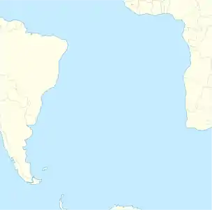 FEN Location off the Atlantic coast of Brazil | |||||||||||
| Runways | |||||||||||
| |||||||||||
It is operated by Dix Empreendimentos.
History
Fernando de Noronha is the biggest island of the archipelago with the same name, located in Brazilian territorial waters, 545 km (339 mi; 294 nmi) away from Recife and 360 km (220 mi; 190 nmi) away from Natal.
The first runway was built in 1934. In 1942, during World War II, the runway was extended and a passenger terminal was built by the United States Army Air Forces Air Transport Command under the Airport Development Program. It provided technical support for the Natal-Dakar air route, which provided a transoceanic link between Brazil and French West Africa for cargo, transiting aircraft and personnel.
The airport was transferred to the jurisdiction of the United States Navy on 5 September 1944.[2] After the end of the war, the administration of the airport was transferred back to the Brazilian Government.
In 1975 another extension of the runway was made, allowing the operations of aircraft up to the class of a Boeing 737. In March 1999, the present passenger terminal was opened for service.
Following the crash of Air France Flight 447 on June 1, 2009, the airport became a base for search and rescue operations. The flight was en route from Rio de Janeiro-Galeão to Paris-Charles de Gaulle when it disappeared in the Atlantic Ocean approximately 550 km (340 mi; 300 nmi) northeast of Fernando de Noronha.[3] Floating debris and bodies were recovered within five days (the flight recorders however, would not be recovered until 2011), and it was determined that the aircraft had crashed into the Atlantic Ocean killing all 228 people on board.[4][5][6]
Airlines and destinations
| Airlines | Destinations |
|---|---|
| Azul Brazilian Airlines | Recife |
| Gol Transportes Aéreos | Recife |
Accidents and incidents
- 14 December 1987: a Brazilian Air Force Lockheed C-130H Hercules registration FAB-2468 flying from Recife to Fernando de Noronha crashed into the sea shortly before landing. All 29 crew and passengers died.[7]
- 20 September 1990: an Embraer EMB110P1 Bandeirante registration PT-PAW belonging to the Government of Pernambuco flying from Fernando de Noronha to Recife crashed into the sea shortly after take-off. All 12 crew and passengers died.[8]
Access
The airport is located 4 km (2.5 mi; 2.2 nmi) from Vila dos Remédios, the administrative center of the island.
See also
References
- "Aeródromos". ANAC (in Portuguese). 22 August 2019. Retrieved 28 October 2020.
- "Document Detail for IRISNUM 00001957". Air Force History Index. 18 May 1982. Retrieved October 20, 2010.
- "Buscas às vítimas do voo 447 serão ampliadas em águas do Senegal" [Searches for victims of Flight 447 will be expanded in Senegal waters] (in Portuguese). Valor Econômico. June 10, 2009. Retrieved April 11, 2013.
- "Brazil: Bodies found near Air France crash site". NBC News. 2009-06-06. Retrieved 2020-12-30.
- "Bodies from missing plane found". BBC News. BBC. 2009-06-06. Archived from the original on 2009-06-08. Retrieved 2020-12-30.
- Ranter, Harro. "Accident description F-GZCP". aviation-safety.net. Aviation Safety Network. Retrieved 2020-12-30.
- Ranter, Harro. "Accident description FAB-2468". aviation-safety.net. Aviation Safety Network. Retrieved May 20, 2011.
- Ranter, Harro. "Accident description PT-FAW". aviation-safety.net. Aviation Safety Network. Retrieved May 20, 2011.
External links
- Airport information for SBFN at World Aero Data. Data current as of October 2006.Source: DAFIF.
- Airport information for SBFN at Great Circle Mapper. Source: DAFIF (effective October 2006).
- Current weather for SBFN at NOAA/NWS
- Accident history for FEN at Aviation Safety Network
Airports in Pernambuco | |
|---|---|
|