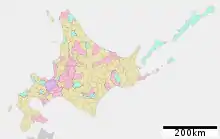
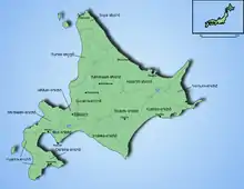
Hokkaido
Hokkaido (Japanese: 北海道, Hokkaidō [hokːaꜜidoː] (![]() listen), "Northern Sea Circuit", Ainu: アイヌ・モシル, Aynu=mosir, "Land of Ainu") is the second largest island of Japan and comprises the largest and northernmost prefecture.[1] The Tsugaru Strait separates Hokkaido from Honshu; the two islands are connected by the undersea railway Seikan Tunnel.
listen), "Northern Sea Circuit", Ainu: アイヌ・モシル, Aynu=mosir, "Land of Ainu") is the second largest island of Japan and comprises the largest and northernmost prefecture.[1] The Tsugaru Strait separates Hokkaido from Honshu; the two islands are connected by the undersea railway Seikan Tunnel.
Hokkaido
北海道 アイヌ・モシル | |||||||||||||
|---|---|---|---|---|---|---|---|---|---|---|---|---|---|
| Japanese transcription(s) | |||||||||||||
| • Japanese | 北海道 | ||||||||||||
| • Rōmaji | Hokkaidō | ||||||||||||
 Flag  Symbol | |||||||||||||
 | |||||||||||||
| Country | |||||||||||||
| Region | Hokkaido | ||||||||||||
| Island | Hokkaido | ||||||||||||
| Capital | Sapporo | ||||||||||||
| Largest city | Sapporo | ||||||||||||
| Subdivisions | Districts: 74, Municipalities: 179 | ||||||||||||
| Government | |||||||||||||
| • Governor | Naomichi Suzuki | ||||||||||||
| Area | |||||||||||||
| • Total | 83,423.84 km2 (32,210.12 sq mi) | ||||||||||||
| Area rank | 1st | ||||||||||||
| Population (May 31, 2019) | |||||||||||||
| • Total | 5,281,297 | ||||||||||||
| • Rank | 8th | ||||||||||||
| • Density | 63/km2 (160/sq mi) | ||||||||||||
| ISO 3166 code | JP-01 | ||||||||||||
| Website | www | ||||||||||||
| |||||||||||||
The largest city on Hokkaido is its capital, Sapporo, which is also its only ordinance-designated city. Sakhalin lies about 43 kilometers (26 mi) to the north of Hokkaido, and to the east and northeast are the Kuril Islands, which are administered by Russia, though the four most southerly are claimed by Japan. Hokkaido was formerly known as Ezo, Yezo, Yeso, or Yesso.[2]
Etymology
When establishing the Development Commission, the Meiji government decided to change the name of Ezochi. Matsuura Takeshirō submitted six proposals, including names such as Kaihokudō (海北道) and Hokkaidō (北加伊道), to the government. The government eventually decided to use the name Hokkaidō, but decided to write it as 北海道, as a compromise between 海北道 and 北加伊道 because of the similarity with names such as Tōkaidō (東海道). According to Matsuura, the name was thought up because the Ainu called the region Kai. The kai element also strongly resembles the On'yomi, or Sino-Japanese, reading of the characters 蝦夷 (on'yomi as [ka.i, カイ], kun'yomi as [e.mi.ɕi, えみし]) which have been used for over a thousand years in China and Japan as the standard orthographic form to be used when referring to Ainu and related peoples; it is possible that Matsuura's kai was actually an alteration, influenced by the Sino-Japanese reading of 蝦夷 Ka-i, of the Nivkh exonym for the Ainu, namely Qoy or IPA: [kʰuɣɪ].[3]
There is no known established Ainu language word for the island of Hokkaido. However, the Ainu people did have a name for all of their domain, which included Hokkaido along with the Kuril Islands, Sakhalin, and parts of northern Honshu, which was Aynu Mosir (アィヌ・モシリ), a name taken by the modern Ainu to refer to their traditional homeland.[4][5][6][7][8] "Ainu Mosir" literally translates as "The Land Where People (the Ainu) Live", and it was traditionally used to be contrasted with Kamuy Mosir, "The Land of the Kamuy (spirits)".[9]
In 1947, Hokkaido became a full-fledged prefecture, but the -ken suffix was never added to its name, so the -dō suffix came to be understood to mean "prefecture". "Hokkai-do-ken" (literally "North Sea Province Prefecture") is, therefore, technically speaking, a redundant term, although it is occasionally used to differentiate the government from the island. The prefecture's government calls itself the "Hokkaido Government" rather than the "Hokkaido Prefectural Government".
History
Early history
| Year | Pop. | ±% p.a. |
|---|---|---|
| 1721 | 15,615 | — |
| 1750 | 21,807 | +1.16% |
| 1786 | 26,310 | +0.52% |
| 1798 | 28,711 | +0.73% |
| 1822 | 61,948 | +3.26% |
| 1834 | 67,862 | +0.76% |
| 1846 | 70,887 | +0.36% |
| 1873 | 123,668 | +2.08% |
| 1890 | 414,430 | +7.37% |
| 1903 | 1,089,503 | +7.72% |
| 1920 | 2,359,183 | +4.65% |
| 1930 | 2,812,335 | +1.77% |
| 1940 | 3,272,718 | +1.53% |
| 1950 | 4,295,567 | +2.76% |
| 1960 | 5,039,206 | +1.61% |
| 1970 | 5,184,287 | +0.28% |
| 1980 | 5,575,989 | +0.73% |
| 1990 | 5,643,647 | +0.12% |
| 2000 | 5,683,062 | +0.07% |
| 2010 | 5,506,419 | −0.32% |
| 2020 | 5,281,297 | −0.42% |
| source:[10][11] | ||
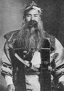
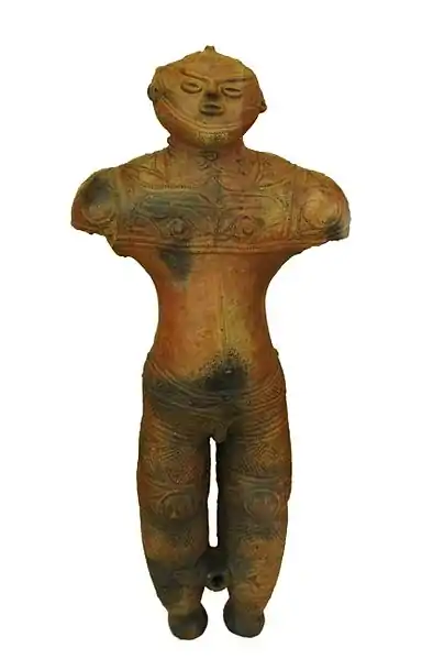
During the Jomon period the local culture and the associated hunter-gatherer lifestyle flourished in Hokkaido, beginning over 15,000 years ago. In contrast to the island of Honshu, Hokkaido saw an absence of conflict during this time period. The indigenous Hokkaido population (the Okhotsk) believed in natural spirits and are theorized to be the origins of Ainu spirituality. About 2,000 years ago, the island was colonized by Yayoi people, and much of the island's population shifted away from hunting and gathering towards agriculture.[12] The Okhotsk culture appears directly ancestral to the Ainu culture.[13][14]
The Okhotsk people, an ancient people of the North, formed the Okhotsk culture unique to Hokkaido from the 5th to 9th centuries. They lived as hunters who caught and ate fish from the sea, and at times caught sea creatures that drifted here along with the sea ice, as the natural bounty found in the Okhotsk Sea was indeed a heavenly blessing. Their expansive living and cultural territory is evidenced by the pit dwelling ruins excavated along the coast of the Okhotsk Sea. They left behind fascinating carvings and earthenware, while evidence suggests that they shared a common belief system with the Ainu culture such as the spiritual worship of the natural world and respect for bears as a sacred animal.
— Hokkaido Museum Abashiri
The Nihon Shoki, finished in 720 AD, is often said to be the first mention of Hokkaido in recorded history. According to the text, Abe no Hirafu[15] led a large navy and army to northern areas from 658 to 660 and came into contact with the various "Ezo tribes". One of the places Hirafu went to was called Watarishima (渡島), which is often believed to be present-day Hokkaido. However, many theories exist concerning the details of this event, including the location of Watarishima.
During the Nara and Heian periods (710–1185), people in Hokkaido conducted trade with Dewa Province, an outpost of the Japanese central government. From the Middle Ages, the people in Hokkaido began to be called Ezo. Hokkaido subsequently became known as Ezochi (蝦夷地, lit. "Ezo-land")[16] or Ezogashima (蝦夷ヶ島, lit. "Island of the Ezo"). The Ezo mainly relied upon hunting and fishing and obtained rice and iron through trade with the Japanese.
Feudal Japan
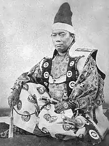
During the Muromachi period (1336–1573), the Japanese created a settlement at the south of the Oshima Peninsula, with a series of fortified residences such as that of Shinoridate. As more people moved to the settlement to avoid battles, disputes arose between the Japanese and the Ainu. The disputes eventually developed into war. Takeda Nobuhiro killed the Ainu leader, Koshamain,[15] and defeated the opposition in 1457. Nobuhiro's descendants became the rulers of the Matsumae-han, which was granted exclusive trading rights with the Ainu in the Azuchi-Momoyama and Edo periods (1568–1868). The Matsumae family's economy relied upon trade with the Ainu. They held authority over the south of Ezochi until the end of the Edo period.
The Matsumae clan rule over the Ainu must be understood in the context of the expansion of the Japanese feudal state. Medieval military leaders in northern Honshu (ex. Northern Fujiwara, Akita clan) maintained only tenuous political and cultural ties to the imperial court and its proxies, the Kamakura shogunate and Ashikaga shogunate. Feudal strongmen sometimes located themselves within medieval institutional order, taking shogunate titles, while in other times they assumed titles that seemed to give them a non-Japanese identity. In fact, many of the feudal strongmen were descended from Emishi military leaders who had been assimilated into Japanese society.[17] The Matsumae clan were of Yamato descent like other ethnic Japanese people, whereas the Emishi of northern Honshu were a distinctive group related to the Ainu. The Emishi were conquered and integrated into the Japanese state dating back as far as the 8th century and as result began to lose their distinctive culture and ethnicity as they became minorities. By the time the Matsumae clan ruled over the Ainu, most of the Emishi were ethnically mixed and physically closer to Japanese than they were to Ainu. From this, the "transformation" theory postulates that native Jōmon peoples changed gradually with the infusion of Yayoi immigrants into the Tōhoku, in contrast to the "replacement" theory that posits the Jōmon was replaced by the Yayoi.[18]
There were numerous revolts by the Ainu against the feudal rule. The last large-scale resistance was Shakushain's revolt in 1669–1672. In 1789, a smaller movement known as the Menashi–Kunashir rebellion was crushed. After that rebellion, the terms "Japanese" and "Ainu" referred to clearly distinguished groups, and the Matsumae were unequivocally Japanese.
After the arrival of Adam Laxman in 1799–1821 and 1855–1858, the Tokugawa shogunate took direct control over Hokkaido in response to a perceived threat from Russia. Leading up to the Meiji Restoration, the Tokugawa shogunate realized there was a need to prepare northern defenses against a possible Russian invasion and took over control of most of Ezochi. The shogunate made the plight of the Ainu slightly easier but did not change the overall form of rule.[19]
Meiji Restoration
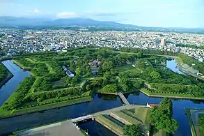
Hokkaido was known as Ezochi until the Meiji Restoration. Shortly after the Boshin War in 1868, a group of Tokugawa loyalists led by Enomoto Takeaki temporarily occupied the island (the polity is commonly but mistakenly known as the Republic of Ezo), but the rebellion was crushed in May 1869. Ezochi was subsequently put under control of Hakodate-fu (箱館府), Hakodate Prefectural Government. When establishing the Development Commission (開拓使, Kaitakushi), the Meiji government introduced a new name. After 1869, the northern Japanese island was known as Hokkaido;[2] and regional subdivisions were established, including the provinces of Oshima, Shiribeshi, Iburi, Ishikari, Teshio, Kitami, Hidaka, Tokachi, Kushiro, Nemuro and Chishima.[20]
The primary purpose of the Development Commission was to secure Hokkaido before the Russians extended their control of the Far East beyond Vladivostok. Kuroda Kiyotaka was put in charge of the venture. His first step was to journey to the United States and recruit Horace Capron, President Ulysses S. Grant's commissioner of agriculture. From 1871 to 1873 Capron bent his efforts to expounding Western agriculture and mining with mixed results. Capron, frustrated with obstacles to his efforts returned home in 1875. In 1876, William S. Clark arrived to found an agricultural college in Sapporo. Although he only remained a year, Clark left a lasting impression on Hokkaido, inspiring the Japanese with his teachings on agriculture as well as Christianity.[21] His parting words, "Boys, be ambitious!", can be found on public buildings in Hokkaido to this day. The population of Hokkaido boomed from 58,000 to 240,000 during that decade.[22]
In 1882, the Development Commission was abolished. Transportation on the island was underdeveloped, so the prefecture was split into several "sub-prefectures" (支庁 shichō), namely Hakodate Prefecture (函館県, Hakodate-ken), Sapporo Prefecture (札幌県, Sapporo-ken), and Nemuro Prefecture (根室県, Nemuro-ken), that could fulfill administrative duties of the prefectural government and keep tight control over the developing island. In 1886, the three prefectures were demoted, and Hokkaido was put under the Hokkaido Agency (北海道庁, Hokkaidō-chō). These sub-prefectures still exist today, although they have much less power than they possessed before and during World War II; they now exist primarily to handle paperwork and other bureaucratic functions.
World War II
In mid-July 1945, various shipping ports, cities, and military facilities in Hokkaido were attacked by the United States Navy's Task Force 38. On 14–15 July, aircraft operating from the task force's aircraft carriers sank and damaged a large number of ships in ports along Hokkaido's southern coastline as well as in northern Honshu. In addition, on 15 July a force of three battleships and two light cruisers bombarded the city of Muroran.[23] Before the Japanese surrender was formalized, the Soviet Union made preparations for an invasion of Hokkaido, but U.S. President Harry Truman made it clear that the surrender of all of the Japanese home islands would be carried out by General Douglas MacArthur per the 1943 Cairo Declaration.[24]
Hokkaido became equal with other prefectures in 1947, when the revised Local Autonomy Law became effective. The Japanese central government established the Hokkaido Development Agency (北海道開発庁, Hokkaidō Kaihatsuchō) as an agency of the Prime Minister's Office in 1949 to maintain its executive power in Hokkaido. The agency was absorbed by the Ministry of Land, Infrastructure and Transport in 2001. The Hokkaido Bureau (北海道局, Hokkaidō-kyoku) and the Hokkaido Regional Development Bureau (北海道開発局, Hokkaidō Kaihatsukyoku) of the ministry still have a strong influence on public construction projects in Hokkaido.
Geography
| Native name: 北海道 | |
|---|---|
 | |
| Geography | |
| Location | East Asia |
| Coordinates | 43°N 142°E |
| Archipelago | Japanese archipelago |
| Area | 77,981.87 km2 (30,108.97 sq mi) |
| Highest elevation | 2,290 m (7510 ft) |
| Highest point | Mount Asahi |
| Administration | |
Japan | |
| Prefectures | Hokkaido |
| Largest settlement | Sapporo (pop. 1,890,561) |
| Demographics | |
| Population | 5,377,435 (September 30, 2016) |
| Pop. density | 64.5/km2 (167.1/sq mi) |
| Ethnic groups | Ainu Japanese |
Government Ordinance Designated City City Town Village
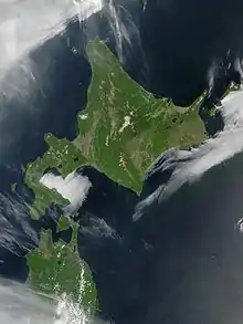
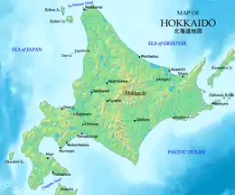
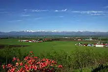
The island of Hokkaido is located in the north of Japan, near Russia (Sakhalin Oblast). It has coastlines on the Sea of Japan (to the west of the island), the Sea of Okhotsk (to the north), and the Pacific Ocean (to the east). The center of the island is mountainous, with volcanic plateaux. Hokkaido has multiple plains such as the Ishikari Plain 3,800 km2 (1,500 sq mi), Tokachi Plain 3,600 km2 (1,400 sq mi), the Kushiro Plain 2,510 km2 (970 sq mi) (the largest wetland in Japan) and Sarobetsu Plain 200 km2 (77 sq mi). Hokkaido is 83,423.84 km2 (32,210.12 sq mi) which make it the second-largest island of Japan.
The Tsugaru Strait separates Hokkaido from Honshu (Aomori Prefecture);[2] La Pérouse Strait separates Hokkaido from the island of Sakhalin in Russia; Nemuro Strait separates Hokkaido from Kunashir Island in the Russian Kuril Islands.
The governmental jurisdiction of Hokkaido incorporates several smaller islands, including Rishiri, Okushiri Island, and Rebun. (By Japanese reckoning, Hokkaido also incorporates several of the Kuril Islands.) Hokkaido Prefecture is the largest and northernmost Japanese prefecture. The island ranks 21st in the world by area.
Population
Hokkaido has the third-largest population of Japan's five main islands, with 5,383,579 people as of 2015).[1][25] It has the lowest population-density in Japan with just 64.5/km2 (160/sq mi) (2016). By population it ranks 20th globally. Major cities include Sapporo and Asahikawa in the central region and the port of Hakodate facing Honshu in the south. Sapporo is the largest city of Hokkaido and 5th-largest in Japan. It had a population of 1,957,914 as of 31 May 2019) and a population density of 1,746/km2 (4,520/sq mi).
| City(-shi) | Inhabitants September 30, 2016 |
|---|---|
| Sapporo | 1,957,914 |
| Asahikawa | 343,393 |
| Hakodate | 266,192 |
| Kushiro | 174,938 |
| Tomakomai | 173,226 |
| Obihiro | 168,258 |
| Otaru | 121,269 |
| Kitami | 120,189 |
| Ebetsu | 119,247 |
| Muroran | 87,498 |
| Iwamizawa | 84,127 |
| Chitose | 96,372 |
| Eniwa | 69,215 |
Flora and fauna
There are three populations of the Ussuri brown bear found on the island. There are more brown bears in Hokkaido than anywhere else in Asia besides Russia. The Hokkaido brown bear is separated into three distinct lineages. There are only eight lineages in the world.[26] Those on Honshu died out long ago.
The native conifer species in northern Hokkaido is the Abies sachalinensis (sakhalin fir)[27] The hydrangea hirta species is also located on the island.
Seismic activity
Like many areas of Japan, Hokkaido is seismically active. Aside from numerous earthquakes, the following volcanoes are considered still active (at least one eruption since 1850):
In 1993, an earthquake of magnitude 7.7 generated a tsunami which devastated Okushiri, killing 202 inhabitants. An earthquake of magnitude 8.3 struck near the island on 26 September 2003. On 6 September 2018, an earthquake of magnitude 6.6 struck with its epicenter near the city of Tomakomai, causing a blackout across the whole island.[28]
Parks
| Shiretoko National Park* | 知床 |
| Akan National Park | 阿寒 |
| Kushiro-shitsugen National Park | 釧路湿原 |
| Daisetsuzan National Park | 大雪山 |
| Shikotsu-Tōya National Park | 支笏洞爺 |
| Rishiri-Rebun-Sarobetsu National Park | 利尻礼文サロベツ |
* designated a World Heritage Site by UNESCO on 2005-07-14.
| Abashiri Quasi-National Park | 網走 |
| Hidaka-sanmyaku Erimo Quasi-National Park | 日高山脈襟裳 |
| Niseko-Shakotan-Otaru Kaigan Quasi-National Park | ニセコ積丹小樽海岸 |
| Ōnuma Quasi-National Park | 大沼 |
| Shokanbetsu-Teuri-Yagishiri Quasi-National Park | 暑寒別天売焼尻 |
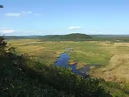 Overview of Kushiro Wetland
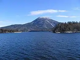
 View of Lake Mashū
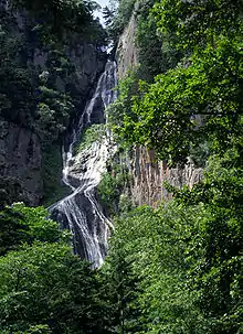 Sōunkyō, a gorge in the Daisetsu-zan Volcanic Area
- Twelve prefectural natural parks (道立自然公園). The prefectural natural parks cover 146,802 ha, the largest area of any prefecture.[29]
- Akkeshi Prefectural Natural Park
- Esan Prefectural Natural Park
- Furano-Ashibetsu Prefectural Natural Park
- Hiyama Prefectural Natural Park
- Kariba-Motta Prefectural Natural Park
- Matsumae-Yagoshi Prefectural Natural Park
- North Okhotsk Prefectural Natural Park
- Nopporo Shinrin Kōen Prefectural Natural Park
- Notsuke-Fūren Prefectural Natural Park
- Sharidake Prefectural Natural Park
- Shumarinai Prefectural Natural Park
- Teshiodake Prefectural Natural Park
| since | ||
|---|---|---|
| Kushiro Wetland | 釧路湿原 | 1980-06-17 |
| Lake Kutcharo | クッチャロ湖 | 1989-07-06 |
| Lake Utonai | ウトナイ湖 | 1991-12-12 |
| Kiritappu Wetland | 霧多布湿原 | 1993-06-10 |
| Lake Akkeshi, Bekkanbeushi Wetland | 厚岸湖・別寒辺牛湿原 | 1993-06-10, enlarged 2005-11-08 |
| Miyajima Marsh | 宮島沼 | 2002-11-18 |
| Uryūnuma Wetland | 雨竜沼湿原 | 2005-11-08 |
| Sarobetsu plain | サロベツ原野 | |
| Lake Tōfutsu | 濤沸湖 | |
| Lake Akan | 阿寒湖 | |
| Notsuke Peninsula, Notsuke Bay | 野付半島・野付湾 | |
| Lake Fūren, Shunkunitai | 風蓮湖・春国岱 |
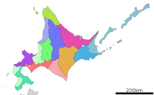
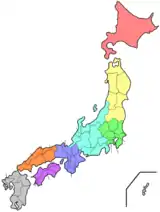
Subprefectures
1
a
2
3
b
4
c
5
d
6
7
8
9
e
(disputed)
(disputed)
| |||||||||
| Subprefecture | Japanese | Main City | Largest Municipality | Pop. (2009) |
Area (km2) |
Municipalities | |||
|---|---|---|---|---|---|---|---|---|---|
| 1 | Sorachi | 空知総合振興局 | Iwamizawa | Iwamizawa | 338,485 | 5,791.19 | 10 cities | 14 towns | |
| a | ↳ Ishikari | 石狩振興局 | Sapporo | Sapporo | 2,324,878 | 3,539.86 | 6 cities | 1 town | 1 village |
| 2 | Shiribeshi | 後志総合振興局 | Kutchan | Otaru | 234,984 | 4,305.83 | 1 city | 13 towns | 6 villages |
| 3 | Iburi | 胆振総合振興局 | Muroran | Tomakomai | 419,115 | 3,698.00 | 4 cities | 7 towns | |
| b | ↳ Hidaka | 日高振興局 | Urakawa | Shinhidaka | 76,084 | 4,811.97 | 7 towns | ||
| 4 | Oshima | 渡島総合振興局 | Hakodate | Hakodate | 433,475 | 3,936.46 | 2 cities | 9 towns | |
| c | ↳ Hiyama | 檜山振興局 | Esashi | Setana | 43,210 | 2,629.94 | 7 towns | ||
| 5 | Kamikawa | 上川総合振興局 | Asahikawa | Asahikawa | 527,575 | 10,619.20 | 4 cities | 17 towns | 2 villages |
| d | ↳ Rumoi | 留萌振興局 | Rumoi | Rumoi | 53,916 | 3,445.75 | 1 city | 6 towns | 1 village |
| 6 | Sōya | 宗谷総合振興局 | Wakkanai | Wakkanai | 71,423 | 4,625.09 | 1 city | 8 towns | 1 village |
| 7 | Okhotsk | オホーツク総合振興局 | Abashiri | Kitami | 309,487 | 10,690.62 | 3 cities | 14 towns | 1 village |
| 8 | Tokachi | 十勝総合振興局 | Obihiro | Obihiro | 353,291 | 10,831.24 | 1 city | 16 towns | 2 villages |
| 9 | Kushiro | 釧路総合振興局 | Kushiro | Kushiro | 252,571 | 5,997.38 | 1 city | 6 towns | 1 village |
| e | ↳ Nemuro | 根室振興局 | Nemuro | Nemuro | 84,035 | 3,406.23 | 1 city | 4 towns | |
| * Japan claims the southern part of Kuril Islands (Northern Territories), currently administered by Russia, belong to Nemuro Subprefecture divided into six villages. However, the table above excludes these islands' data. | |||||||||
As of April 2010, Hokkaido has 9 General Subprefectural Bureaus (総合振興局) and 5 Subprefectural Bureaus (振興局). Hokkaido is one of eight prefectures in Japan that have subprefectures (支庁 shichō). However, it is the only one of the eight to have such offices covering the whole of its territory outside the main cities (rather than having them just for outlying islands or remote areas). This is mostly because of its great size; many parts of the prefecture are simply too far away to be effectively administered by Sapporo. Subprefectural offices in Hokkaido carry out many of the duties that prefectural offices fulfill elsewhere in Japan.
Climate
As Japan's coldest region, Hokkaido has relatively cool summers and icy/snowy winters. Most of the island falls in the humid continental climate zone with Köppen climate classification Dfb (hemiboreal) in most areas but Dfa (hot summer humid continental) in some inland lowlands. The average August temperature ranges from 17 to 22 °C (62.6 to 71.6 °F), while the average January temperature ranges from −12 to −4 °C (10.4 to 24.8 °F), in both cases depending on elevation and distance from the ocean, though temperatures on the western side of the island tend to be a little warmer than on the eastern. The highest temperature ever recorded is 39.5 °C (103.1 °F) on 26 May 2019.[30]
The northern portion of Hokkaido falls into the taiga biome[31] with significant snowfall. Snowfall varies widely from as much as 11 metres (400 in) on the mountains adjacent to the Sea of Japan down to around 1.8 metres (71 in) on the Pacific coast. The island tends to have isolated snowstorms that develop long-lasting snowbanks. Total precipitation varies from 1,600 millimetres (63 in) on the mountains of the Sea of Japan coast to around 800 millimetres (31 in) (the lowest in Japan) on the Sea of Okhotsk coast and interior lowlands and up to around 1,100 millimetres (43 in) on the Pacific side. The generally high quality of powder snow and numerous mountains in Hokkaido make it a popular region for snow sports. The snowfall usually commences in earnest in November and ski resorts (such as those at Niseko, Furano, Teine and Rusutsu) usually operate between December and April. Hokkaido celebrates its winter weather at the Sapporo Snow Festival.
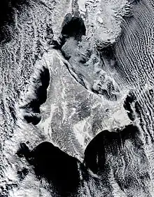
During the winter, passage through the Sea of Okhotsk is often complicated by large floes of drift ice. Combined with high winds that occur during winter, this frequently brings air travel and maritime activity to a halt beyond the northern coast of Hokkaido. Ports on the open Pacific Ocean and Sea of Japan are generally ice-free year round, though most rivers freeze during the winter.
Unlike the other major islands of Japan, Hokkaido is normally not affected by the June–July rainy season and the relative lack of humidity and typically warm, rather than hot, summer weather makes its climate an attraction for tourists from other parts of Japan.
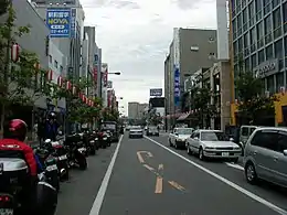
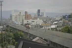
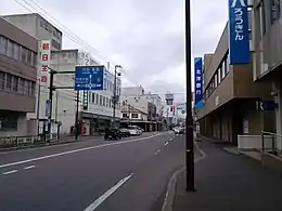
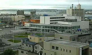
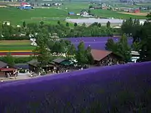
Major cities and towns
_(2374185648).jpg.webp)
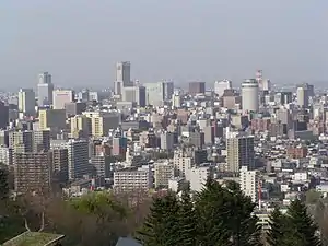
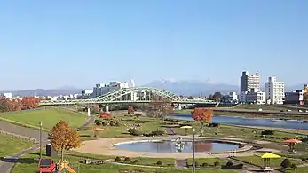
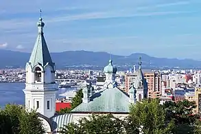
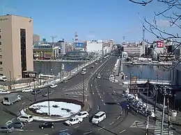
Hokkaido's largest city is the capital, Sapporo, which is a designated city. The island has two core cities: Hakodate in the south and Asahikawa in the central region. Other important population centers include Rumoi, Iwamizawa, Kushiro, Obihiro, Kitami, Abashiri, Wakkanai, and Nemuro.
Gallery
Economy
Although there is some light industry (most notably paper milling and beer brewing) most of the population is employed by the service sector. In 2001, the service sector and other tertiary industries generated more than three-quarters of the gross domestic product.[32]
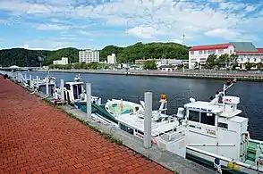
Agriculture and other primary industries play a large role in Hokkaido's economy. Hokkaido has nearly one fourth of Japan's total arable land. It ranks first in the nation in the production of a host of agricultural products, including wheat, soybeans, potatoes, sugar beets, onions, pumpkins, corn, raw milk, and beef. Hokkaido also accounts for 22% of Japan's forests with a sizable timber industry. The prefecture is first in the nation in production of marine products and aquaculture.[32] The average farm size in Hokkaido is 26 hectares per farmer in 2013, which is almost 11 times bigger than the national average of 2.4 hectares.[33]
Tourism is an important industry, especially during the cool summertime when visitors are attracted to Hokkaido's open spaces from hotter and more humid parts of Japan and other Asian countries. During the winter, skiing and other winter sports bring other tourists, and increasingly international ones, to the island.[34]
Coal mining played an important role in the industrial development of Hokkaido, with the Ishikari coalfield. Cities such as Muroran were primarily developed to supply the rest of the archipelago with coal.[12]
Transportation
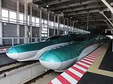
Hokkaido's only land link to the rest of Japan is the Seikan Tunnel. Most travellers travel to the island by air: the main airport is New Chitose Airport at Chitose, just south of Sapporo. Tokyo–Chitose is in the top 10 of the world's busiest air routes, handling more than 40 widebody round trips on several airlines each day. One of the airlines, Air Do was named after Hokkaido.
Hokkaido can be reached by ferry from Sendai, Niigata and some other cities, with the ferries from Tokyo dealing only in cargo. The Hokkaido Shinkansen takes passengers from Tokyo to near Hakodate in slightly over four hours.[35] There is a fairly well-developed railway network, but many cities can only be accessed by road. The coal railways were constructed around Sapporo and Horonai during the late 19th century, as advised by American engineer Joseph Crawford.[12]
Hokkaido is home to one of Japan's three Melody Roads, which is made from grooves cut into the ground, which when driven over causes a tactile vibration and audible rumbling transmitted through the wheels into the car body.[36][37]
Education

The Hokkaido Prefectural Board of Education oversees public schools (except colleges and universities) in Hokkaido. Public elementary and junior high schools (except Hokkaido Noboribetsu Akebi Secondary School and schools attached to Hokkaido University of Education) are operated by municipalities, and public high schools are operated by either the prefectural board or municipalities.
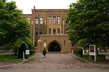
Hokkaido has 37 universities (7 national, 5 local public, and 25 private universities), 34 junior colleges, and 5 colleges of technology (4 national and 1 local public colleges). National universities located in Hokkaido are:
- Hokkaido University (former Sapporo Agricultural College)[38]
- Hokkaido University of Education
- Muroran Institute of Technology
- Otaru University of Commerce
- Obihiro University of Agriculture and Veterinary Medicine
- Asahikawa Medical University
- Kitami Institute of Technology
Hokkaido government runs Sapporo Medical University, a medical school in Sapporo.
Culture
Sports
The 1972 Winter Olympics were held in Sapporo.
The sports teams listed below are based in Hokkaido.
- Consadole Sapporo (Association football)
- Levanga Hokkaido (basketball)
- Japan Basketball League
- Nippon Paper Cranes (Ice hockey)
- Oji Eagles (Ice hockey)
- Loco Solare (Curling)
Winter festivals
- Sapporo Snow Festival
- Asahikawa Ice Festival
- Sōunkyō Ice Festival
- Big Air – snowboarding freestyle competition
- Shōwa-Shinzan International Yukigassen - competitive snowballing
International relations
Hokkaido has relationships with several provinces, states, and other entities worldwide.[39]
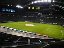
.svg.png.webp) Alberta, Canada, since 1980[40][41]
Alberta, Canada, since 1980[40][41] Heilongjiang, China, since 1980[40]
 Massachusetts, USA, since 1988[40][42]
 Sakhalin Oblast, Russia, since 1998[40]
 Busan, South Korea, since 2005
- Gyeongsangnam-do, South Korea, since 2006
- Seoul, South Korea, since 2010[43]
 Chiang Mai, Thailand, since 2013[44]
 Thimphu, Bhutan
 Hawai'i, United States of America[45]
As of January 2014, 74 individual municipalities in Hokkaido have sister city agreements with 114 cities in 21 different countries worldwide.[46]
Politics
Governor
The current governor of Hokkaido is Harumi Takahashi. She won a fourth term in the gubernatorial election in 2015 with centre-right support. Her first election in 2003 in a close race against centre-left supported Yoshio Hachiro and seven other candidates ended a 20-year streak of victories by Socialist Party Takahiro Yokomichi and then his former vice governor Tatsuya Hori who beat Hideko Itō twice by large margins. Itō, a former Socialist Diet member, was supported by the Liberal Democratic Party against Hori in 1995 (at the time, Socialists and Liberal Democrats formed the ruling "grand" coalition on the national level); In 1999, Hori was supported by all major non-Communist parties and Itō ran without party support. Before 1983, the governorship had been held by Liberal Democrats Naohiro Dōgakinai and Kingo Machimura for 24 years. In the 1971 election when Machimura retired, the Socialist candidate Shōhei Tsukada lost to Dōgakinai by only 13,000 votes;[47] Tsukada was also supported by the Communist Party – the leftist cooperation in opposition to the US-Japanese security treaty had brought joint Socialist-Communist candidates to victory in many other prefectural and local elections in the 1960s and 1970s. In 1959, Machimura had defeated Yokomichi's father Setsuo in the race to succeed Hokkaido's first elected governor, Socialist Toshibumi Tanaka who retired after three terms. Tanaka had only won the governorship in 1947 in a run-off election against Democrat Eiji Arima because no candidate had received the necessary vote share to win in the first round as required by law at the time.
Assembly
The Hokkaido Legislative Assembly has 100 members from 47 electoral districts. As of April 30, 2015, the LDP caucus holds a majority with 51 seats, the DPJ-led group has 26 members. Other groups are the Hokkaidō Yūshikai of New Party Daichi and independents with twelve seats, Kōmeitō with eight, and the Japanese Communist Party with four members.[48] General elections for the Hokkaido assembly are currently held together with gubernatorial elections in the unified local elections (last round: April 2015).
National representation
For the lower house of the National Diet, Hokkaido is divided into twelve single-member electoral districts. In the 2017 election, candidates from the governing coalition of Liberal Democrats and Kōmeitō won seven districts and the main opposition Constitutional Democrats five. For the proportional election segment, Hokkaido and Tokyo are the only two prefectures that form a regional "block" district of their own. The Hokkaido proportional representation block elects eight Representatives. In 2017, the Liberal Democratic Party received 28.8% of the proportional vote and won three seats, the Constitutional Democratic Party won three (26.4% of the vote), one seat each went to Kibō no Tō (12.3%) and Kōmeitō (11.0%). The Japanese Communist Party, who won a seat in 2014, lost their seat in 2017 while receiving 8.5% of the votes.
In the upper house of the National Diet, a major reapportionment in the 1990s halved the number of Councillors from Hokkaido per election from four to two. After the elections of 2010 and 2013, the Hokkaido electoral district – like most two-member districts for the upper house – is represented by two Liberal Democrats and two Democrats. In the 2016 upper house election, the district magnitude will be raised to three, Hokkaidō will then temporarily be represented by five members and six after the 2019 election.
See also
- Former Hokkaidō Government Office
- Hokkaido dialects
- People from Hokkaido
- Sankebetsu brown bear incident
Notes
- "離島とは(島の基礎知識) (what is a remote island?)". MLIT (Ministry of Land, Infrastructure, Transport and Tourism) (in Japanese). Ministry of Land, Infrastructure, Transport and Tourism. 22 August 2015. Archived from the original (website) on 2007-11-13. Retrieved 9 August 2019.
MILT classification 6,852 islands (main islands: 5 islands, remote islands: 6,847 islands)
- Nussbaum, Louis-Frédéric. (2005). "Hokkaido" in Japan Encyclopedia, p. 343, p. 343, at Google Books
- "Chapter 3: Nivkh as an Aspiration Language," p. 53 RUG.nl Archived 2011-09-28 at the Wayback Machine
- "Ainu Mosir. The land of human beings – Nanni Fontana – photographer". Nanni Fontana. Archived from the original on 2012-04-11. Retrieved 2012-09-14.
- July.04.2008 (2008-07-04). "ICU Students Support Indigenous Peoples Summit in Ainu Mosir 2008 « ICU BackNumbersite". Web.icu.ac.jp. Archived from the original on 2013-06-24. Retrieved 2012-09-14.
- "Indigenous Peoples Summit in Ainu Mosir 2008 * News". Win-ainu.com. Archived from the original on 2013-11-07. Retrieved 2012-09-14.
- Lewallen, Ann-Elise (November 30, 2008). "Indigenous at last! Ainu Grassroots Organizing and the Indigenous Peoples Summit in Ainu Mosir". The Asia-Pacific Journal: Japan Focus. 48-6-08. Retrieved September 14, 2012.
- Okada, Mitsuharu Vincent (2012). "The Plight of Ainu, Indigenous People of Japan" (PDF). Journal of Indigenous Social Development. University of Hawaii. 1 (1): 1–14. Retrieved September 14, 2012.
- "National Museum of Ethnology, Japan: Permanent Exhibitions". Retrieved 2011-08-26.
- Statistics Bureau of Japan
- Hokkaido Population during Tokugawa Shogun
- "A Journey into the culture and history of Hokkaido" (PDF). hkd.mlit.go.jp.
- "The Northern People | ROAD EAST". www.road-east.com. Retrieved 2020-12-16.
- "ウェブマガジン カムイミンタラ ~北海道の風土・文化誌 :オホーツク文化人とモヨロ貝塚 網走 流氷とともにやってきた古代民族の謎とロマンに魅せられた父子三代と研究者たち". kamuimintara.net. Retrieved 2020-12-16.
- Japan Handbook, p. 760
- McClain, James L. (2002). Japan, A Modern History (First ed.). New York, N.Y.: W.W. Norton & Company. p. 285. ISBN 978-0-393-04156-9.
- Howell, David. "Ainu Ethnicity and the Boundaries of the Early Modern Japanese State", Past and Present 142 (February 1994), p. 142
- Ossenberg, Nancy (see reference) has the best evidence of this relationship with the Jōmon. Also, a newer study, Ossenberg, et al., "Ethnogenesis and craniofacial change in Japan from the perspective of nonmetric traits" (Anthropological Science v.114:99–115) is an updated analysis published in 2006 which confirms this finding.
- Nakamura, Akemi, "Japan's last frontier took time to tame, cultivate image", The Japan Times, 8 July 2008, p. 3.
- Satow, Ernest. (1882). "The Geography of Japan" in Transactions of the Asiatic Society of Japan, Vols. 1–2, p. 88., p. 33, at Google Books
- McDougall, Walter A. (1993). Let the Sea Make a Noise, pp. 355–356.
- McDougall, p. 357.
- "Chapter VII: 1945". The Official Chronology of the US Navy in World War II. Hyperwar. Retrieved 20 September 2011.
- "Translation of Message from Harry S. Truman to Joseph Stalin", August 19, 1945, History and Public Policy Program Digital Archive, RGASPI Fond 558, Opis 11, Delo 372, Listy 112–113. Translated by Sergey Radchenko. http://digitalarchive.wilsoncenter.org/document/122333. Retrieved 2017 September 22.
- "総務省|住基ネット". soumu.go.jp.
- Hirata, Daisuke; et al. (2013). "Molecular Phylogeography of the Brown Bear (Ursus arctos) in Northeastern Asia Based on Analyses of Complete Mitochondrial DNA Sequences". Mol Biol Evol. 30 (7): 1644–1652. doi:10.1093/molbev/mst077. PMID 23619144. Retrieved 18 March 2015.
- Zhang, D, Katsuki, T. & Rushforth, K. 2013. Abies sachalinensis. The IUCN Red List of Threatened Species 2013: e.T42298A2970610
- "M 6.6 - 27km E of Tomakomai, Japan". United States Geological Survey. Retrieved 6 September 2018.
- "General overview of area figures for Natural Parks by prefecture" (PDF). Ministry of the Environment Japan. 31 March 2008. Retrieved 2009-06-02.
- https://www.straitstimes.com/asia/east-asia/hokkaido-sizzling-in-temperatures-as-high-as-395-deg-c-as-unseasonal-heat-wave-grips
- C.Michael Hogan. 2011. Taiga. eds. M.McGinley & C.Cleveland. Encyclopedia of Earth. National Council for Science and the Environment. Washington DC
- "Hokkaido's Business Environment". Trade and Economic Exchange Group, Commerce and Economic Exchange Division, Department of Economic Affairs, Hokkaido Government. Archived from the original on 2010-07-21. Retrieved 2008-12-05.
- "Trend toward stronger agriculture seen in Hokkaido". The Nikkei. 5 January 2015. Archived from the original on 7 April 2019. Retrieved 7 April 2019.
- Takahara, Kanako (July 8, 2008). "Boom time for Hokkaido ski resort area". The Japan Times. The Japan Times Ltd. Retrieved 2008-09-27.
- Bender, Andrew (28 March 2016). "Japan Opens a Futuristic Bullet Train Line from Tokyo to Hokkaido". Forbes.
- Johnson, Bobbie (13 November 2007). "Japan's melody roads play music as you drive". The Guardian. Farringdon Road, London, England: GMG. p. 19 (International section). Retrieved 2008-10-20.
- "Your car as a musical instrument – Melody Roads". Noise Addicts. 29 September 2008. Retrieved 20 October 2008.
- Nussbaum, "Hokkaido Daigaku" in p. 343, p. 343, at Google Books
- "Exchange Affiliates" Archived 2015-05-24 at the Wayback Machine. Retrieved on 5 December 2008.
- "Hokkaido – Alberta Relations" (PDF). Archived from the original (PDF) on 2010-12-04. Retrieved 2010-05-30.
- "Alberta Sport, Recreation, Parks & Wildlife Foundation". Archived from the original on 2011-10-28. Retrieved 2010-05-30.
- "Massachusetts Hokkaido Association". Retrieved 2010-05-30.
- "ソウル特別市との交流". Retrieved 2013-11-03.
- "MOU of the Establishment of Friendship between Province of Chiang Mai and Prefecture of Hokkaido" (PDF). Retrieved 2018-12-29.
- "Hawaii's Sister-States". State of Hawai'i. Archived from the original on October 16, 2020.
- 市町村の姉妹友好提携 (Sister city partnerships) Archived 2017-12-28 at the Wayback Machine. Retrieved on 3 November 2013. (in Japanese)
- Hokkaido prefectural government: Gubernatorial election results since 1947 (in Japanese)
- Hokkaido Prefectural Assembly: Members by electoral district and parliamentary group (in Japanese)
^[note 1] Source: English edition of Sightseeing in Hokkaido, Winter Festival and Events
References
- Bisignani, J. D. (1993). Japan Handbook. Chico, California: Moon Publications. ISBN 9780960332229; ISBN 9780908054145; OCLC 8954556
- McDougall, Walter A. (1993). Let the Sea Make a Noise: A History of the North Pacific from Magellan to MacArthur. New York: Basic Books. ISBN 9780465051526; OCLC 28017793
- Nussbaum, Louis-Frédéric and Käthe Roth. (2005). Japan encyclopedia. Cambridge: Harvard University Press. ISBN 978-0-674-01753-5; OCLC 58053128
- John Batchelor; Japanese Central Association (1893). An itinerary of Hokkaido, Japan, Volume 1. Tokyo: Hakodate Chamber of Commerce.
External links
| Wikimedia Commons has media related to Hokkaido. |
| Look up Hokkaido in Wiktionary, the free dictionary. |
| Wikivoyage has a travel guide for Hokkaido. |
- Hokkaido Official Website (in Japanese)
- Hokkaido Official Website (in English)
- Hokkaido Ski Resort Archived 2020-08-14 at the Wayback Machine
| ||||||||||||
| ||||||||||||
| ||||||||||||
| ||||||||||||
| ||||||||||||
| ||||||||||||
| ||||||||||||
| ||||||||||||
| ||||||||||||
| ||||||||||||
| ||||||||||||
| ||||||||||||
| ||||||||||||
| ||||||||||||
| Authority control |
|---|