Chandpur District
Chandpur (চাঁদপুর) is a district located in Bangladesh's Chittagong Division.[2] It was a part of Comilla District until 1984.[3]
Chandpur District
চাঁদপুর জেলা | |
|---|---|
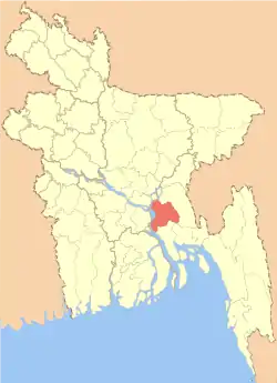 Location of Chandpur District within Bangladesh | |
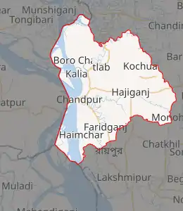
Expandable map of Chandpur District | |
| Coordinates: 23.2139°N 90.6361°E | |
| Country | |
| Division | Chittagong Division |
| Formed | 1878 (Mahkuma), 1894 (City), 1984 (District) |
| Parliamentary seat | 5 |
| Government | |
| • Deputy Commissioner | Anjana Khan Mojlish |
| Area | |
| • District | 1,740.6 km2 (672.0 sq mi) |
| Population (2011 census) | |
| • District | 2,416,018 |
| • Density | 1,400/km2 (3,600/sq mi) |
| • Urban | 435,724 |
| • Rural | 1,980,294 |
| Literacy rate | |
| • Total | 69.8% |
| Time zone | UTC+06:00 (BST) |
| ISO 3166-2 | BD-09 |
| HDI (2018) | 0.614[1] medium · 7th of 21 |
| Calling code | 0841 |
| Website | http://www.chandpur.gov.bd |
History
During the ruling of the Baro-Bhuiyans, this region was occupied by Chand Ray, the Zamindar of Bikrampur and son of Kedar Ray. According to historian J. M. Sengupta, the region was named Chandpur, following the name of Chand Ray. On the other hand, others say that the name of this region comes from Chand Faqir of Purindapur mahalla of Chandpur, Bangladesh. It is said that an administrator named Shah Ahmed Chand came here from Delhi in the fifteenth century and established a river port.
In 1779 AD, Major James Rennel, a British surveyor, drew a map of Bengal during the British rule and included an obscure town called Chandpur. At that time, there were offices and courts at a place called Narsinghpur (which has now sunk) south of Chandpur. The confluence of the Padma and the Meghna was about 60 miles south-west of the present place. This area has now disappeared due to the game of breaking the Meghna river.
The first Chandpur subdivision was formed in 1878 as a result of administrative reorganization during the British rule. On 1 October 1896, Chandpur city was declared as a municipality. It was declared as Chandpur district on 15 February 1984.[4]
Geography
The geological structure of the Chandpur district dates back to the Pleistocene and Holocene eras. The geographical history of Chandpur district can be traced back to the ancient maps of East India compiled by Perguitar.[5]
Demographics
The population of the district as of the 2011 census was 2,416,018.[6]
Administrative subdivisions
Education
- Hasan Ali Government High School
- Al Amin Academy
- Chandpur Polytechnic Institute
- Matlabganj J. B. Pilot High School
- Chhenger Char Govt. High School[7]
See also
References
- "Sub-national HDI - Area Database - Global Data Lab". hdi.globaldatalab.org. Retrieved 2020-03-18.
- Khan, Abul Khaer (2012). "Chandpur District". In Islam, Sirajul; Miah, Sajahan; Khanam, Mahfuza; Ahmed, Sabbir (eds.). Banglapedia: the National Encyclopedia of Bangladesh (Online ed.). Dhaka, Bangladesh: Banglapedia Trust, Asiatic Society of Bangladesh. ISBN 984-32-0576-6. OCLC 52727562. Retrieved 9 February 2021.
- Musa, Muhammad. Brahmanbariar Itibrittyo, Shetu Prokashoni, Brahmanbaria,1998.
- "Naming of Chandpur". chandpur.gov.bd. Retrieved 30 October 2020.
- "Chandpur Geological Structure". chandpur.gov.bd. Retrieved 31 October 2020.
- "Chandpur (District (Zila), Bangladesh) - Population, Map & Location". citypopulation.de.
- http://matripithedu.gov.bd/
- https://www.sohopathi.com/matripith-govt-girls-high-school/
- http://www.infomap24.com/en/point/secondary-school/lady-pratima-mitra-girls-high-school/3615555.asp
- http://aaac.comillaboard.gov.bd/
| Barisal Division | 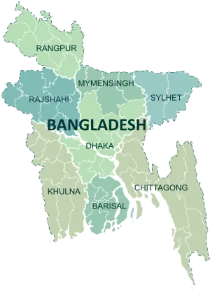 | |
|---|---|---|
| Chittagong Division | ||
| Dhaka Division | ||
| Khulna Division | ||
| Mymensingh Division | ||
| Rajshahi Division | ||
| Rangpur Division | ||
| Sylhet Division | ||
| Upazila/Thana: | ||
|---|---|---|
| Upazila/Thana: | ||
|---|---|---|

| Wikimedia Commons has media related to Chandpur District. |
| Wikivoyage has a travel guide for চাঁদপুর জেলা. |