U.S. Route 400
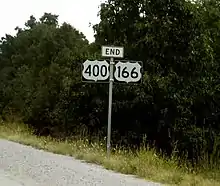
U.S. Route 400 (US 400) is a 481.306-mile-long (774.587 km) mostly east–west U.S. Highway, commissioned in 1994. The highway's western terminus is in Granada, Colorado, at an intersection with US 385. The highway's eastern terminus is southwest of Joplin, Missouri, near Loma Linda, at an interchange with Interstate 44, with which it shares with US 166. It originally ended in Garden City, Kansas; in 1996 it was extended to its current western terminus.
| ||||||||||||
|---|---|---|---|---|---|---|---|---|---|---|---|---|

US 400 highlighted in red | ||||||||||||
| Route information | ||||||||||||
| Maintained by CDOT, KDOT, MoDOT, and the city of Cimarron | ||||||||||||
| Length | 481.306 mi[lower-alpha 1] (774.587 km) | |||||||||||
| Existed | 1994–present | |||||||||||
| History | Extended west in 1996 | |||||||||||
| Major junctions | ||||||||||||
| West end | ||||||||||||
| ||||||||||||
| East end | ||||||||||||
| Location | ||||||||||||
| States | Colorado, Kansas, Missouri | |||||||||||
| Highway system | ||||||||||||
|
Colorado State Highways
| ||||||||||||

Route description
Colorado
US 400 begins in Granada at an intersection with US 385. It then runs concurrently with US 50 through Holly east to the Kansas border.
Kansas

US-400 and US-50 enter Kansas west of Coolidge. They run concurrently through Garden City, where it intersects US-83 and separate at Dodge City, which is where it intersects US-56 and US-283. It continues southeast from Dodge City and first intersects US-54 at Mullinville.
US-400 and US-54 begin a long concurrency at Mullinville which passes through Greensburg, Pratt and Kingman before entering Wichita. While in Wichita, US-400 and US-54 intersect Interstate 235 and the concurrency of US-81 and Interstate 135. K-96 provides a short freeway connection to Interstate 35, which is also the Kansas Turnpike. At Augusta, US-400 and US-54 enter into another concurrency with US-77, and US-400 breaks from this concurrency at Haverhill.

US-400 continues east through several small towns before turning southeast to go through the Fredonia area and intersecting US-75 at Neodesha. After a brief concurrency with US-75, it turns east, first intersecting U.S. Route 169 near Morehead and then US-59 near Parsons before finally intersecting US-69 south of Pittsburg. It then turns south with US-69 and at Crestline, follows US-69A south to Riverton. US-400 then turns east with US-166 at Baxter Springs and the two highways run concurrently eastward into Missouri.
The entire 1.369 miles (2 km) section of US-400 in Cimarron is maintained by the city.[4]
History
US 400 was first established on December 1, 1994, and at that time ran from the east end of the US-50 and US-83 overlap, eastward to the east county line of Cherokee County, Kansas.[5]
U.S. Route 154
A section of U.S. 400 that ran from Dodge City to Mullinville, Kansas was U.S. Route 154 from 1926 to 1982. It later became K-154 before becoming part of U.S. 400.
Construction on the first section of the East Kellogg improvement project started in August 2015. The project included a redesigned intersection with Webb Road and widened US-54 and US-400 from four lanes to six lanes from Webb Road to Greenwich Road. Construction on a second project began in 2016, to continue widening the highway to a six-lane freeway between Greenwich Road and K-96. Also new bridges will be built over I-35/KTA, new ramps will be constructed from southbound I-35/KTA to westbound US-54/US-400 and from eastbound US-54/US-400 to both northbound and southbound I-35/KTA. In addition, two-lane one way frontage roads on each side of the freeway will be built. Construction for both projects should be completed by late 2021.[6] A two-mile section of the new highway, from Eastern Street to the K-96 junction, opened on November 21, 2019.[7] On April 16, 2020, vandals damaged an estimated $50,000 worth of construction equipment, which included a bulldozer, excavator and an off-road vehicle.[8]
Major intersections
| State | County | Location | mi[lower-alpha 2] | km | Destinations | Notes |
|---|---|---|---|---|---|---|
| Colorado | Prowers | Granada | 0.000 | 0.000 | Western terminus; western end of US 50 overlap; highway continues as US 50 west (Goff Avenue west) | |
| Holly | 10.737 | 17.280 | ||||
| 14.814 0.000 | 23.841 0.000 | Colorado–Kansas line | ||||
| Kansas | Hamilton | Syracuse | 16.094 | 25.901 | Western end of concurrency with K-27 | |
| 16.624 | 26.754 | Eastern end of concurrency with K-27 | ||||
| Kearny | Lakin | 43.965 | 70.755 | |||
| Finney | Holcomb | 59.848 | 96.316 | Big Lowe Road – Holcomb | Diamond interchange | |
| Garden City | 65.848 | 105.972 | Diamond interchange; western end of concurrency with US-83 | |||
| 69.618 | 112.039 | Pair of half-diamond interchanges with one-way ramps connecting Mary Street and K-156 | ||||
| 71.156 | 114.514 | Partial cloverleaf interchange; eastern end of concurrency with US-83 | ||||
| Gray | Cimarron | 102.427 | 164.840 | |||
| Ford | | 116.681 | 187.780 | Eastern end of US-50 overlap | ||
| | 119.852 | 192.883 | Western end of US-56 overlap | |||
| | 123.395 | 198.585 | Western end of US-283 overlap | |||
| Dodge City | 126.825 | 204.105 | Eastern end of US-56/US-283 overlap | |||
| | 147.625 | 237.579 | ||||
| Kiowa | | 160.797 | 258.778 | Interchange; western end of US-54 overlap; westbound exit and eastbound entrance | ||
| | 167.767 | 269.995 | ||||
| Pratt | Pratt | 199.963 | 321.809 | |||
| 201.236 | 323.858 | |||||
| Kingman | | 217.105 | 349.397 | 170th Avenue – Cunningham | Interchange | |
| | 230.329 | 370.679 | Former K-14 north | |||
| Kingman | 234.554 | 377.478 | Western end of K-14 overlap | |||
| | 238.301 | 383.508 | 40th Avenue | Interchange; western end of freeway | ||
| | 239.009 | 384.648 | 70th Avenue | |||
| | 244.713 | 393.827 | Eastern end of K-14 overlap; former K-17 | |||
| | 249.778 | 401.979 | Mt. Vernon | |||
| Sedgwick | | 252.769 | 406.792 | |||
| | 253.769 | 408.402 | 383rd Street West | |||
| | 255.819 | 411.701 | 343rd Street West | |||
| | 258.820 | 416.530 | Garden Plain | Interchange; eastern end of freeway; former K-163 | ||
| Wichita | 270.840 | 435.875 | Maize Road | Interchange; western end of freeway | ||
| 271.840 | 437.484 | Tyler Road | ||||
| 272.829 | 439.076 | Ridge Road – Eisenhower National Airport | ||||
| 273.838 | 440.700 | Dugan Road | No direct eastbound exit (signed at Ridge Road) | |||
| 274.303 | 441.448 | I-235 exit 7 | ||||
| 274.840 | 442.312 | West Street | ||||
| Edwards Street / Meridian Avenue | Access to Southwest Boulevard (former K-42) | |||||
| Seneca Street / Sycamore Street | ||||||
| 253.789 | 408.434 | Central Business District | ||||
| 278.459 | 448.136 | Washington Avenue | ||||
| 279.205 | 449.337 | I-135 exits 5B-6A | ||||
| Grove Street | Westbound exit and eastbound entrance | |||||
| Hillside Street | ||||||
| Oliver Avenue / Edgemoor Street | ||||||
| Woodlawn Boulevard | Westbound access via Towne East Drive/Armour Drive | |||||
| Towne East Drive / Armour Drive | ||||||
| 285.943 | 460.181 | Rock Road | Eastbound access via Towne East Drive/Armour Drive | |||
| I-35/Kansas Tpke. exit 50 | ||||||
| 286.017 | 460.300 | Webb Road | ||||
| 286.072 | 460.388 | Greenwich Road | ||||
| Zelta Road / 127th Street East | Opening Soon | |||||
| | 286.172 | 460.549 | Interchange; future eastern end of freeway | |||
| Butler | Augusta | 297.431 | 478.669 | Western end of US-77 overlap | ||
| | 302.952 | 487.554 | Haverhill, Smileyberg | Interchange | ||
| | 305.143 | 491.080 | Partial interchange; westbound access via connector road; eastern end of US-54/US-77 overlap | |||
| Greenwood | | 338.268 | 544.390 | Western end of K-99 overlap | ||
| | 339.315 | 546.075 | Eastern end of K-99 overlap | |||
| Wilson | | 358.104 | 576.313 | |||
| Fredonia | 366.496 | 589.818 | Roundabout | |||
| | 377.295 | 607.197 | Interchange; western end of US-75 overlap | |||
| Montgomery | | 381.326 | 613.685 | Interchange; eastern end of US-75 overlap | ||
| | 390.527 | 628.492 | Interchange | |||
| Labette | Parsons | 406.061 | 653.492 | Interchange | ||
| Cherokee–Crawford county line | | 420.172 | 676.201 | |||
| Cherokee | 430.148 | 692.256 | ||||
| | 437.128 | 703.489 | Western end of US-69/US-160 overlap | |||
| Cherokee | | 439.095 | 706.655 | |||
| | 448.223 | 721.345 | Eastern end of US-69/US-160 overlap; western end of US-69 Alt. overlap; former K-96 | |||
| | 455.507 | 733.067 | Roundabout | |||
| | 457.274 | 735.911 | Eastern end of US-69 Alt. overlap | |||
| | 460.350 | 740.862 | Western end of US-166 overlap | |||
| | 462.251 | 743.921 | ||||
| 465.556 0.000 | 749.240 0.000 | Kansas–Missouri line | ||||
| Missouri | Newton | | 0.936 | 1.506 | Eastern terminus; I-44 exit 1; eastern end of US 166 overlap; eastbound access to S. Outer Road | |
1.000 mi = 1.609 km; 1.000 km = 0.621 mi
| ||||||
See also
Notes
References
- "OTIS Highway Data Explorer". Colorado Department of Transportation. Archived from the original on September 10, 2012. Retrieved April 15, 2017.
- Staff (2016). "Pavement Management Information System". Kansas Department of Transportation. Retrieved April 16, 2017.
- Missouri Department of Transportation (April 16, 2017). MoDOT HPMAPS (Map). Missouri Department of Transportation. Retrieved April 16, 2017.
- Kansas Department of Transportation (January 1, 2012). "Resolution Designating City Connecting Links in State Highway System". Topeka: Kansas Department of Transportation. Retrieved September 7, 2020.
- Kansas Department of Transportation (December 1, 1994). "State Highway Resolution to establish Highway US-400 in thirteen counties in Kansas". Topeka: Kansas Department of Transportation. Retrieved July 22, 2020.
- Kansas Department of Transportation (2020). "About the Projects". Topeka: Kansas Department of Transportation. Retrieved August 27, 2020.
- Kansas Department of Transportation (November 21, 2019). "Two-mile section of Kellogg freeway opens in east Wichita" (PDF). Topeka: Kansas Department of Transportation. Retrieved August 24, 2020.
- Tidd, Jason (April 16, 2020). "After $50K vandalism at East Kellogg construction site, Crime Stoppers offers $10K reward". Wichita: The Wichita Eagle. Retrieved August 27, 2020.
External links
- Kansas Highway Maps: Current, Historic, KDOT
- Sanderson, Dale End of U.S. Highway 400 (with maps of US 400 and related routes)
Routes in italics are no longer a part of the system. Highlighted routes are considered main routes of the system. |