Granby, Colorado
Granby is a statutory town. It is the most populous municipality in Grand County, Colorado, United States. Granby is situated along U.S. Highway 40 in the Middle Park basin, and it is about 85 miles (137 km) northwest of Denver and 14 miles (23 km) southwest of Rocky Mountain National Park. As of the 2010 census the town had a population of 1,864.[7]
Granby, Colorado | |
|---|---|
Statutory Town | |
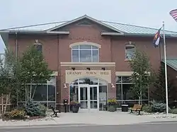 Granby Town Hall | |
| Motto(s): "The heart of something grand" | |
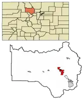 Location of Granby in Grand County, Colorado. | |
| Coordinates: 40°5′11″N 105°56′11″W | |
| Country | USA |
| State | Colorado |
| County[1] | Grand |
| Founded | 1905 |
| Incorporated (town) | December 11, 1905[2] |
| Government | |
| • Type | Statutory Town[1] |
| • Mayor | Paul Chavoustie[3] |
| Area | |
| • Total | 12.68 sq mi (32.84 km2) |
| • Land | 12.68 sq mi (32.84 km2) |
| • Water | 0.00 sq mi (0.00 km2) |
| Elevation | 7,935 ft (2,428 m) |
| Population (2010) | |
| • Total | 1,864 |
| • Estimate (2019)[5] | 2,139 |
| • Density | 168.68/sq mi (65.12/km2) |
| Time zone | UTC-7 (MST) |
| • Summer (DST) | UTC-6 (MDT) |
| ZIP code[6] | 80446 |
| Area code(s) | 970 |
| FIPS code | 08-31605 |
| GNIS feature ID | 0178402 |
| Website | www |
The town was founded in 1904 along the route of the Denver, Northwestern & Pacific Railway and was incorporated one year later. It was named after Granby Hillyer,[8] a Denver lawyer who later served as the United States Attorney for that city's district. The town is best known in modern times for Marvin Heemeyer's rampage and subsequent suicide in a custom built bulldozer, dubbed the "Killdozer", during which he caused $7 million in property damage, following a dispute with local officials.
Geography
Granby sits at 7,935 feet (2,419 m) above sea level in the valley of the Fraser River, 2 miles (3 km) east of its mouth at the Colorado River. It is located in eastern Grand County at 40°5′11″N 105°56′11″W (40.086396, -105.936487),[9] in an area subject to average annual rainfall of 12 1⁄4 inches and annual snowfall of more than 128 inches (3,300 mm).
U.S. Route 40 passes through the center of town as Agate Avenue, leading south and east over Berthoud Pass to the Denver area, west 10 miles (16 km) to Hot Sulphur Springs, the Grand County seat. Kremmling is 27 miles (43 km) to the west on US 40. U.S. Route 34 intersects US 40 on the west side of Granby and leads northeast into Rocky Mountain National Park, crossing the mountains as Trail Ridge Road and reaching Estes Park 60 miles (97 km) northeast of Granby.
According to the United States Census Bureau, Granby has a total area of 12.8 square miles (33.1 km2), all land.[7]
Demographics
| Historical population | |||
|---|---|---|---|
| Census | Pop. | %± | |
| 1910 | 40 | — | |
| 1920 | 32 | −20.0% | |
| 1930 | 90 | 181.3% | |
| 1940 | 251 | 178.9% | |
| 1950 | 463 | 84.5% | |
| 1960 | 503 | 8.6% | |
| 1970 | 554 | 10.1% | |
| 1980 | 963 | 73.8% | |
| 1990 | 966 | 0.3% | |
| 2000 | 1,525 | 57.9% | |
| 2010 | 1,864 | 22.2% | |
| 2019 (est.) | 2,139 | [5] | 14.8% |
| U.S. Decennial Census[10] | |||
As of the census[11] of 2000, there were 1,525 people, 579 households, and 390 families residing in the town. The population density was 856.2 people per square mile (330.8/km2). There were 628 housing units at an average density of 352.6 per square mile (136.2/km2). The racial makeup of the town was 96.26% White, 0.46% African American, 0.26% Native American, 0.98% Asian, 0.07% Pacific Islander, 1.44% from other races, and 0.52% from two or more races. Hispanic or Latino of any race were 3.61% of the population.
There were 579 households, out of which 37.3% had children under the age of 18 living with them, 55.3% were married couples living together, 7.6% had a female householder with no husband present, and 32.5% were non-families. 21.9% of all households were made up of individuals, and 6.4% had someone living alone who was 65 years of age or older. The average household size was 2.59 and the average family size was 3.05.
In the town, the population was spread out, with 28.1% under the age of 18, 9.1% from 18 to 24, 33.5% from 25 to 44, 22.7% from 45 to 64, and 6.6% who were 65 years of age or older. The median age was 34 years. For every 100 females, there were 98.6 males. For every 100 females age 18 and over, there were 104.3 males.
The median income for a household in the town was $46,667, and the median income for a family was $55,250. Males had a median income of $35,455 versus $24,417 for females. The per capita income for the town was $21,224. About 4.0% of families and 5.8% of the population were below the poverty line, including 3.9% of those under the age of 18 and 9.0% of those ages 65 and older.
Local history
Many Granby and Grand County residents are descended from pioneer settlers who arrived before the country was fully surveyed. Early families established themselves under the Homestead Act of 1862, which allowed easy access to land to those who would inhabit and improve upon the territory.
Since the turn of the century, families have contended for prime ranch land. The Hudlers and Cooks are descended from original homesteaders.[12] Their waning ranch once covered approximately 20,000 acres (81 km2) and was rich in cattle and hay.
Bulldozer rampage
On June 4, 2004, Marvin Heemeyer, a local auto muffler shop owner, and entrepreneur, outraged over the outcome of several zoning dispute across a 10 year time span, went on a rampage through town, driving a modified bulldozer. Several buildings were damaged, including a bank, a hardware store, a concrete company, a utility service center, the town hall, the police department, and a former mayor's home. The rampage lasted 2 hours and 7 minutes, ending when the bulldozer got stuck attempting to go through the alleyway of Gambles Hardware Store. Heemeyer then killed himself with a handgun. No other deaths occurred, but an estimated $7 million in damage was done.
Transportation
Amtrak, the national passenger rail system, provides daily service to Granby, operating its California Zephyr daily in both directions between Chicago and Emeryville, California, across the bay from San Francisco.
Granby-Grand County Airport (IATA: GNB, ICAO: KGNB, FAA LID: GNB), a small airport one mile east of town, serves as a stopover for transient general aviation flights, as well as hosts some local aviation activity. There are no scheduled passenger carrier flights into or out of the airport, which features a 5,000-foot-long (1,500 m) by 75-foot-wide (23 m) asphalt runway. Services at the airport are limited to aviation fuel for both piston and jet/turboprop aircraft.
Climate
This climate type is dominated by the winter season, a long, bitterly cold period with short, clear days, relatively little precipitation mostly in the form of snow, and low humidity. According to the Köppen Climate Classification system, Granby has a subarctic climate, abbreviated "Dfc" on climate maps.[13]
| Climate data for Granby, Colorado | |||||||||||||
|---|---|---|---|---|---|---|---|---|---|---|---|---|---|
| Month | Jan | Feb | Mar | Apr | May | Jun | Jul | Aug | Sep | Oct | Nov | Dec | Year |
| Average high °F (°C) | 28 (−2) |
31 (−1) |
37 (3) |
47 (8) |
59 (15) |
69 (21) |
75 (24) |
73 (23) |
68 (20) |
56 (13) |
40 (4) |
30 (−1) |
51 (11) |
| Average low °F (°C) | 1 (−17) |
1 (−17) |
9 (−13) |
20 (−7) |
29 (−2) |
36 (2) |
41 (5) |
40 (4) |
33 (1) |
24 (−4) |
14 (−10) |
5 (−15) |
21 (−6) |
| Average precipitation inches (mm) | 1.2 (30) |
0.8 (20) |
1.2 (30) |
1.1 (28) |
1.3 (33) |
1.2 (30) |
1.5 (38) |
1.7 (43) |
1.1 (28) |
0.8 (20) |
0.9 (23) |
1.4 (36) |
14.2 (360) |
| Source: Weatherbase [14] | |||||||||||||
Notable residents
- Penny Rafferty Hamilton, aviation educator, writer, and photographer
- Marvin Heemeyer, perpetrator of the Granby Bulldozer Rampage
See also
- Outline of Colorado
- State of Colorado
- Colorado cities and towns
- Colorado municipalities
- Colorado counties
- Colorado cities and towns
- Arapaho National Forest
- Arapaho National Recreation Area
- Front Range
- Middle Park (Colorado basin)
- Rocky Mountain National Park
References
- "Active Colorado Municipalities". State of Colorado, Department of Local Affairs. Archived from the original on 2009-12-12. Retrieved 2007-09-01.
- "Colorado Municipal Incorporations". State of Colorado, Department of Personnel & Administration, Colorado State Archives. 2004-12-01. Retrieved 2007-09-02.
- "Mayor & Board of Trustees - Granby, Colorado". townofgranby.com. Retrieved January 4, 2020.
- "2019 U.S. Gazetteer Files". United States Census Bureau. Retrieved July 1, 2020.
- "Population and Housing Unit Estimates". United States Census Bureau. May 24, 2020. Retrieved May 27, 2020.
- "ZIP Code Lookup". United States Postal Service. Archived from the original (JavaScript/HTML) on November 4, 2010. Retrieved September 24, 2007.
- "Geographic Identifiers: 2010 Demographic Profile Data (G001): Granby town, Colorado". American Factfinder. U.S. Census Bureau. Retrieved November 17, 2016.
- Dawson, John Frank. Place names in Colorado: Why 700 communities were so named, 150 of Spanish or Indian origin. Denver, CO: J. Frank Dawson Publishing Co. p. 24.
- "US Gazetteer files: 2010, 2000, and 1990". United States Census Bureau. 2011-02-12. Retrieved 2011-04-23.
- "Census of Population and Housing". Census.gov. Retrieved June 4, 2015.
- "U.S. Census website". United States Census Bureau. Retrieved 2008-01-31.
- "Obituary of Carole Hudler Cook".
- Climate Summary for Granby, Colorado
- "Weatherbase.com". Weatherbase. 2013. Retrieved on October 2, 2013.
External links
- Town of Granby official website
- Granby Chamber of Commerce
- CDOT map of the Town of Granby
- Sky-Hi News, Granby's local newspaper
- Photographs from the Denver Public Library, now kept at the Library of Congress
Municipalities and communities of Grand County, Colorado, United States | ||
|---|---|---|
| Towns | 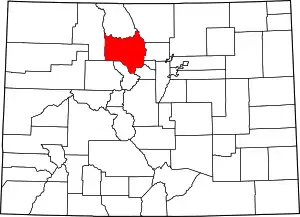 Map of Colorado highlighting Grand County | |
| CDPs | ||
| Unincorporated communities |
| |
| Ghost towns | ||
| ||
