List of historic places in Northern Ontario
This is a list of historic places in Northern Ontario, containing heritage sites listed on the Canadian Register of Historic Places (CRHP), all of which are designated as historic places either locally, provincially, territorially, nationally, or by more than one level of government. Listings in Greater Sudbury are listed separately.
List of historic places outside Greater Sudbury
Algoma District
| Name | Address | Coordinates | IDF | IDP | IDM | Image | |
|---|---|---|---|---|---|---|---|
| Light Tower | Caribou Island, Caribou Island, ON | 47°20′23″N 85°49′34″W | 10361 |  | |||
| Former Canadian National Railways Station | West End Road (at 2nd Ave.), Hornepayne, ON | 49°13′12″N 84°46′34″W | 4588 | 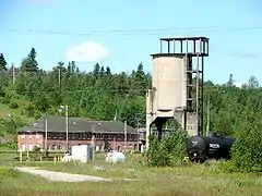 More images | |||
| Fort St. Joseph National Historic Site of Canada | St. Joseph Island, Jocelyn, ON | 46°05′05″N 83°53′45″W | 12976 | 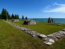 More images | |||
| Light Tower | Michipicoten Island, Michipicoten, ON | 47°45′14″N 85°35′48″W | 10365 | | |||
| Rydal Bank Church | 1634 Highway 638, Plummer Additional, ON | 46°17′55″N 83°47′37″W | 8177 | | |||
| Rydal Bank Community Hall | 16 Hoath Street, Plummer Additional, ON | 46°17′55″N 83°47′37″W | 8176 | | |||
| 34-36 Herrick Street | 34 Herrick Street, Sault Ste. Marie, ON | 46°30′28″N 84°19′22″W | 7374 | 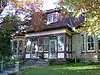 More images | |||
| 115 Upton | 115 Upton Road, Sault Ste. Marie, ON | 46°30′21″N 84°18′50″W | 7348 | | |||
| 143 McGregor Avenue | 143 McGregor Avenue, Sault Ste. Marie, ON | 46°30′22″N 84°18′41″W | 6141 | 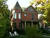 More images | |||
| Algoma Central Engine House | Highway 532, Unorganized North Algoma District (Searchmont), ON | 46°46′59″N 84°03′14″W | 4614 7532 |
 More images | |||
| Algonquin Hotel | 864 Queen Street East, Sault Ste. Marie, ON | 46°30′23″N 84°19′23″W | 3572 | 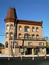 More images | |||
| Barnes-Fawcett Block | 358 Queen Street, Sault Ste. Marie, ON | 46°30′46″N 84°20′03″W | 7375 |  More images | |||
| Bishop Fauquier Memorial Chapel | 1540 Queen Street East, Sault Ste. Marie, ON | 46°30′00″N 84°17′14″W | 3313 | 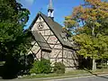 More images | |||
| Bishop Fauquier Memorial Chapel Cemetery | 1540 Queen Street East, Sault Ste. Marie, ON | 46°30′00″N 84°17′12″W | 3574 | 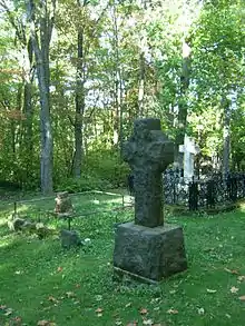 More images | |||
| Buchan House | 943 Landslide Road, Sault Ste. Marie, ON | 46°35′36″N 84°16′48″W | 5600 | | |||
| Central United Church | 160 Spring Street, Sault Ste. Marie, ON | 46°30′40″N 84°19′46″W | 5601 | 4222 | 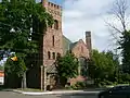 More images | ||
| Clergue Blockhouse | 831 Queen Street East, Sault Ste. Marie, ON | 46°30′23″N 84°19′29″W | 5595 |  More images | |||
| Coronation Block | 234 Queen Street East, Sault Ste. Marie, ON | 46°30′53″N 84°20′12″W | 7356 | 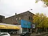 | |||
| Dawson Block | 708 Queen Street East, Sault Ste. Marie, ON | 46°30′28″N 84°19′39″W | 8329 |  More images | |||
| Eastbourne | 1048 Queen Street East, Sault Ste. Marie, ON | 46°30′20″N 84°18′50″W | 4056 | 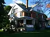 More images | |||
| Ermatinger House National Historic Site of Canada | 831 Queen Street East, Sault Ste. Marie, ON | 46°30′23″N 84°19′26″W | 7415 | 5602 |  More images | ||
| Forest Insect Laboratory | 875 Queen Street East, Sault Ste. Marie, ON | 46°30′20″N 84°19′21″W | 5528 |  More images | |||
| Hussey Block | 246 Queen Street East, Sault Ste. Marie, ON | 46°30′53″N 84°20′12″W | 7685 |  More images | |||
| North West Company Lock | 75 Huron Street, Sault Ste. Marie, ON | 46°30′54″N 84°19′21″W | 5529 | 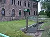 More images | |||
| Old Post Office (Sault Ste. Marie Museum) | 690 Queen Street East, Sault Ste. Marie, ON | 46°30′29″N 84°19′40″W | 5519 | 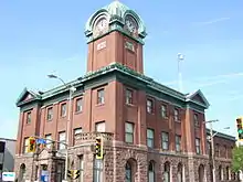 More images | |||
| Old Town Cemetery | 1186 Queen Street East, Sault Ste. Marie, ON | 46°30′18″N 84°18′21″W | 5550 |  More images | |||
| Ontario Provincial Air Service Hangars | 69 Church Street, Sault Ste. Marie, ON | 46°30′17″N 84°19′26″W | 5530 | 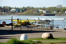 More images | |||
| Precious Blood Cathedral | 778 Queen Street East, Sault Ste. Marie, ON | 46°30′27″N 84°19′33″W | 8185 | 5604 |  More images | ||
| Rotary Welcome Cairns | Russ Ramsay Way, Sault Ste. Marie, ON | 46°30′29″N 84°19′54″W | 7768 |  More images | |||
| Sault Ste. Marie Canal National Historic Site of Canada | 1 Canal Drive, Sault Ste. Marie, ON | 46°30′44″N 84°21′16″W | 4431 | 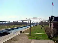 More images | |||
| Sault Ste. Marie Canal Office Building | 1 Canal Drive, Sault Ste. Marie, ON | 46°30′42″N 84°21′26″W | 11363 | 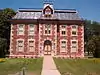 More images | |||
| Sault Ste. Marie Canal Power House | 1 Canal Drive, Sault Ste. Marie, ON | 46°30′48″N 84°20′59″W | 16389 |  More images | |||
| Sault Ste. Marie Canal Superintendent's House | 1 Canal Drive, Sault Ste. Marie, ON | 46°30′50″N 84°21′19″W | 11300 |  More images | |||
| Sault Ste. Marie Canal Workshop | 1 Canal Drive, Sault Ste. Marie, ON | 46°30′48″N 84°20′59″W | 11320 |  More images | |||
| Sault Ste. Marie Cenotaph | 426 Queen Street East, Sault Ste. Marie, ON | 46°30′42″N 84°19′58″W | 8437 |  More images | |||
| Sault Ste. Marie District Courthouse | 420 Queen Street East, Sault Ste. Marie, ON | 46°30′43″N 84°19′57″W | 5611 |  More images | |||
| Tower | Southern tip of Ile Parisienne, northwest of Sault Ste. Marie in Lake Superior, Sault Ste. Marie, ON | 46°38′43″N 84°43′26″W | 11494 | | |||
| Upton | 10 Kensington Terrace, Sault Ste. Marie, ON | 46°30′22″N 84°18′43″W | 7767 | 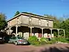 More images | |||
| Lighttower | Northern tip of Shoal Island, in the St. Mary River, St. Joseph, ON | 46°18′48″N 84°04′33″W | 13164 | | |||
| Wellington Square Townhouses | 780 Wellington Street East, Sault Ste. Marie, ON | 46°30′35″N 84°19′15″W | 7376 |  More images | |||
| Whitefish Island National Historic Site of Canada | , Sault Ste. Marie, ON | 46°30′36″N 84°21′04″W | 14945 | 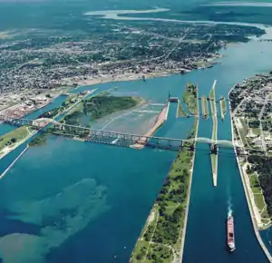 More images | |||
| Canadian Pacific Railway Station | Winnipeg Street (between Elgin & Durham Streets), White River, ON | 4613 | 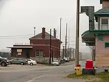 More images |
Cochrane District
| Name | Address | Coordinates | IDF | IDP | IDM | Image | |
|---|---|---|---|---|---|---|---|
| Public Building | 22 Circle Street, Kapuskasing, ON | 49°25′02″N 82°25′29″W | 4063 | | |||
| HBC Staff House | 4 Front Street, Moose Factory, ON | 51°15′08″N 80°36′22″W | 8854 | 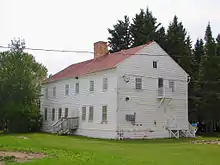 More images | |||
| HBC Worker's House - McLeod House | 2 Museum Street, Moose Factory, ON | 51°15′15″N 80°36′16″W | 8855 | 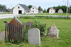 | |||
| HBC Worker's House - Sackabuckiskum House | 2 Museum Street, Moose Factory, ON | 51°15′15″N 80°36′13″W | 8857 | 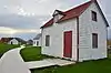 More images | |||
| HBC Worker's House - Turner House | 2 Museum Street, Moose Factory, ON | 51°15′14″N 80°36′18″W | 8856 | | |||
| Moose Factory Buildings National Historic Site of Canada | , Moosonee, ON | 51°16′45″N 80°38′20″W | 10481 | More images |
Kenora District
| Name | Address | Coordinates | IDF | IDP | IDM | Image | |
|---|---|---|---|---|---|---|---|
| Kenora Canadian Pacific Railway Station | Railway Street, Kenora, ON | 4545 | | ||||
| Sioux Lookout railway station CNR | 53 Front Street, Sioux Lookout, ON | 50°05′51″N 91°54′59″W | 6906 | 8900 | 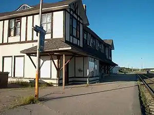 More images |
Manitoulin District
| Name | Address | Coordinates | IDF | IDP | IDM | Image | |
|---|---|---|---|---|---|---|---|
| Janet Head Light Tower | Lot 25, West Range, Gore Bay (Janet Head), ON | 45°56′48″N 82°29′00″W | 16129 | | |||
| Light station Tower | Great Duck Island, West Part, Manitoulin, ON | 45°39′05″N 82°57′12″W | 10937 | | |||
| Manitowaning Lighttower | Arthur Street, Manitowaning, ON | 45°44′41″N 81°48′18″W | 21067 | | |||
| Sheguiandah National Historic Site of Canada | , Northeastern Manitoulin and the Islands (Sheguiandah), ON | 45°52′42″N 81°54′24″W | 14555 | | |||
| Fog Alarm | Mississagi Island, Unorganized West Manitoulin District, ON | 45°53′28″N 83°13′32″W | 9603 | | |||
| Lighttower | Mississagi Island, Unorganized West Manitoulin District, ON | 45°53′28″N 83°13′32″W | 9623 | 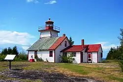 |
Nipissing District
| Name | Address | Coordinates | IDF | IDP | IDM | Image | |
|---|---|---|---|---|---|---|---|
| Canadian National Railway Station | 172 Second Avenue West, North Bay, ON | 6810 | | ||||
| North Bay CNR Station | 214 Second Avenue, North Bay, ON | 46°18′51″N 79°27′40″W | 8182 | | |||
| North Bay CPR Station | 100 Ferguson Street, North Bay, ON | 6903 | 8183 | | |||
| Power Cavern and Control Building | Canadian Air Defence Sector (CADS) Complex, North Bay, ON | 46°20′14″N 79°24′35″W | 13174 | | |||
| Algonquin Provincial Park National Historic Site of Canada | , Unorganized South Nipissing District, ON | 45°33′00″N 78°35′00″W | 3249 | 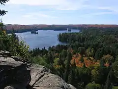 More images |
Rainy River District
| Name | Address | Coordinates | IDF | IDP | IDM | Image | |
|---|---|---|---|---|---|---|---|
| Federal Building | 301 Scott Street, Fort Frances, ON | 48°36′36″N 93°23′43″W | 9485 | | |||
| Fort St. Pierre National Historic Site of Canada | Point Park, Fort Frances, ON | 48°36′55″N 93°21′23″W | 18945 | | |||
| Former Canadian National Railway Station | 4th Street West (west of Central Avenue), Fort Frances, ON | 48°36′49″N 93°24′15″W | 6809 | | |||
| Kay-Nah-Chi-Wah-Nung National Historic Site of Canada | , Morley (Stratton), ON | 48°38′46″N 94°04′30″W | 12056 | 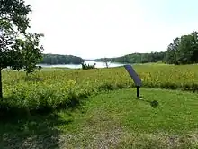 |
Sudbury District
| Name | Address | Coordinates | IDF | IDP | IDM | Image | |
|---|---|---|---|---|---|---|---|
| Canadian Pacific Railway Station | Spencer Avenue, Cartier, ON | 46°42′21″N 81°33′27″W | 4608 | 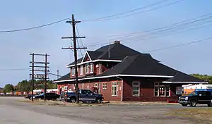 | |||
| Killarney Lighthouse | , Killarney, ON | 45°58′06″N 81°29′20″W | 9685 | 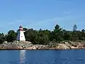 More images | |||
| Killarney Northwest Lighthouse | Southern tip of Partridge Island, Killarney, ON | 45°59′02″N 81°31′56″W | 10240 | |
Thunder Bay District
| Name | Address | Coordinates | IDF | IDP | IDM | Image | |
|---|---|---|---|---|---|---|---|
| VIA Rail/Canadian National Railway Station | Railway Avenue (at Main St.), Greenstone (Nakina), ON | 50°10′37″N 86°42′47″W | 6802 | | |||
| Pic River Site National Historic Site of Canada | , Pic River 50, ON | 48°37′33″N 86°16′56″W | 15782 | | |||
| Canadian Pacific Railway Station | Brunswick Street, Schreiber, ON | 4609 | | ||||
| Armoury | 317 Park Avenue, Thunder Bay, ON | 48°26′11″N 89°13′41″W | 9616 | | |||
| Canadian Car & Foundry National Historic Site of Canada | 1001 Montreal Street, Thunder Bay, ON | 48°21′32″N 89°18′04″W | 16408 | %252C_Thunder_Bay%252C_2013.JPG.webp) | |||
| Cummins Pre-contact Site National Historic Site of Canada | Mapleward Road, Cummins Pond, Thunder Bay, ON | 16843 | | ||||
| Federal Building | 130 Syndicate Ave South, Thunder Bay, ON | 48°22′59″N 89°14′52″W | 10463 | | |||
| Finnish Labour Temple National Historic Site of Canada | 314 Bay Street, Thunder Bay, ON | 48°25′56″N 89°13′48″W | 18724 |  | |||
| Lamb Island Lighthouse | Lamb Island, 90km east of Thunder Bay in Lake Huron, Thunder Bay, ON | 48°36′08″N 88°08′37″W | 20797 | | |||
| Revenue Canada Building | 201 May Street North, Thunder Bay, ON | 48°23′13″N 89°14′46″W | 4767 | .JPG.webp) More images | |||
| Thunder Bay Tourist Pagoda National Historic Site of Canada | 164 Arthur Street, Thunder Bay, ON | 48°26′05″N 89°13′08″W | 7763 | 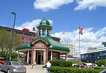 More images | |||
| Union Station (Canadian Pacific Railway Station) | 440 Syndicate Avenue South, Thunder Bay, ON | 4546 | More images | ||||
| Lighttower | Eastern tip of Davieaux Island, Lake Superior, Unorganized Thunder Bay District, ON | 47°41′41″N 85°48′19″W | 4758 | | |||
| Lightstation: Tower | Battle Island, Lake Superior, Unorganized Thunder Bay District, ON | 48°45′06″N 87°33′26″W | 9683 | |
Timiskaming District
| Name | Address | Coordinates | IDF | IDP | IDM | Image | |
|---|---|---|---|---|---|---|---|
| Cobalt Mining District National Historic Site of Canada | , Cobalt, ON | 47°23′51″N 79°40′30″W | 4183 |  More images | |||
| Cobalt O.N.R. Station | 1 Station Road, Cobalt, ON | 47°23′45″N 79°41′03″W | 10423 | | |||
| Sir Harry Oakes Chateau | 2 Chateau Drive, Kirkland Lake, ON | 48°08′55″N 80°02′54″W | 8170 | 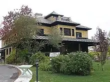 More images |
See also
| Wikimedia Commons has media related to Cultural heritage monuments in Ontario. |
References
This article is issued from Wikipedia. The text is licensed under Creative Commons - Attribution - Sharealike. Additional terms may apply for the media files.