Timiskaming District
Timiskaming is a district and census division in Northeastern Ontario in the Canadian province of Ontario. The district was created in 1912 from parts of Algoma, Nipissing, and Sudbury districts. In 1921, Cochrane District was created from parts of this district and parts of Thunder Bay District.
Timiskaming District
District de Timiskaming | |
|---|---|
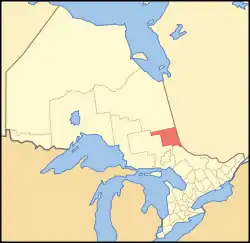 Location of Timiskaming District in Ontario | |
| Coordinates: 47°50′N 80°30′W | |
| Country | |
| Province | |
| Region | Northeastern Ontario |
| Created | 1912 |
| Government | |
| • MPs | Charlie Angus, Marc Serré, Anthony Rota |
| • MPPs | France Gélinas, John Vanthof, Guy Bourgouin |
| Area | |
| • Land | 13,299.92 km2 (5,135.13 sq mi) |
| Population (2016)[2] | |
| • Total | 32,251 |
| • Density | 2.4/km2 (6/sq mi) |
| Time zone | UTC-5 (Eastern (EST)) |
| • Summer (DST) | UTC-4 (EDT) |
| Postal code FSA | P0J, P0K, P2N |
| Area code(s) | 705, 249 |
| Seat | Temiskaming Shores |
The division had a population of 32,251 in the Canada 2016 Census. The land area is 13,299.92 square kilometres (5,135.13 sq mi); the population density was 2.4 per square kilometre (6.2/sq mi).[1]
It is just west of the similarly-named Témiscamingue county in Québec, which is also informally called a region, but is administratively part of a greater region named Abitibi-Témiscamingue.
Temiskaming District is home to several provincial parks.
History
The coureurs de bois explored and traded fur in what is now the Timiskaming District, in the 17th century.[3]
Subdivisions
City
- Temiskaming Shores (Haileybury, New Liskeard, Dymond Township, North Cobalt)
Towns
- Cobalt
- Englehart
- Kirkland Lake (Chaput Hughes)
- Latchford
Townships
- Armstrong (Earlton)
- Brethour
- Casey (Belle Vallée)
- Chamberlain
- Charlton and Dack
- Coleman
- Evanturel
- Gauthier (Dobie)
- Harley
- Harris
- Hilliard (Hilliardton)
- Hudson
- James (Elk Lake)
- Kerns
- Larder Lake
- Matachewan
- McGarry (Kearns, Virginiatown)
First Nations reserve
Unorganized areas
- Timiskaming, Unorganized, East Part
- Timiskaming, Unorganized, West Part (Gowganda, Kenabeek, King Kirkland, Marshall's Corners, Marter, Sesekinika, Tarzwell, Tomstown)
The following local services boards serve inhabitants of these unincorporated areas:
Geographical townships
|
|
|
Demographics
| Canada census – Timiskaming District community profile | |||
|---|---|---|---|
| 2016 | 2011 | 2006 | |
| Population: | 32,251 (-1.2% from 2011) | 32,634 (-1.9% from 2006) | 33,283 (-3.4% from 2001) |
| Land area: | 13,303.30 km2 (5,136.43 sq mi) | 13,299.92 km2 (5,135.13 sq mi) | 13,279.88 km2 (5,127.39 sq mi) |
| Population density: | 2.4/km2 (6.2/sq mi) | 2.5/km2 (6.5/sq mi) | 2.5/km2 (6.5/sq mi) |
| Median age: | 47.2 (M: 46.2, F: 48.0) | 46.6 (M: 45.9, F: 47.2) | 44.7 (M: 44.0, F: 45.3) |
| Total private dwellings: | 16,862 | 16,330 | 16,550 |
| Median household income: | $59,630 | $43,491 | |
| References: 2016[2] 2011[1] 2006[4] earlier[5] | |||
Politics
The district seat is in Temiskaming Shores.
Along with portions of the neighbouring district, Cochrane, Timiskaming is represented in the Legislative Assembly of Ontario by John Vanthof. In the House of Commons of Canada, the district is divided between Nipissing—Timiskaming, represented by Anthony Rota, in the south, and Timmins—James Bay, represented by Charlie Angus, in the north. A very small portion of the district also belongs to the riding of Nickel Belt.
See also
References
- "2011 Community Profiles". 2011 Canadian Census. Statistics Canada. July 5, 2013. Retrieved 2012-03-19.
- "2016 Community Profiles". 2016 Canadian Census. Statistics Canada. February 21, 2017. Retrieved 2019-07-16.
- "Official Plan" (PDF). Town of Kirkland Lake. Retrieved 2011-10-21.
- "2006 Community Profiles". 2006 Canadian Census. Statistics Canada. March 30, 2011. Retrieved 2012-03-19.
- "2001 Community Profiles". 2001 Canadian Census. Statistics Canada. February 17, 2012.
External links
| Wikimedia Commons has media related to Timiskaming District, Ontario. |
- Tembrella.com
- Ontario Highway 11 Homepage - Timiskaming District (community profiles)
- Map of historic geographic townships in Timiskaming District
- Timiskaming Community Health Network
Places adjacent to Timiskaming District | ||||||||||
|---|---|---|---|---|---|---|---|---|---|---|
| ||||||||||
| Regions | |
|---|---|
| Counties | |
| Districts | |
| Regional municipalities | |
| Single-tier municipalities | |
| Separated municipalities | |
| |