List of protected areas of Alberta

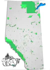
This is a list of protected areas of Alberta. Protected areas are managed by the Government of Canada or the Government of Alberta. The provincial government owns 60% of Alberta's landmass[1] but most of this has not been formally protected. The total protected area throughout Alberta including federal and provincial protected areas is approximately 90,700 km2 (35,000 sq mi).

Alberta Parks
Location and extent of parks in Alberta
TypeNumberArea km²
(sq mi)
Provincial Parks762,214 km2 (855 sq mi)
Wildland Provincial Parks3117,314 km2 (6,685 sq mi)
Provincial Recreation Areas208899 km2 (347 sq mi)
Wilderness Areas31,010 km2 (390 sq mi)
Ecological Reserves15268 km2 (103 sq mi)
Natural Areas1391,299 km2 (502 sq mi)
Heritage Rangelands2120 km2 (46 sq mi)
National Parks563,045 km2 (24,342 sq mi)
Total47690,747 km2 (35,038 sq mi)

International recognition

Six of Canada's 14 UNESCO World Heritage Sites are entirely or partially located in Alberta:

Federally protected areas

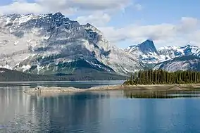
Five National Parks of Canada (Banff, Elk Island, Jasper, Waterton Lakes and Wood Buffalo), managed by Parks Canada are located in the province. Several former national parks (such Buffalo National Park, Wawaskesy National Park, and Nemiskam National Park) formerly existed in Alberta, but were delisted in 1947.

There are several National Historic Sites of Canada in Alberta, but only two are operated by Parks Canada: Rocky Mountain House, which features an indoor interpretation centre and year-round in-person interpretation, and Frog Lake which has only outdoor interpretive panels to mark the site.

Provincially protected areas

There are several different departments and agencies that deal with land use in Alberta, however Alberta's provincial parks are managed by the Government of Alberta's Alberta's Ministry of Environment and Parks Parks Division whose mandate is to protect the province's natural landscapes in Alberta. The government has divided these natural areas into seven categories, provincial parks being one. These categories are:

As of 2016, the province of Alberta managed 76 provincial parks, 32 wildland provincial parks, 208 provincial recreation areas, 15 ecological reserves, 3 wilderness areas, 139 natural areas and 2 heritage rangeland.[2] Although these areas are the responsibility of the Alberta government, private companies have been contracted to handle various aspects of the operation of many parks (e.g. maintenance and campground operation).

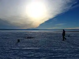
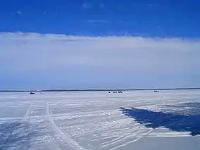
List of wilderness areas

Wilderness areas have the strictest level of protection, no development of any kind is permitted, and travel is only permitted by foot.[3]

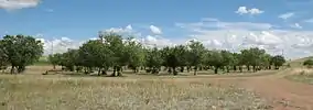
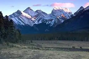
List of provincial parks
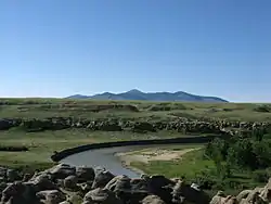
ParkNearest communityEstablishedCoordinateswebsite (ID)
Antelope Hill Provincial Park Hanna2014, December 4[4]51.722°N 111.937°W / 51.722; -111.937 (Antelope Hill Provincial Park)
Aspen Beach Provincial Park Bentley1932, November 2152°27′28″N 113°58′39″W1
Beauvais Lake Provincial Park Pincher Creek1954, February 149°24′39″N 114°06′33″W6
Big Hill Springs Provincial Park Cochrane1957, November 2251°15′6″N 114°23′18″W12
Big Knife Provincial Park Forestburg1962, October 252°29′25″N 112°13′15″W11
Bow Valley Provincial Park Canmore1959, July 2751°04′5″N 115°02′47″W293
Bragg Creek Provincial Park Bragg Creek1960, January 1950°56′30″N 114°35′14″W324
Brown-Lowery Provincial Park Turner Valley1992, October 2950°48′58″N 114°26′4″W16
Calling Lake Provincial Park Athabasca1971, July 2055°10′51″N 113°14′40″W248
Canmore Nordic Centre Provincial Park Canmore198851°05′53″N 115°23′23″W294
Carson-Pegasus Provincial Park Whitecourt1982, May 1954°18′16″N 115°38′30″W247
Castle Provincial Park Crowsnest Pass2017, February 17[5]49.444°N 114.117°W / 49.444; -114.117 (Castle Provincial Park)
Chain Lakes Provincial Park Nanton1969, December 2350°12′24″N 114°11′47″W19
Cold Lake Provincial Park Cold Lake1976, August 1854°27′38″N 110°07′12″W22
Crimson Lake Provincial Park Rocky Mountain House1955, November 2252°27′0″N 115°2′0″W27
Cross Lake Provincial Park Athabasca1955, November 2254°38′17″N 113°48′52″W28
Crow Lake Provincial Park Fort McMurray55°47′47″N 112°10′54″W574
Cypress Hills Interprovincial Park Medicine Hat49°34′31″N 110°00′23″W29
Dillberry Lake Provincial Park Provost1957, January 852°35′47″N 110°04′51″W38
Dinosaur Provincial Park Brooks1955, June 2750°45′44″N 111°31′5″W246
Dry Island Buffalo Jump Provincial Park Trochu1970, December 1551°56′10″N 112°57′41″W39
Dunvegan Provincial Park Fairview1992, May 2155°55′24″N 118°36′2″W40
Eagle Point Provincial Park Drayton Valley2007, August 2953°14′40″N 114°52′28″W589
Fish Creek Provincial Park Calgary1975, June 1050°54′11″N 114°00′55″W45
Garner Lake Provincial Park Vilna1953, July 1454°10′59″N 111°44′22″W49
Glenbow Ranch Provincial Park Calgary
Cochrane
2008, April 1751°10′1″N 114°23′34″W593
Gooseberry Lake Provincial Park Consort1932, November 2152°07′4″N 110°45′6″W51
Greene Valley Provincial Park Peace River2000, June 656°11′53″N 117°14′30″W147
Gregoire Lake Provincial Park Fort McMurray1969, October 2156°28′23″N 111°11′55″W52
Hilliard's Bay Provincial Park High Prairie1978, October 2455°29′57″N 116°01′10″W3
Jarvis Bay Provincial Park Sylvan Lake1965, July 852°21′59″N 114°07′56″W61
Kinbrook Island Provincial Park Brooks1951, November 1450°26′52″N 111°54′40″W65
Lakeland Provincial Park Lac La Biche1992, January 1654°47′24″N 111°29′17″W280
Lesser Slave Lake Provincial Park Slave Lake55°25′3″N 114°48′39″W68
Little Bow Provincial Park Champion1954, January 2050°13′10″N 112°57′56″W69
Little Fish Lake Provincial Park Drumheller1957, April 851°22′18″N 112°11′54″W71
Lois Hole Centennial Provincial Park Edmonton
St. Albert
2005, April 1953°36′22″N 113°40′41″W437
Long Lake Provincial Park Boyle1957, March 2554°25′32″N 112°45′26″W72
Midland Provincial Park Drumheller1979, June 551°28′41″N 112°47′13″W78
Miquelon Lake Provincial Park Hay Lakes1958, May 2053°14′51″N 112°53′15″W81
Moonshine Lake Provincial Park Rycroft1959, April 2155°55′31″N 119°13′51″W82
Moose Lake Provincial Park Bonnyville1967, April 1954°15′50″N 110°55′55″W83
Notikewin Provincial Park Manning1979, November 2057°17′19″N 117°09′3″W87
Obed Lake Provincial Park Edson53°33′19″N 117°07′44″W203
O'Brien Provincial Park Grande Prairie1954, June 2955°03′49″N 118°49′28″W88
Park Lake Provincial Park Lethbridge1932, November 2149°48′14″N 112°55′30″W143
Pembina River Provincial Park Entwistle1953, September 2153°36′18″N 114°59′57″W92
Peter Lougheed Provincial Park Kananaskis1977, October 750°41′0″N 115°13′35″W307
Pierre Grey's Lakes Provincial Park Grande Cache53°54′23″N 118°35′18″W209
Pigeon Lake Provincial Park Wetaskiwin1967, May 2653°01′35″N 114°08′4″W98
Police Outpost Provincial Park Cardston1970, April 2149°00′22″N 113°27′32″W108
Queen Elizabeth Provincial Park Grimshaw1956, March 156°13′43″N 117°41′22″W110
Ram Falls Provincial Park Nordegg52°05′21″N 115°50′11″W213
Red Lodge Provincial Park Bowden1951, May 751°56′38″N 114°16′11″W114
Rochon Sands Provincial Park Stettler1957, January 852°27′51″N 112°53′27″W116
Rock Lake Provincial Park Hinton53°28′2″N 118°15′10″W215
Saskatoon Island Provincial Park Wembley1932, November 2155°12′20″N 119°05′6″W118
Sheep River Provincial Park Turner Valley50°38′49″N 114°38′43″W330
Sir Winston Churchill Provincial Park Lac La Biche1952, September 2954°49′45″N 111°57′45″W120
Spray Valley Provincial Park Kananaskis2000, December 150°50′14″N 115°14′48″W308
Strathcona Science Provincial Park Edmonton
Sherwood Park
1979, December 1253°33′39″N 113°23′2″W123
Sundance Provincial Park Edson1999, April 2853°38′29″N 116°52′47″W142
Sylvan Lake Provincial Park Sylvan Lake1980, January 1652°20′43″N 114°10′11″W125
Thunder Lake Provincial Park Barrhead1958, January 2854°07′59″N 114°43′57″W137
Tillebrook Provincial Park Tilley1965, July 2050°32′16″N 111°48′30″W138
Two Lakes Provincial Park Grande Prairie54°22′22″N 119°45′31″W222
Vermilion Provincial Park Vermilion1953, May 2953°21′53″N 110°52′55″W152
Wabamun Lake Provincial Park Wabamun53°33′58″N 114°27′16″W154
Whitney Lakes Provincial Park Elk Point1982, June 2353°49′48″N 110°29′48″W158
William A. Switzer Provincial Park Hinton1958, December 2253°32′34″N 117°48′20″W159
Williamson Provincial Park Valleyview1960, November 755°04′52″N 117°33′26″W165
Willow Creek Provincial Park Stavely1957, December 1050°06′54″N 113°46′14″W167
Winagami Lake Provincial Park Donnelly1956, November 1355°37′45″N 116°40′41″W169
Woolford Provincial Park Cardston49°10′33″N 113°11′20″W173
Writing-on-Stone Provincial Park Coutts1957, January 849°04′49″N 111°38′21″W177
Wyndham-Carseland Provincial Park Strathmore1979, May 250°49′47″N 113°26′59″W178
Young's Point Provincial Park Valleyview1971, August 355°07′3″N 117°33′29″W180

Other parks

Other provincial lands

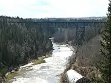
Approximately 60% of land in Alberta is public land owned by the Alberta government.[6] For administrative purposes, the province is divided into two broad land use areas: the Green Area (forested land, almost entirely provincially owned) and the White Area (other).[6] The Rocky Mountains Forest Reserve was created by the Forest Reserves Act of 1964.[7] There are also 32 provincial grazing reserves located throughout Alberta. They are administered by Alberta Sustainable Resource Development.[1]

Municipal parks

See also

References

  1. Alberta Sustainable Resource Development. "Provincial Grazing Reserves". Archived from the original on May 18, 2008. Retrieved 2009-05-08.
  2. "Land Reference Manual". Alberta Parks. Government of Alberta. Retrieved 6 October 2016.
  3. About Alberta's Parks - AlbertaParks.ca Archived 2009-12-27 at the Wayback Machine
  4. "O.C. 455/2014". Government of Alberta. December 4, 2014. Retrieved December 8, 2014.
  5. "O.C. 22/2017". Government of Alberta. January 20, 2017. Retrieved January 21, 2017.
  6. Archived March 12, 2009, at the Wayback Machine
  7. Archived September 13, 2004, at the Wayback Machine
This article is issued from Wikipedia. The text is licensed under Creative Commons - Attribution - Sharealike. Additional terms may apply for the media files.