List of airports in Alberta

This is a list of airports in Alberta. It includes all Nav Canada certified and registered water and land airports, aerodromes and heliports in the Canadian province of Alberta.[1][2] Airports names in italics are part of the National Airports System.[3]
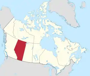
Alberta

List of airports and heliports

The list is sorted by the name of the community served, click the sort buttons in the table header to switch listing order.

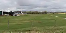
Banff runway
Beaverodge Airport
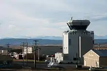
Calgary/Springbank control tower
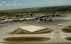
Calgary International Airport
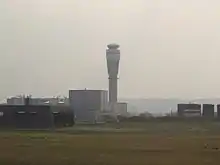
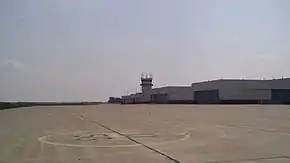
Calgary International control tower
CFB Cold Lake
CFB Edmonton
Fort McMurray Airportt
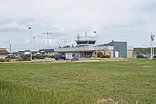
High Level Airport
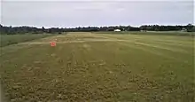
Edmonton/Twin Island Airpark
Grande Prairie Airport
Jasper Airport
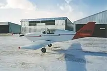
Indus Airpark
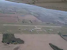
Lloydminster Airport
Medicine Hat Airport
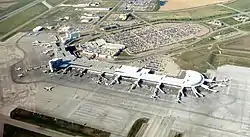
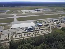
Edmonton International Airport
Edmonton/Cooking Lake
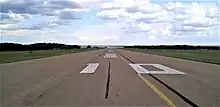
Edmonton/Cooking Lake Aerodrome
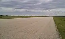
Viking Airport
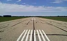
Tofield Airport
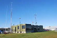
Whitecourt Airport terminal building
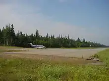
Pelican Airport
Community   Airport name   ICAO   TC LID   IATA   Coordinates  
AirdrieAirdrie AerodromeCEF451°15′50″N 113°56′04″W
AlhambraAlhambra/Ahlstrom AerodromeCAM452°20′45″N 114°40′02″W
AthabascaAthabasca AirportCYWM54°44′35″N 113°12′19″W
Athabasca oil sandsAnzac (Long Lake) HeliportCNZ256°25′27″N 110°57′52″W
BanffBanff AirportCYBA51°12′30″N 115°32′25″W
BanffBanff Mineral Springs (Hospital) HeliportCBM751°10′47″N 115°34′34″W
BanffBanff (Park Compound) HeliportCBP251°11′30″N 115°33′30″W
BarrheadBarrhead AirportCEP354°05′49″N 114°26′20″W
BarrheadBarrhead (Healthcare Centre) HeliportCHC354°07′06″N 114°24′01″W
BashawBashaw AirportCFK252°33′27″N 112°57′53″W
BassanoBassano AirportCEN250°48′00″N 112°28′00″W
BassanoBassano (Health Centre) HeliportCBL450°47′26″N 112°27′39″W
BawlfBawlf (Blackwells) AirportCFR252°53′36″N 112°32′46″W
BeaverlodgeBeaverlodge AirportCEU255°11′03″N 119°25′51″W
BeaverlodgeBeaverlodge/Clanachan AerodromeCLN455°14′04″N 119°50′31″W
BeisekerBeiseker AirportCFV251°23′36″N 113°28′19″W
BenaltoBenalto/Hillman's Farm AerodromeCBH752°13′33″N 114°15′21″W
Birch MountainBirch Mountain AirportCFM257°41′42″N 111°50′20″W
BistchoBistcho AirportCPB859°38′18″N 118°19′59″W
Black DiamondBlack Diamond (Oilfields General Hospital) HeliportCFL350°40′44″N 114°14′03″W
Black DiamondBlack Diamond/Cu Nim AirportCEH250°43′21″N 114°10′46″W
Black DiamondBlack Diamond/Flying R Ranch AerodromeCBD850°38′42″N 114°12′11″W
BlackieBlackie/Wilderman Farm AirportCFT250°33′09″N 113°35′48″W
BlairmoreBlairmore (Crowsnest Pass Hospital) HeliportCBS949°36′58″N 114°27′26″W
BlairmoreBlairmore (Forestry) HeliportCEK449°36′29″N 114°27′05″W
BonnyvilleBonnyville AirportCYBF54°18′17″N 110°44′28″W
BonnyvilleBonnyville Health Centre HeliportCBN254°15′50″N 110°44′25″W
BottrelBottrel/Anchor 9 Ranch AerodromeCBR951°24′46″N 114°34′49″W
Bow IslandBow Island AirportCEF349°53′00″N 111°20′00″W
BoyleBoyle AirportCFM754°34′24″N 112°49′12″W
BoyleBoyle (Healthcare Centre) HeliportCHJ454°35′19″N 112°48′07″W
BrantBrant (Dixon Farm) AirportCEX950°25′10″N 113°32′27″W
BrooksBrooks (Community Health Centre) HeliportCFV850°34′07″N 111°53′18″W
BrooksBrooks Regional AerodromeCYBP50°38′01″N 111°55′33″W
BuffaloBuffalo (Jaques Farms) AerodromeCJF450°51′39″N 110°39′18″W
CalgaryCalgary International AirportCYYCYYC51°06′50″N 114°01′13″W
CalgaryCalgary (Aerial Recon) HeliportCAR350°52′05″N 114°08′17″W
CalgaryCalgary (Alberta Children's Hospital) HeliportCAC651°04′34″N 114°08′52″W
CalgaryCalgary/Blue Con HeliportCBC650°59′49″N 113°53′38″W
CalgaryCalgary (Bow Crow) HeliportCEP251°06′11″N 114°12′54″W
CalgaryCalgary (City/Bow River) HeliportCEL251°03′10″N 114°04′44″W
CalgaryCalgary/Eastlake HeliportCEL950°57′18″N 113°58′22″W
CalgaryCalgary/Elephant Enterprises Inc. HeliportCEE251°06′55″N 114°17′44″W
CalgaryCalgary (Foothills Hospital McCaig Tower) HeliportCMT351°03′55″N 114°08′06″W
CalgaryCalgary/K. Coffey Residence HeliportCKC451°09′56″N 114°18′52″W
CalgaryCalgary (Peter Lougheed Centre) HeliportCLC351°04′46″N 113°58′58″W
CalgaryCalgary (Rockyview Hospital) HeliportCEM250°59′18″N 114°05′53″W
CalgaryCalgary (South Health Campus Hospital) HeliportCSH350°52′58″N 113°57′07″W
CalgaryCalgary/Springbank Airport (Springbank Airport)CYBWYBW51°06′19″N 114°22′17″W
Calling LakeCalling Lake AirportCFK455°19′00″N 113°15′00″W
CalmarEdmonton/Calmar (Maplelane Farm) AerodromeCMF253°11′04″N 113°44′22″W
CalmarCalmar/Wizard Lake AerodromeCWL353°06′57″N 113°46′19″W
CamroseCamrose AirportCEQ353°02′23″N 112°48′58″W
CamroseCamrose/Marek Farms AerodromeCFF953°01′53″N 112°46′40″W
CamroseCamrose/St. Mary's Hospital HeliportCMR653°00′54″N 112°49′49″W
CanmoreCanmore (Hospital) HeliportCCH351°05′33″N 115°20′58″W
CanmoreCanmore Municipal HeliportCEW951°04′43″N 115°20′20″W
CanmoreCanmore/Nakoda HeliportCNK751°06′12″N 115°00′44″W
CardstonCardston AirportCEA649°09′45″N 113°14′28″W
CarstairsCarstairs/Bishell's AirportCGB251°34′58″N 114°03′07″W
CarwayCarway/Grizzly Creek Ranch HeliportCGC449°00′16″N 113°30′19″W
CastorCastor AirportCER252°13′00″N 111°56′00″W
CastorCastor (Our Lady of the Rosary Hospital) HeliportCCR752°13′24″N 111°54′24″W
CayleyCayley/A. J. Flying Ranch AirportCAJ750°27′00″N 113°45′00″W
CheadleCheadle AirportCFQ451°03′27″N 113°37′25″W
ChestermereChestermere (Kirkby Field) AirportCFX851°02′30″N 113°45′06″W
Chipewyan LakeChipewyan Lake AirportCEG556°57′09″N 113°29′44″W
ChipmanChipman AirportCFU353°43′00″N 112°38′00″W
ChipmanChipman/M.Y. AirfieldCMY253°38′11″N 112°36′03″W
Christina BasinChristina Basin AirportCFF255°35′24″N 111°49′23″W
Christina LakeChristina Lake AerodromeCCL355°37′43″N 110°44′59″W
ClaresholmClaresholm (General Hospital) HeliportCFV750°01′06″N 113°34′59″W
ClaresholmClaresholm Industrial AirportCEJ450°00′17″N 113°37′48″W
Clearwater RiverClearwater River AirportCFS851°59′17″N 115°13′42″W
Cline RiverCline River HeliportCCR552°10′44″N 116°28′45″W
CoaldaleCoaldale (Rednek Air) AerodromeCRD249°49′18″N 112°31′50″W
CochraneCochrane/Arkayla Springs AirportCKY851°12′17″N 114°46′28″W
Cold LakeCFB Cold Lake (Cold Lake/Group Captain R.W. McNair Airport)CYODYOD54°24′18″N 110°16′46″W
Cold LakeCold Lake Healthcare Centre HeliportCCH954°29′06″N 110°11′44″W
Cold LakeCold Lake Regional AirportCEN554°28′39″N 110°16′07″W
Cold LakeCold Lake/Three Bears Landing AerodromeCTB854°16′24″N 110°09′45″W
ConklinConklin (Leismer) AirportCET255°41′46″N 111°16′46″W
ConsortConsort AirportCFG352°01′00″N 110°45′00″W
ConsortConsort (Health Centre) HeliportCCS252°00′33″N 110°46′55″W
CoronationCoronation AirportCYCT52°04′30″N 111°26′43″W
CoronationCoronation (Health Centre) HeliportCRH252°05′46″N 111°27′34″W
CouttsCoutts/Ross International AirportCEP448°59′54″N 111°58′42″W
CowleyCowley AirportCYYM49°38′11″N 114°05′40″W
DayslandDaysland Health Centre HeliportCDL352°52′08″N 112°16′23″W
DeBoltDeBolt AerodromeCFG455°14′00″N 118°02′00″W
Del BonitaDel Bonita/Whetstone International AirportCEQ448°59′55″N 112°46′35″W
DelburneDelburne/Hall Residence HeliportCDB352°14′11″N 113°24′32″W
De WintonDe Winton (Highwood) HeliportCED650°48′11″N 113°53′34″W
De WintonDe Winton/South Calgary AirportCEH450°49′19″N 113°49′28″W
DidsburyDidsbury/Minty Field AerodromeCDM251°39′12″N 114°21′04″W
DidsburyDidsbury District Health Services HeliportCDD751°39′42″N 114°07′22″W
DoigDoig AirportCFX356°57′00″N 119°31′00″W
DonnellyDonnelly AirportCFM455°42′34″N 117°05′40″W
Drayton ValleyDrayton Valley (Health Centre) HeliportCFV953°12′44″N 114°58′15″W
Drayton ValleyDrayton Valley Industrial AirportCER353°15′57″N 114°57′37″W
DrumhellerDrumheller (Health Centre) HeliportCDH251°28′09″N 112°43′42″W
DrumhellerDrumheller Municipal AirportCEG451°29′47″N 112°44′55″W
DrumhellerDrumheller/Ostergard's AirportCDO251°17′40″N 112°36′49″W
EagleshamEaglesham/Bice Farm AerodromeCBI255°41′50″N 117°58′21″W
EagleshamEaglesham/Codesa South AerodromeCCP755°43′12″N 118°02′22″W
EagleshamEaglesham South AerodromeCGL455°40′16″N 117°56′08″W
EdmontonEdmonton (City) HeliportCCE753°22′09″N 113°39′49″W
Edmonton Metropolitan RegionEdmonton/Gartner AirportCFQ753°16′54″N 113°27′18″W
EdmontonEdmonton/Grey Nuns Community Hospital HeliportCES853°27′44″N 113°25′40″W
EdmontonEdmonton/Kelsonae HeliportCSG653°21′58″N 113°50′16″W
Edmonton Metropolitan RegionEdmonton/Lechelt Field AerodromeCGF253°34′35″N 112°58′51″W
EdmontonEdmonton/Misericordia (Community Hospital) HeliportCMC253°31′13″N 113°36′40″W
EdmontonEdmonton/Morinville (Currie Field) AerodromeCCF653°49′11″N 113°45′39″W
EdmontonEdmonton/Morinville (Mike's Field) AerodromeCMN653°50′13″N 113°33′48″W
EdmontonEdmonton/Namao Heliport (CFB Edmonton)CYEDYED53°40′09″N 113°28′32″W
EdmontonEdmonton (Royal Alexandra Hospital) HeliportCFH753°33′28″N 113°29′47″W
EdmontonEdmonton/Sturgeon Community HospitalCSA353°39′16″N 113°37′38″W
EdmontonEdmonton/University of Alberta (Stollery Children's Hospital) HeliportCEW753°31′13″N 113°31′18″W
EdraEdra AirportCEV257°51′00″N 113°15′00″W
EdsonEdson AirportCYETYET53°34′44″N 116°27′54″W
Elk PointElk Point AirportCEJ653°53′35″N 110°46′20″W
Elk PointElk Point (Healthcare Centre) HeliportCEP753°53′54″N 110°54′29″W
EmpressEmpress AirportCYEA50°56′00″N 110°00′47″W
EmpressEmpress North 6 (Plains Midstream Canada) AerodromeCFL250°40′57″N 110°02′31″W
FairviewFairview AirportCEB556°04′53″N 118°26′00″W
ForemostForemost AirportCFD449°28′59″N 111°29′40″W
Fort ChipewyanFort Chipewyan AirportCYPYYPY58°46′02″N 111°07′02″W
Fort McKayFort MacKay/Albian AerodromeCAL457°13′26″N 111°25′08″W
Fort McKayFort MacKay/Firebag AerodromeCYFIYFI57°16′33″N 110°58′36″W
Fort McKayFort MacKay/Horizon AirportCYNR57°22′54″N 111°42′04″W
Fort MacleodFort Macleod AirportCEY349°42′00″N 113°25′00″W
Fort MacleodFort Macleod (Alcock Farm) AirportCFM849°35′00″N 113°18′00″W
Fort MacleodFort Macleod (Hospital) HeliportCFM949°43′32″N 113°23′32″W
Fort McMurrayFort McMurray International AirportCYMMYMM56°39′12″N 111°13′24″W
Fort McMurrayFort McMurray (Legend) AerodromeCLG757°11′49″N 112°53′44″W
Fort McMurrayFort McMurray/Mildred Lake AirportCER457°03′20″N 111°34′26″W
Fort McMurrayFort McMurray (North Liege) AerodromeCNL257°08′10″N 113°17′23″W
Fort McMurrayFort McMurray (South Liege) AerodromeCLS356°49′46″N 113°05′55″W
Fort McMurrayFort McMurray Water AerodromeCES756°44′00″N 111°22′00″W
Fort SaskatchewanFort Saskatchewan (General Hospital) HeliportCSV453°41′35″N 113°12′37″W
Fort VermilionFort Vermilion (Wop May Memorial) AerodromeCEZ458°24′15″N 115°57′03″W
Fort VermilionFort Vermilion/Country Gardens B&B HeliportCKV958°21′02″N 115°56′57″W
Fox CreekFox Creek AirportCED454°22′48″N 116°45′59″W
Fox LakeFox Lake AirportCEC358°28′24″N 114°32′34″W
Garden RiverGarden River AirportCFU458°42′50″N 113°52′34″W
GlendonGlendon AirportCFP554°16′15″N 111°04′00″W
GlenwoodGlenwood AerodromeCGW249°21′16″N 113°39′44″W
Gordon LakeGordon Lake AirportCFW256°37′00″N 110°30′00″W
GrandeGrande AirportCFA556°18′00″N 112°14′00″W
Grande CacheGrande Cache (Community Health Complex) HeliportCGC353°53′28″N 119°07′08″W
Grande PrairieGrande Prairie AirportCYQUYQU55°10′55″N 118°53′14″W
Grande PrairieGrande Prairie (Forestry) HeliportCEZ955°09′13″N 118°49′21″W
Grande PrairieGrande Prairie (Queen Elizabeth II Hospital) HeliportCGP255°10′34″N 118°47′16″W
GrimshawGrimshaw AirportCFD556°11′46″N 117°37′31″W
Half Moon LakeEdmonton/Twin Island AirparkCEE653°28′16″N 113°09′16″W
HalkirkHalkirk/Paintearth (Fetaz) AerodromeCPE852°22′58″N 112°00′06″W
HannaHanna AirportCEL451°37′53″N 111°54′15″W
HannaHanna (District Ambulance) HeliportCHD351°39′03″N 111°55′43″W
HardistyHardisty AirportCEA552°38′48″N 111°23′08″W
HardistyHardisty (Health Centre) HeliportCHD252°40′08″N 111°18′27″W
HesperoHespero AirportCFB352°18′00″N 114°27′49″W
HesperoHespero/Safron Residence HeliportCTS652°16′49″N 114°25′41″W
High LevelHigh Level AirportCYOJYOJ58°37′17″N 117°09′53″W
High PrairieHigh Prairie AirportCZHP55°23′37″N 116°28′30″W
High RiverHigh River AirportCEN450°32′00″N 113°50′29″W
High RiverHigh River (Hospital) HeliportCHR250°34′34″N 113°52′46″W
Hill SpringHillspring (Beck Farm) AerodromeCHS349°20′12″N 113°34′24″W
HintonHinton/Entrance AirportCEE453°22′53″N 117°42′04″W
HintonHinton/Jasper-Hinton AirportCEC453°19′09″N 117°45′11″W
HuggettHuggett/Goodwood Field AerodromeCGF553°20′43″N 114°09′21″W
IndusIndus/Winters Aire Park AirportCFY450°54′00″N 113°47′00″W
InnisfailInnisfail Aerodrome (Big Bend Airport)CEM452°04′43″N 114°01′39″W
InnisfailInnisfail (Hospital) HeliportCSF252°01′10″N 113°57′13″W
IrmaIrma AirportCFU852°54′44″N 111°10′26″W
JanvierJanvier AirportCEP555°54′00″N 110°44′00″W
JasperJasper AirportCYJA52°59′48″N 118°03′34″W
Jean LakeJean Lake AirportCFF357°29′00″N 113°53′00″W
John D'Or PrairieJohn D'Or Prairie AerodromeCFG558°29′29″N 115°08′18″W
Johnson LakeJohnson Lake AirportCFL957°34′00″N 110°19′00″W
JosephburgEdmonton/Josephburg AerodromeCFB653°43′41″N 113°05′14″W
Kananaskis VillageKananaskis Village Helistop HeliportCFE750°55′22″N 115°08′37″W
KillamKillam (Health Centre) HeliportCKH552°47′15″N 111°51′35″W
KillamKillam-Sedgewick/Flagstaff Regional AirportCEK652°47′44″N 111°45′38″W
Kirby LakeKirby Lake AerodromeCRL455°21′20″N 110°38′15″W
Lac La BicheLac La Biche AirportCYLB54°46′13″N 112°01′54″W
LacombeLacombe Regional AirportCEG352°29′18″N 113°42′44″W
BlackfaldsLacombe (Mustang Helicopters) HeliportCMH352°22′44″N 113°49′21″W
La CreteLa Crete AirportCFN558°10′00″N 116°20′00″W
LamontLamont (Health Care Centre) HeliportCLM453°45′49″N 112°45′15″W
LeslievilleLeslieville/W. Pidhirney Residence HeliportCWP352°21′33″N 114°34′17″W
LethbridgeLethbridge AirportCYQLYQL49°37′49″N 112°47′59″W
LethbridgeLethbridge (Chinook Regional Hospital) HeliportCLH449°41′09″N 112°49′00″W
LethbridgeLethbridge (Gunnlaugson) AerodromeCGN349°38′10″N 112°41′29″W
LethbridgeLethbridge (J3 Airfield) AerodromeCLJ349°44′30″N 112°44′22″W
LethbridgeLethbridge (Mercer Field) AerodromeCMF349°33′17″N 112°33′49″W
LethbridgeLethbridge (Taylor Field) AerodromeCTF649°42′58″N 112°45′02″W
LloydminsterLloydminster AirportCYLLYLL53°18′33″N 110°04′21″W
Loon RiverLoon River AirportCFS657°08′31″N 115°04′31″W
ManningManning AirportCFX456°57′03″N 117°38′39″W
Margaret LakeMargaret Lake AirportCFV658°57′00″N 115°15′00″W
MarkervilleMarkerville/Safron Farms AerodromeCSF552°11′57″N 114°14′15″W
MayerthorpeMayerthorpe AirportCEV553°56′15″N 115°10′44″W
MayerthorpeMayerthorpe (Healthcare Centre) HeliportCMC353°56′56″N 115°07′59″W
Medicine HatMedicine Hat AirportCYXHYXH50°01′08″N 110°43′14″W
Medicine HatMedicine Hat (Regional Hospital) HeliportCMH550°02′07″N 110°42′07″W
Medicine HatMedicine Hat/Schlenker AirportCFZ349°58′20″N 110°43′25″W
Milk RiverMilk River AirportCEW549°08′00″N 112°03′00″W
MilletMillet/Creekview AerodromeCRK253°04′44″N 113°30′34″W
Mobil BistchoMobil Bistcho AirportCFV359°29′00″N 119°01′00″W
Muskeg TowerMuskeg Tower AirportCFW457°08′15″N 110°53′33″W
NampaNampa/Hockey AerodromeCNP655°54′52″N 117°08′07″W
Namur LakeNamur Lake AirportCFB557°23′00″N 112°48′00″W
NiskuEdmonton International AirportCYEGYEG53°18′35″N 113°34′47″W
NordeggNordegg/Ahlstrom HeliportCEG652°29′29″N 116°03′06″W
OkotoksCalgary/Christiansen Field AerodromeCRS350°47′58″N 114°03′04″W
OkotoksCalgary/Okotoks Airranch AirportCFX250°44′02″N 113°56′04″W
OkotoksCalgary/Okotoks (GG Ranch) HeliportCOK250°44′41″N 113°59′30″W
OkotoksCalgary/Okotoks (Rowland Field) AerodromeCRF450°45′53″N 113°57′29″W
Olds/DidsburyOlds-Didsbury AirportCEA351°42′40″N 114°06′22″W
OldsOlds (Hospital) HeliportCFU951°48′05″N 114°07′00″W
OldsOlds (Netook) AirportCFK651°50′51″N 114°03′53″W
OyenOyen Municipal AirportCED351°20′03″N 110°29′29″W
Parkland CountyParkland Airport (Edmonton/Parkland Aerodrome)CPL653°28′28″N 113°49′46″W
Peace RiverPeace River AirportCYPEYPE56°13′37″N 117°26′50″W
Pincher CreekPincher Creek AirportCZPC49°31′14″N 113°59′50″W
Pincher CreekPincher Creek (Hospital) HeliportCPR849°29′33″N 113°56′51″W
PonokaPonoka (Hospital & Care Centre) HeliportCHC452°41′07″N 113°35′22″W
PonokaPonoka Industrial (Labrie Field) AirportCEH352°39′07″N 113°36′16″W
PrimrosePrimrose AerodromeCFN655°23′26″N 111°07′13″W
ProvostProvost AirportCEH652°20′17″N 110°16′44″W
Rainbow LakeRainbow Lake AirportCYOP58°29′28″N 119°24′24″W
Red DeerRed Deer/Allan Dale Residence HeliportCAD252°16′11″N 113°41′59″W
Red DeerRed Deer/Allan Dale Trailers & RV HeliportCAD352°18′32″N 113°51′48″W
Red DeerRed Deer/Chong Residence HeliportCRE552°21′00″N 113°56′01″W
Red DeerRed Deer Regional AirportCYQFYQF52°10′56″N 113°53′40″W
Red DeerRed Deer Regional Hospital Centre HeliportCRD352°15′43″N 113°48′57″W
Red DeerRed Deer/Truant AerodromeCRD552°17′19″N 113°54′42″W
Red DeerRed Deer/Truant South AerodromeCRD652°16′40″N 113°54′55″W
Red Earth CreekRed Earth Creek AirportCEH556°32′47″N 115°16′27″W
RedwaterRedwater (Health Centre) HeliportCRW853°56′59″N 113°07′37″W
RedwaterRedwater (Heliworks) HeliportCRW253°55′09″N 113°06′15″W
RedwaterRedwater (Pembina) HeliportCRP353°49′29″N 113°07′47″W
RimbeyRimbey AirportCFC752°40′55″N 114°14′15″W
RimbeyRimbey (Hospital & Care Centre) HeliportCRH552°38′25″N 114°14′50″W
RockyfordRockyford AirportCFC651°15′35″N 113°06′39″W
RockyfordRockyford/Early Bird Air AerodromeCEB451°10′40″N 113°16′45″W
Rocky Mountain HouseRocky Mountain House AirportCYRMYRM52°25′47″N 114°54′15″W
Rocky Mountain HouseRocky Mountain House (General Hospital) HeliportCEU452°22′44″N 114°55′15″W
St. AlbertEdmonton/St. Albert (Delta Helicopters) HeliportCES353°41′12″N 113°41′14″W
St. PaulSt. Paul AerodromeCEW353°59′36″N 111°22′49″W
St. PaulSt. Paul (Health Care Centre) HeliportCTP553°59′17″N 111°17′26″W
Sherwood ParkEdmonton/Bailey HeliportCBY253°30′28″N 113°14′11″W
Sherwood ParkEdmonton/Eastport HeliportCEP853°30′18″N 113°19′56″W
ShundaShunda (Fire Base) HeliportCDA752°29′26″N 115°45′31″W
Slave LakeSlave Lake AirportCYZHYZH55°17′35″N 114°46′38″W
Slave LakeSlave Lake/Slave Lake Helicopters HeliportCSL655°17′36″N 114°46′53″W
Smoky LakeSmokey Lake (George McDougall Health Centre) HeliportCGM254°07′18″N 112°27′57″W
South Cooking LakeEdmonton/Cooking Lake AirportCEZ353°25′39″N 113°06′57″W
South Cooking LakeEdmonton/Cooking Lake Water AerodromeCEE753°25′22″N 113°06′16″W
Spirit RiverSpirit River AirportCFS555°47′01″N 118°50′23″W
Steen RiverSteen River AirportCFB759°38′00″N 117°10′00″W
StettlerStettler AirportCEJ352°18′36″N 112°45′16″W
StettlerStettler (Health Centre) HeliportCLH252°19′24″N 112°43′31″W
Stony PlainStony Plain (Lichtner Farms) AirportCSP353°32′15″N 114°04′06″W
Stony PlainStony Plain (Westview Health Centre) HeliportCSP253°32′17″N 113°58′42″W
StrathmoreStrathmore (Appleton Field) AerodromeCAP950°59′38″N 113°22′19″W
StrathmoreStrathmore (D.J. Murray) AirportCDJ551°08′01″N 113°33′35″W
StrathmoreStrathmore (Hospital) HeliportCSM251°03′36″N 113°23′10″W
SuffieldSuffield Heliport (CFB Suffield)CYSDYSD50°16′00″N 111°11′00″W
SundreRed Deer Forestry AirportCFR751°39′05″N 115°14′21″W
SundreSundre AirportCFN751°46′27″N 114°40′37″W
SundreSundre/Goodwins Farm AirportCFZ551°44′00″N 114°40′00″W
SundreSundre (Hospital & Health Care Centre) HeliportCSD251°48′25″N 114°38′11″W
Swan HillsSwan Hills AirportCEM554°40′15″N 115°24′54″W
TaberTaber AirportCED549°49′36″N 112°11′06″W
TaberTaber (Health Centre) HeliportCTB749°47′08″N 112°09′58″W
TeepeeTeepee AirportCFM656°27′34″N 114°07′09″W
Three HillsThree Hills AirportCEN351°41′47″N 113°12′34″W
Three HillsThree Hills (Hospital) HeliportCFA851°42′31″N 113°15′07″W
TofieldTofield AirportCEV753°22′16″N 112°41′48″W
TofieldTofield (Health Centre) HeliportCTF253°22′23″N 112°39′02″W
Trout LakeTrout Lake AerodromeCFB456°30′00″N 114°43′00″W
Two HillsTwo Hills AirportCEL653°42′00″N 111°47′00″W
Two HillsTwo Hills (Health Centre) HeliportCTH453°42′49″N 111°43′51″W
ValleyviewValleyview AirportCEL555°01′57″N 117°17′45″W
ValleyviewValleyview (Health Centre) HeliportCVV255°04′03″N 117°16′18″W
VauxhallVauxhall AirportCEN650°02′00″N 112°05′00″W
VegrevilleVegreville AirportCEV353°30′52″N 112°01′39″W
VegrevilleVegerville (St. Joseph's General Hospital) HeliportCVG853°29′38″N 112°01′57″W
VermilionVermilion AirportCYVG53°21′25″N 110°49′29″W
VermilionVermilion Health Centre HeliportCVH253°21′21″N 110°52′18″W
VikingViking AirportCEE853°06′00″N 111°52′00″W
VikingViking Health Centre (George H. Roddick) HeliportCGR553°06′06″N 111°46′36″W
VikingViking (South) AerodromeCVS253°01′32″N 111°56′55″W
VilleneuveEdmonton/Villeneuve Airport (Villeneuve Airport)CZVLZVL53°40′03″N 113°51′16″W
VilleneuveEdmonton/Villeneuve (Rose Field) AerodromeCRF353°38′44″N 113°48′10″W
VulcanVulcan AirportCFX650°24′17″N 113°17′00″W
VulcanVulcan (Hospital) HeliportCVH750°23′45″N 113°15′33″W
VulcanVulcan/Kirkcaldy AerodromeCVL250°19′55″N 113°21′28″W
WabascaWabasca AirportCEE555°57′43″N 113°49′09″W
Wabasca oil fieldPelican AirportCFT856°09′39″N 113°28′29″W
WainwrightWainwright AerodromeCYWVYWV52°47′48″N 110°51′31″W
WainwrightWainwright/Camp Wainwright Field Airport (CFB Wainwright)[upper-alpha 1]CFF752°49′41″N 110°54′16″W
WainwrightWainwright/Wainwright (Field 21) Airport (CFB Wainwright)[upper-alpha 1]CYWN52°49′50″N 111°06′02″W
WarburgWarburg/Zajes AirportCFH853°13′00″N 114°20′00″W
WarnerWarner AirportCEP649°17′36″N 112°11′21″W
WestlockWestlock AirportCES454°08′32″N 113°44′27″W
WestlockWestlock (Healthcare Centre) HeliportCAA354°08′48″N 113°51′18″W
WestlockWestlock (Hnatko Farms) AerodromeCHF354°12′24″N 114°07′14″W
WetaskiwinWetaskiwin (Hospital & Care Centre) HeliportCWC452°59′18″N 113°22′05″W
WetaskiwinWetaskiwin Regional AirportCEX352°57′54″N 113°24′40″W
WhitecourtWhitecourt AirportCYZUYZU54°08′38″N 115°47′12″W
WildwoodWildwood/Loche Mist Farms AerodromeCJJ353°32′47″N 115°15′38″W

Defunct airports

Community   Airport name   ICAO   TC LID   IATA   Coordinates  
AcmeAcme AirportCEG251°27′23″N 113°30′55″W
AndrewAndrew AirportCEJ253°52′26″N 112°21′28″W
Bjorgum FarmBjorgum Farm AirportCFD953°05′00″N 112°48′10″W
Cadotte LakeCadotte AirportCEJ556°27′00″N 116°21′00″W
CalgaryRCAF Station Lincoln Park51°01′00″N 114°08′00″W
CarolineCaroline AerodromeCCN352°06′15″N 114°46′31″W
Chinchaga Wildland ParkChinchaga AirportCED257°32′34″N 119°07′53″W
ConklinConklin AirportCER555°38′05″N 111°05′16″W
Cowper Lake Indian Reserve 194ACowpar AirportCTM355°57′22″N 110°29′50″W
DidsburyDidsbury (Vertical Extreme Skydiving) AerodromeCDV451°38′05″N 114°06′40″W
EdmontonEdmonton City Centre (Blatchford Field) AirportCYXDYXD53°34′21″N 113°31′14″W
EmbarrasEmbarras AirportCFN458°12′00″N 111°23′00″W
FontasFontas AirportCFK357°48′00″N 119°27′00″W
ForestburgForestburg AirportCEF652°34′29″N 112°05′03″W
Fort ChipewyanFort Chipewyan/Small Lake Water AerodromeCEM758°44′00″N 111°07′00″W
Fort MacleodRCAF Station Pearce49°50′06″N 113°14′31″W
Fort Smith, Northwest TerritoriesFitzgerald (Fort Smith) Water AerodromeCEJ759°51′00″N 111°36′00″W
Grande CacheGrande Cache AirportCEQ553°55′01″N 118°52′27″W
Grist LakeGrist Lake AirportCFY255°24′00″N 110°29′00″W
Hamburg (oil field)Hamburg AerodromeCFM557°21′21″N 119°45′55″W
High LevelHigh Level/Footner Lake Water AerodromeCEK758°37′00″N 117°11′00″W
High RiverRCAF Station High River50°35′35″N 113°50′30″W
LethbridgeLethbridge/Anderson AerodromeCLA549°39′25″N 112°46′22″W
LiegeLiege/CNRL AerodromeCLG357°00′07″N 113°11′38″W
Milk RiverMilk River (Madge) AirportCFQ349°07′59″N 112°02′34″W
OldsOlds/North 40 Ranch AerodromeCTY451°53′59″N 114°08′52″W
Red DeerRed Deer/South 40 AirstripCRD452°15′43″N 113°57′05″W
St. AlbertEdmonton/St. Albert AirportCES353°41′12″N 113°41′14″W
St. FrancisSt. Francis AirportCFE653°16′32″N 114°26′59″W
St. LinaSt. Lina AerodromeCSL454°18′05″N 111°29′52″W
Steen TowerSteen Tower AirportCFG759°38′00″N 117°47′00″W
Turner Valley Bar N RanchTurner Valley Bar N Ranch AirportCFY650°39′16″N 114°20′39″W
VulcanRCAF Station Vulcan50°19′59″N 113°21′47″W
Zama CityZama AirportCEX559°09′07″N 118°42′25″W
Zama LakeZama Lake AirportCFT959°03′50″N 118°53′23″W

See also

Notes

  1. Wainwright/Camp Wainwright Field Airport is a 5,036 ft (1,535 m) grass strip located at the base, and Wainwright/Wainwright (Field 21) Airport is a 7,349 ft (2,240 m) asphalt runway approximately 7 NM (13 km; 8.1 mi) west of the base.

References

  1. Canada Flight Supplement. Effective 0901Z 16 July 2020 to 0901Z 10 September 2020.
  2. Nav Canada's Water Aerodrome Supplement. Effective 0901Z 26 March 2020 to 0901Z 22 April 2021.
  3. National Airports System
This article is issued from Wikipedia. The text is licensed under Creative Commons - Attribution - Sharealike. Additional terms may apply for the media files.