List of state routes in Alabama
The State Route System in Alabama uses the standard numbering convention: odd numbers signify a north–south state route, and even numbers signify an east–west route. Often more than one route number shares the same roadway, so identifying which route the mile markers are for is often difficult.
| State Route System | |
|---|---|
   | |
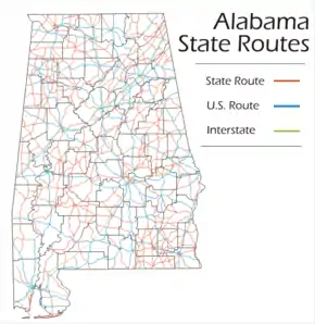 Map of Alabama State Route System | |
| Highway names | |
| Interstates | Interstate nn (I-nn) |
| US Highways | U.S. Route nn (US nn) |
| State | State Route nn (SR nn) |
| System links | |
| |
In no case does a state route number mirror a U.S. Highway number. As such, the following state routes do not exist: 11, 29, 31, 43, 45, 72, 78, 80, 82, 84, 90, 98, 231, 278, 280, 331, 411, or 431.
State routes list
Lengths are from ADOT Milepost Maps unless otherwise noted
| Number | Length (mi)[1] | Length (km) | Southern or western terminus | Northern or eastern terminus | Formed | Removed | Notes | |
|---|---|---|---|---|---|---|---|---|
| 352.958 | 568.031 | US 231 at the Florida state line | US 231/US 431 at the Tennessee state line | 1928[2] | current | Unsigned, concurrent with US 231 and US 431; the road was rerouted in 1930 via what is now SR 21 and US 280/SR 38 from Oxford to Opelika to match US 241, but the road was moved back to its current route in the 1957 renumbering to match US 431 | ||
| 167.211 | 269.100 | US 72 at the Mississippi state line | US 72 at the Tennessee state line | 1928[3] | current | Unsigned, concurrent with US 72; swapped with SR 20 west of Florence in the 1957 renumbering | ||
| 374.377 | 602.501 | US 90/US 98 at Spanish Fort | I-65 at Athens | 1928[3] | current | Unsigned, concurrent with US 31 south of Athens; prior to the 1957 renumbering, the road continued south from Stapleton via current SR 59 | ||
| 192.192 | 309.303 | US 78/I-22 at the Mississippi state line | US 78 at the Georgia state line | 1928[3] | current | Mostly unsigned, concurrent with US 78 | ||
| 197.775 | 318.288 | US 43 at Thomasville | US 278/SR 13 at Natural Bridge | 1928[3] | current | swapped with SR 195 north of Jasper and sections north of Phil Campbell and south of Thomasville replaced by an extended SR 13 in the 1957 renumbering; overlap with SR-13 north of Natural Bridge later eliminated | ||
| 239.895 | 386.074 | US 82 at the Mississippi state line | US 82 at the Georgia state line | 1928[3] | current | Unsigned, concurrent with US 82 | ||
| 250.671 | 403.416 | US 11/US 80 at the Mississippi state line | US 11 at the Georgia state line | 1928[3] | current | Unsigned, concurrent with US 11 | ||
| 217.887 | 350.655 | I-20/I-59 exit 1 near Cuba | US 80 at the Georgia state line | 1928[3] | current | Unsigned, concurrent with US 80 east of I-20/I-59 | ||
| 273.069 | 439.462 | US 331 at the Florida state line | SR 20 at the Georgia state line | 1928[3] | current | Partly unsigned, concurrent with US 80, US 82 within Montgomery, US 231 from Montgomery to Wetumpka and US 331 from Montgomery southward; before the 1957 renumbering, the road went southwest from Brantley via what is now US 29/SR 15 and ended at Andalusia | ||
| 230.721 | 371.309 | MS 19 at the Mississippi state line | SR 37 at the Georgia state line | 1928[3] | current | |||
| — | — | Wetumpka | Piedmont | 1928[3] | 1957 | Section from Lowndesboro to the Florida state line replaced by SR 209 and parts of SR 28 and SR 43 (this section became SR 41 in the 1957 renumbering) in 1955/1956; rest renumbered as part of SR 21 because of US 11 | ||
| 231.682 | 372.856 | US 84 at the Mississippi state line | US 84 at the Georgia state line | 1928[3] | current | Unsigned, concurrent with US 84; prior to the 1957 renumbering, the road went via current SR 52 from Dothan to Opp and went southwest from Andalusia via what is now US 29/SR 15, US 31/SR 3, and US 90/SR 16 | ||
| 335.995 | 540.732 | US 90 at Mobile | US 43 at the Tennessee state line | 1928[3] | current | Mostly unsigned, concurrent with US 43 south of Fayette and north of Russellville; prior to the 1957 renumbering, the road followed what is now SR-69 between Tuscaloosa and Linden, and ran from Phil Campbell to Thomasville; rerouted on current alignment rather than US 43 alignment between Phil Campbell and Bankston around the same time | ||
| 218.289 | 351.302 | MS 69 at the Mississippi state line | SR 147 at Auburn | 1928[3] | current | Prior to the 1957 renumbering, the west end was at Selma | ||
| 226.550 | 364.597 | US 31 at Brewton | US 29 at the Georgia state line | 1928[3] | current | Unsigned, concurrent with US 29 from Brewton northward; prior to the 1957 renumbering, followed was is now SR 87, US 84/SR 12, and US 331/SR 9 south of Troy | ||
| 77.031 | 123.969 | US 90 at the Mississippi state line | US 90 at the Florida state line | 1928[3] | current | Unsigned, concurrent with US 90; prior to the 1957 renumbering, the west end was at Mobile | ||
| 346.562 | 557.737 | US 98 at Mobile | SR 13 at the Tennessee state line | 1928[3] | current | Partly unsigned, concurrent with US 45 south of Deer Park; prior to the 1957 renumbering, followed what is now SR 157 north of Florence | ||
| 61.591 | 99.121 | MS 12 at the Mississippi state line | SR 69 south of Oakman | 1928[3] | current | |||
| — | — | Hamilton | Millport | 1928[3] | 1952 | Replaced by relocated SR 17 | ||
| 35.834 | 57.669 | SR 17 north of Detroit | SR 24 at Red Bay | 1954 | current | Prior to the 1957 renumbering, the north end was at Vina | ||
| 73.978 | 119.056 | SR 69 at the Tennessee state line | I-65 | 1928[3] | current | Swapped with SR 2 west of Florence in the 1957 renumbering | ||
| — | — | Leeds | Vincent | 1928[3] | 1957 | Replaced by relocated SR 25; continued southeast to Opelika until 1931 | ||
| 279.296 | 449.483 | SR 97 at the Florida state line | US 278 at Piedmont | 1957 | current | |||
| 168.543 | 271.244 | SR 5 at Safford | SR 34 at the Georgia state line | 1928[3] | current | Prior to the 1957 renumbering, the east end was at Alexander City | ||
| 12.611 | 20.295 | US 11 east of Springville | US 231 at Ashville | 1928[3] | current | Prior to the 1957 renumbering, continued northeast to Centre | ||
| 69.606 | 112.020 | MS 23 at the Mississippi state line | US 31 at Decatur | 1928[3] | current | |||
| 257.352 | 414.168 | SR 5 west of Pine Hill | US 411 at the Georgia state line | 1928[3] | current | Partly unsigned, concurrent with US 411 north of Leeds; prior to the 1957 renumbering, the south end was at Centreville and the road continued north from Vincent to Cleveland via what is now US 231/SR 53 | ||
| 14.560 | 23.432 | SR 51 at Hurtsboro | US 431 at Seale | 1928[3] | current | Until 1985, continued west to US 82 at Union Springs | ||
| 77.122 | 124.116 | Holmes CR 185 at the Florida state line | SR 10 at Abbeville | 1928[3] | current | |||
| 97.287 | 156.568 | SR 17 north of Boyd | SR 21 north of Oak Hill | 1928[3] | current | Prior to the 1957 renumbering, the south end was at Linden | ||
| — | — | York | Deer Park | 1928[3] | 1952 | Replaced by an extended SR 17; number not reused because of US 29 | ||
| 19.012 | 30.597 | SR 51 at Clayton | US 431 at Eufaula | 1928[3] | current | Prior to the 1957 renumbering, continued southwest to Clintonville | ||
| — | — | Double Springs | Guntersville | 1928[3] | 1946 | Possibly extended west to Hamilton in 1943-1945; renumbered SR 112 because the road intersected US 31 | ||
| — | — | Tarrant City | Scottsboro | 1928[3] | 1957 | Replaced by new SR 79 north of Guntersville and new SR 75 south of Albertville because the route was north-south | ||
| 3.594 | 5.784 | MS 14 at the Mississippi state line | SR 17 south of Cochrane | 1957 | current | |||
| — | — | Wren | Laceys Spring | 1928[3] | 1957 | Renumbered SR 36 because the route was east-west | ||
| 50.609 | 81.447 | US 278/SR 195 at Double Springs | US 72 Alt at Courtland | 1957 | current | |||
| — | — | Tennessee state line | Florence | 1928[3] | 1957 | Replaced by relocated SR 17 | ||
| 12.965 | 20.865 | US 231 at Pell City | SR 77 north of Talladega | 1957 | current | |||
| 68.291 | 109.904 | SR 9 near Centre | US 72 at Woodville | 1928[3] | current | |||
| — | — | Double Springs | Courtland | 1928[3] | 1957 | Renumbered SR 33 because the route was north-south | ||
| 44.473 | 71.572 | SR 33 at Wren | US 231 at Laceys Spring | 1957 | current | |||
| — | — | Centre | Georgia state line | 1928[3] | 1931 | Renumbered SR 62; route number reused on pre-1928 route | ||
| — | — | Hurtsboro | Opelika | 1931 | 1985 | Replaced by an extended SR 51; prior to the 1957 renumbering, continued north to Oxford | ||
| — | — | Perdue Hill | Little River | 1989 | 1995 | |||
| 0.768 | 1.236 | US 84 west of Daleville | Fort Rucker | 1998 | current | |||
| — | — | Birmingham | Tennessee state line | 1928[3] | 1957 | Replaced by new SR 79 south of Cleveland and extended SR 53 north of Cleveland because the route was north-south | ||
| 138.025 | 222.130 | US 31 at Homewood | US 280 at the Georgia state line | 1957 | current | Unsigned, concurrent with US 280 from Homewood eastward | ||
| 23.057 | 37.107 | US 11 south of Epes | SR 14 at Clinton | 1928[3] | current | |||
| — | — | Mississippi state line | Linden | 1928[3] | 1957 | Replaced by an extended SR 14 north of Eutaw and relocated SR 13 south of Eutaw | ||
| 21.184 | 34.092 | SR 35 east of Scottsboro | US 11 at Hammondville | 1958 | current | |||
| — | — | Eutaw | Marion | 1928[3] | 1957 | Replaced by an extended SR 14 | ||
| 127.484 | 205.166 | SR 87 at the Florida state line | SR 14 at Selma | 1957 | current | |||
| 80.248 | 129.147 | US 98 at the Mississippi state line | US 98 at the Florida state line | 1928[3] | current | Unsigned, concurrent with US 98; prior to the 1957 renumbering, the east end was at Mobile | ||
| — | — | Sprott | Monroeville | 1928[3] | 1957 | Section west of Selma replaced by an extended SR 14 and rest was renumbered as part of SR 41 because of US 43 | ||
| — | — | Coffeeville | Evergreen | 1928[3] | 1957 | Replaced by relocated SR 12 | ||
| 10.015 | 16.118 | US 43 at Guin | SR 129 at Brilliant | 1959 | current | |||
| — | — | Montgomery | Mountain Creek | 1928[3] | 1957 | Renumbered SR 143 in the 1957 renumbering because of US 45 | ||
| 21.074 | 33.915 | US 78 at Heflin | SR 166 at the Georgia state line | 1928[3] | current | |||
| 43.063 | 69.303 | US 84 at Mexia | SR 10 at Awin | 1928[3] | current | |||
| 34.321 | 55.234 | SR 9 at Lineville | SR 5 at the Georgia state line | 1928[3] | current | Prior to the 1957 renumbering, the road continued northwest to Pell City via what is now SR 77 and SR 34 | ||
| 82.684 | 133.067 | I-85 exit 32 south of Franklin | SR 281 in Talladega National Forest | 1928[3] | current | |||
| 54.261 | 87.325 | SR 229 near Martin Dam | US 29 at Lanett | 1928[3] | current | |||
| 114.183 | 183.760 | US 84 north of Enterprise | I-85 exit 60 at Opelika | 1928[3] | current | Prior to 1985, the north end was at Midway; prior to the 1957 renumbering, the south end was at Clayton | ||
| 82.805 | 133.262 | US 331 at Opp | SR 62 at the Georgia state line | 1928[3] | current | Prior to the 1957 renumbering, the road went west from Dothan via what is now US 84/SR 12 and SR 189 to Brantley | ||
| 345.287 | 555.686 | SR 71 at the Florida state line | I-65 west of Ardmore | 1928[3] | current | Mostly unsigned, concurrent with US 231 from Dothan to Huntsville; prior to the 1957 renumbering, the north end was at Montgomery and the road followed what is now US 29/SR 15 and SR 93 from Brundidge to Banks | ||
| 15.995 | 25.741 | US 331 at Florala | SR 52 west of Samson | 1928[3] | current | |||
| 49.431 | 79.551 | SR 85 at the Florida state line | US 31 at McKenzie | 1928[3] | current | |||
| 27.696 | 44.572 | MS 42 at the Mississippi state line | US 43 at Wagerville | 1928[3] | current | Swapped with SR 29 (now SR 17) south of Chatom in 1946; extended west from Chatom in 1949/1950 | ||
| 16.127 | 25.954 | US 45 at the Mississippi state line | SR 17 near Deer Park | 1928[3] | current | Unsigned, concurrent with US 45 north of Deer Park | ||
| — | — | Georgia state line | Tennessee state line | 1928[3] | 1957 | Renumbered SR 117 because the route was north-south | ||
| 1.648 | 2.652 | Former US 82/SR 25/SR 219 at Centreville | Former US 82 at Centreville | 1959 | 2015 | Formerly part of US 82/SR 6; mileage transferred to new SR 382 on old US 82 alignment | ||
| 93.670 | 150.747 | SR 182 at Gulf Shores | SR 21 at Uriah | 1928[3] | current | Prior to the 1957 renumbering, the south end was at Bay Minette | ||
| 11.310 | 18.202 | SR 14 at Wedgeworth | SR 69 south of Moundville | 1928[3] | current | |||
| 18.311 | 29.469 | US 80 at Uniontown | SR 14 at Greensboro | 1928[3] | current | |||
| — | — | Wilsonville | Winterboro | 1928[3] | 1934 | Renumbered SR 76 to avoid conflict with the other SR 62 | ||
| — | — | Centre | Georgia state line | 1931 | 1957 | Replaced by relocated SR 25 | ||
| — | — | Ohatchee | Alexandria | 1964 | 1993 | Replaced by an extended SR 144 | ||
| 2.443 | 3.932 | Former Monsanto plant entrance | SR 227 north of Guntersville | 1995 | current | |||
| — | — | Columbiana | Sylacauga | 1928[3] | 1929 | Included a ferry that has now been discontinued; now Shelby CR 30 and Talladega CR 31 and CR 2 | ||
| 45.851 | 73.790 | SR 14 at Claud | SR 9 at Cleveland Crossroads | 1930 | current | Prior to the 1957 renumbering, the road went northeast from Alexander City via what is now SR 22 | ||
| 18.230 | 29.338 | US 43 north of Killen | SR 207 north of Anderson | 1934 | current | |||
| 27.540 | 44.321 | US 72 north of Paint Rock | SR 97 at the Tennessee state line | 1934 | current | |||
| — | — | Florida state line | Ozark | 1934 | 1957 | Renumbered SR 123 because the route was north-south | ||
| 9.291 | 14.952 | SR 28 at Consul | SR 5 south of Safford | 1961 | current | |||
| 47.107 | 75.811 | US 231 south of Summit | US 72 Alt/SR 20 at Decatur | 1934 | current | |||
| 52.926 | 85.176 | SR 75 near Albertville | SR 114 at the Georgia state line | 1934 | current | Prior to the 1957 renumbering, the east end was at Leesburg | ||
| 280.599 | 451.580 | SR 177 at Jackson | US 431 at Guntersville | 1934 | current | Prior to the 1957 renumbering, the north end was at Cullman and the south end was at Tuscaloosa | ||
| — | — | Mississippi state line | Carrollton | 1934 | 1954 | Redesignated as Pickens CR 70; section east of SR 14 restored as SR 86 in 1961; remainder restored as an extension of SR 86 in 1981/1982 | ||
| 8.290 | 13.341 | US 31 north of Calera | SR 25 at Columbiana | 1961 | current | |||
| — | — | MS 14 at the Mississippi state line | SR 17 south of Cochrane | 1934 | 1957 | Renumbered SR 32 because the route was east-west | ||
| 32.024 | 51.538 | SR 35 at Section | SR 136 at the Georgia state line | 1957 | current | |||
| — | — | Piedmont | Forney | 1934 | 1947 | Now Old Ladiga Road, Howell Road, and Cherokee CR 29 | ||
| 11.219 | 18.055 | SR 71 at Higdon | SR 377 at the Tennessee state line | 1956 | current | |||
| 170.856 | 274.966 | I-22/US 78 exit 7 | US 278 at the Georgia state line | 1934 | current | Mostly unsigned, concurrent with US 278 east of Hamilton | ||
| — | — | Cedar Bluff | Georgia state line | 1934 | 1957 | Replaced by an extended SR 68 because the route was east-west | ||
| 113.220 | 182.210 | US 11 at Birmingham | SR 301 at the Georgia state line | 1957 | current | |||
| 16.641 | 26.781 | SR 25 near Wilsonville | Winterboro | 1934 | current | |||
| 112.334 | 180.784 | US 431 at LaFayette | US 431 north of Attalla | 1934 | current | Prior to the 1957 renumbering, the north end was at Ashland | ||
| — | — | Linden | Coffeeville | 1934 | 1957 | Replaced by an extended SR 69 | ||
| 117.605 | 189.267 | I-20/I-59 at Birmingham | SR 16 at the Tennessee state line | 1957 | current | |||
| 10.432 | 16.789 | US 80 at Tuskegee | SR 14 at Notasulga | 1934 | current | |||
| 24.274 | 39.065 | US 31/US 84 at Evergreen | SR 47 at Midway | 1934 | current | |||
| 22.316 | 35.914 | SR 27 at Geneva | Fort Rucker | 1934 | current | |||
| — | — | Curtis | south of Brantley | 1934 | 1957 | Renumbered SR 141 because the route was north-south | ||
| 27.396 | 44.090 | MS 388 at the Mississippi state line | US 82 at Gordo | 1961 | current | |||
| 61.552 | 99.058 | SR 81 at the Florida state line | US 231 at Troy | 1934 | current | Prior to the 1957 renumbering, the north end was at Elba | ||
| — | — | Florida state line | south of Andalusia | 1934 | 1957 | Renumbered SR 137 because the route was north-south | ||
| 3.310 | 5.327 | US 84 at Enterprise | US 84 at Enterprise | 1962 | current | |||
| — | — | Spanish Fort | Florida state line | 1934 | 1957 | Replaced by an extended SR 42 | ||
| 11.815 | 19.014 | SR 21 south of Ackerville | SR 41 at Elm Bluff | 1957 | current | |||
| — | — | Birmingham | Sylacauga | 1934 | 1957 | Renumbered SR 38 (which extended east over part of old SR 1) because the route was east-west | ||
| 38.161 | 61.414 | SR 69 at Wilburn | US 278 at Holly Pond | 1958 | current | |||
| — | — | Greensboro | Brent | 1934 | 1957 | Replaced by an extended SR 25 | ||
| 11.019 | 17.733 | SR 167 south of Enterprise | US 84 north of Wicksburg | 1962 | current | |||
| — | — | Florida state line | Repton | 1934 | 1957 | Replaced by new SR 41; continued west to Frisco City via what is now SR 136 and Monroe CR 23 until 1954/1955 | ||
| 8.398 | 13.515 | US 231 at Brundidge | US 29 at Banks | 1957 | current | |||
| 19.143 | 30.808 | US 331 at Ada | US 231 north of Orion | 1934 | current | |||
| 63.605 | 102.362 | Jackson CR-164 at the Florida state line | US 431 south of Eufaula | 1934 | current | |||
| — | — | Kimbrough | Millers Ferry | 1934 | 1947 | Replaced by relocated SR 10; this section was replaced by SR 162 in 1972 | ||
| 30.680 | 49.375 | MS 50 at the Mississippi state line | US 43 at Fayette | 1952 | current | |||
| 29.798 | 47.955 | US 331 near Lapine | US 80 at Lowndesboro | 1940 | current | |||
| — | — | Opp | Brantley | 1940 | 1957 | Replaced by relocated SR 9 because of US 98 | ||
| — | — | west of Pine Hill | Greensboro | 1940 | 1957 | Replaced by an extended SR 25 | ||
| 21.914 | 35.267 | US 31 at Athens | SR 207 near Anderson | 1958 | current | |||
| — | — | south of Ackerville | Elm Bluff | 1940 | 1957 | Renumbered SR 89 because the route was north-south; prior to 1956, the route continued south to Riley | ||
| 1.670 | 2.688 | US 29 at Andalusia | US 84 at Andalusia | 1962 | current | |||
| 39.107 | 62.937 | Lawrence CR 460 | SR 227 at the Tennessee state line | 1940 | current | |||
| — | — | Talladega | Lincoln | 1940 | 1957 | Replaced by an extended SR 77 because the route was north-south | ||
| 24.281 | 39.076 | US 43 north of Fayette | SR 124 at Townley | 1962 | current | |||
| 17.463 | 28.104 | SR 171 at the Florida state line | SR 123 at Wicksburg | 1940 | current | |||
| 10.769 | 17.331 | US 98 at Fairhope | SR 59 at Robertsdale | 1941 | current | |||
| 18.905 | 30.425 | SR 27 at Ozark | SR 10 north of Clopton | 1946 | current | |||
| 40.819 | 65.692 | Conecuh CR 106 west of Georgiana | US 29 west of Brantley | 1941 | current | |||
| — | — | SR 11 (now SR 21) at Anniston | US 241 (now Noble Street) at Anniston | 1946 | 1957 | Renumbered SR 108 because the route was east-west; now Pelham Road | ||
| 19.105 | 30.747 | SR 18 west of Fayette | US 278 at Guin | 1957 | current | |||
| — | — | Bessemer | Birmingham | 1946 | 1950 | Now Dartmouth Avenue, Avenue K, and Jefferson Avenue | ||
| — | — | SR 21 at Anniston | US 431 (now Noble Street) at Anniston | 1957 | 1962 | Now Pelham Road
}} | ||
| — | — | US 31/US 82 at Montgomery | US 231/US 80 at Montgomery | 1983 | 1991 | Now Birmingham Highway, Bell Street, Maxwell Boulevard, Clay/Herron Street, Bibb Street, and Madison Avenue | ||
| 1 | 2 | SR 110 | I-85 | 1999 | current | Future Interstate 85 | ||
| 9.907 | 15.944 | SR 77 at the Florida state line | US 231 south of Dothan | 1946 | current | |||
| — | — | Georgia state line | Albertville | 1946 | 1957 | Replaced by new SR 75 because the route was north-south | ||
| 32.257 | 51.913 | I-85 and US 80 near Montgomery | US 82 west of Union Springs | 1962 | current | |||
| 17.007 | 27.370 | US 231 at Wetumpka | SR 143 west of Coosa River | 1948 | current | |||
| — | — | Cullman | Guntersville | 1946 | 1957 | Replaced by an extended SR 69; continued west to Hamilton until 1949/1950 | ||
| 30.2 | 48.6 | US 31 at Bay Minette | Escambia CR 184 at the Florida state line | 1962 | 2004 | Decommissioned when SR 181 extended south of US 90; now Baldwin CR 112 | ||
| 15.457 | 24.876 | US 29 at the Florida state line | I-65 exit 69 south of Barnett Crossroads | 1948 | current | |||
| — | — | Garland | US 31 at McKenzie | 1948 | 1954 | Now Butler CR 8 | ||
| 14.251 | 22.935 | SR 10 at Lavaca | SR 69 east of Myrtlewood | 1963 | current | |||
| 3.250 | 5.230 | SR 9 | US 280 at Kellyton | 1948 | current | |||
| — | — | Tuscaloosa | US 11 at Bucksville | 1948 | 1954 | Redesignated as Tuscaloosa CR 116, now SR 216 | ||
| 9.482 | 15.260 | SR 17 between Emelle and Geiger | SR 39 at Gainesville | 1963 | current | |||
| — | — | SR 27 east of Coffee Springs | SR 27 north of Coffee Springs | 1948 | 1954 | Now Leslie Road, Coffee Springs-Geneva Road, Geneva CR 75, and Geneva CR 665 | ||
| 50.156 | 80.718 | SR 48 at the Georgia state line | SR 56 at the Tennessee state line | 1957 | current | |||
| 57.461 | 92.475 | US-278 at the Mississippi state line | SR 5 at Jasper | 1948 | current | Partially unsigned, concurrent with US 278 west of Guin | ||
| 39.625 | 63.770 | SR 25 at Montevallo | US 78 at Leeds | 1948 | current | |||
| 4.160 | 6.695 | SR 49 at Reeltown | SR 14 at Liberty City | 1948 | current | |||
| 0.9 | 1.4 | US 280 at Camp Hill | SR 50 at Camp Hill | 1948 | 2005 | Decommissioned when US 280 bypass opened | ||
| 3.777 | 6.078 | US 84 at New Brockton | SR 51 at Clintonville | 1948 | current | Swapped with SR 51 (which replaced that section of SR 30 at the same time) in the 1957 renumbering | ||
| — | — | SR 30 (now SR 51) southwest of Ariton | US 231 west of Ariton | 1948 | 1955 | Now Dale CR 52 | ||
| 45.750 | 73.627 | SR 167 south of Hartford | US 231 west of Ariton | 1957 | current | Continued south to the Florida state line prior to 1963-1964 | ||
| — | — | Evergreen | River Falls | 1948 | 1957 | Replaced by relocated SR 12 | ||
| 10.896 | 17.535 | US 78 north of Townley | SR 69 at Jasper | 1963 | current | |||
| — | — | SR 124 (now SR 12) southwest of Red Level | SR 55 in Red Level | 1948 | 1954 | Now Covington CR 7 | ||
| 25.646 | 41.273 | US 84 at Elba | US 231 south of Brundidge | 1958 | current | |||
| — | — | US 80 at Tuskegee | SR 81 at Tuskegee | 1948 | 1991 | Now Montgomery Road | ||
| 11.054 | 17.790 | I-85/US 80 east of Montgomery | SR 110 east of Montgomery | 1997 | current | |||
| 13.510 | 21.742 | SR 99 at Athens | SR 166 at the Tennessee state line | 1948 | current | |||
| — | — | Cullman | SR 81 at Holly Pond | 1948 | 1950 | Replaced by an extended SR 74 | ||
| — | — | Garden City | Blountsville | 1950 | 1955 | Now Blount CR 26 | ||
| 1.518 | 2.443 | SR 63 south of Alexander City | Lake Martin | 1963 | current | |||
| 41.191 | 66.290 | US 43 north of Fayette | SR 13 at Haleyville | 1948 | current | |||
| 15.507 | 24.956 | US 29 near Banks | SR 51 at Louisville | 1948 | current | |||
| 27.124 | 43.652 | SR 10 east of Clio | US 431 at Eufaula | 1948 | current | |||
| — | — | Boyds | Moscow | 1948 | 1957 | Replaced by an extended SR 28 | ||
| 17.438 | 28.064 | SR 75 at Oneonta | US 278 east of Walnut Grove | 1963 | current | |||
| 16.976 | 27.320 | US 72 Alt east of Tuscumbia | SR 20 west of Florence | 1948 | current | |||
| 76.795 | 123.590 | US 331 at Opp | SR 95 at Columbia | 1948 | current | Prior to the 1957 renumbering, the east end was at Newton | ||
| — | — | US 80 at Demopolis | US 43 at Demopolis | 1948 | 1952 | Now Maria Avenue and Jackson Street | ||
| 2.138 | 3.441 | SR 182 at Gulf Shores | SR 180 at Gulf Shores | 1957 | current | |||
| — | — | Midland City | CR 49 east of Headland | 1948 | 1957 | Replaced by an extended SR 134 | ||
| 6.151 | 9.899 | SR 21/SR 41 south of Monroeville | US 84 east of Excel | 1964 | current | |||
| — | — | SR 17 in Silas | SR 17 in Silas | 1948 | 1954 | Now First Street | ||
| 13.997 | 22.526 | SR 189 at the Florida state line | US 29 south of Andalusia | 1957 | current | |||
| — | — | SR 182 at Gulf Shores | SR 180 at Gulf Shores | 1948 | 1957 | Renumbered SR 135 because the route was north-south | ||
| — | — | SR 225 at Crossroads | US 31/SR 3/SR 59 at Bay Minette | 1964 | 1987 | Now Baldwin CR 138 | ||
| — | — | Mississippi border | SR 44 | 1989 | 1993 | Replaced by relocated US 78/SR 4 | ||
| 0.785 | 1.263 | I-85 at Shorter | US 80 at Shorter | 1997 | current | |||
| — | — | US 231 at Dothan | US 84 at Dothan | 1948 | 1958 | Now Westgate Parkway | ||
| 19.856 | 31.955 | SR 22 at Maplesville | SR 25 south of Wilton | 1963 | current | |||
| — | — | US 43 west of Fulton | Fulton | 1948 | 1954 | Redesignated as Clarke CR 17; now SR 178 | ||
| — | — | US 82 east of Gordo | US 82 at Coker | 1964 | 1977 | Now Pickens and Tuscaloosa CR 140 | ||
| 12.480 | 20.085 | SR 41 at Selma | SR 14 east of Burnsville | 1985 | current | |||
| — | — | SR 22 east of Verbena | Mitchell Dam | 1948 | 1954 | Now Chilton CR 93 | ||
| 14.430 | 23.223 | SR 189 at Basin | US 331 south of Brantley | 1957 | current | |||
| — | — | Akron | SR 60 east of Akron | 1948 | 1954 | Now Hale CR 36 | ||
| 1.802 | 2.900 | US 278 west of Guin | US 43/US 278 at Guin | 1964 | current | |||
| — | — | SR 14 east of Elmore | SR 45 (now SR 143) north of Elmore | 1948 | 1954 | Now Fitzpatrick Road | ||
| 28.598 | 46.024 | I-65 exit 176 north of Montgomery | US 31 at Mountain Creek | 1957 | current | |||
| — | — | Moundville Archaeological Site | SR 13 (now SR 69) north of Moundville | 1948 | 1954 | Now Mound Parkway | ||
| 26.663 | 42.910 | US 231 north of Pell City | US 431 near Alexandria | 1965 | current | |||
| 26.996 | 43.446 | US 31 at Clanton | Shelby CR 61 near Wilsonville | 1948 | current | |||
| — | — | US 78 at Irondale | US 11 at Birmingham | 1948 | 1949 | Now Oporto Madrid Boulevard | ||
| 6.334 | 10.194 | SR 65 at Swaim | SR 79 north of Skyline | 1965 | current | |||
| 13 | 21 | I-85 south of Auburn | US 431 south of Lafayette | 1948 | current | |||
| — | — | US 43 at Thomasville | Clarke CR 27 in Thomasville | 1948 | 1954 | Now Alabama Avenue | ||
| 20.025 | 32.227 | SR 21 at Sylacauga | SR 9 at Millersville | 1967 | current | |||
| 4.145 | 6.671 | US 280 at Mountain Brook | Green Springs Highway in Homewood | 1948 | current | |||
| 11.833 | 19.043 | US 11 at Bessemer | US 31 at Hoover | 1948 | current | |||
| — | — | SR 21 east of Hartford | SR 66 (now SR 123) northeast of Hartford | 1948 | 1955 | Now Geneva CR 69 | ||
| 0.404 | 0.650 | SR 79 | SR 75 at Pinson | 1957 | current | |||
| — | — | US 80 at Selma | US 80 southeast of Selma | 1948 | 1954 | Now Old Montgomery Highway | ||
| 6.605 | 10.630 | I-65 exit 173 at Montgomery | US 231/SR 21 at Montgomery | 1967 | current | |||
| — | — | US 31 east of Chapman | US 31 northeast of Chapman | 1948 | 1954 | Now Daffodil Road | ||
| 8.994 | 14.474 | SR 83 at the Florida state line | SR 52 west of Samson | 1959 | current | |||
| — | — | US 82 at Gordo | US 82 at Gordo | 1948 | 1954 | Now 4th Avenue and Main Street | ||
| 29.480 | 47.443 | SR 69 north of Coffeeville | US 43 at Thomasville | 1967 | current | |||
| 10.890 | 17.526 | US 31 north of Jemison | SR 119 at Montevallo | 1948 | current | |||
| — | — | SR 22 at Selma | SR 22 at Selma | 1948 | 1954 | Now Crescent Hill Drive, Cahaba Road, and J.L. Chestnut Jr Boulevard | ||
| 7.186 | 11.565 | SR 17 at Jachin | SR 114 at Pennington | 1967 | current | |||
| — | — | US 43 (this section now SR 295) in Grove Hill | US 43 in Pine Hill | 1948 | 1953 | Now CR 27 / Old Highway 5 | ||
| 91.061 | 146.548 | US 278 east of Cullman | SR 227 at the Tennessee state line | 1957 | current | |||
| — | — | US 241 (this section now SR 95) at Abbeville | CR 57 northeast of Abbeville | 1948 | 1949 | Now Henry CR 46 | ||
| — | — | US 231 at Willow Springs | SR 14 at Tallassee | 1952 | 1953 | Now Elmore CR 8 | ||
| 9.280 | 14.935 | US 45 at Kushla | US 43 at Saraland | 1972 | current | |||
| — | — | US 43 southwest of Willow Springs | US 43 at Leroy | 1948 | 1954 | Now TB Pearson Road and Washington CR 34 | ||
| 29.626 | 47.678 | US 82 at Gordo | SR 171 at Fayette | 1959 | current | |||
| — | — | SR 3 (now SR 59) at Gulf Shores | Orange Beach (Bear Point) | 1948 | 1957 | Replaced by an extended SR 180 | ||
| 18.415 | 29.636 | US 31 north of Warrior | US 231 at Cleveland | 1972 | current | |||
| 1.716 | 2.762 | SR 182 at Orange Beach | SR 180 at Orange Beach | 1948 | current | |||
| — | — | SR 17) west of Bellamy | Bellamy | 1948 | 1954 | Replaced by relocated US 80/SR 8 | ||
| 14.080 | 22.660 | SR 5 at Kimbrough | SR 28 north of Millers Ferry | 1972 | current | |||
| 11.104 | 17.870 | SR 193 west of Hollingers Island | US 90 at Mobile | 1948 | current | |||
| 2.548 | 4.101 | SR 10 west of Camden | SR 28 at Camden | 1948 | current | |||
| 32.384 | 52.117 | US 431 south of Phenix City | US 431 north of Eufaula | 1948 | current | |||
| — | — | Section | Georgia state line | 1948 | 1957 | Renumbered SR 71 because the route was north-south | ||
| 4.726 | 7.606 | SR 141 north of Curtis | US 84 at Elba | 1972 | current | |||
| — | — | SR 18 west of Fayette | US 278 at Guin | 1948 | 1957 | Renumbered SR 107 because of the route length | ||
| 52.445 | 84.402 | SR 79 at the Florida state line | SR 87 south of Spring Hill | 1959 | current | |||
| 17.392 | 27.990 | SR 75 at Douglas | SR 68 at Kilpatrick | 1948 | current | |||
| 26.325 | 42.366 | SR 51 at Opelika | US 431 north of Seale | 1948 | current | |||
| — | — | Bolling | US 31 east of Bolling | 1948 | 1954 | Now Butler CR 28 | ||
| 11.720 | 18.862 | US 231 at Wetumpka | SR 63 north of Eclectic | 1973 | current | |||
| 73.355 | 118.053 | US 43 north of Northport | US 43/US 278/SR 17 at Hamilton | 1948 | current | |||
| 24.420 | 39.300 | SR 19 east of Vina | SR 13 at Bear Creek | 1948 | current | Prior to the 1957 renumbering, the west end was at Red Bay | ||
| 14.462 | 23.274 | US 431 at Headland | SR 27 south of Abbeville | 1948 | current | |||
| 19.607 | 31.554 | US 11 at Springville | US 231 at Pell City | 1949 | current | |||
| — | — | US 78 west of Pell City | SR 174 northwest of Pell City | 1949 | 1954 | Now St. Clair CR 29 | ||
| 5.382 | 8.661 | SR 14/SR 183 west of Sprott | SR 5 south Heiberger | 1962 | current | |||
| — | — | SR 74 (now also US 278) northwest of Altoona | Altoona | 1951 | 1954 | Now Blount and Etowah CR 41 | ||
| 25.618 | 41.228 | SR 68 east of Collinsville | SR 35 north of Blanche | 1973 | current | |||
| — | — | Leeds | south of Ashville | 1949 | 1957 | Replaced by relocated SR 25 | ||
| 5.160 | 8.304 | US 43 at Jackson | US 43 at Jackson | 1957 | current | |||
| — | — | US 280 northwest of Alexander City | US 280 southeast of Alexander City | 1951 | 1955 | Now Washington Street, Central Avenue, and Cherokee Road | ||
| 1.956 | 3.148 | US 43 west of Fulton | Main Street at Fulton | 1975 | current | |||
| 10.434 | 16.792 | US 278 at Howelton | SR 168 west of Boaz | 1951 | current | |||
| 32.184 | 51.795 | Fort Morgan | Orange Beach (Bear Point) | 1951 | current | Prior to the 1957 renumbering, the east end was at Gulf Shores | ||
| 18.235 | 29.346 | US 98 south of Fairhope | US 31 east of Spanish Fort | 1951 | current | |||
| 17.046 | 27.433 | Pine Beach | SR 292 at the Florida state line | 1951 | current | |||
| 47.443 | 76.352 | US 80 at Uniontown | US 82 west of Maplesville | 1951 | current | |||
| 14.891 | 23.965 | South Montgomery Avenue in Sheffield | SR 101 north of Town Creek | 1951 | current | |||
| 23.129 | 37.223 | US 31 south of Greenville | US 31 at Logan | 1951 | current | |||
| 3.829 | 6.162 | I-85 exit 42 east of Tuskegee | US 29/US 80 east of Tuskegee | 1973 | current | |||
| 22.995 | 37.007 | US 43 north of Hamilton | SR 24 at Belgreen | 1951 | current | |||
| 19.686 | 31.682 | I-10 exit 4 north of Grand Bay | SR 193 at Alabama Port | 1952 | current | |||
| 32.857 | 52.878 | SR 52 at Kinston | US 331 south of Brantley | 1951 | current | Prior to the 1957 renumbering, the north end was at Elba | ||
| — | — | US 280/US 431 at Phenix City | Georgia state line | 1985 | 1987 | Was concurrent with US 431 Bypass; decommissioned when US 280 and US 431 were rerouted onto the bypass | ||
| 2 | 3 | US 280/US 431 at Phenix City | Future SR 22 at the Georgia state line at Columbus, Georgia | 1987 | c. 1988 | Decommissioned when US 80 moved onto its current route | ||
| 13.942 | 22.437 | SR 22 east of Maplesville | US 31 at Jemison | 1951 | current | |||
| 6.707 | 10.794 | US 84 at Enterprise | US 84 at Enterprise | 1987 | current | |||
| — | — | SR 16/SR 13/US 43 at Chickasaw | SR 17/US 45 at Prichard | 1951 | 1981 | Now Wilson Avenue | ||
| 26.349 | 42.405 | Dauphin Island | US 90 south of Mobile | 1985 | current | |||
| — | — | SR 193 at Prichard | SR 16/SR 13/US 43 at Prichard | 1953 | 1981 | Now Elm Street | ||
| 1.9 | 3.1 | SR 51 at Clayton | SR 51/SR 239 at Clayton | 1987 | 1995 | Former SR 51 Business; replaced by SR 239 | ||
| 42.179 | 67.881 | SR 5 north of Jasper | SR 13 at Haleyville | 1951 | current | swapped with SR 5 in the 1957 renumbering (the northern section of the old route is now SR 13) | ||
| 1.690 | 2.720 | SR 52 at Geneva | SR 27 at Geneva | 1955 | current | |||
| — | — | SR 53 (now SR 93) south of Banks | US 29 east of Banks | 1952 | 1953 | Restored in 1962 as SR 201 | ||
| 1.023 | 1.646 | US 29 at Union Springs | US 82 at Union Springs | 1962 | current | |||
| 1.686 | 2.713 | SR 30 at Clayton | Midway Street at Clayton | 1987 | current | Former SR 30 Business | ||
| — | — | Alexander City | Cleveland Crossroads | 1952 | 1957 | Replaced by relocated SR 63 | ||
| 10.218 | 16.444 | SR 81 at Tuskegee | SR 14 east Golddust | 1962 | current | |||
| 1.011 | 1.627 | SR 21 at Piedmont | US 278 at Piedmont | 1962 | 2019 | |||
| 1.553 | 2.499 | SR 93 south of Banks | US 29 east of Banks | 1962 | current | |||
| 9.100 | 14.645 | I-20 near Oxford | SR 21 at Anniston | 1953 | current | |||
| — | — | Bankhead National Forest | CR 87 east of Moulton | 1952 | 1955 | Now Lawrence CR 203 | ||
| — | — | US 231/SR 1 at Dothan | US 231/SR 1 near the Florida state line | 1962 | 1973 | now Houston CR 203; one part restored as SR 605 in 2015 | ||
| 3.080 | 4.957 | SR 189 at Elba | SR 125 at Elba | 1985 | current | |||
| 9.620 | 15.482 | US 431 west of Laney | SR 21 at Jacksonville | 1958 | current | |||
| 15.185 | 24.438 | US 431 south of Guntersville | US 431 south of Boaz | 1953 | current | |||
| 2.111 | 3.397 | US 82 west of Prattville | SR 14 at Prattville | 1957 | 2013 | |||
| — | — | SR 166 (now SR 71) at Higdon | Bryant | 1955 | 1956 | Renumbered SR 73 | ||
| 13.959 | 22.465 | US 72 at Rogersville | SR 11 at the Tennessee state line | 1956 | current | |||
| — | — | US 31/US 82 at Montgomery | US 82US 231 at Montgomery | 1955 | 1957 | Replaced by relocated US 82 | ||
| 0.839 | 1.350 | SR 165 at Cottonton | SR 39 Spur at the Georgia state line | 1989 | current | |||
| — | — | Florida state line | Lowndesboro | 1955 | 1957 | Replaced by new SR 21 | ||
| 0.325 | 0.523 | Former SR 58 at Centreville | SR 25 at Centreville | 1962 | 2015 | Mileage transferred to new SR 382 on old US 82 alignment | ||
| 13.766 | 22.154 | US 231 at Dothan | US 231 (Ross Clark Circle) at Dothan | 1955 | current | |||
| — | — | US 431 Bus. at Dothan | US 431 north of Dothan | 1955 | 1977 | Now Headland Avenue | ||
| 4.607 | 7.414 | US 278/US 431 at Gadsden | US 11 northeast of Attalla | 1983 | current | Former southernmost disconnected portion of SR 227 | ||
| 1.145 | 1.843 | SR 14 at Wetumpka | SR 111 at Wetumpka | 1987 | current | |||
| 5.753 | 9.259 | US 45 at Eight Mile | US 43 at Saraland | 1963 | current | |||
| — | — | SR 13 south of Tuscaloosa | US 11 at Cottondale | 1955 | 1955 | Replaced by rerouted SR 13 | ||
| 12.100 | 19.473 | US 82 south of Tuscaloosa | US 11 at Cottondale | 1963 | current | |||
| 21.158 | 34.051 | SR 215 at Tuscaloosa | I-20/I-59 near Bucksville | 1979 | current | |||
| 26.119 | 42.034 | US 45 at Eight Mile | Mobile CR 21 west of Citronelle | 1963 | current | |||
| 47.590 | 76.589 | SR 22 west of Selma | SR 5 north of Centreville | 1963 | current | |||
| 6.381 | 10.269 | SR 28 at Canton Bend | SR 41 south of Camden | 1963 | current | |||
| 26.452 | 42.570 | US 29 north of Banks | US 82 at Union Springs | 1963 | current | |||
| 23.910 | 38.479 | US 31 at Spanish Fort | SR 59 at Stockton | 1963 | current | |||
| — | — | US 431 at Gadsden | US 431 (Now 9th Street and Forrest Avenue) at Gadsden, Alabama | 1963 | 1964 | Now Broad Street and Forrest Avenue | ||
| 39.256 | 63.176 | DeKalb/Etowah County Line south of Crossville | US 431 at Guntersville | 1967 | current | |||
| 22.781 | 36.662 | I-85 south of Millstead | SR 63 south of Martin Lake | 1963 | current | |||
| 14.561 | 23.434 | SR 129 at Glen Allen | US 278 west of Natural Bridge | 1963 | current | |||
| 9.093 | 14.634 | US 231/US 280 at Childersburg | Talladega CR 190 at Grasmere | 1964 | current | |||
| 4.597 | 7.398 | SR 172 east of Hackleburg | SR 13 at Phil Campbell | 1965 | current | |||
| 24.311 | 39.125 | SR 30 at Clayton | US 29 south of Union Springs | 1965 | current | |||
| 14.559 | 23.430 | SR 237 south of Phil Campbell | US 278 at Whitehouse | 1967 | current | |||
| 19.353 | 31.146 | SR 195 west of Rabbittown | SR 24 at Russellville | 1967 | current | |||
| 2.586 | 4.162 | SR 10 at Greenville | SR 185 at Greenville | 1967 | current | |||
| 24.849 | 39.991 | SR 24 east of Halltown | US 72 east of Pride | 1967 | current | |||
| 6.066 | 9.762 | SR 27 at Enterprise | Fort Rucker | 1967 | current | |||
| 5.801 | 9.336 | Fort Rucker | SR 27 at Ozark | 1967 | current | |||
| 16.681 | 26.845 | US 31 at Athens | SR 53 at Ardmore | 1969 | current | |||
| 31.607 | 50.867 | US 43 at Winfield | US 43 at Hackleburg | 1969 | current | |||
| 10.052 | 16.177 | Redstone Arsenal entrance | Bob Wade Lane in Huntsville | 1969 | current | |||
| 9.193 | 14.795 | SR 195 north of Jasper | Winston CR 41 near Duncan Bridge | 1972 | current | |||
| 12.848 | 20.677 | SR 9 at Equality | SR 22 south of Alexander City | 1972 | current | |||
| 5.897 | 9.490 | Shelby CR 17/Shelby CR 52/Shelby CR 91 at Helena | US 31 at Pelham | 1972 | current | |||
| 15.132 | 24.353 | SR 185 north of Greenville | SR 21 at Braggs | 1972 | current | |||
| 20.048 | 32.264 | SR 21/SR 47 at Beatrice | SR 41 at Camden | 1972 | current | |||
| 5.055 | 8.135 | US 29 south of Auburn | SR 147 north of Auburn | 1972 | 2015 | Reassigned to SR 147 | ||
| 41.524 | 66.826 | I-20/I-59 at Birmingham | SR 69 at Jasper | 1972 | current | |||
| — | — | SR 21 at Montgomery | Former SR 108 at Montgomery | 1972 | 1989 | Now Air Base Boulevard | ||
| 5.437 | 8.750 | US 82/US 231 at Barachias | I-85 east of Montgomery | 1991 | current | |||
| 15.836 | 25.486 | SR 79 north of Leesburg | SR 35 at Blanche | 1973 | current | |||
| — | — | SR 273 northeast of Leesburg | SR 35 north of Blanche | 1973 | 1979 | now Cherokee CR 275, DeKalb CR 148, and SR 176 | ||
| 8.250 | 13.277 | SR 21 south of Talladega | SR 21 northeast of Talladega | 1985 | current | |||
| — | — | US 331 south of Ada | US 331 south of Montgomery | 1977 | 1977 | Now Montgomery CR 23 | ||
| — | — | US 331 south of Montgomery | US 80/SR 9 in Montgomery | 1979 | 1989 | Now Norman Bridge Road | ||
| 9.350 | 15.047 | US 72 south of Bridgeport | US 72 north of Bridgeport | 2003 | current | |||
| 9.258 | 14.899 | SR 79 south of Scottsboro | US 72 north of Scottsboro | 1979 | current | |||
| 26.834 | 43.185 | Talladega National Forest | US 78 west of Heflin | 1981 | current | |||
| 3.077 | 4.952 | Business US 411 at Centre | SR 9/SR 68 north of Centre | 1985 | current | |||
| 1.293 | 2.081 | US 431 at Lakepoint Resort State Park | SR 165 north of Wylaunee | 1993 | current | |||
| 6.370 | 10.252 | US 31 at Bay Minette | I-65 exit 37 north of Bay Minette | 1987 | current | |||
| 1.202 | 1.934 | SR 5 and SR 183 at Marion | SR 14 at Marion | 1991 | current | |||
| 0.890 | 1.432 | SR 759 at Gadsden | US 278/US 431 at Gadsden | 1991 | current | |||
| 2.500 | 4.023 | SR 110 east of Montgomery | SR 126 in eastern Montgomery County | 2004 | current | |||
| 3.185 | 5.126 | US 43 at Grove Hill | US 43 in Grove Hill | 2003 | current | |||
| — | — | Rice Mine Road | Road | 2003 | current | Tuscaloosa Eastern Bypass | ||
| 3 | 5 | US 84 near Babbie | SR 9 near Opp | 2003 | 2010[1] | Reassigned to SR 9 and SR 12[1] | ||
| 0.780 | 1.255 | US 11/US 43 at Fosters | I-20/I-59 at Fosters | 2016 | current | Unsigned route[4] | ||
| 0.428 | 0.689 | I-20/US 431 at De Armanville | US 78 at De Armanville | 2016 | current | Appears on 2017-2018 state map[5] | ||
| 2.352 | 3.785 | US 84 near New Brockton | SR 122 at New Brockton | 2016 | current | Appears on 2017-2018 state map.[6] | ||
| 2.320 | 3.734 | US 78/SR 5 at Birmingham | US 31 at Birmingham | 2016 | current | Former US 78[7] | ||
| 4.786 | 7.702 | SR 219 south of Centreville[8] | US 82/SR 6 east of Centreville | 2015 | current | Unsigned route along the former routing of U.S. 82 | ||
| 1.885 | 3.034 | Auburn city limits | US 280 northeast of Auburn | 2006 | 2012 | |||
| 23.420 | 37.691 | US 231/SR 1 near Florida state line[9] | US 231/SR 53 near Midland City[9] | 2012 | current | |||
| 0.866 | 1.394 | I-759 and US 411 at Gadsden | SR 291 at Gadsden | 1987 | current | |||
| 50.08[10] | 80.60 | — | — | proposed | — | Birmingham Northern Beltline; also known as Interstate 422 | ||
| ||||||||
See also
 United States portal
 U.S. roads portal
References
- "Milepost/General Highway Maps". Alabama Department of Transportation. Retrieved November 20, 2018.
- General Drafting Company (1928). State Road Map of Alabama (SID) (Map). 1:1,000,000. New York City: Alabama State Highway Department. Retrieved November 15, 2018.
- Alabama State Highway Department (1929). State Road Map of Alabama (SID) (Map). 1:1,000,000. Montgomery, Alabama. Retrieved November 15, 2018.
- https://aldotgis.dot.state.al.us/MilepostPDF/web/co63mp.pdf
- https://aldotgis.dot.state.al.us/MilepostPDF/web/co8mp.pdf
- https://aldotgis.dot.state.al.us/MilepostPDF/web/co16mp.pdf
- https://aldotgis.dot.state.al.us/MilepostPDF/web/co37mp.pdf
- "Archived copy" (PDF). Archived from the original (PDF) on 2016-03-04. Retrieved 2015-10-12.CS1 maint: archived copy as title (link)
- https://aldotgis.dot.state.al.us/MilepostPDF/web/co35mp.pdf
- Birmingham Northern Beltline (PDF), Alabama Department of Transportation, Third Division, archived from the original (PDF) on 2008-06-25, retrieved 2008-10-26
External links
- Alabama Department of Transportation, 95th Annual Report (PDF) (includes a route log on pages 91–102)
- Alabama State Highway Ending Photos
This article is issued from Wikipedia. The text is licensed under Creative Commons - Attribution - Sharealike. Additional terms may apply for the media files.