National Register of Historic Places listings in Des Moines County, Iowa
This is a list of the National Register of Historic Places listings in Des Moines County, Iowa.
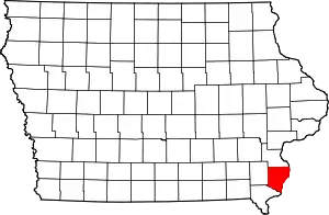
Location of Des Moines County in Iowa
This is intended to be a complete list of the properties and districts on the National Register of Historic Places in Des Moines County, Iowa, United States. Latitude and longitude coordinates are provided for many National Register properties and districts; these locations may be seen together in a Google map.[1]
There are 33 properties and districts listed on the National Register in the county. Another 4 properties were once listed but have been removed.
- This National Park Service list is complete through NPS recent listings posted January 29, 2021.[2]
Current listings
| [3] | Name on the Register[4] | Image | Date listed[5] | Location | City or town | Description |
|---|---|---|---|---|---|---|
| 1 | Baptist Church | 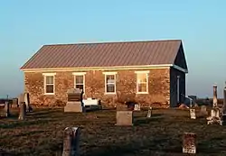 Baptist Church |
April 18, 1977 (#77000509) |
West of Sperry off U.S. Route 61 40°57′30″N 91°11′56″W |
Sperry | |
| 2 | Bridgeport Bridge | .jpg.webp) Bridgeport Bridge |
May 15, 1998 (#98000533) |
Old Quarry Rd. 40°47′26″N 91°21′51″W |
Denmark | A Pennsylvania through truss bridge built by the Clinton Bridge and Iron Works and completed in 1904. Extends into Lee County. |
| 3 | Burlington and Missouri River Railroad Passenger Station | 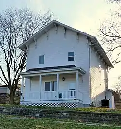 Burlington and Missouri River Railroad Passenger Station |
October 22, 1976 (#76000761) |
237 S. 4th St. 40°48′22″N 91°06′19″W |
Burlington | |
| 4 | Burlington Public Library | 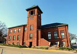 Burlington Public Library |
March 27, 1975 (#75000682) |
501 N. 4th St. 40°48′44″N 91°06′13″W |
Burlington | |
| 5 | Burlington, Cedar Rapids & Northern Freight House | 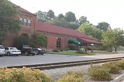 Burlington, Cedar Rapids & Northern Freight House |
January 27, 1983 (#83000351) |
Front and High Sts. 40°48′50″N 91°05′56″W |
Burlington | |
| 6 | The Capitol Theater | 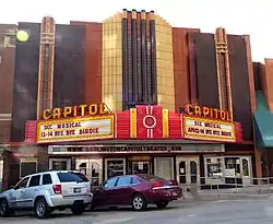 The Capitol Theater |
November 22, 1996 (#96001373) |
211 N. 3rd St. 40°48′34″N 91°06′11″W |
Burlington | |
| 7 | Cascade Bridge | 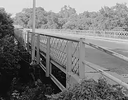 Cascade Bridge |
June 25, 1998 (#98000793) |
S. Main St. over the Cascade Ravine 40°46′52″N 91°05′54″W |
Burlington | |
| 8 | Chicago, Burlington, and Quincy Station |  Chicago, Burlington, and Quincy Station |
February 4, 2002 (#01001540) |
300 S Main St. 40°48′21″N 91°06′06″W |
Burlington | |
| 9 | Church of St. John the Baptist | 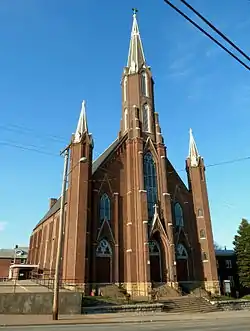 Church of St. John the Baptist |
February 26, 1982 (#82002615) |
712 Division St. 40°48′28″N 91°06′31″W |
Burlington | |
| 10 | Crapo Park and Arboretum Historic District | 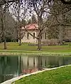 Crapo Park and Arboretum Historic District |
June 3, 1976 (#76000762) |
Bounded by Parkway Dr., Koestner, Madison Rd., and the Mississippi River 40°46′33″N 91°06′07″W |
Burlington | |
| 11 | Mary Darwin House | 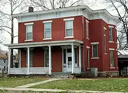 Mary Darwin House |
January 24, 1980 (#80001445) |
537 Summer St. 40°48′06″N 91°06′51″W |
Burlington | |
| 12 | Des Moines County Court House | 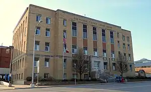 Des Moines County Court House |
August 28, 2003 (#03000817) |
513 N. Main St. 40°48′43″N 91°06′04″W |
Burlington | |
| 13 | Augustus Caesar Dodge House | 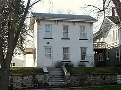 Augustus Caesar Dodge House |
January 25, 1980 (#80001446) |
829 N. 5th St. 40°48′57″N 91°06′12″W |
Burlington | |
| 14 | Downtown Commercial Historic District | 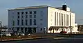 Downtown Commercial Historic District |
January 21, 2015 (#14001168) |
100-800 blocks of Jefferson Street, plus parts of adjacent blocks east of 4th Street from Columbia to Market 40°48′36″N 91°06′10″W |
Burlington | |
| 15 | First Congregational Church | 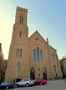 First Congregational Church |
November 21, 1976 (#76000763) |
313 N. 4th St. 40°48′38″N 91°06′14″W |
Burlington | |
| 16 | James M. Forney House | 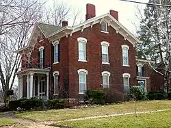 James M. Forney House |
September 22, 1986 (#86002689) |
401 Cedar St. 40°48′02″N 91°06′13″W |
Burlington | |
| 17 | German Methodist Episcopal Church | 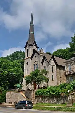 German Methodist Episcopal Church |
September 22, 1977 (#77000508) |
7th and Washington Sts. 40°48′43″N 91°06′24″W |
Burlington | |
| 18 | Hawkeye Creek Bridge | 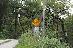 Hawkeye Creek Bridge |
June 25, 1998 (#98000790) |
Hawkeye Rd. over Hawkeye Creek 41°02′33″N 91°03′26″W |
Mediapolis | |
| 19 | Hedge Block | 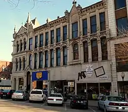 Hedge Block |
October 7, 1982 (#82000405) |
401-407 Jefferson St. 40°48′36″N 91°06′15″W |
Burlington | |
| 20 | Heritage Hill Historic District | 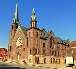 Heritage Hill Historic District |
December 21, 1982 (#82000406) |
Roughly bounded by Central Ave. and High, 3rd, and Jefferson Sts. 40°48′46″N 91°06′22″W |
Burlington | |
| 21 | Hotel Burlington | 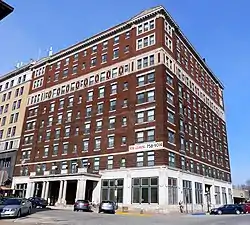 Hotel Burlington |
December 31, 1987 (#87002214) |
206 N. 3rd St. 40°48′33″N 91°06′09″W |
Burlington | |
| 22 | Jagger-Churchill House | 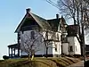 Jagger-Churchill House |
March 5, 1982 (#82002616) |
201 Spring St. 40°48′55″N 91°06′00″W |
Burlington | |
| 23 | Lagomarcino-Grupe Company | 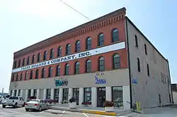 Lagomarcino-Grupe Company |
September 30, 2013 (#13000796) |
101-111 Valley St. 40°48′31″N 91°06′04″W |
Burlington | |
| 24 | Lock and Dam No. 18 Historic District | 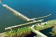 Lock and Dam No. 18 Historic District |
March 10, 2004 (#04000178) |
Spanning the Mississippi River, 1.5 miles north of an unnamed county road from Gladstone, Illinois 40°52′56″N 91°01′27″W |
Burlington | Extends into Henderson County, Illinois. |
| 25 | Manufacturing and Wholesale Historic District | 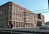 Manufacturing and Wholesale Historic District |
June 12, 2012 (#12000326) |
Roughly 209 N. 3rd to 231 S. 3rd & 219 to 425 Valley Sts. 40°48′29″N 91°06′12″W |
Burlington | |
| 26 | Dennis Melcher Pottery and House | 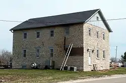 Dennis Melcher Pottery and House |
August 28, 2003 (#03000832) |
22981 and 22982 Agency Rd. 40°48′58″N 91°22′18″W |
Danville | |
| 27 | Prairie Grove School | May 20, 2019 (#100003973) |
13598 Beaverdale Rd. 40°52′49″N 91°14′55″W |
West Burlington | ||
| 28 | Schramm Building | 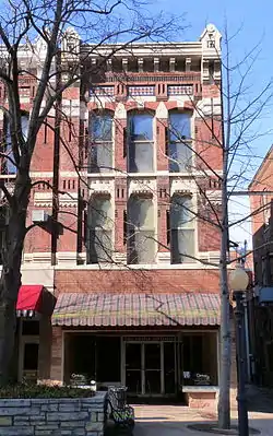 Schramm Building |
March 12, 1999 (#99000310) |
212 Jefferson St. 40°48′36″N 91°06′07″W |
Burlington | |
| 29 | Snake Alley | 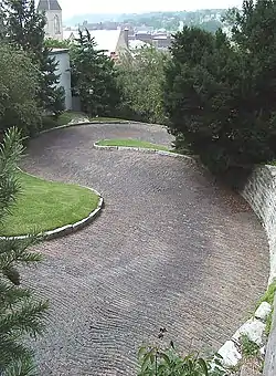 Snake Alley |
September 6, 1974 (#74000783) |
N. 6th St. between Washington and Columbia Sts. 40°48′43″N 91°06′21″W |
Burlington | Street of many curves |
| 30 | Snake Alley Historic District | 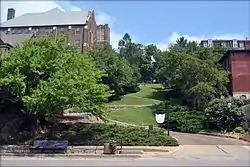 Snake Alley Historic District |
May 21, 1975 (#75000683) |
Roughly bounded by Columbia and Washington Sts., Cobblestone Alley, and Service Dr. 40°48′43″N 91°06′21″W |
Burlington | |
| 31 | Starker-Leopold Historic District | 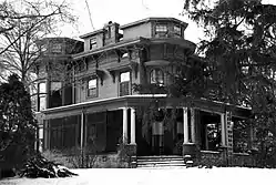 Starker-Leopold Historic District |
February 2, 1983 (#83000352) |
101 and 111 Clay and 110 Grand Sts. 40°47′43″N 91°05′47″W |
Burlington | |
| 32 | West Jefferson Street Historic District | 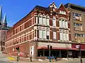 West Jefferson Street Historic District |
April 9, 1991 (#91000409) |
Roughly the 400 to 800 blocks of W. Jefferson St. 40°48′38″N 91°06′22″W |
Burlington | |
| 33 | Abiathar and Nancy White House | 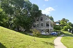 Abiathar and Nancy White House |
January 15, 2014 (#13001076) |
713 N. Main St. 40°48′50″N 91°06′01″W |
Burlington |
Former listings
| [3] | Name on the Register | Image | Date listed | Date removed | Location | City or town | Summary |
|---|---|---|---|---|---|---|---|
| 1 | Flint River Bridge | June 25, 1998 (#98000792) | October 15, 2014 | 155th St. over the Flint River 40°54′19″N 91°13′22″W |
Burlington | ||
| 2 | Charles Mason House | 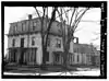 Charles Mason House |
January 25, 1980 (#80001447) | September 23, 1987 | 931 N. 6th St. 40°49′03″N 91°06′15″W |
Burlington | |
| 3 | Union Hotel | Union Hotel |
April 4, 1993 (#93000328) | May 12, 2009 | 301-311 S. Main St. 40°48′21″N 91°06′09″W |
Burlington | Hotel is the white and light gray building at the far right, matching a drawing in Commercial and Statistical Review of the City of Burlington, Iowa (1882).[6] |
| 4 | Yellow Spring Creek Bridge | June 25, 1998 (#98000791) | December 15, 2003 | Sperry Rd. over Yellow Spring Creek |
Mediapolis |
See also
| Wikimedia Commons has media related to National Register of Historic Places in Des Moines County, Iowa. |
References
- The latitude and longitude information provided in this table was derived originally from the National Register Information System, which has been found to be fairly accurate for about 99% of listings. Some locations in this table may have been corrected to current GPS standards.
- "National Register of Historic Places: Weekly List Actions". National Park Service, United States Department of the Interior. Retrieved on January 29, 2021.
- Numbers represent an alphabetical ordering by significant words. Various colorings, defined here, differentiate National Historic Landmarks and historic districts from other NRHP buildings, structures, sites or objects.
- "National Register Information System". National Register of Historic Places. National Park Service. April 24, 2008.
- The eight-digit number below each date is the number assigned to each location in the National Register Information System database, which can be viewed by clicking the number.
- Commercial and Statistical Review of the City of Burlington, Iowa: Showing Her Manufacturing, Mercantile and General Business Interests, Together with Historical Sketches of the Growth and Progress of the "Orchard City," Also Sketches of the Principal Business Houses and Manufacturing Concerns. J.L. Spalding & Company. 1882. p. 131. Retrieved January 21, 2016.
| Topics | |
|---|---|
| Lists by state |
|
| Lists by insular areas | |
| Lists by associated state | |
| Other areas | |
| Related | |
| |

Municipalities and communities of Des Moines County, Iowa, United States | ||
|---|---|---|
| Cities | Map of Iowa highlighting Des Moines County | |
| Townships |
| |
| CDP | ||
| Other unincorporated communities | ||
| ||
This article is issued from Wikipedia. The text is licensed under Creative Commons - Attribution - Sharealike. Additional terms may apply for the media files.