Golden Highway
The Golden Highway is a 313-kilometre (194 mi)[1] highway, located in the Hunter and Orana regions of New South Wales, Australia.
Golden Highway | |
|---|---|
 | |
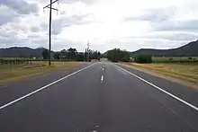
Direction sign at end of Bylong Valley Way | |
| General information | |
| Type | Highway |
| Length | 313 km (194 mi)[1] |
| Route number(s) | |
| Former route number | |
| Major junctions | |
| East end | |
| West end |
|
| Location(s) | |
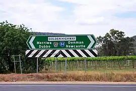
| Major settlements | Denman, Sandy Hollow, Merriwa, Dunedoo |
| Highway system | |
Designated as route B84, it runs eastwards from Dubbo towards Newcastle on the coast and enables road transport to avoid travelling over the Blue Mountains to Sydney.
Route
From west to east, the Golden Highway runs through Dunedoo – where it is concurrent with the Castlereagh Highway for approximately 10 kilometres (6.2 mi) – then through Merriwa, Sandy Hollow, Denman, Jerrys Plains and Mount Thorley, joining the New England Highway at Belford, south of Singleton. The Bylong Valley Way turns off the Golden Highway 1 kilometre (0.62 mi) east of Sandy Hollow. The Golden Highway and The Putty Road are concurrent for around 2 kilometres (1.2 mi), east of the Mount Thorley industrial estate near Singleton. The highway then turns east onto Mitchell's Line of Road while the Putty Road continues to Singleton.[2]
The Golden Highway provides a fairly low altitude crossing of the Great Dividing Range.[3] It runs through the Hunter Region[4] and gives access to the golden west of New South Wales.[5]
Major junctions
| LGA | Location | km[1] | mi | Destinations | Notes | |
|---|---|---|---|---|---|---|
| Singleton | Belford | 0.0 | 0.0 | T intersection eastern terminus; north and southeast as the New England Highway | ||
| Mount Thorley | 10.0 | 6.2 | Putty Road – Singleton | T intersection; Putty Road continues north | ||
| 13.4 | 8.3 | Putty Road – Putty, Windsor | Hybrid interchange; Putty Road continues southwest; concurrency terminus | |||
| Mount Thorley Road | Hybrid interchange; Mount Thorley Road continues south | |||||
| Warkworth | 23.4 | 14.5 | Wallaby Scrub Road – to Putty Road | |||
| Hunter River | 46.7 | 29.0 | Bridge over the river (bridge name unknown) | |||
| Muswellbrook | Denman | 64.5 | 40.1 | Denman Road – Muswellbrook | T intersection; Golden Highway continues southwest | |
| Hunter River | 65.3 | 40.6 | Bridge over the river (bridge name unknown) | |||
| Muswellbrook | Sandy Hollow | 82.6 | 51.3 | Bylong Valley Way – Bylong, Mudgee | ||
| 83.0 | 51.6 | Wybong Road – Muswellbrook | ||||
| Upper Hunter | Merriwa | 119 | 74 | Scone Road – Scone | ||
| Merriwa River | 120 | 75 | Bridge over the river (bridge name unknown) | |||
| Krui River | 144 | 89 | Bridge over the river (bridge name unknown) | |||
| Warrumbungle | Leadville | 215 | 134 | |||
| Dunedoo | 225 | 140 | Y intersection; Castlereagh Highway continues northwest; concurrency terminus | |||
| Dubbo | Dubbo | 313 | 194 | T intersection; western terminus; north and southwest as the Newell Highway | ||
1.000 mi = 1.609 km; 1.000 km = 0.621 mi
| ||||||
References
- "3800 New England Highway, Whittingham NSW 2330". Google Maps. Google Inc. 2016. Retrieved 17 November 2016.
- "NSW State Route 83: Golden Highway". Ozroads. Retrieved 28 October 2016.
- "Golden Highway Home Page". Craigmhor Enterprises. Retrieved 7 March 2008.
- "Upper Hunter Country". Retrieved 7 March 2008.
- "Heart of Country, NSW, Accommodation, Tours, Events and Hire". Visit NSW.com.au. Retrieved 7 March 2008.