Marion Road
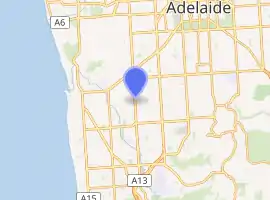
Marion Road is a north–south conduit through the western suburbs of Adelaide, South Australia. It forms part of State Route number A14.
Marion Road | |
|---|---|
| |
| General information | |
| Type | Road |
| Length | 11.3 km (7.0 mi)[1] |
| Route number(s) | |
| Major junctions | |
| North end | Henley Beach Road, Torrensville, Adelaide |
| South end | |
| Location(s) | |
| Major suburbs | Brooklyn Park, Cowandilla, Richmond, West Richmond, Marleston, Netley, North Plympton, Plympton, South Plympton, Plympton Park, Ascot Park, Park Holme, Mitchell Park, Marion, Sturt |
Where it terminates in Bedford Park, southwest of Adelaide's centre, Marion Road feeds into the Southern Expressway near the northern starting point of that road. This is also the southern end of Route A14.
At its northern end, Marion Road terminates at Henley Beach Road. Route A14 continues west on Henley Beach Road for about 250 metres; north along the entire length of Holbrooks Road; at Grange Road it take a 50-metre dog leg to the east; and then A14 continues north along the entire length of East Avenue until it terminates at Port Road.
The Glenelg Tram Line has a level crossing in Plympton between Anzac Highway and Cross Road. The crossing in close proximity to two major intersections sometimes causes congestion during peak times. Just south of Daws Road/Oaklands Road, the Seaford railway line has an overpass over Marion road.
The road name is based on its traversal through the suburb (Marion) and city of Marion.
Major intersections
| LGA | Location | km[1] | mi | Destinations | Notes |
|---|---|---|---|---|---|
| West Torrens | Underdale – Torrensville – Brooklyn Park tripoint | 0.0 | 0.0 | Northern terminus | |
| Brooklyn Park – Cowandilla boundary | 0.9 | 0.56 | |||
| West Richmond – Richmond – Netley – Marleston quadripoint | 2.0 | 1.2 | Richmond Road | ||
| Plympton | 4.4 | 2.7 | |||
| Marion | Plympton Park – South Plympton boundary | 4.8 | 3.0 | ||
| Ascot Park – Park Holme boundary | 7.7 | 4.8 | Oaklands Road (west) / Daws Road (east) | ||
| Sturt – Bedford Park boundary | 11.1 | 6.9 | Southbound entrance to and northbound exit from expressway | ||
| Marion–Onkaparinga boundary | Sturt – Bedford Park – Darlington tripoint | 11.3 | 7.0 | Southern terminus | |
See also
![]() Australian Roads portal
Australian Roads portal
References
- Google (13 March 2015). "Marion Road" (Map). Google Maps. Google. Retrieved 13 March 2015.
