Nainital district
Nainital district is a district of Uttarakhand state, India. The headquarters is at Nainital.
Nainital district | |
|---|---|
District | |
 Nainital Lake | |
| Nickname(s): Lake District of India | |
 Location in Uttarakhand, India | |
| Coordinates: 29°20′N 79°30′E | |
| Country | |
| State | Uttarakhand |
| Division | Kumaon |
| Headquarters | Nainital |
| Area | |
| • Total | 3,860 km2 (1,490 sq mi) |
| Population (2011) | |
| • Total | 954,605 |
| • Rank | 4(Out of 13 districts in Uttarakhand) |
| • Density | 247/km2 (640/sq mi) |
| Languages | |
| • Official | Hindi |
| • Native | Kumaoni |
| Time zone | UTC+5:30 (IST) |
| Website | nainital |
Nainital District is located in Kumaon Division, and is bounded on the north by the Almora District and on the south by the Udham Singh Nagar District. Haldwani is the largest city in the district.
Demographics
According to the 2011 census, Nainital district has a population of 954,600. The district has a population density of 225 inhabitants per square kilometre (580/sq mi), and a population growth rate over the preceding decade at 25.1%. It has a sex ratio of 934 females for every 1000 males, and a literacy rate of 83.9%.[1]:12–13
As of 2001 Indian census, the Nainital district had a population of 762,909, including 655,290 Hindus, 86,532 Muslims, and 16,107 Sikhs.[2]
| Year | Pop. | ±% p.a. |
|---|---|---|
| 1901 | 182,284 | — |
| 1911 | 182,016 | −0.01% |
| 1921 | 155,790 | −1.54% |
| 1931 | 156,034 | +0.02% |
| 1941 | 164,244 | +0.51% |
| 1951 | 188,736 | +1.40% |
| 1961 | 259,685 | +3.24% |
| 1971 | 319,697 | +2.10% |
| 1981 | 441,436 | +3.28% |
| 1991 | 574,832 | +2.68% |
| 2001 | 762,909 | +2.87% |
| 2011 | 954,605 | +2.27% |
| source:[3] | ||
| Nainital district: mother-tongue of population, according to the 2011 Indian Census.[4] | |||
|---|---|---|---|
| Mother tongue code | Mother tongue | People | Percentage |
| 002007 | Bengali | 4,174 | 0.4% |
| 006102 | Bhojpuri | 6,688 | 0.7% |
| 006195 | Garhwali | 15,348 | 1.6% |
| 006240 | Hindi | 369,373 | 38.7% |
| 006340 | Kumauni | 462,493 | 48.4% |
| 006439 | Pahari | 683 | 0.1% |
| 014011 | Nepali | 5,984 | 0.6% |
| 016038 | Punjabi | 19,644 | 2.1% |
| 022015 | Urdu | 63,170 | 6.6% |
| 053005 | Gujari | 1,416 | 0.1% |
| – | Others | 5,632 | 0.6% |
| Total | 954,605 | 100.0% | |
Languages
At the time of the 2011 Census of India, the major first languages of the population were Kumaoni (48%), Hindi (39%), Urdu (6.6%), Punjabi (2.1%), Garhwali (1.6%), Bhojpuri (0.70%), and Nepali (0.63%).[5] There are also speakers of Buksa, found in a number of villages in Ramnagar development block.[6]
Assembly Constituencies
- Lalkua
- Bhimtal
- Nainital (SC)
- Haldwani
- Kaladhungi
- Ramnagar
References
- District Census Handbook: Nainital (PDF). Directorate of Census Operations, Uttarakhand. 2011.
- "India 2001 Census Nainital Data Sheet" (PDF). 2001 India Census. Retrieved 29 April 2012.
- Decadal Variation In Population Since 1901
- C-16 Population By Mother Tongue – Uttarakhand (Report). Office of the Registrar General & Census Commissioner, India. Retrieved 14 July 2020.
- C-16 Population By Mother Tongue (Report). Office of the Registrar General & Census Commissioner, India. Retrieved 6 October 2019.
- Pant, Jagdish (2015). "Buksa/Buksari". In Devy, Ganesh; Bhatt, Uma; Pathak, Shekhar (eds.). The Languages of Uttarakhand. People's Linguistic Survey of India. 30. Hyderabad: Orient Blackswan. pp. 3–26. ISBN 9788125056263.
External links
| Wikimedia Commons has media related to Nainital district. |
The Highlander Post brings to you Uttarakhand News, Stories, and opinions that matter from India & across the globe scale. Get Latest Breaking News online.
https://thehighlanderpost.com/
Places adjacent to Nainital district | |
|---|---|
| Government | 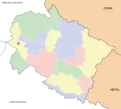 | ||||||||||||||||
|---|---|---|---|---|---|---|---|---|---|---|---|---|---|---|---|---|---|
| History |
| ||||||||||||||||
| Geography and Ecology |
| ||||||||||||||||
| Demographics |
| ||||||||||||||||
| Administrative divisions |
| ||||||||||||||||
| Politics | |||||||||||||||||
| Tourism |
| ||||||||||||||||
| Sports | |||||||||||||||||
| Other topics | |||||||||||||||||
| Districts |
| ||||||||||||||||
| Major cities | |||||||||||||||||