Rudraprayag district
Rudraprayag is a district of the state of Uttarakhand of northern India. The district occupies an area of 1984 km². The town of Rudraprayag is the administrative headquarters of the district. The district is bounded by Uttarkashi District on the north, Chamoli District on the east, Pauri Garhwal District on the south, and Tehri Garhwal District on the west.
Rudraprayag district | |
|---|---|
District | |
 | |
| Country | India |
| State | Uttarakhand |
| Division | Garhwal division |
| Headquarters | Rudraprayag |
| Government | |
| • District magistrate | Manuj Goyal, IAS |
| Area | |
| • Total | 1,984 km2 (766 sq mi) |
| Population (2011) | |
| • Total | 242,285 |
| • Density | 120/km2 (320/sq mi) |
| ISO 3166 code | IN-UT |
| Vehicle registration | UK 13 |
| Website | rudraprayag |
Overview
Rudraprayag District was established on 16 September 1997. It was carved out from the following areas of three adjoining districts:
- The whole of Augustmuni and Ukhimath block and part of Pokhri and Karnprayag block from Chamoli District
- Part of Jakholi and Kirtinagar block from Tehri District
- Part of Khirsu block from Pauri District
The internationally known Kedarnath Temple is at the north, Madmaheshwar at east, Nagrasu at southern east and Srinagar at extreme south. The Mandakini River is the main river of the district.
As of 2011 it is the least populous district of Uttarakhand (out of 13).[1]
Demographics
| Year | Pop. | ±% p.a. |
|---|---|---|
| 1901 | 70,510 | — |
| 1911 | 78,790 | +1.12% |
| 1921 | 80,700 | +0.24% |
| 1931 | 88,743 | +0.95% |
| 1941 | 100,305 | +1.23% |
| 1951 | 105,848 | +0.54% |
| 1961 | 119,921 | +1.26% |
| 1971 | 135,654 | +1.24% |
| 1981 | 169,743 | +2.27% |
| 1991 | 200,515 | +1.68% |
| 2001 | 227,439 | +1.27% |
| 2011 | 242,285 | +0.63% |
| source:[2] | ||
According to the 2011 census Rudraprayag district has a population of 242,285,[1] roughly equal to the nation of Vanuatu.[3] This gives it a ranking of 585th in India (out of a total of 640).[1] The district has a population density of 119 inhabitants per square kilometre (310/sq mi) .[1] Its population growth rate over the decade 2001-2011 was 4.14%.[1] Rudraprayag has a sex ratio of 1120 females for every 1000 males, making it the 6th highest in the country as per 2011 census, second being Almora that too in uttarakhand,[1] and a literacy rate of 82.09%.[1]
The predominant first language of the district is Garhwali, spoken by 94.5% of the population according to the 2011 census. Hindi, though widely used a lingua franca, is the first language of 4.2%, while 0.60% are speakers of Nepali.[4]
| Rudraprayag district: mother-tongue of population, according to the 2011 Indian Census.[4] | |||
|---|---|---|---|
| Mother tongue code | Mother tongue | People | Percentage |
| 006102 | Bhojpuri | 371 | 0.2% |
| 006195 | Garhwali | 228,916 | 94.5% |
| 006240 | Hindi | 10,167 | 4.2% |
| 006340 | Kumauni | 172 | 0.1% |
| 014011 | Nepali | 1,444 | 0.6% |
| 022015 | Urdu | 155 | 0.1% |
| – | Others | 1,060 | 0.4% |
| Total | 242,285 | 100.0% | |
Assembly constituencies
- Kedarnath Vidhan Sabha
- Rudraprayag Vidhan Sabha
Shrines and temples
Cities, towns and villages in Rudraprayag district
- Rudraprayag
- Sumerpur
- Bawai - 20 km from Rudraprayag city via Maikoti-Durgadhar, and 18 km from Tilwada
- Maikoti
- Biron Dewal village
- Darmwari
- Benji Village
- Triyuginarayan village
- Guptakashi
- Gaurikund
- Jaggi Kandai village
- Bainji Kandai Dashjula village
See also
References
- "District Census 2011". Census2011.co.in. 2011. Retrieved 30 September 2011.
- Decadal Variation In Population Since 1901
- US Directorate of Intelligence. "Country Comparison:Population". Retrieved 1 October 2011.
Vanuatu 224,564 July 2011 est.
- C-16 Population By Mother Tongue – Uttarakhand (Report). Office of the Registrar General & Census Commissioner, India. Retrieved 14 July 2020.
External links
| Wikimedia Commons has media related to Rudraprayag district. |
Places adjacent to Rudraprayag district | ||||||||||
|---|---|---|---|---|---|---|---|---|---|---|
| ||||||||||
| Government | 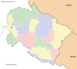 | ||||||||||||||||
|---|---|---|---|---|---|---|---|---|---|---|---|---|---|---|---|---|---|
| History |
| ||||||||||||||||
| Geography and Ecology |
| ||||||||||||||||
| Demographics |
| ||||||||||||||||
| Administrative divisions |
| ||||||||||||||||
| Politics | |||||||||||||||||
| Tourism |
| ||||||||||||||||
| Sports | |||||||||||||||||
| Other topics | |||||||||||||||||
| Districts |
| ||||||||||||||||
| Major cities | |||||||||||||||||
| Authority control |
|
|---|