Pithoragarh district
Pithoragarh is the easternmost district in the state of Uttarakhand. It is located in the Himalayas and has an area of 7,110 km2 (2,750 sq mi) and a population of 483,439 (as of 2011). The city of Pithoragarh, located in Saur Valley, is its headquarters. The district is within the Kumaon division of Uttarakhand state. The Tibet plateau is situated to the north and Nepal is to the east. The Kali River is formed by the joining of two headwaters near Gunji and flows south, forming the eastern border with Nepal.[1] The Hindu pilgrimage route for Mount Kailash-Lake Manasarovar passes through this district via Lipulekh Pass in the greater Himalayas. The district is administratively divided into six tehsils: Munsyari; Dharchula; Didihat; Berinag; Gangolihat; and Pithoragarh. Naini Saini Airport is the nearest civil airport, but it does not have regular scheduled commercial passenger service. The mineral deposits present in the district are magnesium ore, copper ore, limestone and slate. There are 11 tehsil.
Pithoragarh district | |
|---|---|
District | |
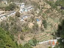
 Gori River Valley | |
| Nickname(s): mini Kashmir | |
|
Location in Uttarakhand, India | |
| Coordinates: 30°00′N 80°20′E | |
| Country | |
| State | Uttarakhand |
| Division | Kumaon |
| Headquarters | Pithoragarh |
| Area | |
| • Total | 7,110 km2 (2,750 sq mi) |
| Population (2011) | |
| • Total | 483,439 |
| • Density | 69/km2 (180/sq mi) |
| Languages | |
| • official | Hindi |
| • Native | Kumaoni |
| Time zone | UTC+5:30 (IST) |
| PIN | 262501 |
| Telephone code | 91 5964 |
| Vehicle registration | UK-05 |
| Website | pithoragarh |
Etymology
Some attribute the name to King Pithora Chand from the Chand Dynasty, who built a fort named Pithora Garh in the Saur Valley.
History
Pals ( Branch of Katyuri kings)
After its conquest by Bhartpal, the Rajwar of Uku (now in Nepal), in the year 1364, Pithoragarh was ruled for the rest of the 14th century by three generations of Pals, and the kingdom extended from Pithoragarh to Askot.
Bam Dynasty
According to a tamrapatra (inscribed copper or brass plaque) from 1420, the Pal dynasty, based out of Askot, was uprooted by Chand kings. Vijay Brahm (of the Brahm dynasty from Doti) took over the empire as King. Following the death of Gyan Chand, in a conflict with Kshetra Pal, the Pals were able to regain the throne.
Chand Dynasty
It is believed that Bharti Chand, an ancestor of Gyan Chand, had replaced Bams, the ruler of Pithoragarh, after defeating them in 1445. In the 16th century, the Chand dynasty again took control over Pithoragarh town and, in 1790, built a new fort on the hill where the present Girls Inter College is situated. The Chand rule, at its zenith, is seen as one of the most prominent empires in Kumaon. Their rule also coincides with a period of cultural resurgence. Archeological surveys point towards the development of culture and art forms in this period.
Modern history
British rule began on 2 December 1815 when Nepal was forced to sign the Sugauli Treaty. Pithoragarh remained a tehsil under Almora district until 1960 when its status was elevated to that of a district. There was an army cantonment, a church, and a mission school, resulting in the spread of Christianity in the region.
In 1997, part of Pithoragarh district was separated to form the new Champawat district.
Demographics
| Year | Pop. | ±% p.a. |
|---|---|---|
| 1901 | 135,083 | — |
| 1911 | 156,541 | +1.49% |
| 1921 | 157,943 | +0.09% |
| 1931 | 173,716 | +0.96% |
| 1941 | 204,684 | +1.65% |
| 1951 | 230,180 | +1.18% |
| 1961 | 274,226 | +1.77% |
| 1971 | 313,747 | +1.36% |
| 1981 | 365,141 | +1.53% |
| 1991 | 416,647 | +1.33% |
| 2001 | 462,289 | +1.04% |
| 2011 | 483,439 | +0.45% |
| source:[2] | ||
According to the 2011 census Pithoragarh district has a population of 483,439, roughly equal to the nation of Suriname.[3] This gives it a ranking of 546th among the 640 Districts of India. The district has a population density of 69 inhabitants per square kilometre (180/sq mi). Its population growth rate over the decade 2001–2011 was 5.13%. Pithoragarh has a sex ratio of 1021 females for every 1000 males, and a literacy rate of 82.93%.[4]
Native tribes in the district include the Van Rawats and Shaukas. Van Rawats are hunter-gatherers. Shaukas are traders. In Pithoragarh the Shaukas are divided into two main tribes. Johari Shaukas and Rung Shaukas. The Johari Shauka community inhabits the areas in Munsiyari while Rung Shaukas tribe are spread among the three valleys of Darma, Chaundas and Byans. Kangdali Festival, celebrated once every 12 years by inhabitants of Chaundas Valley, is one of the major festivals in this area.
Languages
Kumaoni, with its several dialects, is the most widely spoken language.[5] Hindi is the common language between the locals and outsiders, and English is spoken by some people, especially teachers, lecturers, and students in tertiary education.
Several Sino-Tibetan languages of the West Himalayish branch are spoken by small communities. These include the three closely related languages of Byangsi, Chaudangsi and Darmiya, as well as Rangkas and Rawat.[6] The Van Rawat tribe speaks their own variety of Kumaoni.
| Pithoragarh district: mother-tongue of population, according to the 2011 Indian Census.[5] | |||
|---|---|---|---|
| Mother tongue code | Mother tongue | People | Percentage |
| 002007 | Bengali | 414 | 0.1% |
| 004001 | Dogri | 396 | 0.1% |
| 006102 | Bhojpuri | 1,654 | 0.3% |
| 006195 | Garhwali | 1,634 | 0.3% |
| 006240 | Hindi | 35,590 | 7.4% |
| 006340 | Kumauni | 423,862 | 87.7% |
| 006439 | Pahari | 653 | 0.1% |
| 013071 | Marathi | 281 | 0.1% |
| 014011 | Nepali | 7,259 | 1.5% |
| 016038 | Punjabi | 383 | 0.1% |
| 022015 | Urdu | 1,224 | 0.3% |
| 031001 | Bhotia (also called "Jad") | 1,325 | 0.3% |
| 046003 | Halam | 5,623 | 1.2% |
| 103003 | Rai | 263 | 0.1% |
| – | Others | 2,878 | 0.6% |
| Total | 483,439 | 100.0% | |
Assembly Constituencies
- Dharchhula
- Didihat
- Pithoragarh
- Gangolihat (SC)
Climate
Pithoragarh town, being in a valley, is relatively warm during summer and cool during winter. During the coldest months of December and January, the tropical and temperate mountain ridges and high locations receive snowfall and have an average temperature of 5.5–8.0 °C (41.9–46.4 °F). Pithoragarh district has extreme variation in temperature due to the large variations in altitude. The temperature rises from mid-March through mid-June. The areas above 3,500 metres (11,500 ft) remain in a permanent snow cover. Regions lying at 3,000–3,500 metres (9,800–11,500 ft) become snowbound for four to six months. At places like the river gorges at Dharchula, Jhulaghat, Ghat and Sera, temperatures reach 40 °C (104 °F). The annual average rainfall in lower reaches is 360 centimetres (140 in).. ISBN 8170998980. Missing or empty |title= (help) After June the district receives monsoon showers. Winter is a time for transhumance – the seasonal migration of the Bhotiya tribe with their herds of livestock to lower, warmer areas.
Seasons
- Winter (cold weather): December–March
- Summer (hot weather): March–June
- Season of general rains: North–West monsoon – mid-June to mid-September
- Season of retreating monsoon: September–November
Glaciers of Pithoragarh
Locally, glaciers are known as Gal. Some important glaciers of the district are as follows:
- Milam Glacier
- Namik Glacier
- Ralam Glacier
- Meola Glacier
- Sona Glacier
- Panchchuli Glacier
- Balati Glacier
- Shipu Glacier
- Rula Glacier
- Kalabaland Glacier
- Lawan Glacier
- Bamlas Glacier
- Baldimga Glacier
- Terahar Glacier
- Poting Glacier
- Talkot Glacier
- Sankalpa Glacier
- Lassar Glacier
- Dhauli Glacier
- Baling Golfu Glacier
- Dhauli Glacier
- Sobla Tejam Glacier
- Kali Glacier
- Kuti Glacier
- Yangti Basin Glacier
Himalayan peaks of Pithoragarh
| Peak | Height (m) |
|---|---|
| Sunanda Devi | 7,434 |
| Hardeol | 7,151 |
| Trishuli | 7,099 |
| Rishi Pahar | 6,992 |
| Panchchuli II | 6,904 |
| Nanda Kot | 6,861 |
| Chiring We | 6,559 |
| Rajrambha | 6,537 |
| Chaudhara | 6,510 |
| Sangthang | 6,480 |
| Panchchuli V | 6,437 |
| Nagalaphu | 6,410 |
| Suitilla (Suj Tilla West) | 6,374 |
| Suj Tilla East | 6,393 |
| Panchchuli I | 6,355 |
| Bamba Dhura | 6,334 |
| Burphu Dhura | 6,334 |
| Panchchuli IV | 6,334 |
| Changuch | 6,322 |
| Nanda Gond | 6,315 |
| Panchchuli III | 6,312 |
| Nanda Pal | 6,306 |
| Suli Top | 6,300 |
| Kuchela | 6,294 |
| Nital Thaur | 6,236 |
| Kalganga Dhura | 6,215 |
| Jonglingkong or Baba Kailash | 6,310 |
| Om Parvat | 6,191 |
| Lalla We | 6,123 |
| Kalabaland Dhura | 6,105 |
| Telkot | 6,102 |
| Bainti | 6,079 |
| Ikualari | 6,059 |
| Nagling | 6,041 |
| Menaka Peak | 6,000 |
| Trigal | 5,983 |
| Yungtangto | 5,945 |
| Sankalp | 5,929 |
| Laspa Dhura | 5,913 |
| Sahdev | 5,782 |
| Ralam Dhura | 5,630 |
| Gilding Peak | 5,629 |
| Shivu | 5,255 |
| Tihutia | 5,252 |
| Draupadi Peak | 5,250 |
| Rambha Kot | 5,221 |
| Panchali Chuli | 5,220 |
Mountain passes of Pithoragarh
International passes to Tibet
| Pass | Height (m) |
|---|---|
| Lampiya Dhura | 5,530 |
| Lipu-Lekh pass | 5,450 |
| Lowe Dhura | 5,562 |
| Mangshya Dhura | 5,630 |
| Nuwe Dhura | 5,650 |
Intra-district Himalayan passes
| Pass | Height (m) |
|---|---|
| Ghantesh Baba | 5,164 |
| Kungri Bhingri La | 5,564 |
| Nama pass | 5,500 |
| Sinla pass | 5,495 |
| Ralam pass | 5,630 |
| Keo Dhura | 5,439 |
| Belcha Dhura | 5,384 |
| Kalganga Dhura | 5,312 |
| Traills pass | 5,312 |
| Gangchal Dhura | 5,050 |
| Birejrang Dhura | 4,666 |
| Ghatmila Dhura | |
| Unta Dhura pass | |
| Yangkchar Dhura | 4,800 |
| Rur Khan | 3,800 |
| Bainti Col | 5,100 |
| Longstaff Col | 5,910 |
Valleys of Pithoragarh
- Byans valley (includes Kuthi Valley and the valley of Kalapani River)
- Chaudans valley
- Darma Valley
- Goriganga valley
- Johar Valley
- Kalabaland valley
- Kali valley
- Lassar Yangti valley
- Ralam valley
- Saur valley
Flora
A wide variety of flora exist in the district, including many unique sub-tropical, temperate, and alpine plants. Bryophytes (mosses), pteridophytes (ferns), gymnosperms (conifers), and angiosperms (flowering plants) are present. Rare varieties of orchids are also present in the high-altitude valleys of Milan, Darma, Beyans, and Kuthi. Species present include:
- Abies pindrow
- Aconitum heterophyllum
- Berberis aristata (Kirmod)
- Betula utilis (Himalayan birch or Bhoj Patra)
- Cedrus deodara (Deodar Cedar)
- Cypripedium cordigerum
- Dendrobium normale
- Myrica esculenta (Kafal)
- Nardostachys grandiflora (Jatmasi)
- Pedicularis punctata
- Picrorhiza kurroa (Kutki)
- Pinus roxburghii (Salla or Chir)
- Pinus wallichiana (Blue Pine or Raisalla)
- Prunus cornuta
- Prunus puddum
- Quercus dilatata
- Quercus incana
- Quercus leucotricophora (Banjh)
- Quercus semicarpifolia
- Rhododendron barbatum (Burans)
- Rhododendron campanulatum
- Rubus ellipticus (Hisalu)
- Saussurea obvallata (Brahm Kamal)
- Saussurea simpsonia
- Taxus wallichiana (Himalayan yew)
- Vanda cristata
- Zanthoxylum armatum (Timur)
- 10–15 kinds of cactus
- Aadu
- Different type of pulses like red and green lentils
- Figs
- Green apples
- Himalyan pears
- Mulberry
- Oranges
- Peaches
- Red apples
- Rye (a local staple)
- Simal
- Soy beans
- Yellow plums
Tourist attractions
Adi-Kailash (Chhota Kailash)
At an altitude of 6,191 M on Indo-Tibet border in Byans valley of Tehsil Dharchula, Adi-Kailash (Chota Kailash) or is situated. Trekking from Mangti to Jollingkong via Chialekh (Chaetoh), Garbyang, Gunji and Kuti one can reach Adi Kailash. If one goes towards kalapani from village Gunji, one can go further to Nabhidang just beyond Kalapani and see the sacred Hindu peak named Om Parvat, elevation 6,191 M.
Askot Musk Deer Sanctuary
Askot Musk Deer Sanctuary is a 599.93 km2 wildlife sanctuary located around Askot near Didihat, in Pithoagarh district of the Himalaya of Kumaon in Uttarakhand, India.
Belkot
Belkot is a small village in Pithoragarh District, around 10 km from Berinag. Located in the foothills of the Kumaon Himalayas, it is known for its salubrious climate and is home to the famed Bhagwati Temple.
Berinag
A small town located 102 km from Pithoragarh, Berinag is at an altitude of 2010 m. Berinag places from where Himalayan snow-clad peaks can be viewed. The area has a number of Nag (snake) temples of Dhaurinag, Feninag, Kalinag, Bashukinag, Pinglenag, and Harinag. Other tourist spots are Tripura Devi Temple, Cave Temple of Koteshwar, Garaun waterfalls, and Musk Deer Farm at Kotmanya. The Berinag is named after the Nagveni King Benimadhava.
Chandak
A place, 7 km from Pithoragarh, at an altitude of 6,000 feet (1,830 m), one can see panoramic and a breath-taking view of the Pithoragarh Soar Valley, from here. According to legends, it is a place where demon 'Chandghat' was killed by Goddess Durga.
The temple of Mostamanu of Lord Shiva is a locally adored place in Chandak. Every year the Mostamanu fair is organised by the local people here and is very popular. There is a long swing about 20 feet. Apart from that, the temple is also famous for the tulip garden developed in 2019. The temple also organises 'Ramleela' on a dedicated stage every year.
Chaukori
Probably the perfect tourist destination to have a full panoramic view of snow-capped Himalayan peaks in Pithoragarh. It is situated 10 km from Berinag and has an altitude of 2010 m. This place is also has tea gardens and orchards.
Chhipla Kedar
Chipla Kedar is 34 km from Tawaghat situated 4626 meters (15,177 ft) above sea level.
Dharchula
Dharchula is a Tehsil and a nagar panchayat in Pithoragarh district in the state of Uttarakhand, India. Dharchula is a valley surrounded by mountains. An ancient trading town for the trans-Himalayan trade routes, it is covered by high mountains and is situated on the banks of the river Kali. Dharchula is about 90 km far away from Pithoragarh and it lies on the route to the Kailash-Mansarovar pilgrimage tour. The town is virtually split between India and Nepal near the border with Tibet. The Indian side of the town is known as Dharchula whereas its Nepalese counterpart is known as Darchula.
Dhwaj
Fifteen kilometres from Pithoragarh near Totanaula, there is a mountain called Dhwaj, elevation 2134 m. It is an abode of Goddess Jayanti or Durga and Lord Shiva, atop the hill. Hindu legends tell that at this place 'Chanda and Munda' demons were killed by Devi. Dense forest about the mountain is considered sacred and sacrosanct, so it is in an excellent state of conserved biome with a large number of endemic plants.
Didihat
Didihat, 54 km from Pithoragarh, has views of the Himalaya ranges, especially the Panchchuli range. The Shira-kot Temple of Lord Malay Nath is nearby, and was built by Reka Kings. Nearby, ten km away from here Narayan Swami Ashram at Narayan Nagar is situated.
Jauljibi
This is a significant trading centre bordering Nepal and 68 km from Pithoragarh. Situated at the confluence of rivers Gori and Kali, it turns into a lively fairground annually. In the fair Bhotiya tribes use to sell their woolen articles. A hanging rope bridge across Kali links this place to Nepal. From Jauljibi tribal country of the district actually begins.
Jhaltola
A small village between Chaukori and Patal Bhuvanshwar, it was an erstwhile tea estate and is at an altitude of 2100 meters to 2600 meters asl. There is an old Shive temple at the top of the mountain known as Lamkeshwar Mahadev, it is an upcoming offbeat destination for tourists interested in nature, Himalayan views and birding. The village is surrounded on three sides by fabulous mixed forests and has the widest range of Himalayan views in Kumaon and a vibrant flora and fauna. The only place to stay here is The Misty Mountains retreat.
Jhulaghat
This small town on the banks of river Kali at Indo-Nepal border is named after a hanging rope bridge across the Kali river. Previously it was called 'Juaghat'. Cross-border trade with Nepal takes place through this bridge.
Kailash Mansarovar Yatra
The Hindu pilgrimage tour to Kailash-Mansarovar passes through the district. From Mangti pilgrims have to move on foot.
Kapileshwar Mahadev
The cave temple dedicated to Lord Shiva affords the fine view of the Saur valley and lofty Himalayan peaks. This temple is three kilometres from Pithoragarh.
Madkot
Madkot, 22 km from Munsiari, has hot water springs which are supposed to cure rheumatism, arthritis, and skin ailments.
Munsyari
Munsyari is situated in the northern part of the Pithoragarh district, distance is 124 km. This small town is located at the foot of the main Himalayan peaks, which are covered with snow throughout the year. Munsyari is in the base for the track routes to Milam Glacier, Ralam Glacier, and Namik Glacier, at the base of majestic Himalayan peak Trishuli (7,074 m). This place is also known for the Khalia Bugyal, an alpine meadow. The forest ponds of Mesar Kund and Thamri Taal, close to Munsyari are also popular with tourists. The valley from Munsyari to Milam is known as Johar Valley.
Nakuleshwar
It is believed that Nakuleshwara Temple was built by Nakula and Sahadeva (Pandavas). The place is located near Pithoragarh town.
Narayan Ashram
An Ashram established by Shri Narayan Swamy near village Sosa in the Chaudans valley in 1936, on the way to Lipu Lekh, is full of wild flowers and rare varieties of fruits and number of waterfalls. The Ashram was primarily made to help Kailash-Mansarovar pilgrims. The ashram has been engaged in socio-spiritual works.
Patal Bhuvaneshwar
It is a place 77 km from Pithoragarh at Gangolihat, and has an ancient Temple of Goddess Kali-Mother Deity of Indian Army's Kumaon Regiment. Hatkalika Temple was established by Sankaracharya as a Mahakali Shakti Peeth at Gangolihat. At a distance of 14 km from Gangolihat, there is a village located in Tehsil Didihat, named Bhuvaneshwar, where a cave of Patal Bhuvaneshwar, the subterranean shrine of Lord Shiva is situated with sprawling interiors exist. Limestone rock formations have created various spectacular stalactite and stalagmite figures. This cave has a narrow tunnel-like opening which leads to a number of caves. The cave is fully electrically illuminated.
Pithoragarh Fort
It is set atop a hill on the outskirts of the town. The fort was built by the Gorkhas in 1789. The fort has served as a tehsil headquarters in past but now it has been completely renovated and is used as a museum.
Rai Gufa
This cave provides an excellent example of peculiar limestone formations and situated near Pithoragarh.
Thal
Surrounded by Kalinag, Sundarinag and Dhaulinag, Thal is situated on the bank of the Ramganga river. Thal Valley has its own history main attractions are the ancient temple of Lord Shiva and Ek Hathia Devalaya Which means - "Made with one hand", this temple is dedicated to Lord Shiva.(temple carved by one stone and by one person in a single night). Gaucher is 2 miles (3.2 km) away from Thal market in the route of Munsiari and Kailash Manas Sarovar.
Thal Kedar
This ancient Shiva Temple is also known for its scenic splendour. During the annual fair of Maha Shivratri a large number of devotees and pilgrims flock here. Situated at 16 km from Pithoragarh.
References
| Wikimedia Commons has media related to Pithoragarh district. |
- Hoon, Vineeta (1996), Living on the Move: Bhotiyas of the Kumaon Himalaya, Sage Publications, p. 48, ISBN 978-0-8039-9325-9: "The river Kaliganga forms a natural boundary between India and Nepal. It has two headwaters: the eastern one Kalapani is a collection of springs, and the western one Kutiyankti [Kuthi Yankti] rises from the snow fields of the Himadri near Kuti, the last Bhotiya village in Vyas."
- Decadal Variation In Population Since 1901
- US Directorate of Intelligence. "Country Comparison:Population". Retrieved 1 October 2011.
Suriname 491,989 July 2011 est.
- "District Census 2011". Census2011.co.in. 2011. Retrieved 30 December 2012.
- C-16 Population By Mother Tongue – Uttarakhand (Report). Office of the Registrar General & Census Commissioner, India. Retrieved 14 July 2020.
- Eberhard, David M.; Simons, Gary F.; Fennig, Charles D., eds. (2019). "India – Languages". Ethnologue (22nd ed.). SIL International.
External links
Places adjacent to Pithoragarh district | ||||||||||
|---|---|---|---|---|---|---|---|---|---|---|
| ||||||||||
| Government | 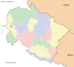 | ||||||||||||||||
|---|---|---|---|---|---|---|---|---|---|---|---|---|---|---|---|---|---|
| History |
| ||||||||||||||||
| Geography and Ecology |
| ||||||||||||||||
| Demographics |
| ||||||||||||||||
| Administrative divisions |
| ||||||||||||||||
| Politics | |||||||||||||||||
| Tourism |
| ||||||||||||||||
| Sports | |||||||||||||||||
| Other topics | |||||||||||||||||
| Districts |
| ||||||||||||||||
| Major cities | |||||||||||||||||