Okayama Prefecture
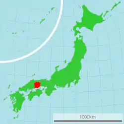
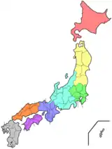
Okayama Prefecture (岡山県, Okayama-ken) is a prefecture of Japan located in the Chūgoku region of Honshu.[1] Okayama Prefecture has a population of 1,906,464 (1 February 2018) and has a geographic area of 7,114 km² (2,746 sq mi). Okayama Prefecture borders Tottori Prefecture to the north, Hyogo Prefecture to the east, and Hiroshima Prefecture to the west.
Okayama Prefecture
岡山県 | |||||||||||||
|---|---|---|---|---|---|---|---|---|---|---|---|---|---|
| Japanese transcription(s) | |||||||||||||
| • Japanese | 岡山県 | ||||||||||||
| • Rōmaji | Okayama-ken | ||||||||||||
 Flag  Symbol | |||||||||||||
 | |||||||||||||
| Country | |||||||||||||
| Region | Chūgoku (Sanyō) | ||||||||||||
| Island | Honshu | ||||||||||||
| Capital | Okayama | ||||||||||||
| Subdivisions | Districts: 10, Municipalities: 27 | ||||||||||||
| Government | |||||||||||||
| • Governor | Ryūta Ibaragi | ||||||||||||
| Area | |||||||||||||
| • Total | 7,114.50 km2 (2,746.92 sq mi) | ||||||||||||
| Area rank | 17th | ||||||||||||
| Population (February 1, 2018) | |||||||||||||
| • Total | 1,906,464 | ||||||||||||
| • Rank | 21st | ||||||||||||
| • Density | 270/km2 (690/sq mi) | ||||||||||||
| ISO 3166 code | JP-33 | ||||||||||||
| Website | www | ||||||||||||
| |||||||||||||
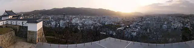
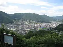
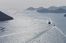
Okayama is the capital and largest city of Okayama Prefecture, with other major cities including Kurashiki, Tsuyama, and Sōja.[2][3][4] Okayama Prefecture's south is located on the Seto Inland Sea coast across from Kagawa Prefecture on the island of Shikoku, which are connected by the Great Seto Bridge, while the north is characterized by the Chūgoku Mountains.
History
Prior to the Meiji Restoration of 1868, the area of present-day Okayama Prefecture was divided between Bitchū, Bizen and Mimasaka Provinces. Okayama Prefecture was formed and named in 1871 as part of the large-scale administrative reforms of the early Meiji period (1868–1912), and the borders of the prefecture were set in 1876.[3][5]
Geography
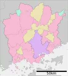
Government Ordinance Designated City City Town
Okayama Prefecture borders Hyōgo Prefecture, Tottori Prefecture, and Hiroshima Prefecture.[3] It faces Kagawa Prefecture in Shikoku across the Seto Inland Sea and includes 90 islands in the sea.
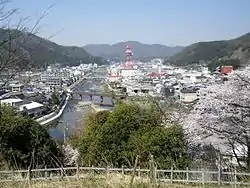
Okayama Prefecture is home to the historic town of Kurashiki. Most of the population is concentrated around Kurashiki and Okayama. The small villages in the northern mountain region are aging and declining in population - more than half of the prefecture's municipalities are officially designated as depopulated.[6]
As of 1 April 2014, 11% of the total land area of the prefecture was designated as Natural Parks, namely the Daisen-Oki and Setonaikai National Parks; the Hyōnosen-Ushiroyama-Nagisan Quasi-National Park; and seven Prefectural Natural Parks.[7]
Cities

Fifteen cities are located in Okayama Prefecture:
Towns and villages
These are the towns and villages in each district:
Mergers
Demographics
Per Japanese census data,[8] and,[9] Okayama prefecture has had continual negative population growth since 2005
| Year | Pop. | ±% |
|---|---|---|
| 1920 | 1,218,000 | — |
| 1930 | 1,284,000 | +5.4% |
| 1940 | 1,329,000 | +3.5% |
| 1950 | 1,661,000 | +25.0% |
| 1960 | 1,670,000 | +0.5% |
| 1970 | 1,707,000 | +2.2% |
| 1980 | 1,871,000 | +9.6% |
| 1990 | 1,926,000 | +2.9% |
| 2000 | 1,950,828 | +1.3% |
| 2010 | 1,945,276 | −0.3% |
| 2020 | 1,920,739 | −1.3% |
Education
Universities
- Okayama
- Kurashiki
- Soja
- Tsuyama
- Niimi
High schools
- Okayama
- Okayama Ichinomiya Senior High School
- Okayama Asahi Senior High School
- Okayama Sozan Senior High School
- Okayama Hosen Senior High School
- Okayama Joto Senior High School
- Okayama Sakuyo High School[10]
- Kurashiki High School
Transportation
Rail
- JR West
- JR West and JR Shikoku
- Seto-Ōhashi Line
- Honshi-bisan Line
- Chizu Express
- Ibara Railway
- Mizushima Rinkai Railway
Tramways
Expressways
- Sanyo Expressway
- Chugoku Expressway
- Seto Central Expressway
- Yonago Expressway
- Okayama Expressway
- Tottori Expressway
National highways
- Route 2 (Osaka-Kobe-Himeji-Bizen-Okayama-Kurashiki-Asakuchi-Onomichi-Hiroshima-Shunan-Shimonoseki-Kitakyushu)
- Route 30 (Okayama-Uno-Takamatsu
- Route 53 (Okayama-Tsuyama-Tottori)
- Route 179
- Route 180 (Okayama-Takahashi-Niimi)
- Route 181 (Tsuyama-Maniwa-Yonago-Yasugi-Matsue)
- Route 182
- Route 183
- Route 250 (Okayama-Setouchi-Ako-Aioi-Takasago-Akashi)
- Route 313 (Fukuyama-Takahashi-Maniwa-Kurayoshi)
- Route 373
- Route 374
- Route 429
- Route 430
- Route 482 (Kyotango-Toyooka-Wakasa-Kagamino-Maniwa-Kofu of Tottori
- Route 484
Airport
Culture
- Bizen-yaki (Bizen pottery)
- Bizen Osafune/Bitchu Aoe swords
Association with Momotarō legend
Okayama Prefecture is closely associated with the folklore hero, Momotarō. This tale is said to have roots in the legendary story of Kibitsuhiko-no-mikoto and Ura which explains that the Prince Ura of Kudara used to live in Kinojo (castle of the devil) and was a cause of trouble for the people living in the village. The emperor's government sent Kibitsuhiko-no-mikoto (Momotarō) to defeat Ura. The city of Okayama holds an annual Momotarō-matsuri, or Momotarō Festival.[4][11]
Sports
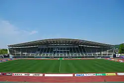
The sports teams listed below are based in Okayama.
Volleyball
Tourism
Some tourist attractions are:
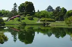
- Koraku-en Japanese garden in Okayama
- Okayama Castle, Okayama
- Ki Castle, Sōja
- Shizutani School, Bizen
- Bikan Historical Area (倉敷美観地区, Kurashiki Bikan Chiku), Kurashiki
- Bitchu Matsuyama Castle, Takahashi
- Kakuzan Park, Tsuyama
- Bisei Astronomical Observatory (美星天文台, Bisei Tenmondai), Ibara Town (following dissolution of Bisei Town)
- Maki-do Cave, in Niimi
Notable people

- Shin Koyamada, Hollywood actor[12]
- Yuko Arimori, marathon runner[13]
- Tesshō Genda, voice actor
- Ryutaro Hashimoto, Kiichiro Hiranuma, Inukai Tsuyoshi, former Prime Ministers of Japan
- Sen'ichi Hoshino, baseball manager
- Koshi Inaba, singer
- Ichiyo Izawa, pianist and former member of Tokyo Jihen
- Yoshio Nishina, known as the Father of Physics in Japan
- Yumeji Takehisa, famous and influential early 20th century artist
- Sesshu Toyo, suiboku master
- Joichiro Tatsuyoshi, boxer
- Haruka Fukushima, manga artist
- Masashi Kishimoto, manga artist and creator of Naruto[14]
- Seishi Kishimoto, manga artist
- Daisuke Takahashi, Olympic figure skater
- Dorlis, jazz musician
- Miyamoto Musashi, samurai
- Megumi Fujii, MMA Fighter
- Masaki Kajishima, creator of Tenchi Muyo!
- Morihiro Hashimoto, darts player
Notes
- Nussbaum, Louis-Frédéric. (2005). "Okayama-ken" in Japan Encyclopedia, p. 745, p. 745, at Google Books; "Chūgoku" at p. 127, p. 127, at Google Books.
- Nussbaum, "Okayama" at p. 745, p. 745, at Google Books.
- "Okayama Prefecture". Encyclopedia of Japan. Tokyo: Shogakukan. 2012. OCLC 56431036. Archived from the original on August 25, 2007. Retrieved 2012-08-01.
- "岡山(県)" [Okayama Prefecture]. Nihon Daihyakka Zensho (Nipponika) (in Japanese). Tokyo: Shogakukan. 2012. OCLC 153301537. Archived from the original on August 25, 2007. Retrieved 2012-08-15.
- Nussbaum, "Provinces and prefectures" at p. 780, p. 780, at Google Books.
- Okayama official website Archived 2013-01-02 at the Wayback Machine accessed Nov. 2007
- "General overview of area figures for Natural Parks by prefecture" (PDF). Ministry of the Environment. 1 April 2014. Archived (PDF) from the original on 21 April 2012. Retrieved 19 February 2015.
- Okayama 1995-2020 population statistics
- Okayama 1920-2000 population statistics
- "岡山県作陽高等学校". www.sakuyo-h.ed.jp. Archived from the original on 11 January 2018. Retrieved 24 April 2018.
- "Okayama History". Archived from the original on 22 May 2012. Retrieved 24 June 2012.
- "Shin Koyamada's IMDB Biography". Archived from the original on 2013-03-27.
- "Yuko Arimori's profile".
- "Masashi Kishimoto's Biography on TV.com". Archived from the original on 2013-08-17.
References
- Nussbaum, Louis-Frédéric and Käthe Roth (2005). Japan Encyclopedia. Cambridge: Harvard University Press. ISBN 978-0-674-01753-5; OCLC 58053128.
External links
| Wikimedia Commons has media related to Okayama prefecture. |
| Wikivoyage has a travel guide for Okayama prefecture. |
- Official website
- Official tourism site
- Official account's channel on YouTube
 Geographic data related to Okayama Prefecture at OpenStreetMap
| Authority control |
|---|