Kyoto Prefecture
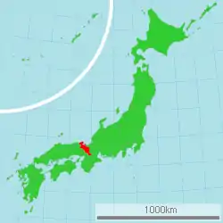
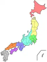
Kyoto Prefecture (京都府, Kyōto-fu) is a prefecture of Japan located in the Kansai region of Honshu.[1](pp477,587) Kyoto Prefecture has a population of 2,610,353 (as of 1 October 2015) and has a geographic area of 4,612 square kilometres (1,781 sq mi). Kyoto Prefecture borders Fukui Prefecture to the northeast, Shiga Prefecture to the east, Mie Prefecture to the southeast, Nara Prefecture and Osaka Prefecture to the south, and Hyogo Prefecture to the west.
Kyoto Prefecture
京都府 | |||||||||||||
|---|---|---|---|---|---|---|---|---|---|---|---|---|---|
| Japanese transcription(s) | |||||||||||||
| • Japanese | 京都府 | ||||||||||||
| • Rōmaji | Kyōto-fu | ||||||||||||
 Flag  Symbol | |||||||||||||
 | |||||||||||||
| |||||||||||||
| Coordinates: 35°1′18″N 135°45′20.2″E | |||||||||||||
| Country | |||||||||||||
| Region | Kansai | ||||||||||||
| Island | Honshu | ||||||||||||
| Capital | Kyoto City | ||||||||||||
| Subdivisions | Districts: 6, Municipalities: 26 | ||||||||||||
| Government | |||||||||||||
| • Governor | Takatoshi Nishiwaki | ||||||||||||
| Area | |||||||||||||
| • Total | 4,612.19 km2 (1,780.78 sq mi) | ||||||||||||
| Area rank | 31st | ||||||||||||
| Population (1 October 2015) | |||||||||||||
| • Total | 2,610,353 | ||||||||||||
| • Rank | 13th | ||||||||||||
| • Density | 566/km2 (1,470/sq mi) | ||||||||||||
| ISO 3166 code | JP-26 | ||||||||||||
| Website | www | ||||||||||||
| |||||||||||||
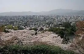
Kyoto is the capital and largest city of Kyoto Prefecture, with other major cities including Uji, Kameoka, and Maizuru.[1](pp565-587) Kyoto Prefecture is located on the Sea of Japan coast and extends to the southeast towards the Kii Peninsula, covering territory of the former provinces of Yamashiro, Tamba, and Tango. Kyoto Prefecture is centered on the historic Imperial capital of Kyoto, and is one of Japan's two "prefectures" using the designation fu rather than the standard ken for prefectures. Kyoto has made Kyoto Prefecture one of the most popular tourism destinations in Japan for national and international tourists, and 21% of the prefecture's land area was designated as Natural Parks. Kyoto Prefecture forms part of the Keihanshin metropolitan area, the second-most-populated region in Japan after the Greater Tokyo area and one of the world's most productive regions by GDP.
History
Until the Meiji Restoration, the area of Kyoto Prefecture was known as Yamashiro.[1](p780)
For most of its history, the city of Kyoto was Japan's Imperial capital. The city's history can be traced back as far as the 6th century. In 544, the Aoi Matsuri was held in Kyoto to pray for good harvest and good weather.
Kyoto did not start out as Japan's capital. A noteworthy earlier capital was Nara. In 741, Emperor Shōmu moved the capital briefly to Kuni-kyo, between the cities of Nara and Kyoto, in present-day Kyoto Prefecture. In 784, the capital was moved to Nagaokakyō, also in present-day Kyoto Prefecture. In 794, Emperor Kanmu moved the capital to Heian-kyō, and this was the beginning of the current-day city of Kyoto. Even today, almost all of the streets, houses, stores, temples and shrines in Kyoto exist where they were placed in this year.
Although in 1192 real political power shifted to Kamakura, where a samurai clan established the shogunate, Kyoto remained the imperial capital as the powerless emperors and their court continued to be seated in the city. Imperial rule was briefly restored in 1333, but another samurai clan established a new shogunate in Kyoto three years later.
In 1467, a great civil war, the Ōnin War, took place inside Kyoto, and most of the town was burned down. Japan plunged into the age of warring feudal lords. A new strong man, Tokugawa Ieyasu, established the shogunate at Edo (today's Tokyo) in 1603.
In the 15th century AD, tea-jars were brought by the shōguns to Uji in Kyoto from the Philippines which was used in the Japanese tea ceremony.[2]
The Meiji Restoration returned Japan to imperial rule in 1868. Emperor Meiji, who was now the absolute sovereign, went to stay in Tokyo during the next year. The imperial court has not returned to Kyoto since then. During the instigation of Fuhanken Sanchisei in 1868, the prefecture received its suffix fu. The subsequent reorganization of the old provincial system merged the former Tango Province, Yamashiro Province and the eastern part of Tanba Province into today's Kyoto Prefecture.
Although many Japanese major cities were heavily bombed during World War II, the old capital escaped such devastation.[3] During the occupation, the U.S. Sixth Army was headquartered in Kyoto.[4]
Geography
| Year | Pop. | ±% |
|---|---|---|
| 1885 | 846,761 | — |
| 1890 | 894,928 | +5.7% |
| 1900 | 1,022,695 | +14.3% |
| 1910 | 1,197,473 | +17.1% |
| 1920 | 1,287,147 | +7.5% |
| 1930 | 1,552,832 | +20.6% |
| 1940 | 1,729,993 | +11.4% |
| 1950 | 1,832,934 | +6.0% |
| 1960 | 1,993,403 | +8.8% |
| 1970 | 2,250,087 | +12.9% |
| 1980 | 2,527,330 | +12.3% |
| 1990 | 2,602,460 | +3.0% |
| 2000 | 2,644,391 | +1.6% |
| 2010 | 2,636,092 | −0.3% |
| 2015 | 2,610,353 | −1.0% |
| Source: Information Policy Division, Policy Planning Department, Kyoto Prefecture[5] | ||
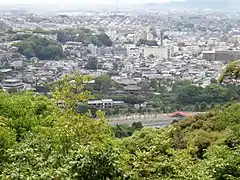
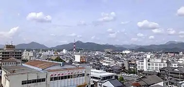
Kyoto Prefecture is almost in the center of Honshu and of Japan. It covers an area of 4,612.19 square kilometres (1,780.78 sq mi), which is 1.2% of Japan. Kyoto is 31st by size. To the north, it faces the Sea of Japan and Fukui Prefecture. To the south, it faces Osaka and Nara Prefectures. To the east, it faces Mie and Shiga Prefectures. To its west is Hyōgo Prefecture. The prefecture is separated in the middle by the Tanba Mountains. This makes its climate very different in the north and south.
As of April 2016, 21% of the prefecture's land area was designated as Natural Parks, namely Sanin Kaigan National Park; Biwako, Kyoto Tamba Kogen, Tango-Amanohashidate-Ōeyama and Wakasa Wan Quasi-National Parks; and Hozukyō, Kasagiyama, and Rurikei Prefectural Natural Parks.[6]
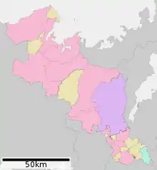
Cities
Fifteen cities are located in Kyoto Prefecture:
Kansai Science City is located in the southwest.
Mergers
Economy
| Year | US$ |
|---|---|
| 1975 | 4,746 |
| 1980 | 8,375 |
| 1985 | 12,799 |
| 1990 | 18,128 |
| 1995 | 21,190 |
| 2000 | 24,692 |
| 2005 | 29,256 |
| 2010 | 33,058 |
| 2015 | 38,567 |
Kyoto prefecture's economy is supported by industries that create value that is unique to Kyoto, such as the tourism and traditional industries supported by 1,200 years of history and culture, as well as high-technology industries that combine the technology of Kyoto's traditional industries with new ideas.[9]
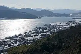
Northern Kyoto on the Tango Peninsula has fishing and water transportation, and midland Kyoto has agriculture and forestry. The prefecture produces 13% of the domestic sake and green tea. Japan's largest vertical farm is located in the prefecture.[10]
The Kyoto-based manufacturing industry holds shares of Japan's high-technology product markets and others. As of 2018, six Forbes Global 2000 companies were located in Kyoto prefecture: Nidec, Kyocera, Murata Manufacturing, Nintendo, Omron, Bank of Kyoto. Takara Holdings, GS Yuasa, SCREEN Holdings, Mitsubishi Logisnext, Maxell, and Kyoto Animation are based in the prefecture.
As of September 2020, the minimum wage in the prefecture was ¥909 per hour.[11]
Culture
Kyoto has been, and still remains, Japan's cultural center.[12][13] For over 1000 years it was Japan's capital. When the capital was changed to Tokyo, Kyoto remained Japan's cultural capital. The local government proposes a plan to move the Agency for Cultural Affairs to Kyoto and to regard Tokyo as the capital of politics and economy and Kyoto as the capital of culture.[14] See Culture of Japan.
.JPG.webp) Togetsu Bridge in Arashiyama
Togetsu Bridge in Arashiyama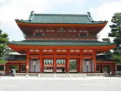
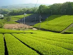 Japanese tea plantation
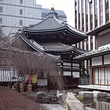 Rokkaku-dō, where a school of the Japanese flower arrangement originated from.
Education
Colleges and universities
- Bukkyo University
- Doshisha University
- Doshisha Women's College of Liberal Arts
- Doshisha Women's Junior College
- Hanazono University
- Heian Jogakuin University
- Ikenobo College
- Kacho College
- Kyoto Bunkyo University
- Kyoto Bunkyo Junior College
- Kyoto City University of Arts
- Kyoto College of Economics
- Kyoto College of Graduate Studies for Informatics
- Kyoto College of Medical Science
- Kyoto College of Nursing
- Kyoto Institute of Technology
- Kyoto Junior College of Foreign Languages
- Kyoto Kacho University
- Kyoto Koka Women's University
- Kyoto Koka Women's College
- Kyoto Notre Dame University
- Kyoto Pharmaceutical University
- Kyoto Prefectural University
- Kyoto Prefectural University of Medicine
- Kyoto Saga Art College
- Kyoto Saga University of Arts
- Kyoto Sangyo University
- Kyoto Seika University
- Kyoto Seizan College
- Kyoto Tachibana University
- Kyoto University
- Kyoto University of Advanced Science
- Kyoto University of the Arts
- Kyoto Arts and Crafts University
- Kyoto University of Education
- Kyoto University of Foreign Studies
- Kyoto Women's University
- Meiji University of Integrative Medicine
- Ōtani University
- Otani University Junior College
- Ritsumeikan University
- Ryukoku University
- Ryukoku University Faculty of Junior College
- Shuchiin University
- University of Fukuchiyama
Sports
The sports teams listed below are based in Kyoto.
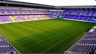
Football (soccer)
- Kyoto Sanga F.C. (J2 League)
- Amitie SC Kyoto (Kansai Soccer League)
- AS. Laranja Kyoto (Kansai Soccer League)
- Bunnys Kyoto SC (Japan Women's Football League)
Basketball
Baseball
- Kyoto Flora (Japan Women's Baseball League)
Rugby
- Mitsubishi Motors Kyoto Red Evoluitions (Top West)
Transportation
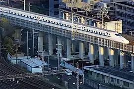
Rail
Ports
Expressways
- Meishin Expressway
- Hanshin Expressway
- Second Keihan Highway
- Keiji(Kyoto-Shiga) Bypass
- Maizuru Wakasa Expressway
- Keinawa(Kyoto-Nara-Wakayama) Expressway
- Kyoto-Jukan Expressway
- San'in Kinki Expressway
National highways
- Route 1
- Route 9 (Kyoto-Fukuchiyama-Tottori-Yonago-Izumo-Hamada-Yamaguchi)
- Route 24 (Kyoto-Nara-Kashihara-Hashimoto-Wakayama)
- Route 27 (Tanba-Maizuru-Tsuruga)
- Route 162
- Route 163
- Route 171 (Kyoto-Takatsuki-Minoo-Itami-Nishinomiya)
- Route 173
- Route 175 (Akashi-Nishiwaki-Fukuchiyama-Maizuru)
- Route 176 (Osaka-Sanda-Sasayama-Fukuchiyama-Miyazu)
- Route 178
- Route 307
- Route 312
- Route 372 (Kameoka-Sasayama-Kasai-Himeji)
- Route 423
- Route 426
- Route 429
- Route 477
- Route 478
Tourism
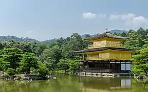
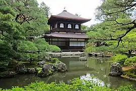
The city of Kyoto is one of the most popular tourist spots in Japan, and many people from far and wide visit there. Along with Tokyo, Kyoto is a favorite location for the graduation trip of Junior High and High schools.
Some of the festivals held in Kyoto are Aoi Matsuri from 544, Gion Matsuri from 869, Ine Matsuri from the Edo-era, Daimonji Gozan Okuribi from 1662, and Jidai Matsuri from 1895. Every shrine and temple holds some sort of event, and many of them are open for public viewing.
Defense facilities
On 1 August 2013, prefectural and municipal authorities gave consent for a USFJ missile monitoring station to be set up in the city of Kyōtango. It will be co-located with a JASDF facility already based in the city. At least initially, its primary sensor will be a mobile X-band radar used to gather data on ballistic missile launches which will then be relayed by the station to warships equipped with Aegis air defense systems and to ground-based interceptor missile sites. A hundred and sixty personnel will be based at the station.[15]
Politics
The current governor of Kyoto is Takatoshi Nishiwaki, a former vice minister of the Reconstruction Agency. He has been elected in April 2018.[16]
The previous governor of Kyoto is former Home Affairs Ministry bureaucrat Keiji Yamada. He has been reelected to a fourth term in April 2014 with support from the major non-Communist parties against only one JCP-supported challenger.[17][18][19]
The prefectural assembly has 60 members from 25 electoral districts and is still elected in unified local elections (last round: 2019). As of September 2020, it was composed as follows: Liberal Democratic Party 30, Japanese Communist Party 12, Democratic Party 11, Kōmeitō 5, Japan Restoration Party 2.[20]
Kyoto's delegation to the National Diet consists of six members of the House of Representatives and four members (two per election) of the House of Councillors. After the national elections of 2016, 2017 and 2019, the prefecture is represented by four Liberal Democrats and two Democrats in the lower house, and two Liberal Democrats, one Democrat and one Communist in the upper house.
Prefectural symbols
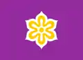
The prefectural flower of Kyoto is the weeping cherry. The Kitayama Sugi is the official tree, and the streaked shearwater the bird that symbolizes the prefecture.
Sister areas
Kyoto Prefecture has sister relationships with these places:[21]
These relationships are distinct from those of cities in Kyoto Prefecture with other cities.
References
- Frédéric, Louis (31 May 2002). Japan Encyclopedia. Translated by Roth, Käthe. Harvard University Press. ISBN 978-0674007703. OCLC 58053128. OL 7671330M.
- Manansala, Paul Kekai (5 September 2006). "Quests of the Dragon and Bird Clan: Luzon Jars (Glossary)".
- Oi, Mariko (9 August 2015). "The city saved from the atomic bomb". Retrieved 16 January 2019.
- Chronology of the Occupation
- "[Kyōtofu] Kyōtofu no jinkō nenji betsu suii" 【京都府】京都府の人口年次別推移 [[Kyoto Prefecture] Changes in Kyoto Prefecture by population year] (in Japanese). Kyoto Prefecture. Information Policy Division, Policy Planning Department. n.d. Archived from the original on 6 August 2020. Retrieved 12 November 2020.
- "General overview of area figures for Natural Parks by prefecture" (PDF) (in Japanese). Ministry of the Environment. 15 April 2016. Retrieved 12 June 2016.
- "Kokumin Keizai Keisan (GDP Tōkei) > Kenmin Keizai Keisan" 国民経済計算(GDP統計) > 県民経済計算 [National Accounts (GDP Statistics)> Prefectural Accounts] (in Japanese). Government of Japan. Cabinet Office. 14 October 2020. Archived from the original on 13 November 2020. Retrieved 12 November 2020.
- "Purchasing power parities (PPP)". OECD. Retrieved 16 October 2017.
- "Kyoto Prefecture Financial Profile and Fiscal Reforms" (PDF). October 2017. Retrieved 17 May 2018.
- "The only way is up: Vertical farming in Kyoto". CNN. 19 September 2016.
- 地域別最低賃金の全国一覧 [List of minimum wages by region] (in Japanese). Ministry of Health, Labour and Welfare. Retrieved 8 September 2018.
- Kyoto | History, Geography, & Points of Interest | Britannica.com
- Shinzō Abe (18 November 2018). Committee on Budget. The 190th ordinary session of the Diet (in Japanese). 8. House of Representatives. Archived from the original on 14 December 2017. Retrieved 18 November 2018.
京都というのは文化的な中心
- Shigefumi Matsuzawa (7 June 2018). Committee on Education, Culture and Science. The 196th ordinary session of the Diet (in Japanese). 14. House of Councillors.
政治経済の首都東京に対して文化の首都京都をつくっていく、そういう双眼構造、二元構造にする
- U.S. to deploy mobile radar in Kyoto Prefecture to detect missile launches Archived 2013-08-12 at the Wayback Machine The Asahi Shimbun, 2 August 2013
- "Nishiwaki triumphs in Kyoto gubernatorial race, vows to continue policies of predecessor". The Japan Times. 8 April 2018.
- Asahi Shimbun, 6 April 2014: 京都知事に山田氏、4選 新顔の尾崎氏破る
- Yomiuri Shimbun, 6 April 2014: 京都府知事選、現職の山田啓二氏が4選
- The Japan Times, 7 April 2014: Kyoto re-elects Yamada to top post
- Kyoto Prefectural Assembly: caucuses (in Japanese)
- International Exchange: Regions with Friendly Ties to Kyoto Prefecture Retrieved 29 November 2015
- "Peringatan 25 Tahun Sister City Kyoto-Yogya, Kedua Kota Mendapat Manfaat" (in Indonesian). Koran Tempo. 6 October 2010. Retrieved 20 May 2014.
- "Edinburgh – Twin and Partner Cities". 2008 The City of Edinburgh Council, City Chambers, High Street, Edinburgh, EH1 1YJ Scotland. Archived from the original on 28 March 2008. Retrieved 21 December 2008.
- "Twin and Partner Cities". City of Edinburgh Council. Archived from the original on 14 June 2012. Retrieved 16 January 2009.
- "Communiqué du 26 mai 2016 – Signature d'une première entente de collaboration entre le Québec et la préfecture de Kyoto". www.premier-ministre.gouv.qc.ca.
External links
| Wikimedia Commons has media related to Kyoto prefecture. |
- Official Kyoto Prefecture website
- Kyoto Prefectural International Center
- Kyoto Prefecture Tourism Guide
- Kyoto Visitors Guide
 Kyoto Prefecture travel guide from Wikivoyage
| Authority control |
|---|