Pangil
Pangil, officially the Municipality of Pangil (Tagalog: Bayan ng Pangil), is a 4th class municipality in the province of Laguna, Philippines. According to the 2015 census, it has a population of 24,274 people. [3]
Pangil | |
|---|---|
| Municipality of Pangil | |
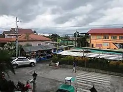 Downtown area | |
 Seal | |
| Nickname(s): "Tunay na Bayan ni Maria" "The Home of Nuestra Señora and Santo Niño De La O" | |
| Anthem: Pangil Hymn | |
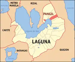 Map of Laguna with Pangil highlighted | |
OpenStreetMap 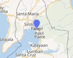
| |
.svg.png.webp) Pangil Location within the Philippines | |
| Coordinates: 14°24′N 121°28′E | |
| Country | |
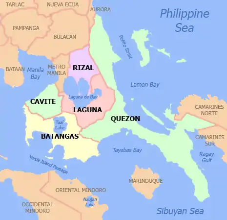
| Region | Calabarzon (Region IV-A) |
| Province | Laguna |
| District | 4th District |
| Founded | September 8, 1579 |
| Barangays | 8 (see Barangays) |
| Government | |
| • Type | Sangguniang Bayan |
| • Mayor | Gerald A. Aritao |
| • Vice Mayor | Divine Grace Astoveza |
| • Representative | Benjamin C. Agarao Jr. |
| • Electorate | 15,199 voters (2019) |
| Area | |
| • Total | 45.03 km2 (17.39 sq mi) |
| Elevation | 188 m (617 ft) |
| Population | |
| • Total | 24,274 |
| • Density | 540/km2 (1,400/sq mi) |
| • Households | 5,393 |
| Economy | |
| • Income class | 4th municipal income class |
| • Poverty incidence | 8.61% (2015)[4] |
| • Revenue | ₱78,215,830.17 (2016) |
| Time zone | UTC+8 (PST) |
| ZIP code | 4018 |
| PSGC | |
| IDD : area code | +63 (0)49 |
| Climate type | tropical monsoon climate |
| Native languages | Tagalog |
Etymology
According to a paper entitled "Alamat ng Pangil, Laguna" written by Santiago T. Adre, there are three commonly believed and popular theories from which the name "Pangil" was derived.
One theory reveals that the town derived its name from the peculiar shape of the land area of the town looked like especially when viewed from a high place. The town's shape resmbles a wild boar's Fang.
The second theory shows that the town's name was derived from the name of the pioneer settlers in this area who were known as "Panguilagan". The town was eventually given the name "Panguil" (this is the spelling which appears in moost Spanish Era documents) because most of the Spaniards had a hard time pronouncing the original term "Panguilagan".
The last theory discloses that the town's first pre-Hispanic leader, a certain "Gat Paguil". When the Spaniards had reached the area, it was this leader whom they recognized and talked with.
It was when the Americans came and took control of the Philippines in 1898, that the former name "Panguil" became what its present name "Pangil".
History
The town is one of the oldest settlements in Laguna, rich in Hispanic, American and Japanese history. Discovered artifacts of the 12th century Ming and Sung Dynasty were attributed to Chinese immigrants and traders who settled in this place then. According to oral literature, the first leader of the area, which now encompasses four separate towns, was Gat Pangil, who united four ancient settlements to establish a Tagalog kingdom in the area. During the Hispanic period, Pangil became a staging ground of the Spanish missionaries in Christian Evangelization drive in 1578 in the provinces of Rizal, Laguna and Tayabas until it gained recognition as a town through the Franciscan friars in the year 1579.
Pangil has a high advocacy for environmental protection and fast becoming a hub for ecotourism. Vested with all sorts of natural attributes, such as clean and pristine water included its natural falls, rivers, nature trails, forest, communities by the lake, cool breeze by the lake, Baguio-like microclimate in its upland, represents a wide array of highland, lowland and lake-ecosystems. It’s also holds a vast of natural attributes that a small and simple town can possibly be contented of and when these resources are sustainably developed. And can contribute to provide all its need to move forward as a very progressive yet an environment-friendly municipality.
The municipality is strategically situated at the southern tip of Sierra Madre mountain range (six barangays) and along the eastern margin of Jalajala Peninsula and just west of the northwestern shore of the easternmost major embayment of Laguna de Bay (two barangays). Its narrow strip of territory traverses in its length by Pangil River (12.5 km long), valued for its pristine and abundant water contributing to its domestic, agricultural, ecotourism and other potential economic uses like bulk water and hydropower. Its topography is generally flat in between rolling and steep hills.
Currently, based on the results of the Barangay Information Management System (BIMS) data, the municipality of Pangil has a total population of 27,711 consisting of 5,728 households, with about 4.84 average household size. Of the eight (8) barangays of Pangil, five (5) are classified as urban barangays which is actually the communities that compose the town proper, one (1) rural barangay in the upland and two (2) other rural barangays across the lake.
King Charles III in Pangil
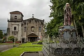
One of the revered myths in the town of Pangil is the belief that in the year 1724, Prince Carlos, the son of King Philip V of Spain, was banished from his country and was sent to the Philippines. The young prince stayed in the town for three years and resided with the Franciscans in the adjoining convent of the Paroquia del Nuestra Señora de la Natividad Church considered then as the biggest in Laguna. The prince was a known hunter and he enjoyed his stay in the Sierra Madre mountain range that was known as a good hunting ground for wild animals and fowls. He was also very fond of the creek that branched out from the Pangil River and now called as the Bambang Hari or King’s Canal.
By the year 1728, the King lifted the ban on the Prince and ordered the latter to return to their kingdom. With his ascension to the throne of Spain as King Charles III , he ordered his emissaries to send the statue of Nuestra Seńora de la O (Our Lady of Expectation) and the statue of Santo Nińo de la O (Holy Child of Expectation) as a sign of gratitude and appreciation to the Pangilenians for the hospitality and kindness that was accorded to him. Although this story is a source of pride among the Pangilenos, there is nothing in the historical records of the archives of the Franciscan Province in the Philippines or the Archdiocese of Manila, or the Ministerio del Ultramar in Madrid that could corroborate this folk history.
Barangays
Climate
| Climate data for Pangil, Laguna | |||||||||||||
|---|---|---|---|---|---|---|---|---|---|---|---|---|---|
| Month | Jan | Feb | Mar | Apr | May | Jun | Jul | Aug | Sep | Oct | Nov | Dec | Year |
| Average high °C (°F) | 26 (79) |
27 (81) |
29 (84) |
31 (88) |
31 (88) |
30 (86) |
29 (84) |
29 (84) |
29 (84) |
29 (84) |
28 (82) |
26 (79) |
29 (84) |
| Average low °C (°F) | 22 (72) |
22 (72) |
22 (72) |
23 (73) |
24 (75) |
25 (77) |
24 (75) |
24 (75) |
24 (75) |
24 (75) |
24 (75) |
23 (73) |
23 (74) |
| Average precipitation mm (inches) | 58 (2.3) |
41 (1.6) |
32 (1.3) |
29 (1.1) |
91 (3.6) |
143 (5.6) |
181 (7.1) |
162 (6.4) |
172 (6.8) |
164 (6.5) |
113 (4.4) |
121 (4.8) |
1,307 (51.5) |
| Average rainy days | 13.4 | 9.3 | 9.1 | 9.8 | 19.1 | 22.9 | 26.6 | 24.9 | 25.0 | 21.4 | 16.5 | 16.5 | 214.5 |
| Source: Meteoblue [5] | |||||||||||||
Demographics
| Year | Pop. | ±% p.a. |
|---|---|---|
| 1903 | 2,200 | — |
| 1918 | 4,424 | +4.77% |
| 1939 | 3,889 | −0.61% |
| 1948 | 4,156 | +0.74% |
| 1960 | 5,364 | +2.15% |
| 1970 | 8,118 | +4.23% |
| 1975 | 9,263 | +2.68% |
| 1980 | 10,519 | +2.57% |
| 1990 | 15,212 | +3.76% |
| 1995 | 17,664 | +2.84% |
| 2000 | 20,698 | +3.46% |
| 2007 | 23,421 | +1.72% |
| 2010 | 23,201 | −0.34% |
| 2015 | 24,274 | +0.86% |
| Source: Philippine Statistics Authority [3] [6] [7][8] | ||
In the 2015 census, the population of Pangil was 24,274 people, [3] with a density of 540 inhabitants per square kilometre or 1,400 inhabitants per square mile.
Municipal Mayors
Under the American Civil Government:
- 1900-1905 Antonio A. Fabricante
- 1906-1907 Pedro Dalena
- 1908-1909 Agustin Martinez
- 1910-1912 Roman Maulawin
- 1913-1919 Engracio Balita
- 1920-1922 Victor Acapulco
- 1923-1925 Antonio Aclan
- 1926-1928 Abraham de Guia
- 1929-1934 Santiago T. Adre
During the Commonwealth Period:
- 1935-1937 Canuto Galvez
- 1938-1940 Esteban C. Icarangal
During World War II:
- 1941-1945 Zoilo Pajarillo
During the post- war period:
- 1946-1947 Santiago T. Adre
- 1948-1955 Alfredo M. Fabricante
- 1956-1959 Pastor de Ramos
- 1960-1963 Geminiano C. Gualberto
During the Marcos dictatorship:
- 1964-1967 Cristobal T. Demery
- 1968-1971 Geminiano C. Gualberto
- 1972-1979 Pedro D. Aritao
During the Contemporary Period:
- 1980-1992 Dominador V. Manzana
- 1992-1995 Valentin B. Santa Ana
- 1995-2004 Sergio C. Manzana
- 2004-2013 Juanita C. Manzana
- 2013-2016 Jovit Reyes
- 2016-2019 Oscar Rafanan
- 2019-2020 Jovit Reyes
- 2020–present Gerald A. Aritao
Image gallery
 Public market
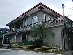 Pangil Town Hall
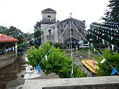 Church and plaza
 Rice field at Pangil
References
- Municipality of Pangil | (DILG)
- "Province: Laguna". PSGC Interactive. Quezon City, Philippines: Philippine Statistics Authority. Retrieved 12 November 2016.
- Census of Population (2015). "Region IV-A (Calabarzon)". Total Population by Province, City, Municipality and Barangay. PSA. Retrieved 20 June 2016.
- "PSA releases the 2015 Municipal and City Level Poverty Estimates". Quezon City, Philippines. Retrieved 1 January 2020.
- "Pangil: Average Temperatures and Rainfall". Meteoblue. Retrieved 11 May 2020.
- Census of Population and Housing (2010). "Region IV-A (Calabarzon)". Total Population by Province, City, Municipality and Barangay. NSO. Retrieved 29 June 2016.
- Censuses of Population (1903–2007). "Region IV-A (Calabarzon)". Table 1. Population Enumerated in Various Censuses by Province/Highly Urbanized City: 1903 to 2007. NSO.
- "Province of Laguna". Municipality Population Data. Local Water Utilities Administration Research Division. Retrieved 17 December 2016.
External links
| Wikimedia Commons has media related to Pangil, Laguna. |
- Pangil Profile at PhilAtlas.com
- Philippine Standard Geographic Code
- Philippine Census Information
- Local Governance Performance Management System
Eastern part (includes the poblacion) | ||||||||||
|---|---|---|---|---|---|---|---|---|---|---|
| ||||||||||
Western part (includes barangays Dambo, Mabato-Azufre) | ||||||||||
|---|---|---|---|---|---|---|---|---|---|---|
| ||||||||||
Santa Cruz (capital) | ||
| Municipalities |  | |
| Component Cities | ||
| Barangays | ||