Taal, Batangas
Taal ([taʔal]), officially the Municipality of Taal (Tagalog: Bayan ng Taal), is a 3rd class municipality in the province of Batangas, Philippines. According to the 2015 census, it has a population of 56,327 people. [3]
Taal | |
|---|---|
| Municipality of Taal | |
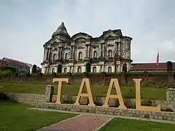 Minor Basilica of Saint Martin of Tours | |
 Seal | |
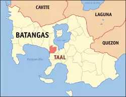 Map of Batangas with Taal highlighted | |
OpenStreetMap 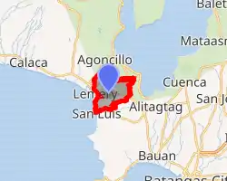
| |
.svg.png.webp) Taal Location within the Philippines | |
| Coordinates: 13°53′N 120°56′E | |
| Country | |
| Region | Calabarzon (Region IV-A) |
| Province | Batangas |
| District | 1st District |
| Founded | April 26, 1572 |
| Barangays | 42 (see Barangays) |
| Government | |
| • Type | Sangguniang Bayan |
| • Mayor | Fulgencio I. Mercado |
| • Vice Mayor | Jovito M. Albufera |
| • Representative | Elenita R. Ermita-Buhain |
| • Electorate | 37,188 voters (2019) |
| Area | |
| • Total | 29.76 km2 (11.49 sq mi) |
| Elevation | 63 m (207 ft) |
| Population | |
| • Total | 56,327 |
| • Density | 1,900/km2 (4,900/sq mi) |
| • Households | 11,900 |
| Economy | |
| • Income class | 3rd municipal income class |
| • Poverty incidence | 5.45% (2015)[4] |
| • Revenue | ₱126,663,130.62 (2016) |
| Time zone | UTC+8 (PST) |
| ZIP code | 4208 |
| PSGC | |
| IDD : area code | +63 (0)43 |
| Climate type | tropical monsoon climate |
| Native languages | Tagalog |
Taal is famous for its old ancestral houses, one particular ancestral house (now a museum) where Marcela Coronel Mariño de Agoncillo grew up in Taal, Batangas built in the 1770s by her grandparents, Don Andres Sauza Mariño and Doña Eugenia Diokno Mariño, (added by Slavstan Mariño). Its poblacion (central business district) is designated as a National Historical Landmark.[5] The municipality is known as the Balisong and Barong Tagalog Capital of the Philippines. The town is home to hundreds of heritage structures dating from the Spanish colonial period. Scholars have been pushing for its inclusion in the UNESCO World Heritage List.
History
The town of Taal was founded by Augustinian friars in 1572.[6] In 1575, the town transferred later to the edge of Domingo lake, now Taal Lake in 1575. In 1754, Taal Volcano erupted endangering the town of Taal which stood at present day San Nicolas. Threatened by the new danger, the townspeople, together with the Augustinian Francisco Benchucillo, sought refuge in the sanctuary of Caysasay.[7][8]
In 1955 the northern barrios of San Nicolas, Gipit, Bangin, Pansipit, Calangay, Sinturisan, Talang, Abilo, Balete, Bancora, Saimsim, Maabud, Mulawin, Tambo, Calumala, Alasas, Calawit, and Pulangbato were separated from Taal and formed into the municipality of San Nicolas.[9]
Geography
According to the Philippine Statistics Authority, the municipality has a land area of 29.76 square kilometres (11.49 sq mi) [2] constituting 0.95% of the 3,119.75-square-kilometre- (1,204.54 sq mi) total area of Batangas.
A dominant feature of the province of Batangas is Taal Lake. It covers an area of 270 square kilometres (100 sq mi) and is drained by Pansipit River down into Balayan Bay. Pansipit is one of the major ecological highways that allow migration of two fish species: maliputo (Cranx ignobilis) and muslo (Cranx marginalis) which are unique to lake Taal. Adult fish migrate to the sea from Taal Lake via Pansipit River and Palanas River in Lemery. The tawilis (Harengula tawilis) is a freshwater sardine also endemic to Taal lake.
Climate
Taal has two seasons: dry from November to April, and wet during the rest of the year. The lowest minimum temperature does not drop below 20 °C (68 °F) while the highest maximum temperature of 34.5 °C (94.1 °F) occurs from March to July of each year.
| Climate data for Taal, Batangas | |||||||||||||
|---|---|---|---|---|---|---|---|---|---|---|---|---|---|
| Month | Jan | Feb | Mar | Apr | May | Jun | Jul | Aug | Sep | Oct | Nov | Dec | Year |
| Average high °C (°F) | 28 (82) |
30 (86) |
31 (88) |
33 (91) |
32 (90) |
30 (86) |
29 (84) |
29 (84) |
29 (84) |
29 (84) |
29 (84) |
28 (82) |
30 (85) |
| Average low °C (°F) | 20 (68) |
20 (68) |
20 (68) |
22 (72) |
24 (75) |
24 (75) |
24 (75) |
24 (75) |
24 (75) |
23 (73) |
22 (72) |
21 (70) |
22 (72) |
| Average precipitation mm (inches) | 11 (0.4) |
13 (0.5) |
14 (0.6) |
32 (1.3) |
101 (4.0) |
142 (5.6) |
208 (8.2) |
187 (7.4) |
175 (6.9) |
131 (5.2) |
68 (2.7) |
39 (1.5) |
1,121 (44.3) |
| Average rainy days | 5.2 | 5.0 | 7.4 | 11.5 | 19.8 | 23.5 | 27.0 | 25.9 | 25.2 | 23.2 | 15.5 | 8.3 | 197.5 |
| Source: Meteoblue [10] | |||||||||||||
Cultural events
- The EL PASUBAT Festival, celebrated annually during the month of April, is the conglomeration of the trademarks of Taal. "EL PASUBAT" stands for Empanada, Longganisa, Panutsa, Suman, Balisong, Barong Tagalog, Tapa, Tamales, Tawilis, Tulingan — the delicacies and crafts that Taal is known for.[11]
- The Feast of St. Martin of Tours is held November 11 every year. Celebrations are in the form of prayer, hymns, declamation, flower offerings and big religious processions. Most families celebrate with food and drinks for visitors thereafter.
- The Feast of Our Lady of Caysasay, the well known miraculous image of the Immaculate Conception, is celebrated every December 8. A joint town fiesta celebrated on December 9 honoring both Our Lady of Caysasay and Saint Martin of Tours.
- Lua is a traditional declamation in the vernacular recited by a maiden to honor the Virgin Mary or a boy in praise of a male saint like Saint Martin of Tours. In the procession, young girls and ladies in their pretty gowns make up the hila (pull), so called because they are supposed to pull the cord of lights originating from the Virgin's karosa (procession carriage) bedecked with flowers.
Barangays
Taal is politically subdivided into 42 barangays.[12]
| PSGC | Barangay | Population | ±% p.a. | |||
|---|---|---|---|---|---|---|
| 2015 [3] | 2010 [13] | |||||
| 041029001 | Apacay | 3.8% | 2,117 | 1,955 | 1.53% | |
| 041029002 | Balisong | 5.5% | 3,097 | 2,839 | 1.67% | |
| 041029003 | Bihis | 1.2% | 702 | 572 | 3.98% | |
| 041029004 | Bolbok | 2.0% | 1,131 | 1,027 | 1.85% | |
| 041029005 | Buli | 7.2% | 4,033 | 3,460 | 2.96% | |
| 041029006 | Butong | 8.7% | 4,926 | 4,627 | 1.20% | |
| 041029007 | Carasuche | 1.4% | 766 | 669 | 2.61% | |
| 041029008 | Cawit | 3.8% | 2,150 | 1,843 | 2.98% | |
| 041029009 | Caysasay | 1.1% | 610 | 577 | 1.06% | |
| 041029010 | Cubamba | 1.6% | 904 | 772 | 3.05% | |
| 041029011 | Cultihan | 3.5% | 1,948 | 1,812 | 1.39% | |
| 041029012 | Gahol | 2.1% | 1,202 | 1,060 | 2.42% | |
| 041029013 | Halang | 2.5% | 1,410 | 1,250 | 2.32% | |
| 041029014 | Iba | 5.3% | 2,962 | 2,633 | 2.27% | |
| 041029015 | Ilog | 2.1% | 1,183 | 1,113 | 1.17% | |
| 041029016 | Imamawo | 1.2% | 700 | 615 | 2.50% | |
| 041029017 | Ipil | 1.4% | 796 | 712 | 2.15% | |
| 041029018 | Luntal | 2.3% | 1,315 | 1,186 | 1.99% | |
| 041029019 | Mahabang Lodlod | 2.2% | 1,218 | 1,089 | 2.15% | |
| 041029020 | Niogan | 0.7% | 411 | 341 | 3.62% | |
| 041029021 | Pansol | 1.6% | 881 | 819 | 1.40% | |
| 041029022 | Poblacion 11 | 0.5% | 294 | 355 | −3.53% | |
| 041029023 | Poblacion 1 | 0.7% | 419 | 401 | 0.84% | |
| 041029024 | Poblacion 10 | 1.2% | 700 | 760 | −1.55% | |
| 041029025 | Poblacion 12 | 0.5% | 283 | 249 | 2.47% | |
| 041029026 | Poblacion 2 | 0.5% | 280 | 323 | −2.68% | |
| 041029027 | Poblacion 3 | 1.3% | 760 | 918 | −3.53% | |
| 041029028 | Poblacion 4 | 0.5% | 284 | 395 | −6.09% | |
| 041029029 | Poblacion 5 | 3.2% | 1,805 | 1,710 | 1.03% | |
| 041029030 | Poblacion 6 | 1.5% | 858 | 828 | 0.68% | |
| 041029031 | Poblacion 7 | 0.3% | 158 | 258 | −8.91% | |
| 041029032 | Poblacion 8 | 1.8% | 1,036 | 761 | 6.05% | |
| 041029033 | Poblacion 9 | 1.7% | 977 | 925 | 1.05% | |
| 041029034 | Pook | 2.3% | 1,316 | 1,077 | 3.89% | |
| 041029044 | Seiran | 5.3% | 2,995 | 2,678 | 2.15% | |
| 041029045 | Laguile | 5.0% | 2,790 | 2,544 | 1.77% | |
| 041029046 | Latag | 1.7% | 960 | 950 | 0.20% | |
| 041029047 | Tierra Alta | 1.7% | 963 | 893 | 1.45% | |
| 041029048 | Tulo | 4.8% | 2,717 | 2,370 | 2.64% | |
| 041029049 | Tatlong Maria | 2.3% | 1,287 | 1,159 | 2.01% | |
| 041029050 | Poblacion 13 | 0.8% | 477 | 449 | 1.16% | |
| 041029051 | Poblacion 14 | 0.9% | 506 | 529 | −0.84% | |
| Total | 56,327 | 51,503 | 1.72% | |||
Demographics
|
| ||||||||||||||||||||||||||||||||||||||||||||||||
| Source: Philippine Statistics Authority [3] [13] [14][15] | |||||||||||||||||||||||||||||||||||||||||||||||||
In the 2015 census, Taal had a population of 56,327. [3] The population density was 1,900 inhabitants per square kilometre (4,900/sq mi).
The first census in 1903 recorded a total population of 17,525. The 2007 population was 51,459 growing at 2.44% annually over the previous 7 years, with 7,961 households. By 2010, the population slightly increased to 51,503.
Local products and delicacies
Since the Spanish period, the people of Taal lived by farming and commerce. The main produce are cotton, cacao and sugar which are made through the use of crude sugar mill called trapeche. Weaving and embroidery of barong and camisa (blouses) made from piña are popular home industries. Local embroidery businesses later expanded their products to include curtains, piano covers, pillow cases, table cloth, table napkins and bed covers, adding more fame already earned by Taal embroidery.
Other products produced in the town are: balisong (fan knife) and various food treats such as the panocha (peanut brittle candy) and suman salehiya (a sweet suman), tapa (cured pork product) and the local longganisa, all of which are available at the public market. Popular Filipino dishes that originated from Taal are Adobo sa Dilaw (Yellow Adobo) and Sinaing na Tulingan (Bonita Fish Soup).
Notable people
Philippine Revolution
- Gliceria de Villavicencio was named as the “godmother of the revolutionary forces” by Gen. Emilio Aguinaldo. She supported the revolution against the Spaniards, and later the Americans inflamed by the death of her husband, Eulalio Villavicencio, in February 1898.
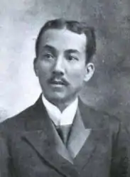
- Felipe Agoncillo is a revolutionary hero, statesman, and diplomat Philippine Republic to the United States and to the Treaty of Paris in 1898.
- Doña Marcela Mariño de Agoncillo is best known as "The Mother of the Philippine Flag", (added by Slavstan Mariño), the maker of the present flag of the Philippines, first unfurled at the declaration of Philippine Independence on June 12, 1898 in Kawit, Cavite.
- Vicente Ilustre was associated with other Filipino patriots like Rizal, Plaridel, Naning Ponce, Galicano Apacible and others in Madrid. He later became a member of the Philippine Commission under Gov. Gen. Francis Burton Harrison where he served as president of the Committee for Mindanao and Sulu. Thereafter, he became a Senator in the First Senate of the Philippines. He was also instrumental in the installation of public light and water utilities in Taal.
- Ananias Diokno was the only Tagalog general to lead a full-scale military expedition to the Visayas against the Spanish forces.
- Galicano Apacible, a cousin of Jose Rizal, was a co-founder of La Solidaridad. He later became a politician and co-founded the Nacionalista Party.
Other notable Taaleños
- Father Fernando Suarez, a Catholic priest known worldwide for faith healing, was born here in 1967.
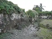
Gallery
(2018-07-30).jpg.webp)
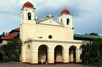 Archdiocesan Shrine of Our Lady of Caysasay
(2018-07-30).jpg.webp) Municipal hall
Municipal hall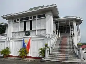 Felipe Agoncillo ancestral house
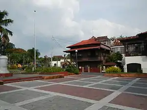
- Taal Plaza
(2018-07-30).jpg.webp) Taal Public Market
Taal Public Market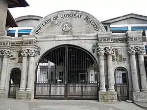 Our Lady of Caysasay Academy gate
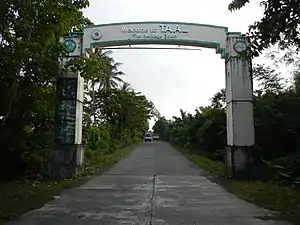 Welcome arch from San Nicolas
See also
- Basilica de San Martin de Tours (Taal) – the biggest Catholic Basilica Church in the Far East
- Our Lady of Caysasay
- Our Lady of Caysasay Academy
References
- Municipality of Taal | (DILG)
- "Province: Batangas". PSGC Interactive. Quezon City, Philippines: Philippine Statistics Authority. Retrieved 12 November 2016.
- Census of Population (2015). "Region IV-A (Calabarzon)". Total Population by Province, City, Municipality and Barangay. PSA. Retrieved 20 June 2016.
- "PSA releases the 2015 Municipal and City Level Poverty Estimates". Quezon City, Philippines. Retrieved 1 January 2020.
- NHCP Historic Preservation Division. "Portion of the Town of Taal". National Registry of Historic Sites & Structures in the Philippines. Retrieved on 2013-07-03.
- Worcester, Dean C. (April 1912). "Taal Volcano and Its Recent Destructive Eruption". The National Geographic Magazine.
- Galende, O.S.A, Pedro G.; Javellana, S.J, Rene B. (1993). Great Churches of the Philippines. pp. 46–47.
- Hargrove, Thomas (1991). The Mysteries of Taal: A Philippine volcano and lake, her sea life and lost towns. Manila: Bookmark Publishing. pp. 24–34, 145–148. ISBN 9715690467.
- "An Act Creating the Municipality of San Nicolas, Province of Batangas". LawPH.com. Retrieved 2011-04-11.
- "Taal: Average Temperatures and Rainfall". Meteoblue. Retrieved 5 May 2020.
- "El Pasubat". Taal Tourism Office.
- "Municipal: Taal, Batangas". PSGC Interactive. Quezon City, Philippines: Philippine Statistics Authority. Retrieved 8 January 2016.
- Census of Population and Housing (2010). "Region IV-A (Calabarzon)". Total Population by Province, City, Municipality and Barangay. NSO. Retrieved 29 June 2016.
- Censuses of Population (1903–2007). "Region IV-A (Calabarzon)". Table 1. Population Enumerated in Various Censuses by Province/Highly Urbanized City: 1903 to 2007. NSO.
- "Province of Batangas". Municipality Population Data. Local Water Utilities Administration Research Division. Retrieved 17 December 2016.
External links
| Wikimedia Commons has media related to Taal, Batangas. |
- Official website
- Official Tourism Website of Taal
- Taal Profile at PhilAtlas.com
- Philippine Standard Geographic Code
- Taal, Batangas Heritage Town
Places adjacent to Taal, Batangas | |
|---|---|
Batangas (capital) | |
| Municipalities | |
| Component cities | |
| Authority control |
|
|---|