Wabasca, Alberta
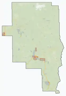
Wabasca, also known as Wabasca-Desmarais, is a hamlet in northern Alberta, Canada, within the Municipal District of Opportunity No. 17.[3] It is located between and along the South and North Wabasca Lakes, at the intersection of highways 813 and 754. It is approximately 123 km (76 mi) northeast of Slave Lake.
Wabasca | |
|---|---|
Hamlet | |
 Wabasca  Wabasca | |
| Coordinates: 55°58′N 113°51′W | |
| Country | Canada |
| Province | Alberta |
| Region | Northern Alberta |
| Municipal district | Opportunity No. 17 |
| Elevation | 550 m (1,800 ft) |
| Population | |
| • Total | 1,569 |
| Time zone | UTC−07:00 (MST) |
| • Summer (DST) | UTC−06:00 (MDT) |
| Area code(s) | +1-780 |
| Highways | Highway 813 Highway 754 |
| Waterways | Wabasca Lakes |
| Website | M.D. of Opportunity No. 17 |
Wabasca, which is the location of the M.D of Opportunity No. 17's municipal office, consists of two communities – Wabasca and Desmarais. The hamlet has a population of 1,569,[1][2] which is largely indigenous. Another 2,207 additional residents live on five Indian reserves in the immediate surrounding area. These First Nations reserves include Wabasca 166, 166A, 166B, 166C and 166D of the Bigstone Cree Nation, a Woodland Cree people.[4]
The name Wabasca originates from the Cree word wâpaskâw, meaning "white grass" the name for the Wabasca River. Desmarais was named after Father Alphonse Desmarais, the first missionary in this area.[5]
A mandatory evacuation order was issued for Wabasca on May 29, 2019, due to multiple wildfires in the region.[6]
Geography
Wabasca's hamlet boundary includes three Statistics Canada census geographic units – the Wabasca and Desmarais designated places and the Desmarais Indian settlement – as well as additional lands.[7][8]
Demographics
| Name | Census geographic unit |
Population (2011) |
Population (2006) |
Per cent change |
Occupied dwellings |
Private dwellings |
Land area (km²) |
Population density |
|---|---|---|---|---|---|---|---|---|
| Desmarais[9] | Designated place | 74 | 138 | -46.4% | 30 | 41 | 5.61 | 13.2 |
| Desmarais[10] | Indian settlement | 105 | 129 | -18.6% | 51 | 91 | 1.45 | 72.4 |
| Wabasca[9] | Designated place | 1,406 | 1,302 | 8% | 446 | 545 | 21.38 | 65.8 |
| Total Hamlet of Wabasca | 1,585 | 1,569 | 1.0% | 527 | 677 | 28.44 | 55.7 | |
| Wabasca 166[10] | Indian reserve | 160 | 152 | 5.3% | 42 | 49 | 84.96 | 1.9 |
| Wabasca 166A[10] | Indian reserve | 658 | 738 | -10.8% | 183 | 213 | 6.33 | 103.9 |
| Wabasca 166B[10] | Indian reserve | 190 | 250 | -24% | 43 | 52 | 25.52 | 7.4 |
| Wabasca 166C[10] | Indian reserve | 188 | 182 | 3.3% | 47 | 58 | 35.24 | 5.3 |
| Wabasca 166D[10] | Indian reserve | 961 | 885 | 8.6% | 248 | 273 | 58.8 | 16.3 |
| Total Indian reserves | 2,157 | 2,207 | -2.3% | 563 | 645 | 210.85 | 10.2 | |
| Total Wabasca community | 3,742 | 3,776 | -0.9% | 1,090 | 1,322 | 239.29 | 15.6 | |
In the 2016 Census of Population conducted by Statistics Canada, by combining the Wabasca and Desmarais designated places and the Desmarais Indian settlement, the Hamlet of Wabasca recorded a population of 1,585 living in 527 of its 677 total private dwellings, a change of 1% from its 2011 population of 1,569. With a land area of 28.44 km2 (10.98 sq mi), it had a population density of 55.7/km2 (144.3/sq mi) in 2016.[9][10]
In the 2011 Census, by combining the Wabasca and Desmarais designated places and the Desmarais Indian settlement, the Hamlet of Wabasca had a population of 1,569 living in 527 of its 600 total dwellings, a 19.2% change from its 2006 population of 1,316. With a land area of 28.6 km2 (11.0 sq mi), it had a population density of 54.86/km2 (142.09/sq mi) in 2011.[1][2] By including the five nearby First Nation reserves, the Wabasca community had a population of 3,776 living in 1,077 of its 1,239 total dwellings, a 14.6% change from its 2006 population of 3,294.[1][2]
The population of the Hamlet of Wabasca was 1,410 according to a municipal census conducted in 2007 by the M.D. of Opportunity No. 17.[11]
Climate
Wabasca has a subarctic climate (Köppen climate classification Dfc).
| Climate data for Wabasca | |||||||||||||
|---|---|---|---|---|---|---|---|---|---|---|---|---|---|
| Month | Jan | Feb | Mar | Apr | May | Jun | Jul | Aug | Sep | Oct | Nov | Dec | Year |
| Record high °C (°F) | 14.5 (58.1) |
14.0 (57.2) |
17.2 (63.0) |
28.5 (83.3) |
32.0 (89.6) |
33.0 (91.4) |
33.0 (91.4) |
32.5 (90.5) |
31.0 (87.8) |
26.0 (78.8) |
15.0 (59.0) |
10.0 (50.0) |
33.0 (91.4) |
| Average high °C (°F) | −9.5 (14.9) |
−5.0 (23.0) |
1.6 (34.9) |
9.7 (49.5) |
16.2 (61.2) |
20.5 (68.9) |
22.8 (73.0) |
21.8 (71.2) |
15.8 (60.4) |
8.3 (46.9) |
−3.0 (26.6) |
−7.3 (18.9) |
7.7 (45.9) |
| Daily mean °C (°F) | −15.3 (4.5) |
−12.1 (10.2) |
−5.2 (22.6) |
3.3 (37.9) |
9.7 (49.5) |
14.3 (57.7) |
16.9 (62.4) |
15.6 (60.1) |
9.9 (49.8) |
3.3 (37.9) |
−7.7 (18.1) |
−12.5 (9.5) |
1.7 (35.1) |
| Average low °C (°F) | −21.1 (−6.0) |
−19.0 (−2.2) |
−11.8 (10.8) |
−3.0 (26.6) |
3.1 (37.6) |
8.2 (46.8) |
11.0 (51.8) |
9.4 (48.9) |
3.9 (39.0) |
−1.8 (28.8) |
−12.3 (9.9) |
−17.6 (0.3) |
−4.3 (24.3) |
| Record low °C (°F) | −51.0 (−59.8) |
−49.0 (−56.2) |
−42.2 (−44.0) |
−35.0 (−31.0) |
−18.9 (−2.0) |
−1.1 (30.0) |
−1.1 (30.0) |
−4.5 (23.9) |
−13.3 (8.1) |
−26.0 (−14.8) |
−36.5 (−33.7) |
−43.5 (−46.3) |
−51.0 (−59.8) |
| Average precipitation mm (inches) | 22.2 (0.87) |
17.7 (0.70) |
15.8 (0.62) |
22.7 (0.89) |
46.9 (1.85) |
74.0 (2.91) |
96.3 (3.79) |
61.1 (2.41) |
38.8 (1.53) |
25.3 (1.00) |
20.2 (0.80) |
21.1 (0.83) |
462.1 (18.19) |
| Average rainfall mm (inches) | 0.5 (0.02) |
0.6 (0.02) |
1.7 (0.07) |
12.7 (0.50) |
44.5 (1.75) |
74.0 (2.91) |
96.3 (3.79) |
61.1 (2.41) |
38.7 (1.52) |
16.1 (0.63) |
1.7 (0.07) |
0.5 (0.02) |
348.4 (13.72) |
| Average snowfall mm (inches) | 22.8 (0.90) |
18.0 (0.71) |
14.8 (0.58) |
10.0 (0.39) |
2.5 (0.10) |
0.0 (0.0) |
0.0 (0.0) |
0.0 (0.0) |
0.1 (0.00) |
8.7 (0.34) |
19.3 (0.76) |
21.2 (0.83) |
117.2 (4.61) |
| Average precipitation days (≥ 0.2 mm) | 8.6 | 6.7 | 5.6 | 7.1 | 10.9 | 13.0 | 15.2 | 12.4 | 11.2 | 9.0 | 8.6 | 8.1 | 116.4 |
| Average rainy days (≥ 0.2 mm) | 0.23 | 0.18 | 0.68 | 5.0 | 10.7 | 13.0 | 15.2 | 12.4 | 11.2 | 7.1 | 0.57 | 0.09 | 76.2 |
| Average snowy days (≥ 0.2 cm) | 8.6 | 6.4 | 5.1 | 2.7 | 0.58 | 0.0 | 0.0 | 0.0 | 0.08 | 2.5 | 8.1 | 8.1 | 42.0 |
| Source: Environment Canada[12] | |||||||||||||
Economy
Located west of the Wabasca oil field, oil and gas exploration and extraction is Wabasca's primary industry. Forestry also plays a role in the local economy with Alberta Pacific Forest Industries operating an office out of the community.[11] The community is also within vicinity of the Wabasca oil sands, the fourth largest deposit of oil sands in Alberta.[13]
Arts and culture
Wabasca hosts numerous events on an annual basis including the Royal Canadian Mounted Police (RCMP) Fish Derby, the Wabasca Road Race, and the Lions Club Ski-Doo Rally among others.[11]
Infrastructure
Transportation
The Hamlet of Wabasca is served by Highway 813 and Highway 754. The Wabasca Airport is located within the hamlet.[11]
Health care
The community is home to the Wabasca General Hospital.[11]
Amenities
The community is home to the Wabasca Public Library and a recreation centre that includes a pool.[11] Wabasca also has two exercise centres, an ice arena, outdoor rodeo grounds, baseball diamonds, a skateboard park, and winter outdoor ice rinks.
Wabasca has four churches including St. Charles Catholic Church, St. John's Anglican Church, St. Martins Catholic Church, and the Wabasca Revival Centre.[11]
Education
The Northland School Division operates three schools in the community – St. Theresa School for students in kindergarten through grade 6 and Mistassiniy School for students in grades 7 through 12. As well as an outreach school for Jr and Sr high.[11]
The Bigstone Cree First Nation Education Authority operates the Bigstone Community School (Oski Pasikoniwew Kamik).OPK is from preschool to grade 9 with plans on Building a future Jr and Sr high school [14]
A campus of Northern Lakes College is located in Wabasca.[11] The college provides part-time and full-time programming for adult upgrading, apprenticeships, university studies, workforce development, and other careers.[15]
Activities
Fishing, ice fishing, hunting, trapping, quadding, and snowmobiling are traditional and recreational activities in the area. Other activities includes cross-country skiing, skating, skateboarding, and swimming.
A paved walking trail links Desmarais and Wabasca with an approximate distance of 20 km (12 mi).
Located along the shores of the North and South Wabasca Lakes, the community has a boat launch, a swimming dock, and a fishing bridge between the two lakes.
No Limits Boxing Club also operates out of Wabasca, as does Hart Legacy Wrestling.
See also
References
- "Population and dwelling counts, for Canada, provinces and territories, and designated places, 2011 and 2006 censuses (Alberta)". Statistics Canada. 2012-02-08. Retrieved 2012-04-08.
- "Population and dwelling counts, for Canada, provinces and territories, and census subdivisions (municipalities), 2011 and 2006 censuses (Alberta)". Statistics Canada. 2012-02-08. Retrieved 2012-04-08.
- Alberta Municipal Affairs (2010-04-01). "Specialized and Rural Municipalities and Their Communities" (PDF). Retrieved 2010-07-03.
- Bigstone Cree Nation webpage Archived January 9, 2006, at the Wayback Machine
- M.D. of Opportunity No. 17 - History Archived August 31, 2006, at the Wayback Machine
- "Evacuation ordered for Wabasca, Alta. and Bigstone Cree Nation #166 due to wildfire". CBC News. 2019-05-29. Retrieved 2019-05-30.
- "Bylaw 2008-10 To establish the hamlet boundaries for Wabasca, Alberta". Municipal District of Opportunity No. 17. 2008-10-08. Retrieved 2012-04-08.
- "GeoSearch 2011 - Census Subdivisions (CSD)". Statistics Canada. 2012-02-07. Retrieved 2012-04-08.
- "Population and dwelling counts, for Canada, provinces and territories, and designated places, 2016 and 2011 censuses – 100% data (Alberta)". Statistics Canada. February 8, 2017. Retrieved February 13, 2017.
- "Population and dwelling counts, for Canada, provinces and territories, and census subdivisions (municipalities), 2016 and 2011 censuses – 100% data (Alberta)". Statistics Canada. February 8, 2017. Retrieved February 8, 2017.
- "M.D. of Opportunity No. 17 Profile". Prairie Wind Consulting Inc. November 2009. Retrieved 2011-04-28.
- "Canadian Climate Normals 1981-2010". Environment Canada. 2018-01-11. Retrieved 2018-04-06.
-
Bruce Biossat (1973-11-23). "An oil-hungry world eyes Alberta's sand". Rome News-Tribune. Retrieved 2010-06-22.
Great as is the Athabasca spread, where real scientific exploration began just 60 years ago, it's not the full story. Alberta hold three other oil sands deposits -- Wabasca just southwest of Athabasca, Cold Lake to the south, Peace River to the west.
- "Oski Pasikoniwew Kamik (BCN School)". Bigstone Cree Nation. Retrieved 2011-04-28.
- "Programs". Northern Lakes College. Retrieved 2011-04-28.
External links
Places adjacent to Wabasca, Alberta | |
|---|---|