Shawano County, Wisconsin
Shawano County (originally Shawanaw County) is a county located in the U.S. state of Wisconsin. As of the 2010 census, the population was 41,949.[1] Its county seat is Shawano.[2]
Shawano County | |
|---|---|
 Shawano County Courthouse, built mid-1950s | |
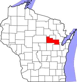 Location within the U.S. state of Wisconsin | |
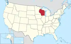 Wisconsin's location within the U.S. | |
| Coordinates: 44°47′N 88°46′W | |
| Country | |
| State | |
| Founded | February 16, 1853 |
| Seat | Shawano |
| Largest city | Shawano |
| Area | |
| • Total | 909 sq mi (2,350 km2) |
| • Land | 893 sq mi (2,310 km2) |
| • Water | 16 sq mi (40 km2) 1.8%% |
| Population (2010) | |
| • Total | 41,949 |
| • Estimate (2019) | 40,899 |
| • Density | 46/sq mi (18/km2) |
| Time zone | UTC−6 (Central) |
| • Summer (DST) | UTC−5 (CDT) |
| Congressional district | 8th |
| Website | www |
Shawano County is included in the Shawano, WI Micropolitan Statistical Area, which is also included in the Green Bay-Shawano, WI Combined Statistical Area.
History
Its name is from a modified Ojibwa term meaning "southern";[3][4] it was the southern boundary of the Ojibwa nation.[5] A Menominee chief named Sawanoh led a band that lived in the area.[6] Many citizens of Shawano believe the lake, county, and city (Town of Shawanaw founded 1853 and changed to Shawano in 1856), were named after Chief Sawanoh. A historical marker placed in 1958 near the lake along Highway 22 states the lake was named as the southern boundary of Chippewa (Ojibwe) territory.
Various historical recordings of the spelling of Shawano include: Sawanoh, Shawanaw, Sharuno, Shabin, Savannah, Savanah... which show the influence of French, German, and English translation (v's, w's, and b's, sounding very similar and thus being recorded incorrectly at times). Similar differences in spelling have been seen in the following versions: Mahican/Mahikan/Maikens tribe or Mohecan/Morhican/Mohican tribe, all referring to the same Algonquian-speaking people.
The federally recognized Stockbridge-Munsee Community (made up of Algonquian-speaking Mahican and Lenape), whose ancestors traditionally lived in the East along the Hudson River Valley, is located in Shawano County. Their reservation encompasses the towns of Bartelme and Red Springs.
The county was created as a separate county in 1853 under the name Shawanaw County. The county, unlike the city, retained the old spelling until 1864.[7]
From the mid-nineteenth century on, the county was settled by European Americans, including many German, and later, Polish immigrants. They developed the county for agriculture. Before that, French-Canadian and British fur traders traveled widely through the area, trading with the Chippewa and other Native American peoples of the region.
The first non-Indian credited with exploring the region where Shawano is now located is Samuel Farnsworth. He paddled up the Wolf River in 1843 with a few men to scout the area for logging the vast forests. A small Menominee village was located along the Shawano lake Channel when their party arrived, and the Indians were friendly and cooperative. Charles Wescott and the Farnsworth group then set up a sawmill where the Channel meets the Wolf River.
Captain William Powell, an officer of the Black Hawk War, established a trading post on the Wolf River about two miles from the village in 1844. He had been an interpreter for the government when the treaties were signed allowing white people to settle this area of Wisconsin.
E. F. Sawyer platted a village near Powell’s trading post in 1854 but public favor clung to the region adjacent to the old mill property and it was decided by popular vote to locate the county seat at Shawanaw, which was the name of the newly formed county.
The county, which was organized in 1853, was formed from areas of Oconto and Outagamie Counties. Forty-seven votes were cast and Elias Murray, Charles D Wescott and Elisha Alexander were elected supervisors. At that time there were 254 registered inhabitants, but only the men were allowed to vote.
When the county was first organized the name was spelled Shawanaw, taken from the Indian Sha-wa-Nah-Pay-Sa which meant “lake to the south” in Menominee and Chippewa. The spelling was changed in 1864 to its present Shawano, with three townships: Richmond, Waukechon and Shawano. Later others were added, making twenty-five townships.
In 1860 the first school house was erected in the county and Orlin Andrews was employed as its teacher. In 1898 there were 108 public schools in the county with 124 teachers.
A courthouse was erected on Main Street in 1857 and was replaced in 1879-80 at a cost of $17,000.00. Officially, the County Board authorized a new courthouse and jail in June of 1953 and both of these buildings serve the citizens very well at the present time.
Shawano County has always been very cognizant of the price paid by the young men and women who served the United States, especially during wartime. The Veterans of Foreign Wars unit in Shawano placed an Army tank on the corner of Lieg Avenue and Main Street in the Memorial Park as a remembrance of World War II.
In October of 1993 a very fine marble-based memorial was dedicated on the Courthouse lawn honoring all Shawano County Veterans who served America. A program is held annually on Veterans Day at this site and is well attended by school children and adults alike, with the names of all county veterans who were lost through death during the previous year announced.
Some of the industries that were operating in the early days of Shawano County were: logging, sawmills, cheese factories, agriculture and mills handling the timber and wood products.
One of the oldest industries in the City of Shawano is the Wolf River Paper and Fiber Co. which has been in operation over one hundred years in the same place along the Wolf River. It is now part of the Little Rapids Corp.
A brickyard was operating near the paper mill by Tom Larson for many years creating bricks for the many houses needed by the new residents.
The earliest settlers who came to Shawano County consisted mostly of people from the New England States, Canada, and a few from British Columbia. A large influx of Bohemians settled in the Leopolis area and near Powell’s Trading Post in the area about two miles from the city on Highway K. Norwegians settled in the area around Wittenberg, Lessor, Lunds and Navarino. Germans have been very predominate in the entire county, with 4,524 of the 27,475 inhabitants in 1900 born in Germany.
From this honorable start, Shawano County grew to 40,944 inhabitants in the year 2000 and expanded to become a section of Wisconsin characterized by its outstanding industry, agriculture, businesses, job opportunities and recreation.
We have produced outstanding and highly recognized citizens, educators, doctors, lawyers and industrial leaders.
The mighty and courageous contributions of our leaders and our citizens are depicted in the individual reports that comprise the heart of this countywide publication.[8]
Geography

According to the U.S. Census Bureau, the county has a total area of 909 square miles (2,350 km2), of which 893 square miles (2,310 km2) is land and 16 square miles (41 km2) (1.8%) is water.[9]
Adjacent counties
- Menominee County - north
- Oconto County - east
- Brown County - southeast
- Outagamie County - south
- Waupaca County - south
- Portage County - southwest
- Marathon County - west
- Langlade County - northwest
Major highways
 U.S. Highway 45
 Highway 22 (Wisconsin)
 Highway 29 (Wisconsin)
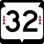 Highway 32 (Wisconsin)
 Highway 47 (Wisconsin)
 Highway 52 (Wisconsin)
 Highway 55 (Wisconsin)
 Highway 110 (Wisconsin)
 Highway 117 (Wisconsin)
 Highway 153 (Wisconsin)
 Highway 156 (Wisconsin)
 Highway 160 (Wisconsin)
 Highway 187 (Wisconsin)
Airport
The city and county jointly operate the Shawano Municipal Airport (KEZS) which is located on Shawano Lake.
Demographics
| Historical population | |||
|---|---|---|---|
| Census | Pop. | %± | |
| 1860 | 829 | — | |
| 1870 | 3,166 | 281.9% | |
| 1880 | 10,371 | 227.6% | |
| 1890 | 19,236 | 85.5% | |
| 1900 | 27,475 | 42.8% | |
| 1910 | 31,884 | 16.0% | |
| 1920 | 33,975 | 6.6% | |
| 1930 | 33,516 | −1.4% | |
| 1940 | 35,378 | 5.6% | |
| 1950 | 35,249 | −0.4% | |
| 1960 | 34,351 | −2.5% | |
| 1970 | 32,650 | −5.0% | |
| 1980 | 35,928 | 10.0% | |
| 1990 | 37,157 | 3.4% | |
| 2000 | 40,664 | 9.4% | |
| 2010 | 41,949 | 3.2% | |
| 2019 (est.) | 40,899 | [10] | −2.5% |
| U.S. Decennial Census[11] 1790–1960[12] 1900–1990[13] 1990–2000[14] 2010–2019[1] | |||

As of the census[15] of 2000, there were 40,664 people, 15,815 households, and 11,149 families residing in the county. The population density was 46 people per square mile (18/km2). There were 18,317 housing units at an average density of 20 per square mile (8/km2). The racial makeup of the county was 91.61% White, 0.22% Black or African American, 6.26% Native American, 0.33% Asian, 0.04% Pacific Islander, 0.31% from other races, and 1.22% from two or more races. 1.00% of the population were Hispanic or Latino of any race. 54.9% were of German and 8.1% Polish ancestry.
There were 15,815 households, out of which 31.50% had children under the age of 18 living with them, 58.30% were married couples living together, 8.00% had a female householder with no husband present, and 29.50% were non-families. 24.90% of all households were made up of individuals, and 12.10% had someone living alone who was 65 years of age or older. The average household size was 2.51 and the average family size was 3.00.
In the county, the population was spread out, with 25.70% under the age of 18, 6.90% from 18 to 24, 27.50% from 25 to 44, 23.10% from 45 to 64, and 16.80% who were 65 years of age or older. The median age was 38 years. For every 100 females there were 99.80 males. For every 100 females age 18 and over, there were 97.60 males.
In 2017, there were 465 births, giving a general fertility rate of 69.8 births per 1000 women aged 15–44, the 18th highest rate out of all 72 Wisconsin counties.[16] Additionally, there were 16 reported induced abortions performed on women of Shawano County residence in 2017.[17]
Communities


Cities
- Marion (mostly in Waupaca County)
- Shawano (county seat)
Villages
- Aniwa
- Birnamwood (partly in Marathon County)
- Bonduel
- Bowler
- Cecil
- Eland
- Gresham
- Mattoon
- Pulaski (mostly in Brown County and Oconto County)
- Tigerton
- Wittenberg
Towns
Census-designated places
Unincorporated communities
Politics
In presidential elections, Shawano County has voted Democratic on three occasions since 1940, each time by margins of less than four percent.
| Year | Republican | Democratic | Third parties |
|---|---|---|---|
| 2020 | 67.5% 15,447 | 31.2% 7,131 | 1.3% 308 |
| 2016 | 64.5% 12,769 | 30.6% 6,068 | 4.9% 973 |
| 2012 | 54.4% 11,022 | 44.4% 9,000 | 1.3% 257 |
| 2008 | 47.5% 9,538 | 51.1% 10,259 | 1.5% 292 |
| 2004 | 57.9% 12,150 | 41.2% 8,657 | 0.9% 192 |
| 2000 | 54.2% 9,548 | 41.7% 7,335 | 4.1% 720 |
| 1996 | 41.3% 6,396 | 44.2% 6,850 | 14.5% 2,254 |
| 1992 | 40.4% 7,253 | 33.8% 6,062 | 25.8% 4,637 |
| 1988 | 55.6% 8,362 | 43.8% 6,587 | 0.7% 98 |
| 1984 | 65.6% 10,635 | 33.7% 5,469 | 0.8% 121 |
| 1980 | 61.0% 9,922 | 33.2% 5,410 | 5.8% 944 |
| 1976 | 54.6% 8,505 | 43.4% 6,751 | 2.0% 310 |
| 1972 | 67.0% 8,807 | 30.0% 3,940 | 3.0% 395 |
| 1968 | 63.8% 8,444 | 27.2% 3,602 | 9.1% 1,199 |
| 1964 | 49.7% 6,519 | 50.1% 6,560 | 0.2% 26 |
| 1960 | 67.2% 9,734 | 32.7% 4,734 | 0.1% 21 |
| 1956 | 71.5% 9,388 | 28.0% 3,675 | 0.5% 59 |
| 1952 | 76.8% 11,131 | 23.0% 3,334 | 0.3% 36 |
| 1948 | 59.0% 6,286 | 39.3% 4,192 | 1.7% 181 |
| 1944 | 68.2% 8,732 | 31.3% 4,015 | 0.5% 64 |
| 1940 | 54.2% 6,377 | 44.5% 5,241 | 1.3% 156 |
| 1936 | 28.5% 3,679 | 68.6% 8,865 | 3.0% 381 |
| 1932 | 23.6% 2,450 | 73.2% 7,593 | 3.1% 324 |
| 1928 | 57.3% 5,198 | 41.7% 3,779 | 1.0% 88 |
| 1924 | 23.0% 2,063 | 5.3% 471 | 71.7% 6,431 |
| 1920 | 73.6% 5,836 | 6.6% 525 | 19.7% 1,564 |
| 1916 | 68.7% 3,415 | 27.5% 1,367 | 3.8% 188 |
| 1912 | 33.9% 1,535 | 36.7% 1,661 | 29.3% 1,327 |
| 1908 | 63.9% 3,349 | 33.4% 1,750 | 2.7% 142 |
| 1904 | 72.6% 3,684 | 24.4% 1,239 | 3.0% 154 |
| 1900 | 67.3% 3,243 | 31.2% 1,504 | 1.5% 72 |
| 1896 | 64.2% 3,035 | 33.7% 1,594 | 2.1% 101 |
| 1892 | 35.9% 1,323 | 55.4% 2,040 | 8.7% 322 |
References
- "State & County QuickFacts". United States Census Bureau. Retrieved January 23, 2014.
- "Find a County". National Association of Counties. Retrieved June 7, 2011.
- Shawano county [origin of place name] Archived August 5, 2008, at the Wayback Machine
- Shawano's Modern History Began in 1844 with Logging and Later Farming]
- "Here's How Iron Got Its Name". The Rhinelander Daily News. June 16, 1932. p. 2. Retrieved August 24, 2014 – via Newspapers.com.

- History. Shawano Country Chamber of Commerce.
- "The Blue Book of the state of Wisconsin". 1903. Cite journal requires
|journal=(help) - Shawano County Sesquicentennial, 2003
- "2010 Census Gazetteer Files". United States Census Bureau. August 22, 2012. Retrieved August 9, 2015.
- "Population and Housing Unit Estimates". Retrieved March 26, 2020.
- "U.S. Decennial Census". United States Census Bureau. Retrieved August 9, 2015.
- "Historical Census Browser". University of Virginia Library. Retrieved August 9, 2015.
- Forstall, Richard L., ed. (March 27, 1995). "Population of Counties by Decennial Census: 1900 to 1990". United States Census Bureau. Retrieved August 9, 2015.
- "Census 2000 PHC-T-4. Ranking Tables for Counties: 1990 and 2000" (PDF). United States Census Bureau. April 2, 2001. Retrieved August 9, 2015.
- "U.S. Census website". United States Census Bureau. Retrieved May 14, 2011.
- Annual Wisconsin Birth and Infant Mortality Report, 2017 P-01161-19 (June 2019): Detailed Tables
- Reported Induced Abortions in Wisconsin, Office of Health Informatics, Division of Public Health, Wisconsin Department of Health Services. Section: Trend Information, 2013-2017, Table 18, pages 17-18
- Leip, David. "Dave Leip's Atlas of U.S. Presidential Elections". uselectionatlas.org. Retrieved November 9, 2020.
Further reading
External links
- Shawano County
- Shawano County map from the Wisconsin Department of Transportation
- Shawano Country Tourism
- Shawano County Barns Adorned With Colorful Barn Quilts Video produced by PBS Wisconsin
Municipalities and communities of Shawano County, Wisconsin, United States | ||
|---|---|---|
| Cities | | |
| Villages | ||
| Towns | ||
| CDPs | ||
| Unincorporated communities | ||
| Indian reservations | ||
| Footnotes | ‡This populated place also has portions in an adjacent county or counties | |
| ||
| Authority control |
|---|