Vernon County, Wisconsin
Vernon County is a county in the U.S. state of Wisconsin. As of the 2010 census, the population was 29,773.[1] Its county seat is Viroqua.[2]
Vernon County | |
|---|---|
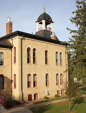 Vernon County Courthouse in October 2015 | |
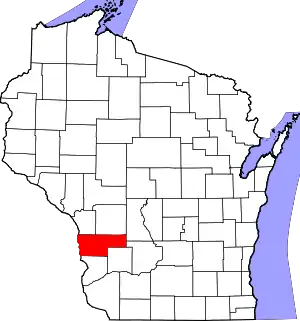 Location within the U.S. state of Wisconsin | |
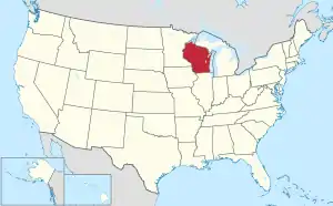 Wisconsin's location within the U.S. | |
| Coordinates: 43°35′N 90°50′W | |
| Country | |
| State | |
| Founded | 1851 |
| Named for | Mount Vernon |
| Seat | Viroqua |
| Largest city | Viroqua |
| Area | |
| • Total | 816 sq mi (2,110 km2) |
| • Land | 792 sq mi (2,050 km2) |
| • Water | 25 sq mi (60 km2) 3.0%% |
| Population (2010) | |
| • Total | 29,773 |
| • Estimate (2019) | 30,822 |
| • Density | 36/sq mi (14/km2) |
| Time zone | UTC−6 (Central) |
| • Summer (DST) | UTC−5 (CDT) |
| Congressional district | 3rd |
| Website | www |
History
Vernon County was renamed from Bad Ax County on March 22, 1862. Bad Ax County had been created on March 1, 1851 from territory that had been part of Richland and Crawford counties.[3][4] The name Vernon was chosen to reflect the county's green fields of wheat and to evoke Mount Vernon.[5]
Geography
According to the U.S. Census Bureau, the county has a total area of 816 square miles (2,110 km2), of which 792 square miles (2,050 km2) is land and 25 square miles (65 km2) (3.0%) is water.[6]
Major highways
 U.S. Highway 14
 U.S. Highway 61
 Highway 27 (Wisconsin)
 Highway 33 (Wisconsin)
 Highway 35 (Wisconsin)
 Highway 56 (Wisconsin)
 Highway 80 (Wisconsin)
 Highway 82 (Wisconsin)
 Highway 131 (Wisconsin)
 Highway 162 (Wisconsin)
Airports
- Viroqua Municipal Airport (Y51) serves the county and surrounding communities.
- The Joshua Sanford Field airport (
KHBW) closed on November 10, 2016.
Adjacent counties
- La Crosse County - northwest
- Monroe County - north
- Juneau County - northeast
- Sauk County - east
- Richland County - southeast
- Crawford County - south
- Allamakee County, Iowa - southwest
- Houston County, Minnesota - west
Demographics and religion statistics
| Historical population | |||
|---|---|---|---|
| Census | Pop. | %± | |
| 1860 | 11,007 | — | |
| 1870 | 18,645 | 69.4% | |
| 1880 | 23,235 | 24.6% | |
| 1890 | 25,111 | 8.1% | |
| 1900 | 28,351 | 12.9% | |
| 1910 | 28,116 | −0.8% | |
| 1920 | 29,252 | 4.0% | |
| 1930 | 28,537 | −2.4% | |
| 1940 | 29,940 | 4.9% | |
| 1950 | 27,906 | −6.8% | |
| 1960 | 25,663 | −8.0% | |
| 1970 | 24,557 | −4.3% | |
| 1980 | 25,642 | 4.4% | |
| 1990 | 25,617 | −0.1% | |
| 2000 | 28,056 | 9.5% | |
| 2010 | 29,773 | 6.1% | |
| 2019 (est.) | 30,822 | [7] | 3.5% |
| U.S. Decennial Census[8] 1790–1960[9] 1900–1990[10] 1990–2000[11] 2010–2019[1] | |||
As of the census[12] of 2000, there were 28,056 people, 10,825 households, and 7,501 families residing in the county. The population density was 35 people per square mile (14/km2). There were 12,416 housing units at an average density of 16 per square mile (6/km2). The racial makeup of the county was 98.81% White, 0.06% Black or African American, 0.15% Native American, 0.21% Asian, 0.01% Pacific Islander, 0.27% from other races, and 0.48% from two or more races. 0.66% of the population were Hispanic or Latino of any race. 38.3% were of Norwegian, 26.9% German, 6.4% Irish and 6.1% English ancestry. 90.9% spoke English, 3.5% German, 1.8% Norwegian, 1.2% Pennsylvania Dutch and 1.0% Spanish as their first language.
There were 10,825 households, out of which 31.50% had children under the age of 18 living with them, 58.70% were married couples living together, 6.80% had a female householder with no husband present, and 30.70% were non-families. 26.70% of all households were made up of individuals, and 13.70% had someone living alone who was 65 years of age or older. The average household size was 2.55 and the average family size was 3.11.
In the county, the population was spread out, with 27.40% under the age of 18, 6.80% from 18 to 24, 25.30% from 25 to 44, 23.50% from 45 to 64, and 17.00% who were 65 years of age or older. The median age was 39 years. For every 100 females there were 97.70 males. For every 100 females age 18 and over, there were 95.60 males.
In 2017, there were 434 births, giving a general fertility rate of 90.5 births per 1000 women aged 15–44, the fourth highest rate out of all 72 Wisconsin counties. Of these births, 123 occurred at home, second only to Clark County which had 184 home births.[13]
In 2010, the largest religious groups by reported number of adherents were ELCA Lutheran at 6,735 adherents, Catholic at 3,060 adherents, Amish at 2,786 adherents, United Methodist at 1,533 adherents, Wisconsin Synod Lutheran at 1,402 adherents, and Non-denominational Christian at 766 adherents.[14]
Economy
The county is home to the headquarters of Organic Valley, the world's largest cooperative of family farmers.[15][16]
Parks
Vernon County is home to multiple county and state parks.[17] The Kickapoo Valley Reserve, an 8600-acre natural reserve, is between the villages of La Farge and Ontario. Wildcat Mountain State Park is also in the county.
County Parks and Forests
- Blackhawk Park
- Duck Egg County Forest
- Esofea/Rentz Memorial Park
- Jersey Valley Park
- Kooyumjian - Lost Creek County Forest
- Runge Hollow Recreation Area
- Sidie Hollow Park
- Wayside Park & Coon Prairie Trail
Communities
Villages
- Chaseburg
- Coon Valley
- De Soto (partly in Crawford County)
- Genoa
- La Farge
- Ontario
- Readstown
- Stoddard
- Viola (mostly in Richland County)
Towns
Unincorporated communities
Gallery
 Round barn near Hillsboro
 Farm and countryside near Hillsboro, along Wisconsin Highway 80
Politics
Vernon County had been a Democratic-leaning county since the 1988 presidential election, but Republican Donald Trump won a plurality of the vote in 2016.
| Year | Republican | Democratic | Third parties |
|---|---|---|---|
| 2020 | 51.6% 8,216 | 46.9% 7,457 | 1.5% 237 |
| 2016 | 49.1% 7,004 | 44.6% 6,371 | 6.3% 900 |
| 2012 | 41.6% 5,942 | 56.4% 8,044 | 2.0% 283 |
| 2008 | 38.1% 5,367 | 60.1% 8,463 | 1.7% 245 |
| 2004 | 45.6% 6,774 | 53.4% 7,924 | 1.0% 147 |
| 2000 | 43.6% 5,684 | 50.4% 6,577 | 6.0% 783 |
| 1996 | 33.8% 3,796 | 49.6% 5,572 | 16.6% 1,858 |
| 1992 | 32.0% 4,072 | 44.6% 5,673 | 23.4% 2,971 |
| 1988 | 47.2% 5,226 | 51.9% 5,754 | 0.9% 98 |
| 1984 | 55.8% 6,469 | 43.5% 5,051 | 0.7% 83 |
| 1980 | 51.1% 6,528 | 43.1% 5,501 | 5.8% 744 |
| 1976 | 51.6% 6,132 | 46.5% 5,534 | 1.9% 226 |
| 1972 | 65.8% 6,836 | 32.8% 3,407 | 1.4% 142 |
| 1968 | 55.2% 5,824 | 34.7% 3,666 | 10.1% 1,065 |
| 1964 | 42.6% 4,640 | 57.3% 6,242 | 0.2% 16 |
| 1960 | 58.8% 6,909 | 41.1% 4,836 | 0.1% 15 |
| 1956 | 55.7% 6,200 | 44.2% 4,923 | 0.2% 17 |
| 1952 | 65.3% 7,619 | 34.6% 4,032 | 0.1% 12 |
| 1948 | 43.7% 4,139 | 55.2% 5,226 | 1.1% 105 |
| 1944 | 51.0% 5,676 | 48.6% 5,409 | 0.3% 36 |
| 1940 | 53.0% 6,614 | 46.2% 5,776 | 0.8% 102 |
| 1936 | 42.4% 4,811 | 53.2% 6,044 | 4.4% 502 |
| 1932 | 32.9% 2,979 | 65.6% 5,939 | 1.5% 139 |
| 1928 | 71.3% 6,596 | 27.7% 2,559 | 1.1% 99 |
| 1924 | 30.4% 2,670 | 4.6% 406 | 65.0% 5,703 |
| 1920 | 86.0% 5,694 | 9.5% 627 | 4.5% 298 |
| 1916 | 58.6% 2,912 | 36.8% 1,830 | 4.5% 225 |
| 1912 | 57.7% 2,663 | 27.1% 1,253 | 15.2% 701 |
| 1908 | 69.7% 4,114 | 26.5% 1,561 | 3.9% 227 |
| 1904 | 82.4% 4,744 | 13.2% 762 | 4.4% 255 |
| 1900 | 75.6% 4,463 | 21.5% 1,268 | 2.9% 173 |
| 1896 | 71.4% 4,393 | 26.4% 1,627 | 2.2% 137 |
| 1892 | 60.0% 3,106 | 27.8% 1,440 | 12.3% 635 |
See also
References
- "State & County QuickFacts". United States Census Bureau. Retrieved January 24, 2014.
- "Find a County". National Association of Counties. Archived from the original on May 31, 2011. Retrieved June 7, 2011.
- Bad Axe (county). Wisconsinhistory.org. Retrieved on July 21, 2013.
- Vernon County [origin of place name]. Wisconsinhistory.org. Retrieved on July 21, 2013.
- "Winnebago Took Its Name from an Indian Tribe". The Post-Crescent. December 28, 1963. p. 14. Retrieved August 25, 2014 – via Newspapers.com.

- "2010 Census Gazetteer Files". United States Census Bureau. August 22, 2012. Retrieved August 9, 2015.
- "Population and Housing Unit Estimates". Retrieved March 26, 2020.
- "U.S. Decennial Census". United States Census Bureau. Retrieved August 9, 2015.
- "Historical Census Browser". University of Virginia Library. Retrieved August 9, 2015.
- Forstall, Richard L., ed. (March 27, 1995). "Population of Counties by Decennial Census: 1900 to 1990". United States Census Bureau. Retrieved August 9, 2015.
- "Census 2000 PHC-T-4. Ranking Tables for Counties: 1990 and 2000" (PDF). United States Census Bureau. April 2, 2001. Retrieved August 9, 2015.
- "U.S. Census website". United States Census Bureau. Retrieved May 14, 2011.
- Annual Wisconsin Birth and Infant Mortality Report, 2017 P-01161-19 (June 2019): Detailed Tables
- thearda.com County Membership Report for Vernon County
- "Food & Farming - Driftless Wisconsin Region Guide". Driftless Wisconsin Region Guide. Retrieved August 14, 2018.
- "Why Organic Valley? | Leaders in Organic". www.organicvalley.coop. Retrieved August 14, 2018.
- "Land and Water Resources". Vernon County. Retrieved June 6, 2019.
- Leip, David. "Dave Leip's Atlas of U.S. Presidential Elections". uselectionatlas.org. Retrieved November 11, 2020.
Further reading
- History of Vernon County, Wisconsin. Springfield, Ill.: Union Publishing Company, 1884.
- Rogers, Earl M. (ed.) Memoirs of Vernon County. Madison, Wis.: Western Historical Association, 1907.
External links
- Vernon County
- Vernon County map from the Wisconsin Department of Transportation
- Vernon County Health and Demographic Data
- Vernon County Broadcaster
Places adjacent to Vernon County, Wisconsin | |
|---|---|
Municipalities and communities of Vernon County, Wisconsin, United States | ||
|---|---|---|
| Cities | | |
| Villages | ||
| Towns | ||
| Unincorporated communities | ||
| Indian reservation | ||
| Footnotes | ‡This populated place also has portions in an adjacent county or counties | |
| ||
| Authority control |
|---|