Urqipi
Urqipi (Aymara urqu male, ipi a small wild potato,[2] also spelled Orkhepi) is a 4,230-metre-high (13,878 ft) mountain in the Andes of Bolivia. It lies in the La Paz Department, Pacajes Province, Calacoto Municipality, north of the Anallajsi volcano. It is located at the Achuta River, north-east of the mountain Pukara and north of the mountain Churi Willk'i. [1][3]
| Urqipi | |
|---|---|
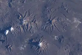 Urqipi is visible in the upper right part of this satellite image. Sajama volcano is shown in the lower center. | |
| Highest point | |
| Elevation | 4,230 m (13,880 ft) [1] |
| Coordinates | 17°46′26″S 68°55′20″W |
| Geography | |
 Urqipi Location within Bolivia | |
| Location | Bolivia, La Paz Department |
| Parent range | Andes |
See also
References
- Bolivian IGM map 1:50,000 Estancia Huancarama 5840-IV
- Radio San Gabriel, "Instituto Radiofonico de Promoción Aymara" (IRPA) 1993, Republicado por Instituto de las Lenguas y Literaturas Andinas-Amazónicas (ILLLA-A) 2011, Transcripción del Vocabulario de la Lengua Aymara, P. Ludovico Bertonio 1612 (Spanish-Aymara-Aymara-Spanish dictionary)
- "Calacoto". INE, Bolivia. Retrieved November 8, 2014.

This article is issued from Wikipedia. The text is licensed under Creative Commons - Attribution - Sharealike. Additional terms may apply for the media files.