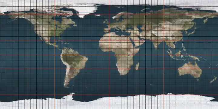
68th parallel north

The 68th parallel north is a circle of latitude that is 68 degrees north of the Earth's equatorial plane, in the Arctic. It crosses the Atlantic Ocean, Europe, Asia and North America.

68°
68th parallel north

At this latitude the sun is visible for 24 hours, 0 minutes during the summer solstice and Civil Twilight during the winter solstice.

Around the world

Starting at the Prime Meridian and heading eastwards, the parallel 68° north passes through:

Co-ordinates Country, territory or ocean Notes
68°0′N 0°0′E Atlantic Ocean Norwegian Sea
68°0′N 13°0′E  Norway Moskenesøya, Lofoten, Nordland
68°0′N 13°17′E Atlantic Ocean Vestfjorden, Norwegian Sea
68°0′N 15°4′E  Norway Engeløya, Nordland
68°0′N 15°7′E Atlantic Ocean Skagstadsundet, Norwegian Sea
68°0′N 15°4′E  Norway Lundøya and Finnøya, and the mainland Nordland
68°0′N 13°17′E Atlantic Ocean Vestfjorden, Norwegian Sea
68°0′N 15°4′E  Norway Engeløya, Lundøya and Finnøya, and the mainland Nordland
68°0′N 13°17′E Atlantic Ocean Vestfjorden, Norwegian Sea
68°0′N 15°6′E  Norway Islands of Engeløya, Lundøya and Finnøya, and the mainland Nordland
68°0′N 17°1′E  Sweden Norrbotten County (Lapland province)
68°0′N 17°48′E  Norway Nordland, for about 5,8 km
68°0′N 17°56′E  Sweden Norrbotten County (Lapland and Norrbotten provinces)
68°0′N 23°33′E  Finland Lapland
68°0′N 29°25′E  Russia Kola Peninsula, Murmansk Oblast
68°0′N 39°58′E Arctic Ocean White Sea
68°0′N 44°14′E  Russia Kanin Peninsula, Nenets Autonomous Okrug
68°0′N 46°33′E Arctic Ocean Barents Sea
68°0′N 49°43′E  Russia Nenets Autonomous Okrug
Komi Republic
Yamalo-Nenets Autonomous Okrug
68°0′N 73°6′E Arctic Ocean Gulf of Ob, Kara Sea
68°0′N 74°48′E  Russia Yamalo-Nenets Autonomous Okrug
68°0′N 77°12′E Arctic Ocean Taz Estuary, Kara Sea
68°0′N 77°30′E  Russia Yamalo-Nenets Autonomous Okrug
Krasnoyarsk Krai
Yakutia
Chukotka Autonomous Okrug
68°0′N 176°31′W Arctic Ocean Chukchi Sea
68°0′N 165°15′W  United States Alaska
68°0′N 141°0′W  Canada Yukon
Northwest Territories
Nunavut
68°0′N 115°7′W Arctic Ocean Coronation Gulf
Passing just north of the Couper, Berens and Lawford Islands
Passing just north of Hepburn Island
Passing just south of the Jameson Islands
68°0′N 110°9′W  Canada Nunavut
68°0′N 110°0′W Arctic Ocean Bathurst Inlet
68°0′N 109°26′W  Canada Nunavut - Chapman Islands
68°0′N 109°0′W Arctic Ocean Bathurst Inlet
Passing just north of Lewes Island
Fishers Island
68°0′N 107°53′W  Canada Nunavut
68°0′N 103°17′W Arctic Ocean Queen Maud Gulf
68°0′N 98°59′W  Canada Nunavut - O'Reilly Island, Klutschak Peninsula and Adelaide Peninsula
68°0′N 96°6′W Arctic Ocean Chantrey Inlet
68°0′N 95°25′W  Canada Nunavut
68°0′N 88°20′W Arctic Ocean Committee Bay
68°0′N 86°48′W  Canada Nunavut - Wales Island and Melville Peninsula
68°0′N 82°9′W Arctic Ocean Foxe Basin
68°0′N 77°2′W  Canada Nunavut - Prince Charles Island, Air Force Island and Baffin Island
68°0′N 64°46′W Arctic Ocean Davis Strait
68°0′N 50°20′W  Greenland Avannaata
Sermersooq
68°0′N 31°49′W Atlantic Ocean Greenland Sea
Norwegian Sea

See also

This article is issued from Wikipedia. The text is licensed under Creative Commons - Attribution - Sharealike. Additional terms may apply for the media files.