Alberta Highway 54
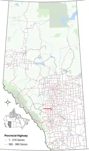
Alberta Provincial Highway No. 54,[2] commonly referred to as Highway 54, is an east–west highway located in central Alberta. It is 70 kilometres (43 mi) in length, starting at Highway 22 (Cowboy Trail), 8 kilometres (5.0 mi) west of the Village of Caroline, and ending at exit 365 of Highway 2 (Queen Elizabeth II Highway) at the south end of the Town of Innisfail.[3][4]
| ||||
|---|---|---|---|---|
 | ||||
| Route information | ||||
| Length | 69.4 km[1] (43.1 mi) | |||
| Major junctions | ||||
| West end | ||||
| East end | ||||
| Location | ||||
| Specialized and rural municipalities | Clearwater County, Red Deer County | |||
| Towns | Innisfail | |||
| Villages | Caroline | |||
| Highway system | ||||
Provincial highways in Alberta
| ||||

Highway 54 originally passed through Innisfail's central business district along 50 Street, ending at Highway 2 / Highway 590 interchange. In 2008, Highway 54 was aligned along a new bypass and linked to Highway 2 at an interchange that was previously opening in 2005.[5]
Major intersections
From west to east:[6]
| Rural/specialized municipality | Location | km[1] | mi | Destinations | Notes |
|---|---|---|---|---|---|
| Clearwater County | | 0.0 | 0.0 | West end of Hwy 22 concurrency | |
| 0.2 | 0.12 | Crosses the Clearwater River | |||
| Caroline | 8.1 | 5.0 | 50 Street (Range Road 61) | ||
| | 13.0 | 8.1 | East end of Hwy 22 concurrency | ||
| 16.3 | 10.1 | ||||
| Red Deer County | | 32.8 | 20.4 | ||
| Spruce View | 37.6 | 23.4 | UAR 114 north (Range Road 31) – Dickson | ||
| | 50.5 | 31.4 | Crosses the Medicine River | ||
| 52.3 | 32.5 | ||||
| 61.0 | 37.9 | Crosses the Red Deer River | |||
| Innisfail | 65.0 | 40.4 | Lakewood Drive to Hwy 590 east / 50 Street | Former Hwy 54 alignment | |
| 69.4 | 43.1 | Interchange; Hwy 2 exit 365 | |||
1.000 mi = 1.609 km; 1.000 km = 0.621 mi
| |||||
References
- Google (December 19, 2017). "Highway 54 in Alberta" (Map). Google Maps. Google. Retrieved December 19, 2017.
- Provincial Highways Designation Order, Alberta Transportation, p. 8
- "2010 Provincial Highways 1 - 216 Progress Chart (map, 8 MB)" (PDF). Alberta Transportation. 2010. Retrieved 2010-12-31.
- British Columbia, Alberta: Provincial Road Atlas (3rd ed.). Markham, ON: Rand McNally Canada Inc. 2000. p. 48. ISBN 0-88640-682-X.
- "Transportation Infrastructure Management System - Existing Structures in the Provincial Highway Corridor" (PDF). Alberta Transportation. September 28, 2012. p. 159. Retrieved May 8, 2018.
- Alberta Road Atlas (2005 ed.). Oshawa, ON: MapArt Publishing Corp. pp. 69 and 70.
This article is issued from Wikipedia. The text is licensed under Creative Commons - Attribution - Sharealike. Additional terms may apply for the media files.
