Ali Kadam Upazila
Alikadam (Bengali: আলিকদম) is an upazila of Bandarban District in the Division of Chittagong, Bangladesh.[1]
Alikadam
আলিকদম | |
|---|---|
 Alikadam Location in Bangladesh | |
| Coordinates: 21°40′N 92°18.3′E | |
| Country | |
| Division | Chittagong Division |
| District | Bandarban District |
| Unions | Alikadam
Choikkhong Noyapara Kurukpata |
| Government | |
| • Upzilla Chairman | Abul Kalam |
| • Upazila Nirbahi Officer & Executive Magistrate | Md. Sayed Iqbal |
| Area | |
| • Total | 885.78 km2 (342.00 sq mi) |
| Population (1991) | |
| • Total | 24,782 |
| • Density | 28/km2 (72/sq mi) |
| Time zone | UTC+6 (BST) |
| Postal code | 4650 |
| Website | www |
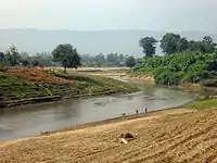
Geography
Ali Kadam is located at 21.6667°N 92.3056°E. It has 4,923 households and a total area of 885.78 km2.
Demographics
According to the 1991 Bangladesh census, Ali Kadam had a population of 24,782. Males constituted 55.21% of the population, and females 44.79%. The population aged 18 or over was 13,312. Ali Kadam had an average literacy rate of 20.7% (7+ years), compared to the national average of 32.4%.[2]
Religion
The religions of Ali Kadam are Muslim 85.32%, Buddhist 13.68%, Hindu 0.77%, with 0.23% following other religions. The religious institutions consist of 680 mosques, 65 pagodas, 55 Buddhist temples and 8 Hindu temples.
Points of interest
Alikadam is a popular hiking destination among tourists for the tunnels in the mountains known as "Alir Guha" or "Ali's Tunnels". Tourists are expected to face slippery and muddy terrains for the hike to the tunnels. Winter is the safest season to travel because the mountain streams and rivers are dangerous during Monsoon.
Administration
Alikadam Upazila is divided into four union parishads: Alikadam, Chaikkhyang, Kurukpata, and Nayapara.[3][4]
Education
There is a shortage of high schools. Now there is only a government high in Ali Kadam.
References
- Atikur Rahman (2012). "Alikadam Upazila". In Sirajul Islam and Ahmed A. Jamal (ed.). Banglapedia: National Encyclopedia of Bangladesh (Second ed.). Asiatic Society of Bangladesh.
- "Population Census Wing, BBS". Archived from the original on 2005-03-27. Retrieved November 10, 2006.
- "District Statistics 2011: Bandarban" (PDF). Bangladesh Bureau of Statistics. Archived from the original (PDF) on 13 November 2014. Retrieved 14 July 2014.
- ইউনিয়ন সমূহ [Unions]. Alikadam Upazila (in Bengali).
| Upazila/Thana: | ||
|---|---|---|
