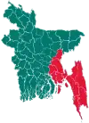
Burichang Upazila
Burichang, also known as Burichong, (Bengali: বুড়িচং) is an upazila of Comilla District in the Division of Chittagong, Bangladesh.[1]
Burichang
বুড়িচং | |
|---|---|
 Burichang Location in Bangladesh | |
| Coordinates: 23°33′N 91°7.6′E | |
| Country | |
| Division | Chittagong Division |
| District | Comilla District |
| Area | |
| • Total | 163.76 km2 (63.23 sq mi) |
| Population (1991) | |
| • Total | 228,479 |
| • Density | 1,400/km2 (3,600/sq mi) |
| Time zone | UTC+6 (BST) |
| Website | Official Website of Burichong |
History
Raghunath Tarkavachaspati, a Bramhin scholar in the subject of logic migrated from Dingshai village now in West Bengal in the 17th century to establish the village of Burichang on the land granted to him by Chatra Manikya [Nakshatra Rai] the Maharaja of Tripura to start a Toll (an institute for Vedic learning).[2][3]
Geography
Burichang is located at 23.5500°N 91.1264°E. It has 37,739 households and a total area of 163.76 km2 (63.23 sq mi).
Demographics
According to the 1991 Bangladesh census, Burichang had a population of 228,479. Males constituted 51.68% of the population, and females 48.32%. The population aged 18 or over was 106,787. Burichang had an average literacy rate of 34.3% (7+ years), against the national average of 32.4%.[4]
Administration
Burichang Upazila is divided into eight union parishads: 4 No Sholanal Union Parishad, Bakshimul,
Burichang, Moynamoti, Mokam, Pirjatrapur, Rajapur, Sholonal, and Varella.
The union parishads are subdivided into 149 mauzas and 172 villages.[5]
References
- Rahman, Mahfuzur (2012). "Burichang Upazila". In Islam, Sirajul; Jamal, Ahmed A. (eds.). Banglapedia: National Encyclopedia of Bangladesh (Second ed.). Asiatic Society of Bangladesh.
- Bengali article "Burichonger Itikatha" by Satyaranjan Bhattacharjee in "Rajat Jayanti Barsha Sankalan" published in the year 2000 by Burichong Sammelani, Kolkata
- Bengali article "Burichonger Itihas" by Radhaprasanna Chakraborty in "Rajat Jayanti Barsha Sankalan" published in the year 2000 by Burichong Sammelani, Kolkata
- "Population Census Wing, BBS". Archived from the original on 2005-03-27. Retrieved November 10, 2006.
- "District Statistics 2011: Comilla" (PDF). Bangladesh Bureau of Statistics. Archived from the original (PDF) on 13 November 2014. Retrieved 14 July 2014.
