Kaptai Upazila
Kaptai (Bengali: কাপ্তাই) is an Upazila of Rangamati District in the Division of Chittagong, Bangladesh.[1] Name of the Kaptiai was derived from a Marma word "Kraitoi' which is a name of river just a half kilometre downstream of the Kaptai dam (right oppisite of Karnafuli Forestal range office) and also it is named after the river herself which me ans- the river full of canes. It is said that in the past days the reverine was so wild and full in tropical flora and fauna. Huge amount of several verities of canes used to be found throughout the course of the river that flows that from the south, upper tridge and the river makes its estuary into the Kainsa Khyong (Karnafuli river).
Kaptai Sub-District
কাপ্তাই | |
|---|---|
 Kaptai Sub-District Location in Bangladesh | |
| Coordinates: 22°30′N 92°13′E | |
| Country | |
| Division | Chittagong Division |
| District | Rangamati District |
| Area | |
| • Total | 259 km2 (100 sq mi) |
| Population (2001) | |
| • Total | 66,135 |
| • Density | 260/km2 (660/sq mi) |
| Time zone | UTC+6 (BST) |
| Postal code | 4530 |
| Website | kaptai |
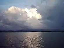
Notable landmarks are the Karnaphuli Hydroelectric Power Station, the only Hydro-electric power plant of Bangladesh. The Kaptai Dam, built for this purpose on the Karnaphuli River, created the Kaptai Lake, the largest man-made dam in Bangladesh.
Geography
Kaptai is located at 22.5000°N 92.2167°E. It has 12992 households and total area 259 km2.
Demographics
At the 2001 Bangladesh census, Kaptai had a population of 66,135. Males constituted 55.45% of the population, and females 44.55%. The population of those aged 18 and older was 32,352. The average literacy rate was 49.9% (7+ years).[2]
Points of interest
Karnaphuli Paper Mills
Karnaphuli Paper Mills is one of the greatest paper mills in Asia. It streams alongside Karnaphuli river. The distance between Chittagong and the mill is forty eight kilometers.[3]
Kaptai National Park
Kaptai National Park is situated at Rangamati. It was established in 1999 and its area is 5,464.78 hectares(13,498.0 Acres).
- Navy camp picnic spot
- Joom picnic spot
Waggachara Tea Estate
It is situated on the bank of the Karnaphuli river. It takes one and half hour to reach there from the city Chittagong.[4]
Administration
Kaptai Upazila is divided into five union parishads: Chandraghona, Chitmorom, Kaptai, Raikhali, and Waggya. The union parishads are subdivided into 10 mauzas and 144 villages.[5]
References
- Atikur Rahman (2012), "Kaptai Upazila", in Sirajul Islam and Ahmed A. Jamal (ed.), Banglapedia: National Encyclopedia of Bangladesh (Second ed.), Asiatic Society of Bangladesh
- "Population Census Wing, BBS". Archived from the original on 2005-03-27. Retrieved November 10, 2006.
- "Karnaphuli paper mill in Kaptai".
- "Kaptai tea garden".
- "District Statistics 2011: Rangamati" (PDF). Bangladesh Bureau of Statistics. Archived from the original (PDF) on 13 November 2014. Retrieved 14 July 2014.
External links
- Sifatul Quader Chowdhury (2012), "Karnafuli Hydropower Station", in Sirajul Islam and Ahmed A. Jamal (ed.), Banglapedia: National Encyclopedia of Bangladesh (Second ed.), Asiatic Society of Bangladesh
- Nuruddin Mahmood and M Abdul Hai (2012), "Kaptai Lake", in Sirajul Islam and Ahmed A. Jamal (ed.), Banglapedia: National Encyclopedia of Bangladesh (Second ed.), Asiatic Society of Bangladesh
| Upazila/Thana: | ||
|---|---|---|
