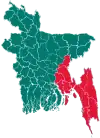
Ukhia Upazila
Ukhiya (Bengali: উখিয়া) is an upazila of Cox's Bazar District in the Division of Chittagong, Bangladesh.[2]
Ukhiya
উখিয়া | |
|---|---|
 Ukhiya Location in Bangladesh | |
| Coordinates: 21°17′N 92°6′E | |
| Country | |
| Division | Chittagong Division |
| District | Cox's Bazar District |
| Area | |
| • Total | 261.8 km2 (101.1 sq mi) |
| Population (2011 Census)[1] | |
| • Total | 207,379 |
| • Density | 790/km2 (2,100/sq mi) |
| Time zone | UTC+6 (BST) |
| Website | ukhiya |
Geography
Ukhia is located at 21.2833°N 92.1000°E. It has 19,189 households and a total area of 261.8 km2.
Demographics
As of the 2011 Bangladesh census, Ukhia has a population of 207,379. Males constitute 51.45% of the population, and females 48.55%. This Upazila's eighteen up population is 51749. Ukhia has an average literacy rate of 16.8% (7+ years), and the national average of 32.4% literate.[3]
Administration
Ukhia Upazila is divided into five union parishads: Holdia Palong, Jalia Palong, Raja Palong, Ratna Palong, and Palong Khali. The union parishads are subdivided into 13 mauzas and 54 villages.[4]
Education
High Schools: [Balukhali Kashemia High School], Abul Kashem Noor Jahan Chowdhury High School, Palong Model High School, Ukhiya govt. High School Rumkha Palong High School, Sonar Para High School, Kutupalong High School,Jalia palong High school. Kutupalong Primary School. Monkhali Chakma_para gov't. primary school. Moricha Phalong High School. Shaleh Bulbul govt. Primary School. Nolbania govt. Primary School.
Media
NGO Working MSF (Doctors without Borders),SHED (Society for Health Extension & Development), Brac, Pulse Bangladesh, Nacom, Muslim Aid, Uddipon, Rtm, Tai, Msf, Save the children,IOM, Mukti cox's Bazar, ACF, DRC, Ipsa, Codec, aid comilla etc.
References
- Ukhia (Subdistrict (Upazila), Bangladesh) - Population Statistics, Charts, Map and Location
- Chowdhury, Towhid Hossain (2012). "Ukhia Upazila". In Islam, Sirajul; Jamal, Ahmed A. (eds.). Banglapedia: National Encyclopedia of Bangladesh (Second ed.). Asiatic Society of Bangladesh.
- "Population Census Wing, BBS". Archived from the original on March 27, 2005. Retrieved November 10, 2006.
- "District Statistics 2011: Cox's Bazar" (PDF). Bangladesh Bureau of Statistics. Archived from the original (PDF) on 13 November 2014. Retrieved 14 July 2014.
