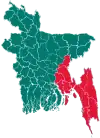
Ramu Upazila
Ramu (Bengali: রামু) is an upazila of Cox's Bazar District in the Division of Chittagong, Bangladesh.[1]
Ramu
রামু | |
|---|---|
 Ramu Location in Bangladesh | |
| Coordinates: 21°27.5′N 92°6′E | |
| Country | Bangladesh |
| Division | Chittagong Division |
| District | Cox's Bazar District |
| Area | |
| • Total | 391.71 km2 (151.24 sq mi) |
| Population (1991) | |
| • Total | 167,480 |
| • Density | 428/km2 (1,110/sq mi) |
| Time zone | UTC+6 (BST) |
| Website | ramu |
Geography
Ramu is located at 21.4583°N 92.1000°E. It has 26964 households and the area of the town is 22.03 km2.
Demographics
As of the 1991 Bangladesh census, Ramu has a population of 167480. Males constitute 51.41% of the population, and females 48.59%. This Upazila's eighteen up population is 74742. Ramu has an average literacy rate among town people is 34%., and the national average of 32.4% literate. Ramu thana was transformed into an upazila in 1983. It consists of 9 union parishads, 39 mouzas and 102 villages.[2]
Administration
Ramu Upazila is divided into 11 union parishads: Chakmarkul, Dakshin Mithachhari, Eidghar, Fotekharkul, Garjoniya, Jouarianala, Kacchapia, Kauwarkhop, Khuniapalong, Rajarkul, and Rashidnagar. The union parishads are subdivided into 39 mauzas and 102 villages.[3]
References
- Chowdhury, Muhammad Tawhid Hossain (2012). "Ramu Upazila". In Islam, Sirajul; Jamal, Ahmed A. (eds.). Banglapedia: National Encyclopedia of Bangladesh (Second ed.). Asiatic Society of Bangladesh.
- "Table S04: Selected Statistics By Thana, 1991 (Enumerated)". Bangladesh Government. Archived from the original on 27 March 2005. Retrieved 25 August 2018.
- "District Statistics 2011: Cox's Bazar" (PDF). Bangladesh Bureau of Statistics. Archived from the original (PDF) on 13 November 2014. Retrieved 14 July 2014.
